MercoPress. South Atlantic News Agency
Sunday, June 28th 2026 - 20:51 UTC
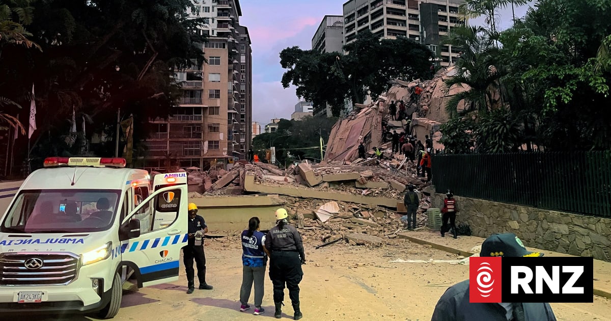
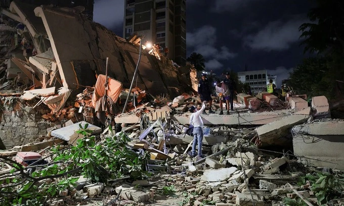
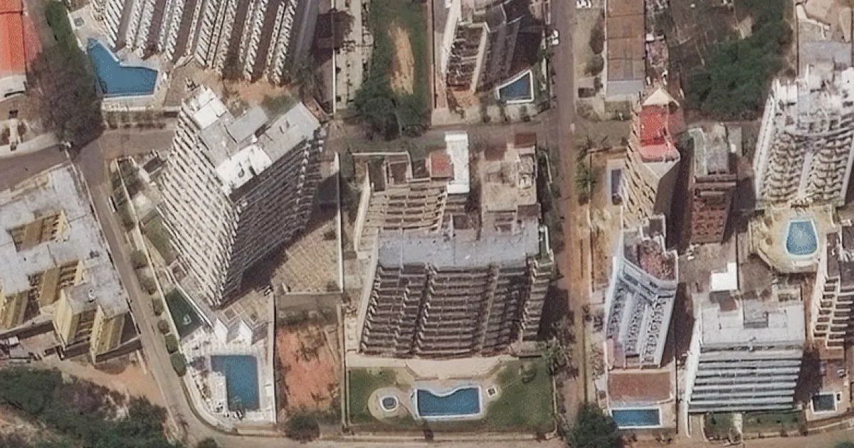
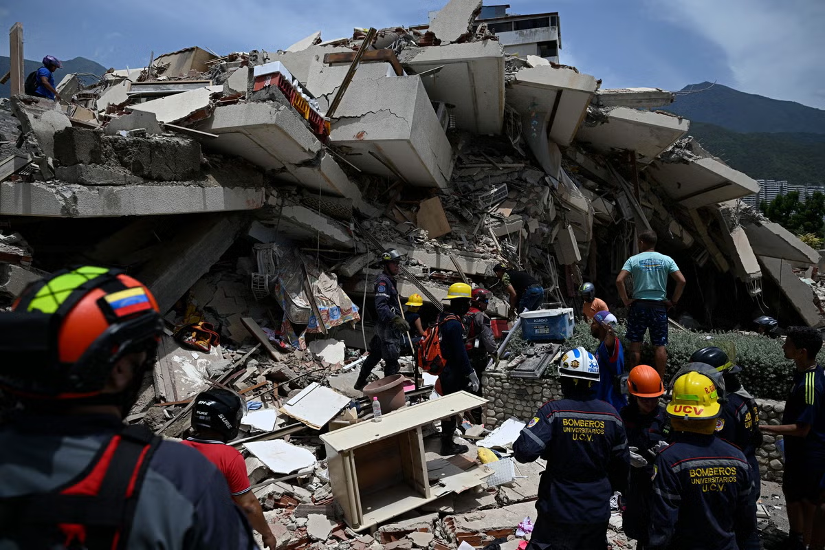
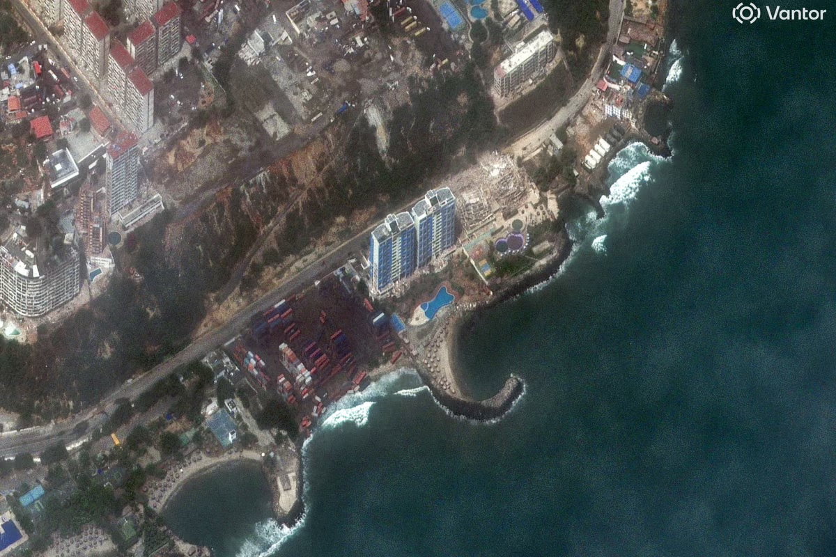
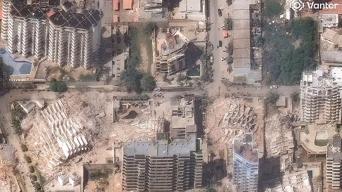
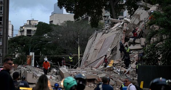
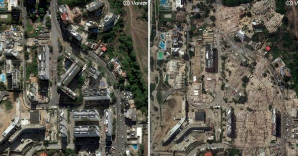
The satellite images that have gradually emerged confirm a trail of collapsed buildings along the coast, the most densely populated and hardest-hit area
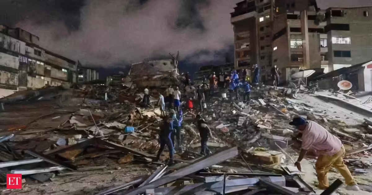
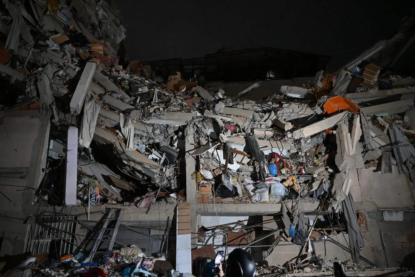
The combination of two powerful, very shallow earthquakes just 39 seconds apart explains much of the devastation left by Wednesday's earthquake in north-central Venezuela, where the latest official toll exceeds 1,450 dead and 3,150 injured. The satellite images that have gradually emerged confirm a trail of collapsed buildings along the coast, the most densely populated and hardest-hit area.
The first tremor, of magnitude 7.2, had its epicenter in Yaracuy state, west of La Guaira and Caracas. The second, 39 seconds later and of magnitude 7.5, released almost three times more energy than the first, according to the US Geological Survey. Both occurred at a shallow depth —the main one at about ten kilometers— a decisive factor in the scale of the surface damage. “Not only was the energy high, but they were also very shallow, especially the second, which is devastating,” Miguel Ángel Rodríguez Pascua, of Spain's Geological and Mining Institute, told EL PAÍS. Another element worsened the consequences: because the two quakes occurred within less than a minute, many people did not have time to evacuate their buildings between one and the other.