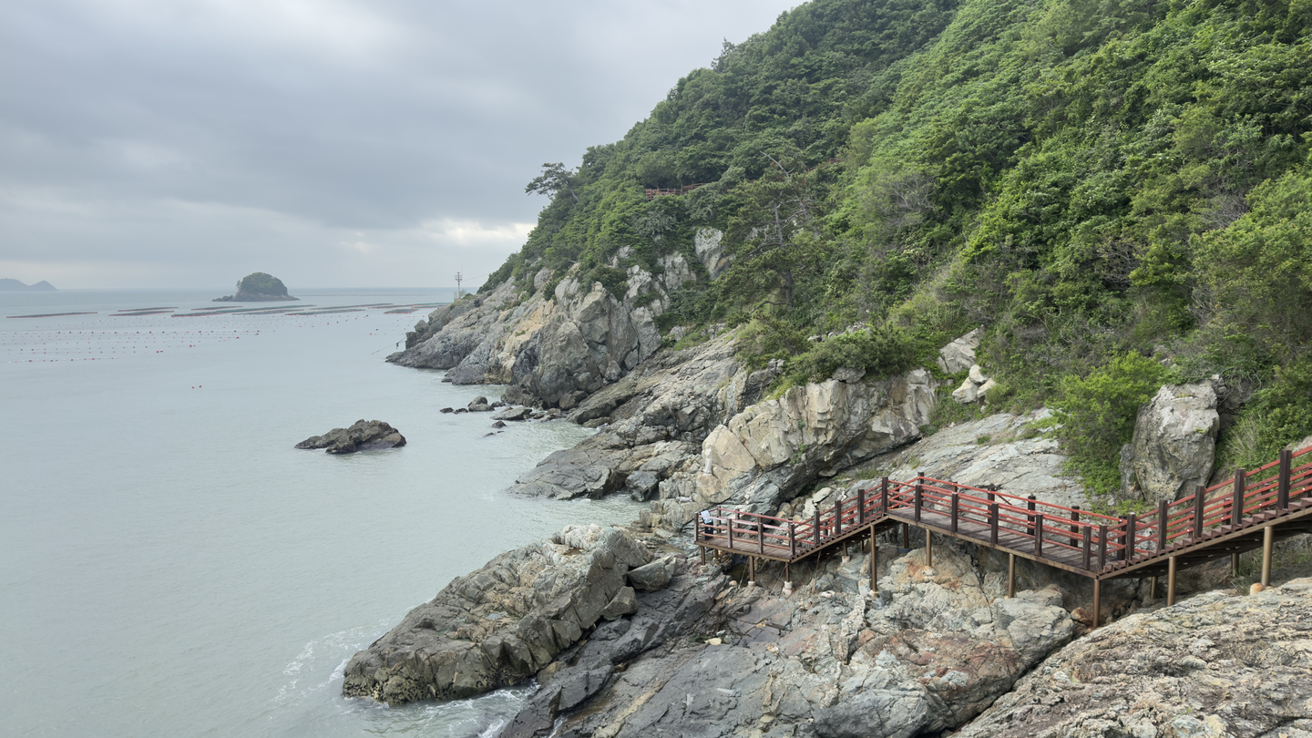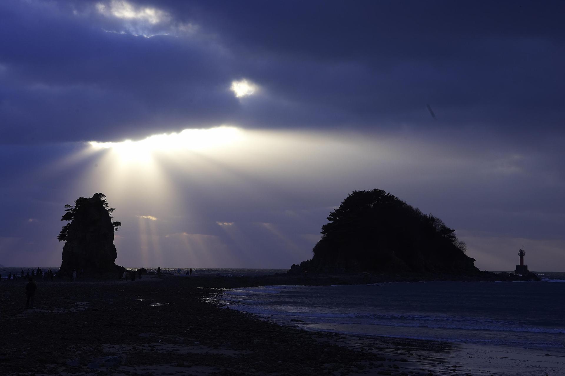
From Gangjin’s tea fields and Dalmasan’s cliffs to Ttangkkeut’s sea and Mokpo’s harbor songs, this coastal stretch offers a country’s worth of scenery in one short section of trail Dasan Chodang (Hong Yoo/The Korea Herald) GANGJIN, HAENAM, MOKPO, SOUTH JEOLLA PROVINCE — Have you walked any of the Korea Dulle Trail, the 4,500-kilometer route that rings the country's coastline and border?The trail strings together four routes: the Haeparang Trail along the east coast, the Namparang Trail across the south, the Seohaerang Trail up the west coast and the DMZ Peace Trail near the northern border. At 5.7 times the length of Spain's Camino de Santiago, it would take about eight months to finish at a pace of 20 kilometers a day.Few travelers have that kind of time. The good news is that the trail is built to be walked in pieces, one course at a time.This guide follows a stretch of the Namparang and Seohaerang trails that meet at Ttangkkeut, the southernmost point of the Korean Peninsula. The route runs through Gangjin, Haenam and Mokpo, all in South Jeolla Province, and pairs coastal walking with some of the region's richest history. A tea field near Baengnyeonsa, or White Lotus Temple, on the slopes of Mandeoksan mountain (Hong Yoo/The Korea Herald) Gangjin: Camellia, tea and a scholar's exileThe Namparang Trail, whose name refers to the path walked alongside the indigo sea of the south, covers 1,470 kilometers over 90 courses from Oryukdo Sunrise Park in Busan to Ttangkkeut Village in Haenam.Course 83 in Gangjin is 17.9 kilometers long and takes about 6 hours and 30 minutes, and is rated as average in terms of difficulty. It climbs to Baengnyeonsa, or White Lotus Temple, on the slopes of Mandeoksan mountain.The temple is housed in a camellia forest during winter and spring, and green tea fields in spring and summer."The temple was named Mandeoksa at first, after the beauty of Mandeoksan mountain, and the name was changed to Baengnyeonsa later. This is where the White Lotus Society began, a form of Buddhism that ordinary people can take part in," Kim Hye-su, a cultural heritage guide at the temple, told The Korea Herald.She emphasized how the temple is renowned for its scenic view."Because this region was invaded so often, only a couple of its treasures have survived, and it was rebuilt after a fire in 1760. You will not find ornate architecture here, but you can see the sea from the grounds, and that is what makes it beautiful. Seen from Gaudo island in the distance, Mandeoksan and Baengnyeonsa look as though they are resting inside a lotus flower," she said.From the temple, a 1.3-kilometer forest path leads to Dasan Chodang, the thatched study where the Silhak scholar Jeong Yak-yong, known by his pen name Dasan, spent the most productive decade of his 18-year exile and wrote foundational works on good governance including "Momgmingsimseo" and "Gyeongseyupyo." Jeong walked this path often to discuss philosophy and tea with the monk Hyejang. Camellia trees and tea fields still crowd the hillside. Dosolam Hermitage on Dalmasan (Haenam County Government) Haenam: The long walk to TtangkkeutCourse 90, the final course of the Namparang Trail, is the hardest of the stretch. It covers 13.4 kilometers in about seven hours and is rated as difficult.The route climbs the Dalmagodo trail across Dalmasan mountain, a ridge of jagged rock that early travelers compared to rows of standing Buddhas. Mihwangsa Temple sits quietly near the southern foot of the mountain, and the nearby Dosolam Hermitage clings to a cliff.The hermitage path is a steep cliff route that calls for caution. On foggy mornings, the drop below disappears into the clouds, leaving walkers with the sense of standing above it.The course finishes at Ttangkkeut Tower, the monument marking the southernmost point of the Korean Peninsula. For walkers who started 1,470 kilometers away in Busan, this is the end of the line. Ttangkkeut Tower (Hong Yoo/The Korea Herald) Land's End: Where one trail ends and another beginsTtangkkeut, which means Land's End, is the rare place that is both a finish and a start. The Namparang Trail ends here, and the Seohaerang Trail begins.The Seohaerang Trail, the path walked alongside the west sea, runs 1,800 kilometers over 109 courses from Ttangkkeut Tower to Ganghwa in Incheon. Along the way, it passes the tidal flats of the west coast, listed as a UNESCO World Heritage Site, and has a long history of religious and cultural exchange.Course 1 sets off from the tower for 14.9 kilometers, or about five hours on foot, at average difficulty. It passes the torch-shaped Ttangkkeut Observatory and Songho Beach, a 2-kilometer crescent of white sand backed by a pine forest. Those who would rather ride than walk can take the Ttangkkeut Monorail from Ttangkkeut Village to the observatory and tower, for 5,000 won ($3.30) round trip or 3,500 won one way.At the foot of the tower, markers set into the ground note the start and end points of the Namparang and Seohaerang trails. The rock ridges of Mandeoksan and Dalmasan rise above, and ahead lie the southern islands of Wando and Heugildo. (Haenam 126 Hotel) Where to restFarther up the Seohaerang Trail, Course 14 runs 17.7 kilometers, or about six hours on foot, through the Oceano Tourism Complex, a resort area whose first hotel opened recently.That hotel, Haenam 126, opened in November 2024 as the area's first four-star property. Its name refers to the 126 degrees east longitude on which it sits. The design reinterprets the traditional architecture of Nogudang, the historic Haenam home of the scholar Yun Seon-do, in a modern form. Facilities include an infinity pool, a restaurant and a gym.Kim Gwang-sik, who leads the regional development planning team at the Korea Tourism Organization, said the design was chosen with care."Every room looks out on the sea. There are 120 rooms in nine types, a banquet hall on the first floor and five separate gardens, because we wanted to create interesting spaces between the buildings. The hotel is barrier-free as we built this place hoping to welcome everyone," he said. Trail waymarkers on Seohaerang Trail (Hong Yoo/The Korea Herald) Mokpo: An old harbor steeped in historyThe stretch ends in Mokpo, where Seohaerang Course 16 covers 16.6 kilometers in about 5 hours 30 minutes at easy difficulty. The course links the city's waterfront and its history. It begins on Samhakdo, three small islands off Mokpo harbor.On one of the islands, Lee Nan-young Park honors the singer Lee Nan-young, whose 1935 song "The Tears of Mokpo" spoke to a nation under Japanese colonial rule. Her remains were laid to rest here in 2006.Kim Dae-jung Nobel Peace Prize Memorial Hall, dedicated to the former president, the first Korean to win the prize, also stands on Samhakdo. Five exhibition halls trace his years of house arrest and a death sentence, and the 2000 inter-Korean summit that led to the award. The view from the front yard, where the sea meets the Yeongsan River, is worth the pause. Mokpo Modern History Museum (Hong Yoo/The Korea Herald) From Samhakdo, the route heads toward Yudalsan mountain through Mokpo's modern history district, a grid of old streets sometimes called a museum without a roof. The red-brick former Japanese consulate, now the Mokpo Modern History Museum, is the city's oldest Western-style building, which appeared in the hit TV series "Hotel del Luna." Nearby are a former colonial-era land company archive, an old department store and Japanese-style houses.Cafes and local restaurants have moved into many of the renovated buildings, making the district a natural place to stop and eat. Walked end to end, the Mokpo course runs from the Samhakdo park, the Kim Dae-jung Nobel Peace Prize Memorial Hall, then up to Nojeokbong peak on Yudalsan, where the city spreads out below.Safety on the trailWalkers are advised to travel in groups of two or more and choose a course that matches their fitness. Carry water, emergency food and a first-aid kit. In summer, set out between 9 a.m. and 6 p.m. Stay on the marked course, avoid steep valleys and cliffs and do not start in bad weather.Go-go-ssing: Explore Korea is The Korea Herald's guide to lesser-known destinations, local stories and distinctive travel experiences. -- Ed.
To the land's end, through stone and clouds: Walking Korea's southwest coast
GANGJIN, HAENAM, MOKPO, SOUTH JEOLLA PROVINCE — Have you walked any of the Korea Dulle Trail, the 4,500-kilometer route that rings the country's coastline and b
1,367 words~6 min read