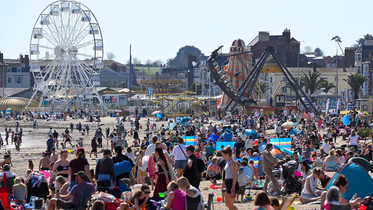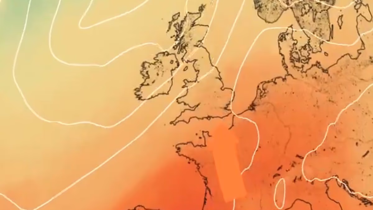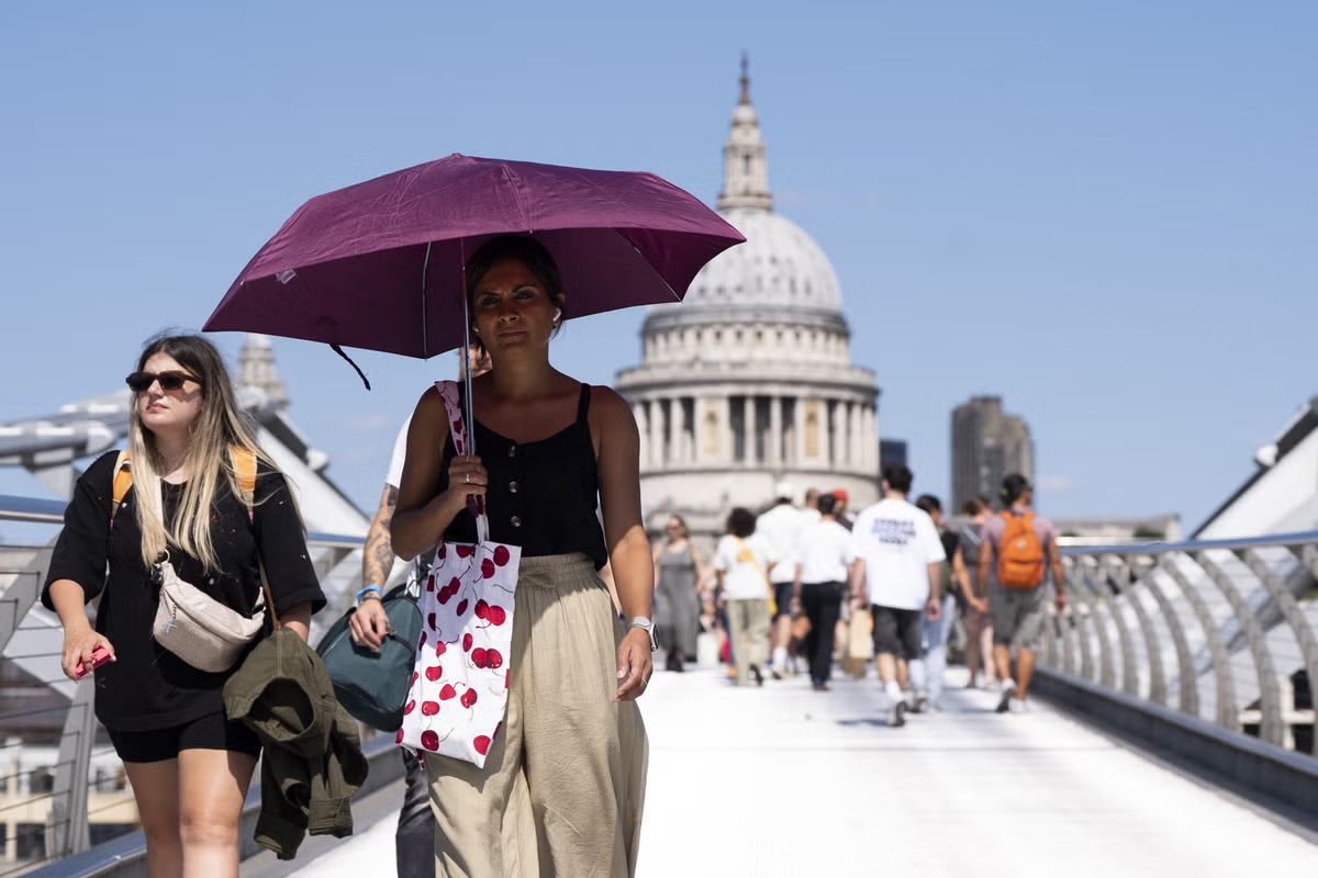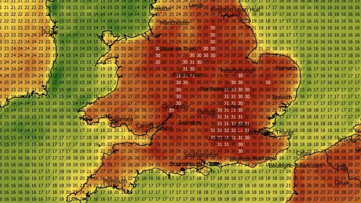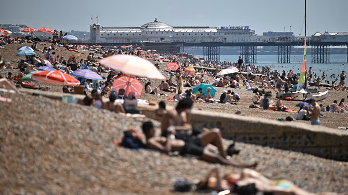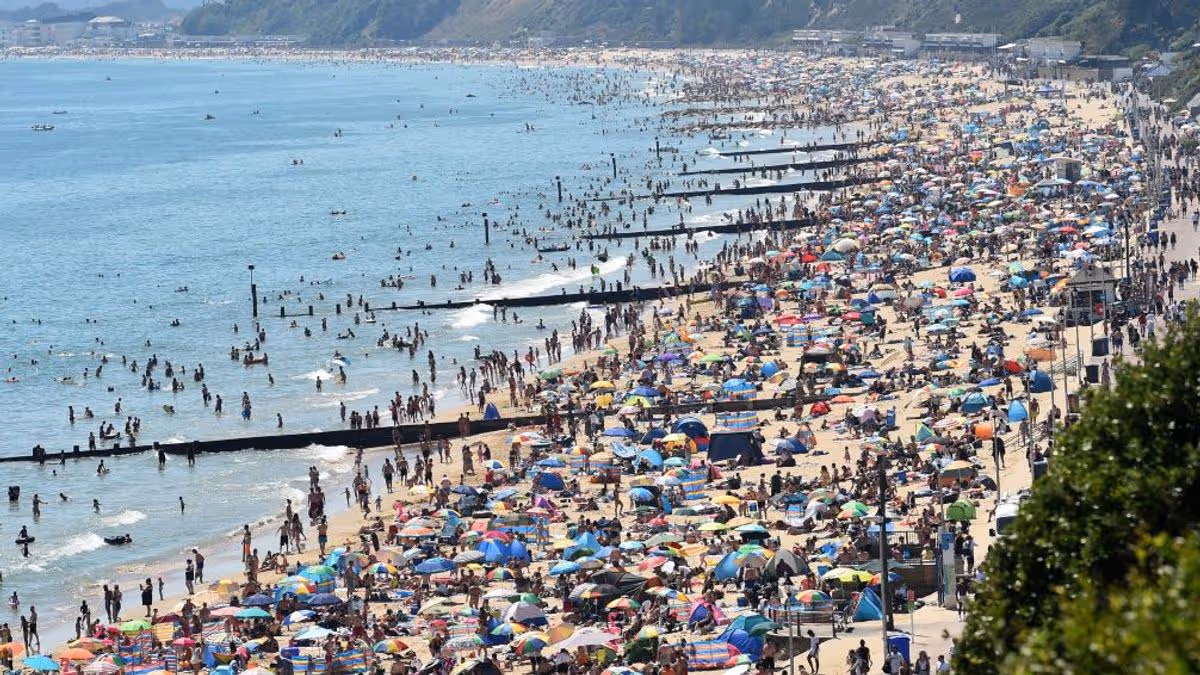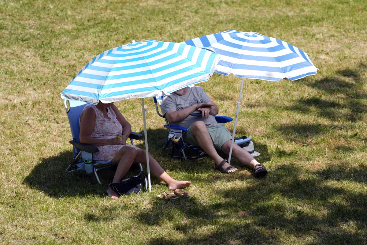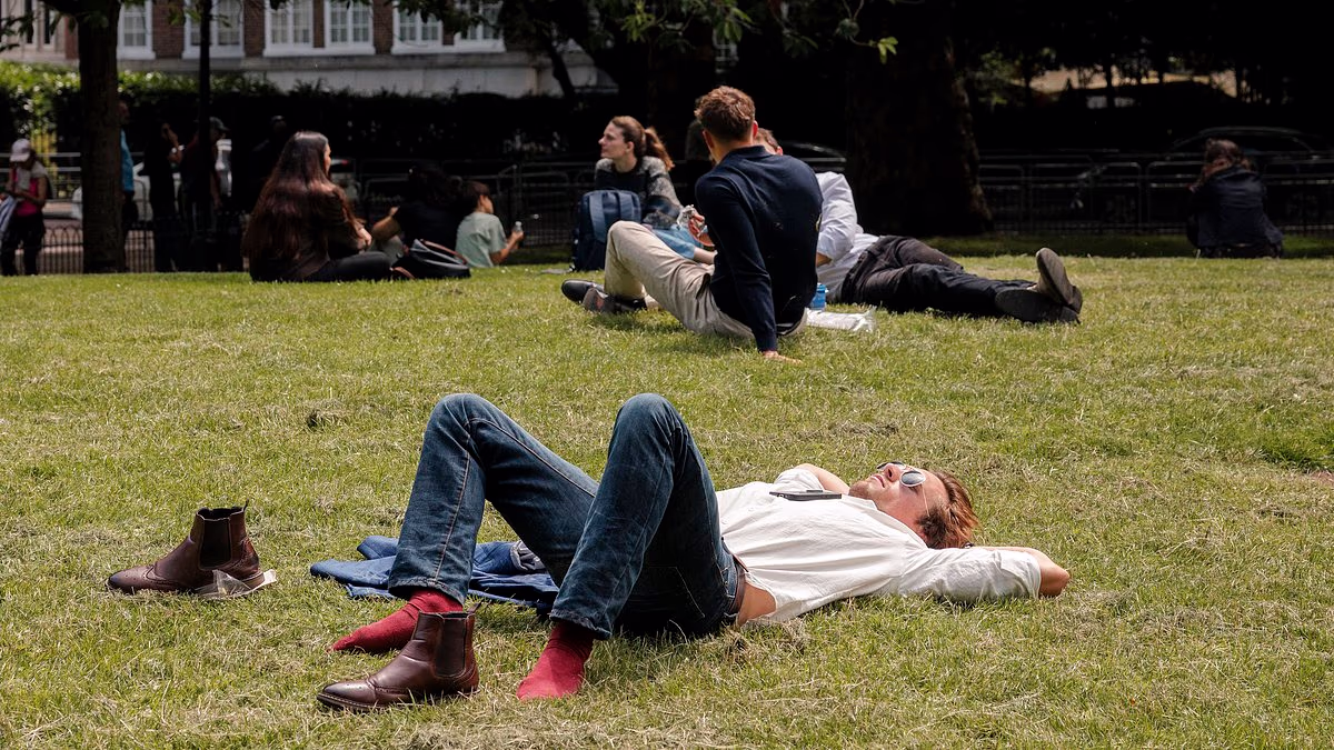
Britain will endure a six-day heatwave from tomorrow as temperatures hit 30C and Government health alerts warning of a 'greater risk to life' come into force.The Met Office warned southern England will experience the hottest weather, with thermometers set to reach at least 28C every day between tomorrow and Tuesday.The heatwave threshold - defined as three consecutive days at or above a set temperature, which is 28C in London - could be reached in the South by Saturday.The UK Health Security Agency (UKHSA) said yellow heat health alerts will be activated for the South East, East, East Midlands and London from 3pm today.The alerts - which warn of some impacts on health and social care services including a 'greater risk to life of vulnerable people' and 'increased potential for indoor environments to become very warm' - will run until at least next Monday evening.Officials also raised concerns that water‑related incidents such as cold‑water shock and drowning could increase, after at least 17 people died when they got into trouble in open water during the record-breaking May heatwave three weeks ago.High pressure building across mainland Europe will see the UK get to 29C tomorrow and Friday, 28C on Saturday, 30C on Sunday, 31C on Monday and 30C on Tuesday. Sunday will be hotter in London than Ibiza and Faro (both 27C) and Malta and Crete (29C), although some parts of Spain, France and Italy are likely to see 40C highs.But forecasters warned there could also be some spells of rain across northern and western areas of Britain and an increasing chance of thunderstorms later this week. People enjoy the sunshine and the warm weather at St James's Park in London yesterday The Met Office forecast for London shows temperatures will soar towards 30C this weekend UKHSA yellow heat health alerts will be activated for parts of England from 3pm this afternoonUnsettled conditions will bring some rain to parts of England and Wales today, although East Anglia and the South East are expected to remain mostly dry.Scotland and Northern Ireland will see a mixture of sunny spells and showers, with winds being light to moderate although fresher around some northwestern coasts.Tomorrow will bring a fine and dry start for much of England, east Wales and eastern Scotland, with the best of the sunshine towards the South East.Meanwhile cloud and rain will become more extensive across Northern Ireland, western Scotland and western England and Wales, with heavy rain possible.Temperatures tomorrow will be close to average for the time of year in the North and West, but become very warm and increasingly humid in the South East.On Friday, Scotland, Northern Ireland and northwest England are all expected to see further rain, although conditions will become brighter later with a few showers.Much of the rest of England and Wales will start mostly fine, although there is expected to be a risk of thunderstorms developing - particularly in the South East.Met Office deputy chief forecaster Tom Crabtree said: 'This week's contrasting weather of both heat, rain, and potential thunderstorms is a result of a low pressure system influencing the UK from the northwest.'The southerly flow stalls a front over the west of the UK whilst allowing temperatures to build in the South East. Friday is set to be the warmest day of the week, but it's important to note that peak temperatures could be impacted by cloud cover. The heatwave threshold is defined as three consecutive days at or above a set temperature'Temperatures are likely to range from 26C to 28C, with the potential to approach 30C in parts of South East England. Elsewhere temperatures will remain closer to average but could be warm at times in parts of Wales and the west Midlands.'Temperatures are likely to remain high across the weekend for the South East.The Met Office said some warmth will remain at the start of next week, but the 'extent and longevity is still being determined'.People heading to the coast were also warned to be 'mindful that sea surface temperatures are not as high as they would be in mid-summer'.A UKHSA spokesperson said: 'Friday is likely to see very warm, locally hot conditions for south-east and some eastern areas of England, with higher humidity and the chance of a few thunderstorms.'There is considerable uncertainty for the duration of the very warm conditions however, as a weak weather front moving east into Saturday may bring slightly lower temperatures and fresher conditions.'However, there is the potential that the weather front stalls toward the South East allowing very warm or hot conditions to linger across, or near to the far south or South East, perhaps then becoming more extensive again into the following week.'It comes three weeks after a record-breaking heatwave saw England and Wales record their hottest ever day in May with highs of 35.1C and 32.9C respectively.At the start of last week, the Met Office was also forecasting a heatwave for the weekend just gone, but temperatures ended up only hitting 24.1C – well below the threshold.The UK had four heatwaves in 2025 - two in June, one in July and one in August. The country's highest temperature of last year was 35.8C at Faversham in Kent on July 1.
Britain braces for six-day 30C heatwave from tomorrow
The Met Office warned southern England will experience the hottest weather, with thermometers set to reach at least 28C every day between tomorrow and Tuesday.
865 words~4 min read