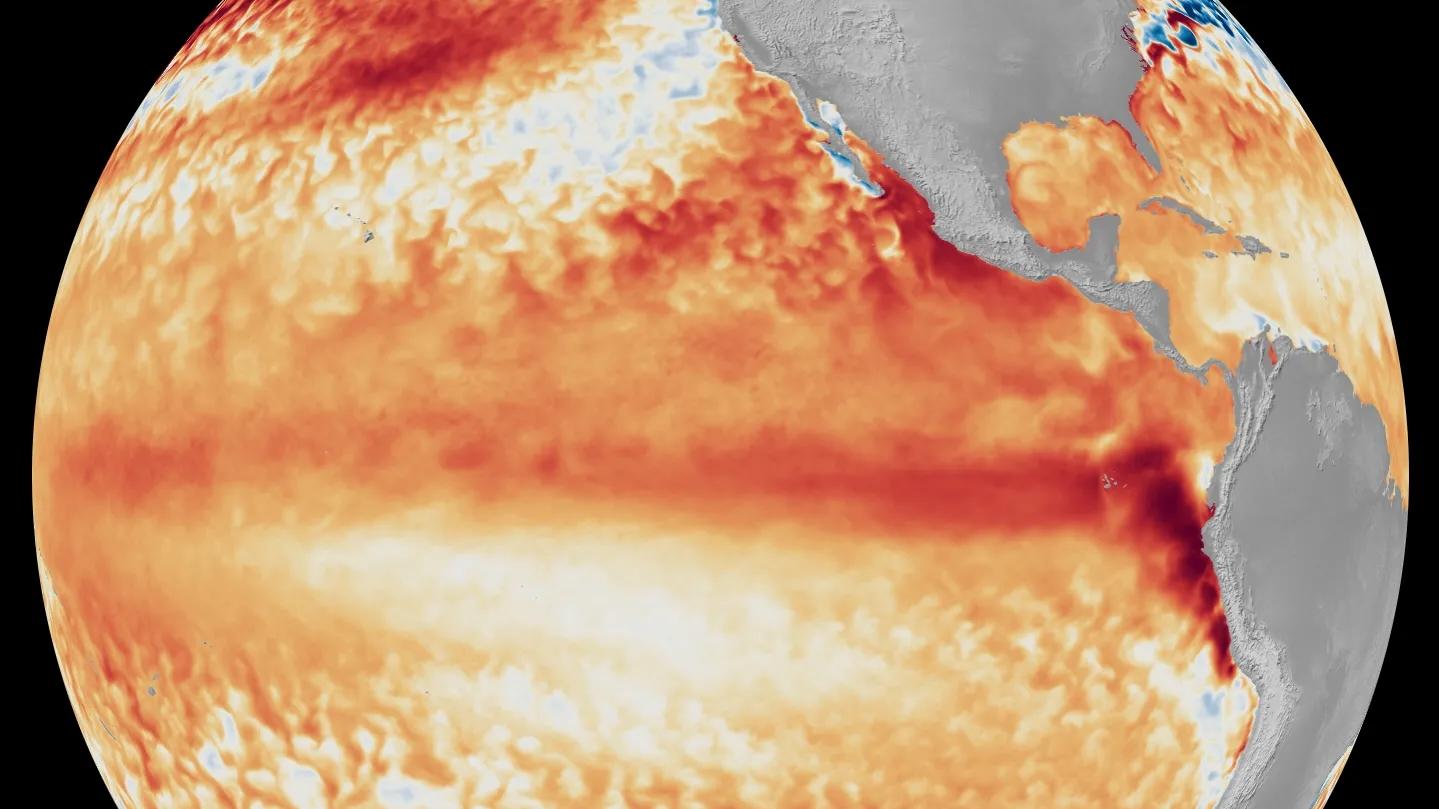
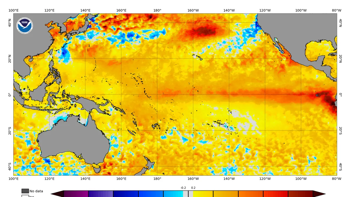
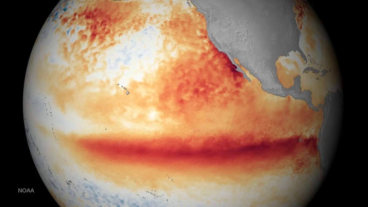
Warm sea surface temperatures during the first week of June indicate the presence of El Niño.
The FIFA World Cup matches began this week, but that is not the only thing with global implications in recent days. The National Oceanic and Atmospheric Administration announced that El Niño has formed. Here’s what that means, and why forecasters believe it could be a potentially “super” one.
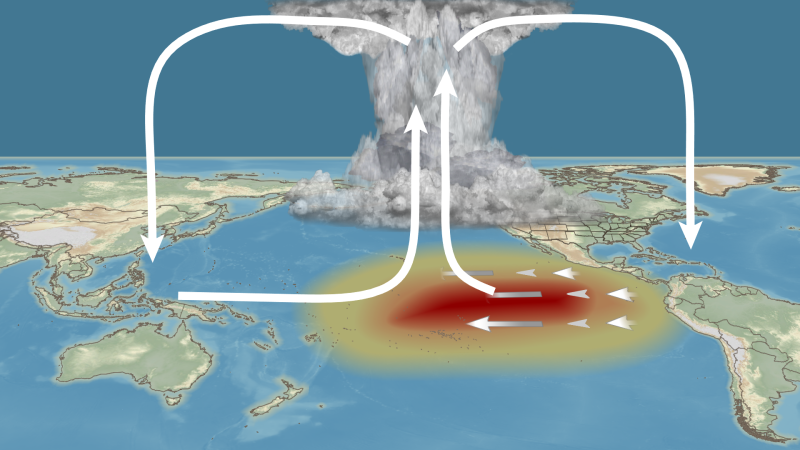
El Niño Is Here
“El Niño has developed in the tropical Pacific," wrote a NOAA press release earlier this week announcing an El Nino Advisory. “El Niño, the warm phase of the El Niño Southern Oscillation (ENSO), is predicted to intensify to a moderate or strong level this fall," the notice continued. NOAA forecasters and experts around the world say there is a 63% chance that the sea surface temperatures in the eastern Central Pacific will exceed 2 degrees Celsius above the neutral threshold." For those of you who do not speak Celsius, that is 3.6 degrees Fahrenheit. “If this threshold is surpassed, NOAA considers the event a “very strong” El Niño,” the press release stated.
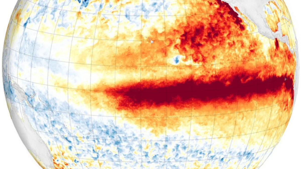
Neutral and El Niño conditions