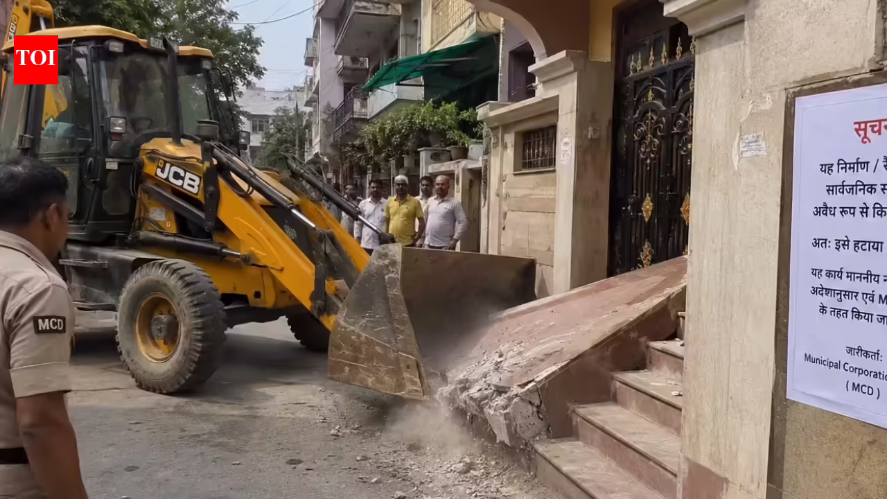
The Maharashtra State Road Development Corporation (MSRDC) on Wednesday floated tenders to appoint specialised agencies to identify violations across its jurisdiction.The survey will cover unauthorised buildings, encroachments and various forms of illegal advertisements, including hoardings, sky-signs, banners, flex boards, kiosks and unipoles. (REPRESENTATIVE PHOTO)As part of the exercise, the appointed agencies will conduct detailed surveys of illegal constructions, encroachments, and unauthorised hoardings, and create a GIS-based digital database of violations across Special Planning Authority (SPA) areas and land parcels under its jurisdiction.Officials said the move is aimed at strengthening enforcement and enabling faster action against illegal developments on MSRDC-owned land.“The GIS-based survey will help create a comprehensive inventory of illegal constructions and unauthorised hoardings while enabling faster and more effective enforcement action. Technology-driven monitoring will improve transparency and strengthen regulatory control across MSRDC areas,” said Vinod Bonde, general manager, MSRDC.The survey will cover unauthorised buildings, encroachments and various forms of illegal advertisements, including hoardings, sky-signs, banners, flex boards, kiosks and unipoles. Agencies will use GPS mapping, GIS technology, drone surveys and high-resolution satellite imagery to identify and document violations.Each structure will be geo-tagged and digitally recorded with details such as location, ownership, the nature of the violation, and photographic evidence. Survey teams will also verify whether the structures have approved building plans, occupancy certificates and other mandatory permissions.Officials said special attention will be given to encroachments on government land, footpaths, road alignments, open spaces and natural drainage channels. The agencies will prepare compliance reports comparing approved plans with actual construction on the ground.MSRDC has directed that violations be classified based on risk levels. Structures posing safety concerns or encroaching on government land will be prioritised for immediate action, while other cases will be processed according to their severity.The selected agencies will coordinate with planning authorities, municipal bodies, police and enforcement departments to support the issuance of notices, stop-work orders and other legal proceedings. The geo-mapped database will also be shared with enforcement teams to facilitate field action.Under the tender conditions, the appointed agencies must submit a mobilisation plan within 10 days of receiving the work order. The primary survey is expected to be completed within 90 days, followed by interim and final reports detailing violations and recommended actions. Monthly monitoring reports will continue throughout the contract period.
Illegal buildings, hoarding under scanner as MSRDC adopts GIS technology
Officials said the move is aimed at strengthening enforcement and enabling faster action against illegal developments on MSRDC-owned land
377 words~2 min read