See more Daily Mail on Google - save us as a Preferred SourceBy MARK DUELL, DEPUTY CHIEF REPORTER (DIGITAL) Published: 08:43 BST, 9 June 2026 | Updated: 08:48 BST, 9 June 2026
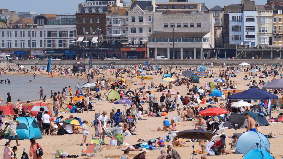
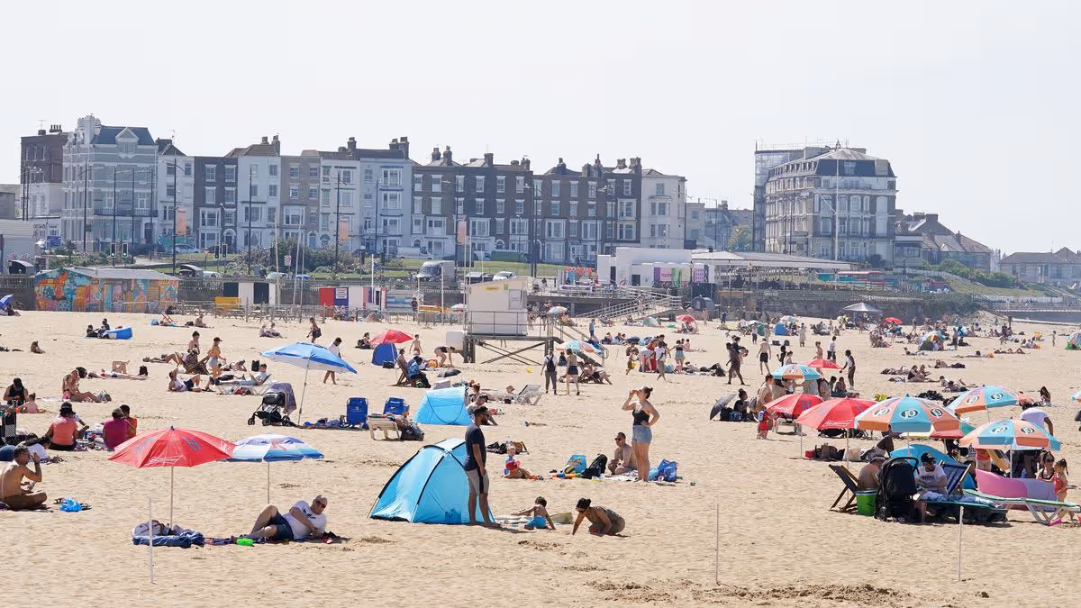
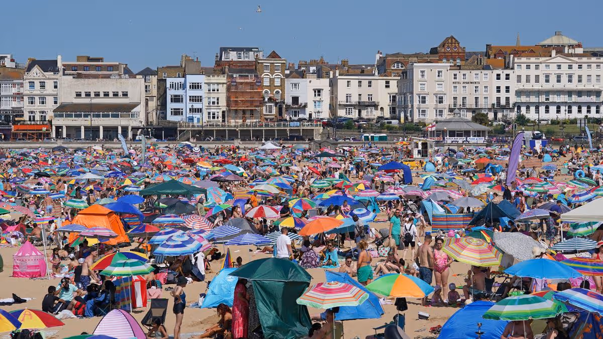
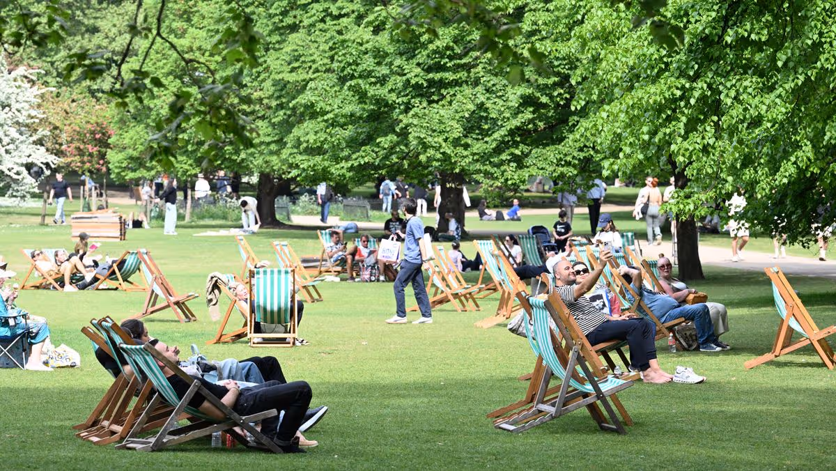
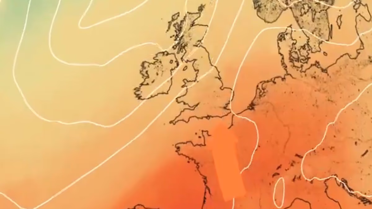
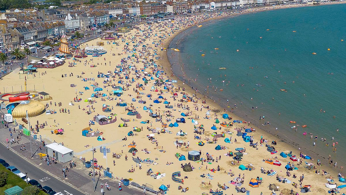
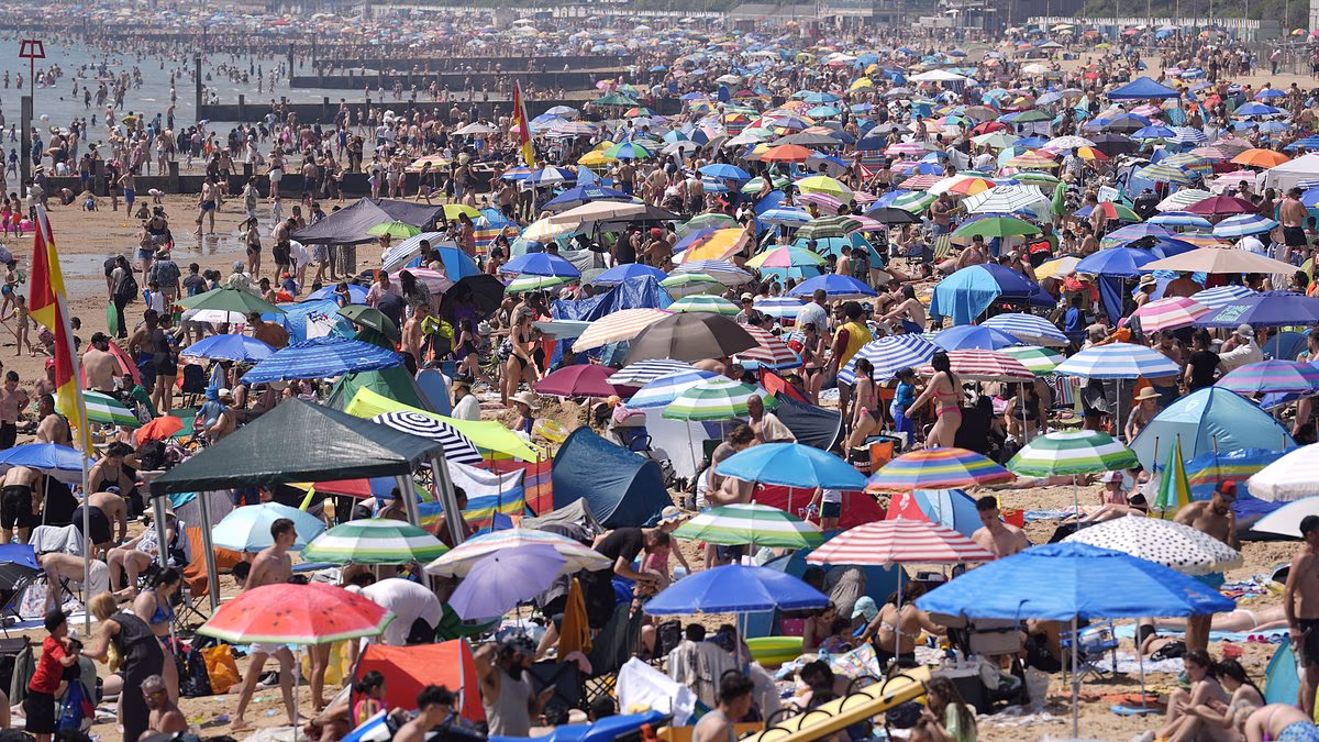
Britain faces its second heatwave of the year this weekend as summer finally arrives a fortnight late with temperatures of 30C following another wet and windy week.The UK is currently experiencing a spell of unsettled weather with rain and showers expected to continue affecting most of the country over the coming days.Temperatures in southern England will be at least a few degrees below the seasonal average of around 21C - with highs of 17C to 19C between today and Thursday.But the Met Office said conditions are expected to take a sharp turn at the weekend, with temperatures likely to rise to 24C on Friday and the high-20Cs from Saturday.The heatwave threshold - defined as three consecutive days at or above a set temperature, which is 28C in London – could be reached in the South by Monday.It comes two weeks after a record-breaking heatwave saw England and Wales record their hottest ever day in May with highs of 35.1C and 32.9C respectively.Met Office meteorologist Dan Stroud said: 'We're looking at temperatures climbing into the weekend, particularly on Saturday and Sunday.'So feeling much warmer than recent days, with temperatures quite widely above average, especially across the south come Saturday, and even more so on Sunday.' Racegoers with umbrellas try to take cover from the rain on Derby Day at Epsom on SaturdayTwo weeks ago people flocked to Bournemouth beach to enjoy the heat on Monday, May 25 The Met Office forecast for London shows temperatures will hit the high-20Cs this weekendCurrent indicators also suggest temperatures might hit the 30C barrier and possibly break it, Mr Stroud added.He continued: 'How high the temperatures get is still open to a fair amount of debate. 'There is growing signal that temperatures will be heading comfortably into the high 20Cs, perhaps breaking 30C again.'There is definitely a chance of temperatures scraping into the above 30C on Sunday, and then more so on Monday. We keep close tabs on it because there is always the potential for hitting heatwave criteria again.'The coming shift in weather conditions is because of a change in the jet stream, which is currently running across the UK and driving unsettled Atlantic weather fronts across the country.'End of this week, high pressure starts to build from the south, with clearing skies and rising temperatures over the continent,' Mr Stroud added. 'It's just a perfect recipe for temperatures to actually start climbing.'The South and South East of England are likely to experience the highest temperatures over the coming weekend.The Met Office said there was a 'prolonged spell of above-average temperatures in the forecast', adding that the warm spell is expected to 'last well into the following week at least'.But more unsettled weather is to be expected in the meantime, with today set to be a day of sunny spells and showers for most. Heavy and thundery summer showers can also be expected across the North of the country, Mr Stroud said. Hail is also possible.Thursday will likely be wet and windy for many, before the weather turns drier and increasingly settled from the south on Friday.'Thursday is likely the wettest day of the week, with an organised band of rain moving across us,' Mr Stroud said. 'But there is light at the end of the tunnel.'The UK Health Security Agency (UKHSA) has not issued any heat health alerts for England at this stage.Met Office deputy chief meteorologist Steven Keates said: 'From this weekend the UK forecast will have a distinctly warmer and drier component with a prolonged spell of above-average temperatures, with values in some locations quite likely to reach 27C to 29C, with the potential for higher values than this.' It comes after a record-breaking heatwave which saw May 26 become the hottest day in May on record for both England and Wales, with 35.1C measured at Kew Gardens in London and 32.9C at Bute Park in Cardiff.This came at the end of meteorological spring, which finished on May 31. England and Wales had their warmest spring on record thanks partly to the heatwave.Meteorological summer began on June 1 and runs until August 31. The UK had four heatwaves in 2025 - two in June, one in July and one in August. The country's highest temperature of the year was 35.8C at Faversham in Kent on July 1.