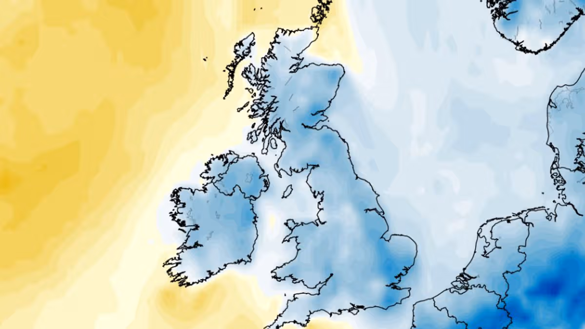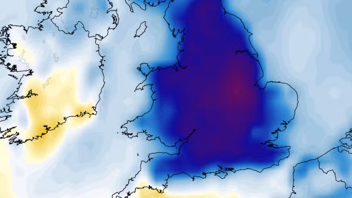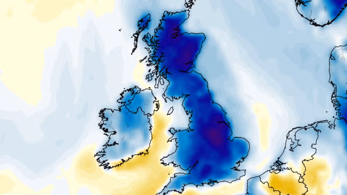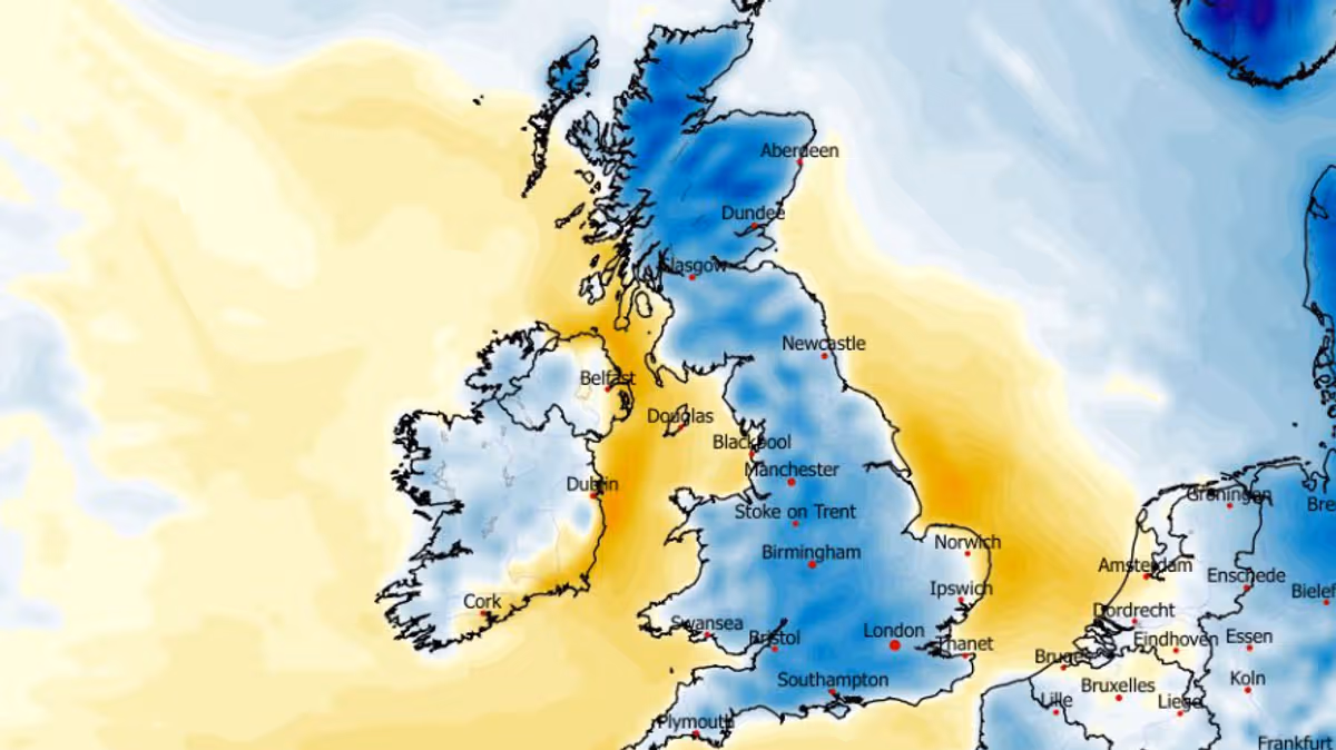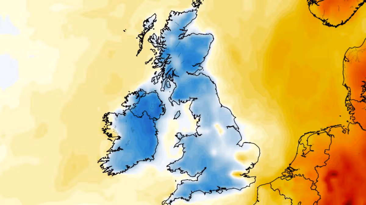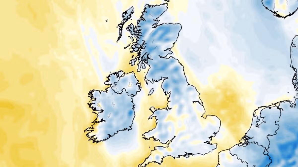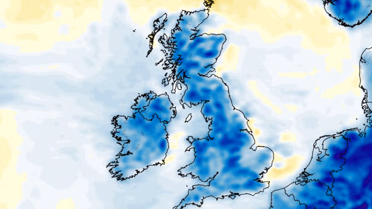
NewsUK NewsWeatherDespite a scorching heatwave in May and forecasters predicting more hot conditions this summer, weather modelling maps suggest a chilly spell is just days away15:57, 05 Jun 2026Weather models suggest morning temperatures could soon drop into single digits right across the UK - plunging as low as 1C in the coldest regions.That is despite weather forecasters from the Met Office and MeteoGroup - which provides data to BBC Weather - saying Brits face an increased chance of heatwaves this summer following the record-breaking hot spell in May.Although warm conditions shouldn’t be too far away, the ECMWF weather model suggests a cold spell is on the cards next week, starting on Tuesday. Minimum possible temperature maps show every inch of the UK - all 92 counties - could see temperatures below 10C at around 6am.Predictably, the coldest conditions on Tuesday are expected in northern Scotland, where 4C is on the cards in the morning - but even in the south-east of England, where temperatures tend to be warmest, the mercury could struggle to surpass 8-9C.ECMWF model data for Wednesday morning shows a similar picture, this time with temperatures dropping to 2C in Scotland. For Northern Ireland, northern England, central England and Wales, the mercury could reach just 6-8C. The data does however show minimum temperatures hitting double digits (just 10C) in the south-east of England on Wednesday morning.On Thursday morning, northern Scotland might see highs of just 1C. The maps for Thursday do however show slight improvements in southern England, particularly in the south-west where minimum temperatures at 6am are shown as reaching 10-11C.Temperature anomaly maps for Tuesday, Wednesday and Thursday next week show the whole country shaded in blue. This indicates where temperatures are expected to drop well below the seasonal average.Met Office’s latest weather forecastThe Met Office forecast also shows a grim picture heading into next week. It predicts “often breezy” conditions and below-average temperatures for the start of the week, with long spells of rain possible too.The Met Office forecast for June 9 to 19 states: “Changeable early in this period with Atlantic frontal systems moving across the UK. These will bring showers or longer spells of rain at times, with wettest conditions in the northwest, drier in the southeast. Strong winds may affect parts of the UK at times, especially the northwest.Article continues below“Later in the period, higher pressure and more settled conditions may begin to become more prevalent, especially in the south. There will probably still be some wet interludes though. Temperatures are likely to be near to or a little above normal overall.”Choose Daily Mirror as a 'Preferred Source' on Google News for quick access to the news you value.BBCMet OfficeWeather
UK weather maps show temperature plunge to 1C days away – 92 counties below 10C
Despite a scorching heatwave in May and forecasters predicting more hot conditions this summer, weather modelling maps suggest a chilly spell is just days away
447 words~2 min read