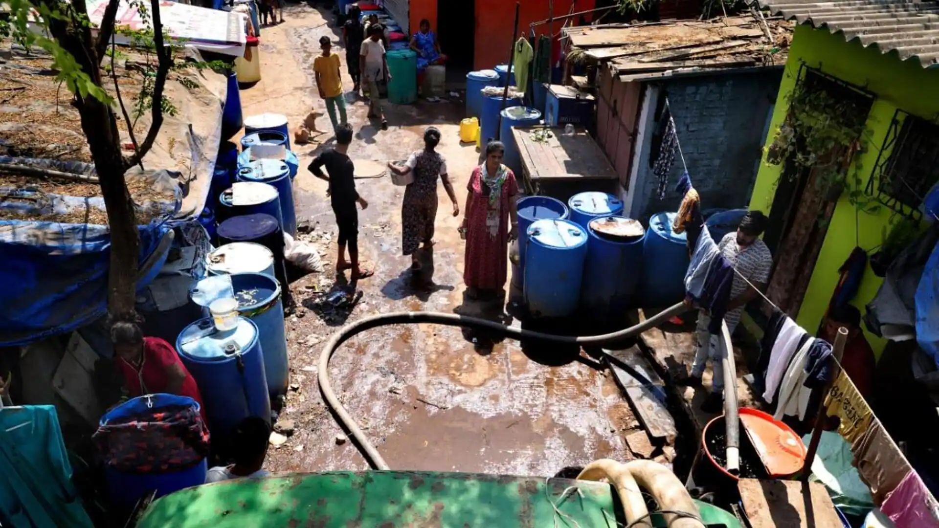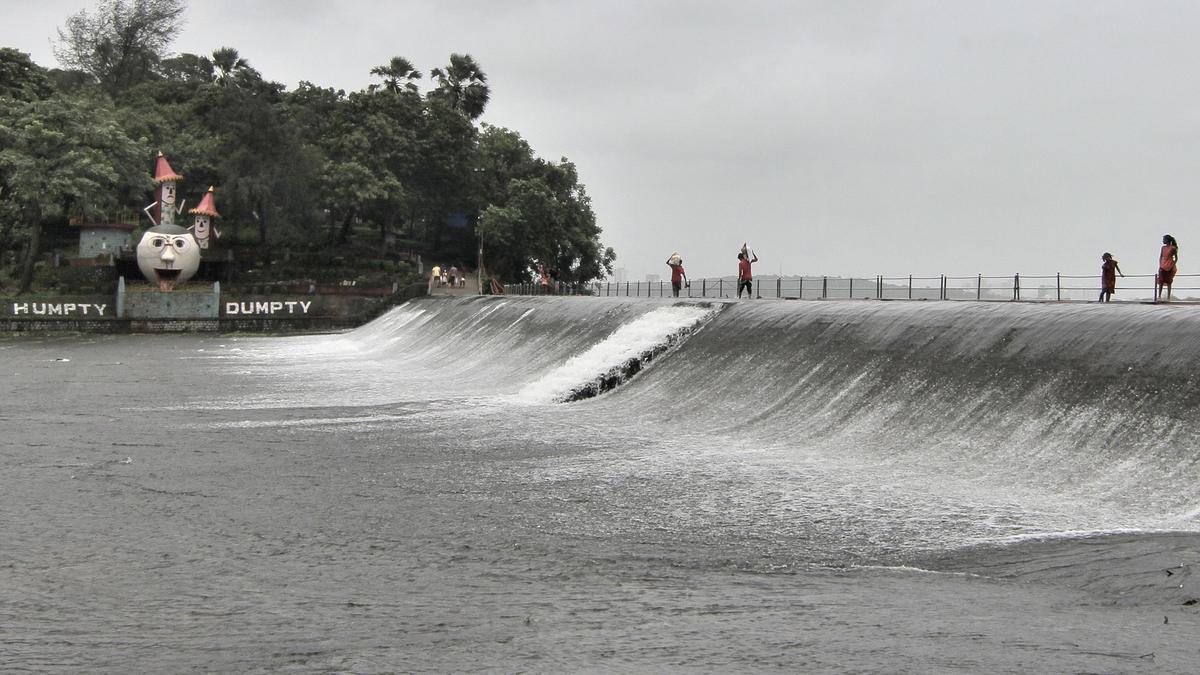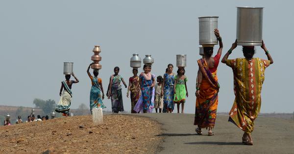
This summer, the Brihanmumbai Municipal Corporation implemented a 10% water cut from May 15 as levels in the seven lakes, which the city depends on, plummeted. The city had water for 45 days as of June 3, amid concerns over a weak monsoon season.Mumbai’s water problems overshadow the situation in other cities in the Mumbai Metropolitan region. As Mumbai continues to draw heavily from shared regional resources, tankers and water shortages have become routine in neighbouring Vasai-Virar, Bhiwandi-Nizampur and Mira-Bhayandar. Despite being located next to the dams that supply Mumbai city with water, many villages within the metropolitan region also continue to face routine shortages.Ironically, Mumbai receives the highest per capita water supply in the Mumbai Metropolitan Region – well over 200 litres per capita per day. By contrast, Vasai-Virar gets 70 lpcd, Bhiwandi-Nizampur 100 lpcd, and Mira-Bhayandar 105 lpcd – well below the prescribed standard of 135 lpcd.The continued scarcity is part of a larger story: how Mumbai city, without expanding its borders, redrew the map of water control around in ways that continue to shape who gets water – and who does not – for decades to come.A man walks beside two water pipelines in Bandra in Mumbai in this photo from October 2006. Credit: AFP.Where does Mumbai’s water come from?Most of the water that Mumbai consumes comes from sources far beyond the city’s limits, some from over 100 km away. Every day, millions of litres travel through long-distance pipelines from mainland reservoirs to Mumbai’s taps, much of it from dams the city has built and controls.How does the island city claim water from outside its own jurisdiction? The answer lies not just in dams, pipelines, engineering, or even Mumbai’s economic and political power as the state capital. It is in something less visible: how the region was mapped and imagined.About five decades ago, planners redrew the geography of water around Mumbai. River basins on the mainland, including the Vaitarna and Ulhas, were brought together into a single planning unit – the Mumbai Hydrometric Area.Managing water along natural hydrological boundaries was seen as scientific, efficient and modern, promising coordinated planning and better use of scarce resources.But this seemingly neutral idea had far-reaching consequences.The Mumbai Hydrometric Area spans a vast stretch of the mainland, far beyond the city’s municipal limits. Mumbai is not part of this hydrological region. Yet the area was named after the city, granting it a right to water resources located outside its jurisdiction.By defining and organising this space in Mumbai’s name, planners created a means for the city to extend its influence over these sources.Women from drought-affected villages carry pots to spread awareness on water use, in Mumbai in May 2016. Credit: AFP.Growing water needsIn the 1960s and 1970s, as Mumbai’s population grew, so did its demand for water. New towns and industrial centres emerging in the surrounding region were also beginning to plan their own water supplies.Various agencies were competing for limited resources. The Maharashtra Industrial Development Corporation was planning dams for industry, the Irrigation Department was developing projects such as Bhatsa, and the City and Industrial Development Corporation was seeking water for Navi Mumbai.For Mumbai’s planners, this piecemeal and uncoordinated development posed a clear threat: what if these competing demands reduced the city’s access to water from the mainland?Experts and international agencies, including the World Bank, stepped in. They argued that the region’s water resources needed to be planned better, treating the entire hydrological region as a single unit.This approach was taken forward through regional institutions such as the Mumbai Metropolitan Region Development Authority, established in 1975. Within it, a Water Resources Management Board was set up in the same year, alongside the formal adoption of the Mumbai Hydrometric Area as the basis for water resource planning.The board assessed water demand and resources across the region through expert-led studies. In 1983, it presented a Perspective Plan to develop the metropolitan region’s water resources, allocating them among users, including Mumbai.But this plan to build an integrated regional water system did not last. The MMRDA Act was amended in 1983, and the Board meant to coordinate this vision was eventually dissolved.The promise of shared planning faded. But the allocations made during that process remained.Map of the Mumbai Hydrometric Area and dams supplying water to the city of Mumbai. Credit: Sachin Tiwale.Mumbai’s damsIn this process, Mumbai legitimately secured permission to develop three large dams on the mainland – Middle Vaitarna, Kalu and Gargai. Backed by its financial capacity, the city could move ahead independently, without coordinating with other corporations and councils, and on its own timeline.When Mumbai’s master plan for water supply was being prepared in 1999, its administrators decided against building the Kalu dam and instead focused on the Pinjal dam.But the Pinjal dam had been allotted to the Vasai-Virar Municipal Corporation and the surrounding villages in the northern part of the metropolitan region, according to the 1983 Perspective Plan. Water from the Pinjal dam in the Vaitarna basin can be brought to Mumbai by gravity unlike the Kalu dam, which would require pumping. The Vaitarna basin was also less populated and less prone to pollution than the Ulhas basin, where the Kalu dam is located.Mumbai strategically chose to prioritise the Pinjal over the Kalu dam to access better-quality water, save on pumping costs and ensure a more reliable supply not dependent on electricity.The Kalu dam was allocated to the urban local bodies in the eastern sub-region, including the municipal corporations of Thane, Bhiwandi, Kalyan-Dombivli, and Ulhasnagar, as well as the municipal councils of Ambernath and Kulgaon-Badlapur.While other city corporations and councils struggled to develop their own supplies, Mumbai went on to build the Middle Vaitarna dam in 2014. In April, the civic body’s standing committee approved the construction of the Gargai dam at a cost of Rs 5,000 crore.By adopting a river basin approach and defining the Mumbai Hydrometric Area, planners created a system that made Mumbai’s expanding control over water appear natural and necessary. The language of efficiency and integration helped depoliticise what were, in effect, deeply political choices.The city’s boundaries were unchanged but its reach expanded.Rather than scarcity, Mumbai’s water supply reflects how decisions that appear technical – focused on maps, boundaries and planning – shape who gets water and who gets better-quality water.It raises difficult questions of power and access to water. Who decides how water is allocated across regions? Whose needs are prioritised and what happens to communities that lie within these “resource zones” but outside centres of power?This article is based on research published in a peer-reviewed academic journal, Political Geography, under the title “Technopolitics of water appropriation: How Mumbai claims hydrological dominance in its metropolitan region”.Sachin Tiwale is Fellow, Water and Society Programme, Centre for Environment and Development, Ashoka Trust for Research in Ecology and the Environment (ATREE), Bengaluru. His email ID is: sachin.tiwale@atree.org.
Mumbai is worried about water, but its control over mainland dams is depriving others
The city receives the highest per capita supply in the metropolitan region while its control over mainland water resources is depriving others.
1,149 words~5 min read