See more Daily Mail on Google - save us as a Preferred SourceBy MARK DUELL, DEPUTY CHIEF REPORTER (DIGITAL) Published: 13:00 BST, 2 June 2026 | Updated: 13:01 BST, 2 June 2026
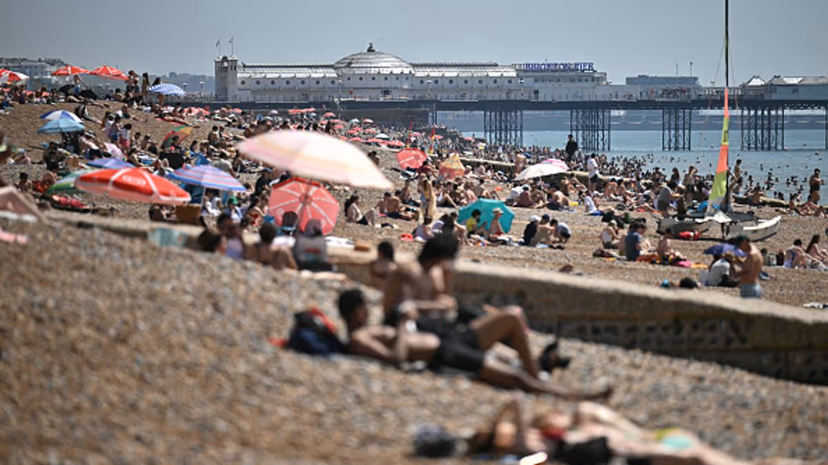
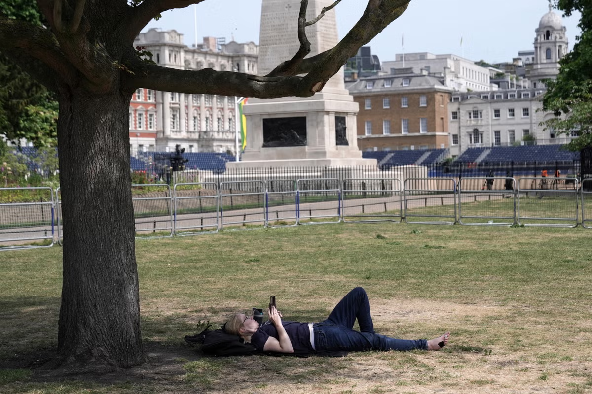
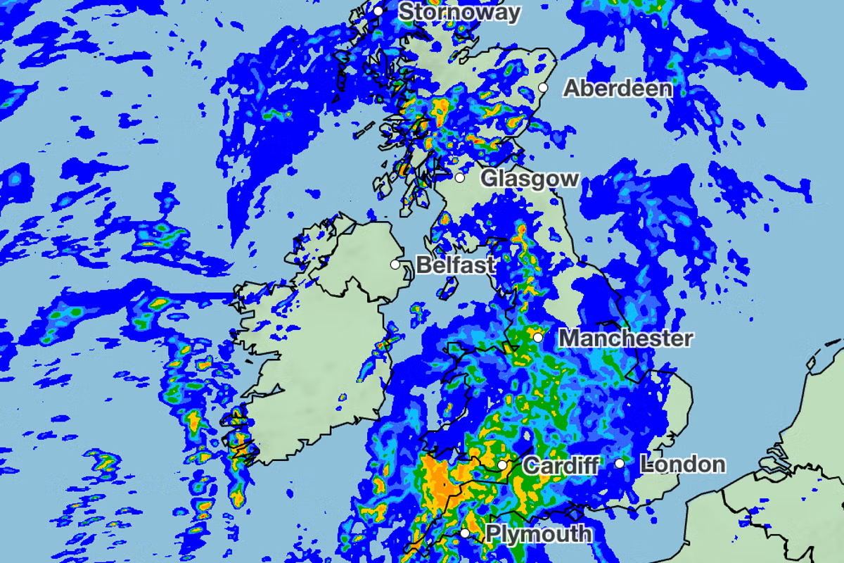
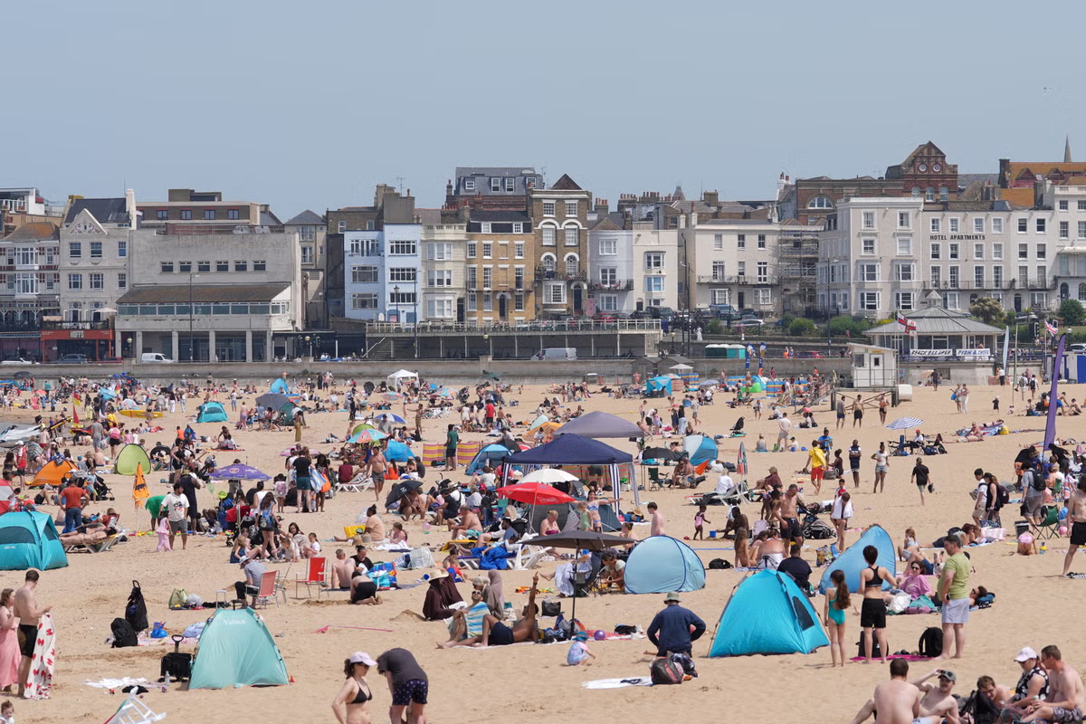
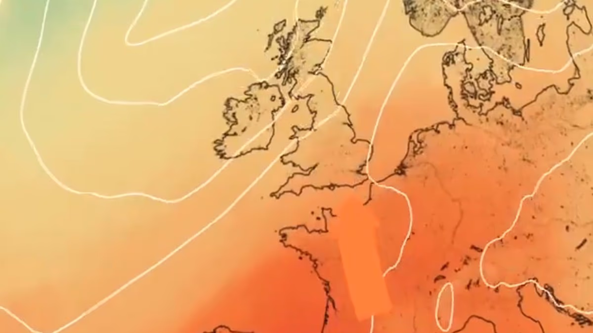
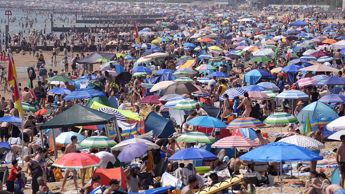
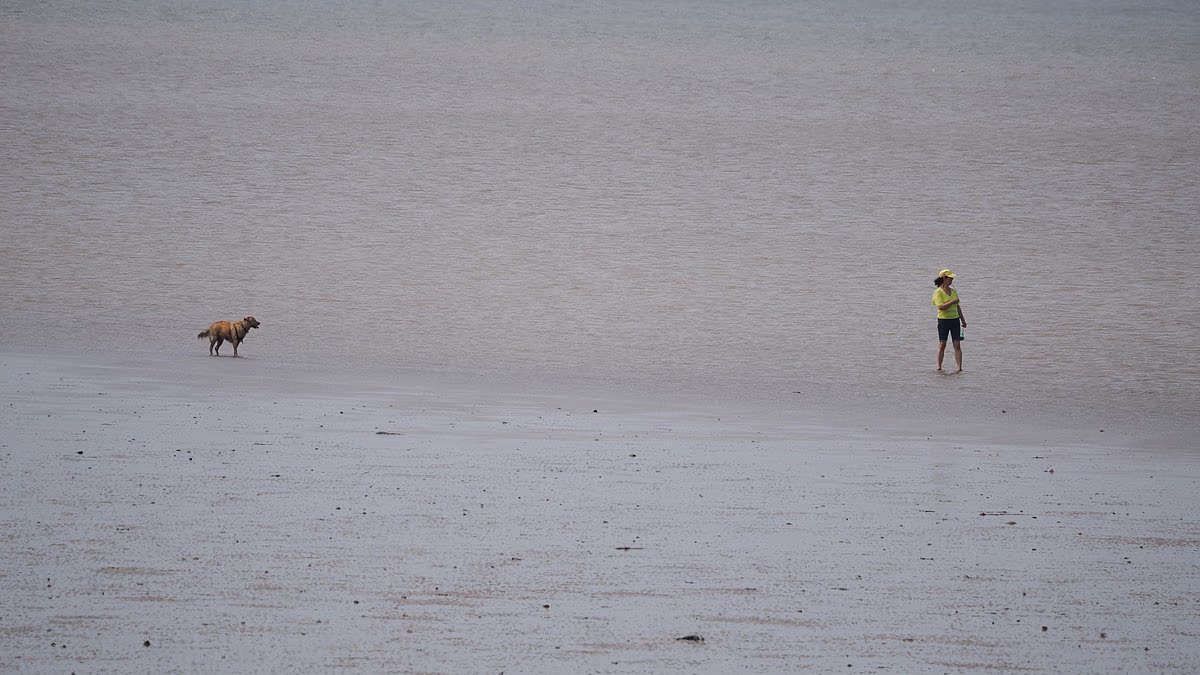
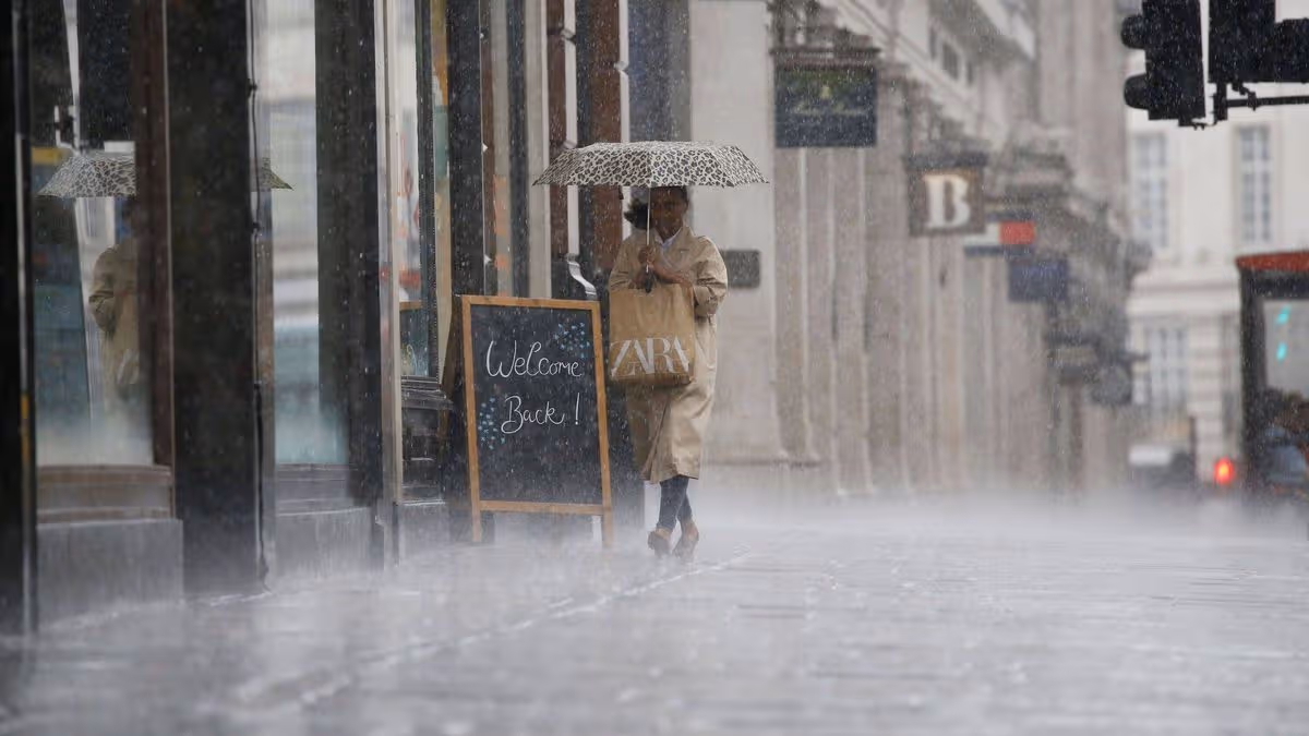
This time last week, Britain was sweating through its hottest day in May on record as temperatures soared beyond 35C during the unprecedented spring heatwave.But the UK is now being deluged by a washout start to summer which officially began yesterday - with further heavy rain and thunderstorms forecast over the coming days.Temperatures are about 14C lower in some areas compared to last week - with highs today of 19C in the North and 21C in the South, around average for the time of year.While this week marked the beginning of meteorological summer, conditions for many felt far more like spring or autumn - representing a big contrast to the heatwave.It comes after last Tuesday became the hottest May day for both England and Wales, with 35.1C measured at Kew Gardens in London and 32.9C at Bute Park in Cardiff.The Met Office said this week is expected to bring thunderstorms and strengthening winds as well as heavy rain – which will be welcomed by farmers and gardeners.Wales faced particularly heavy downpours yesterday, while the highest accumulation of rain recorded across the UK was 36.4mm (1.4in) at Shobdon in Herefordshire.Central and southern areas are the main regions likely to see thunderstorms today, while heavy thunderstorms are also forecast anywhere in the UK on Thursday. ‹ Slide me › People enjoy punting on the River Cam in the Cambridge sunshine during the May heatwave on Monday last week (left) - but they are sheltering under umbrellas in the heavy rain today (right) ‹ Slide me › A woman rides on a bicycle during the hot weather in London's Hyde Park during the heatwave last Tuesday (left) - but cyclists are getting soaked in nearby Regent's Park this morning ‹ Slide me › People walk on London Bridge on a sweltering day in the capital last Wednesday (left), but they are taking cover from the rain under umbrellas on Vauxhall Bridge today (right) ‹ Slide me › Met Office maps show the heatwave last Tuesday (left) and the wet forecast today (right) Senior operational meteorologist Rebecca Mitchell said the rest of the week will bring unsettled weather to the UK along with some sunny spells and highs of low 20Cs.The cooler weather follows at least 17 people dying in the heatwave after getting into difficulties in bodies of water, prompting emergency services to issue safety alerts.The latest incident saw search teams recover the body of 11-year-old boy Mackenzie Swift who entered the River Don near Mexborough in South Yorkshire on Saturday.The alarm was raised when Mackenzie did not emerge from the water, prompting a 48-hour search. This morning, South Yorkshire Police said they had recovered a body.Yesterday, the Met Office revealed England and Wales had their warmest spring on record this year, thanks partly to the 'exceptionally early' heatwave that hit the UK.The mean average temperature in England across March, April and May was 10.41C, beating the previous record of 10.23C set in 2025, according to provisional figures. It is the third year in a row that a new record has been set for the warmest spring in England.Wales saw a mean of 9.73C, pushing 2025 (9.69C) into second place, with 1893 third (9.66C) and 2024 fourth (9.44C). Scotland experienced its eighth warmest spring and Northern Ireland its joint sixth warmest, while the UK as a whole saw its third warmest. The 'exceptionally early and record-breaking spell of heat at the end of May' helped to push the seasonal mean temperature in England and Wales to its highest level since comparable data began in 1884, the Met Office said.Amber heat-health alerts were issued for several regions of England, meaning conditions were a risk to vulnerable people and likely to put pressure on health services.Several counties in the South and East of England received only around a third of their average rainfall this spring. Cambridgeshire had 35 per cent of its long-term average for the season, Essex had 34 per cent while Kent and Suffolk both had 33 per cent.There was a clear north-south split in England, with the north receiving 90 per cent of average seasonal rainfall compared with just 50 per cent across the south.The Environment Agency said a meeting of the National Drought Group will be held in the next few weeks to assess the impact of the heatwave.