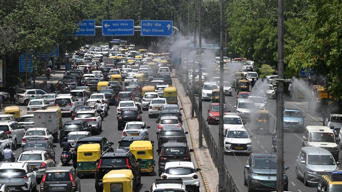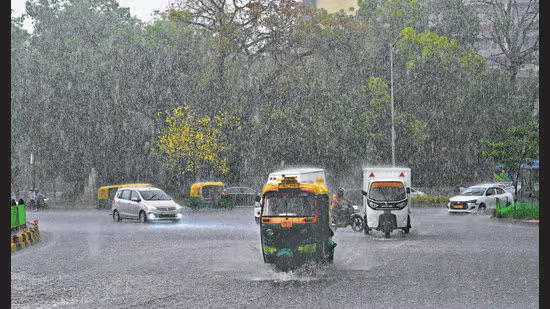
New Delhi: Relief from the searing May heat continued for a second day on Saturday as the city experienced gusty winds and afternoon showers, capping the maximum temperature at 37.1°C – more than three degrees below normal, according to India Meteorological Department (IMD) data.Pollution levels also dipped due to the wind and rain, with the city recording its cleanest air day in more than 230 days. (HT)Pollution levels also dipped due to the wind and rain, with the city recording its cleanest air day in more than 230 days. The air quality index fell to 85, in the “satisfactory” zone, the lowest since October 8, when it was recorded at 80.Saturday marked the fourth “satisfactory” AQI day this month, following May 4, 5, and 8, when the AQI was recorded at 88, 86, and 100 respectively. According to the Central Pollution Control Board (CPCB)’s classification, an AQI between 0 and 50 is “good,” 51-100 “satisfactory,” 101-200 “moderate,” 201-300 “poor,” 301-400 “very poor,” and 401-500 “severe.”The maximum temperature on Sunday is expected to be between 36°C and 38°C, according to IMD’s forecast. The relief, however, will begin to fade from Monday onwards when the maximum is expected to gradually increase and is likely to reach 40°C to 42°C by June 4. The city is set to experience partly cloudy skies on Monday and Tuesday, after which clear skies will persist until Friday.Rains, winds and stormA yellow alert for rain and winds was issued in the city on Saturday morning. All weather stations recorded rain only between 2:30pm and 5:30pm. Mayur Vihar saw the highest amount of rainfall at 4mm, followed by Lodhi Road at 3.8mm and Safdarjung at 0.9mm. Pitampura and Pusa both recorded 0.5mm, followed by the Ridge station at 0.4mm and Ayanagar at 0.2mm. Palam recorded only trace amounts, while no rainfall was recorded at Najafgarh and Janakpuri.The minimum temperature on Saturday was recorded at 24.6°C.At 4:17 p.m., IMD issued a red alert for rain for north Delhi, most of north-west Delhi, and parts of west, southwest, central, and north-east Delhi, indicating a severe thunderstorm with winds up to 60-80 km/h.Residents of Noida received a flash alert warning of storms accompanied by lightning, winds that may reach as high as 70 km/h, and rainfall at 5:16pm. Atul Goyal, president of the United Residents Joint Front, a federation of Delhi RWAs, said residents in other NCR areas such as Gurugram and Sonipat also received weather alerts.In the afternoon, IMD issued a yellow alert for Sunday as well, forecasting “partly cloudy sky becoming generally cloudy sky, a spell of very light to light rain accompanied with thunderstorm/lightning and strong wind speed reaching 40-50 km/h.”Due to the weather, three flights to Delhi’s Indira Gandhi International Airport were diverted to Lucknow. These included Air India flight AI 2516 from Indore, Indigo flight 6E 6430 from Leh, and Akasa Air flight QP 1821 from Bangalore.Experts said the rain was due to a western disturbance inducing a cyclonic formation over the Punjab-Chandigarh-Haryana region. “The city will see more rain during late afternoon and evening tomorrow, but after that the weather will clear up, although a feeble western disturbance may arrive in the coming week. Going into June, one or two episodes of isolated heatwave may occur, but the city will be experiencing occasional rain and thunderstorms as pre-monsoon activities continue, providing short breaks from the heat,” said Mahesh Palawat, vice president of Skymet Weather.A May of two halvesFrom May 1 to May 30, the city recorded an average maximum temperature of 39.6°C and an average minimum of 25.8°C, compared to last year’s average maximum of 37.6°C and average minimum of 25.3°C. According to the IMD, the mean average maximum for May is 39.9°C, while the mean average minimum for May is 25.8°C.This year Delhi experienced only one day when a heatwave was officially declared, but saw multiple days with isolated heatwave conditions. The first half of May saw only one day when the temperature reached 40°C – on May 14 when the maximum was recorded at 40.6°C – while the second half saw 13 consecutive days from May 16 to 28 during which the temperature remained above 40°C.In 2024, Delhi experienced the hottest May in at least 13 years, according to IMD data available going back to 2011, recording an average temperature of 41.7°C with six consecutive heatwave days from May 26 to May 31.May this year also saw lower rainfall than normal, with 17.61 mm recorded at Safdarjung, which is considered representative of Delhi’s weather. The normal rainfall for May according to the IMD is 30.7 mm. In 2024, Delhi saw an unusually high amount of rainfall in May, with Safdarjung recording 186.4 mm – almost six times the normal amount.
Rain and wind keep Delhi cool; air quality also improves
New Delhi saw relief from heat with gusty winds and rain, lowering temperatures to 37.1°C and improving air quality to its best in 230 days.
787 words~4 min read