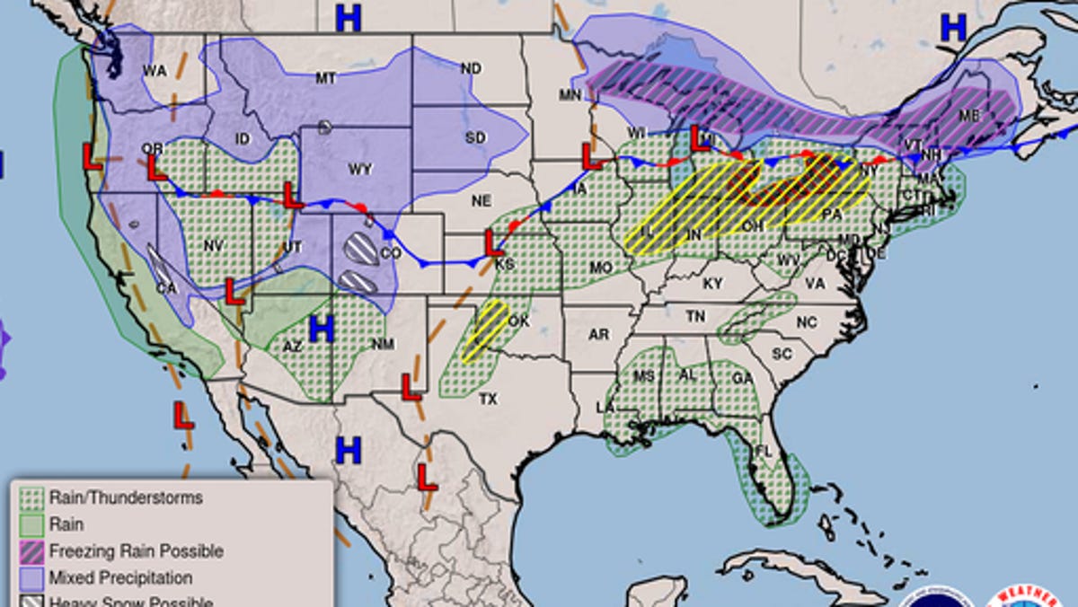
Severe weather is expected to sweep across much of the country through the early part of next week, with the potential for everything from flash floods, tornadoes and hail, to strong winds, wildfires and snow.
According to the National Weather Service, a "very active Spring weather pattern" is forecasted for the central U.S. through Sunday, April 26, and into early next week, beginning with strong winds and large hail threatening Kansas and Oklahoma.
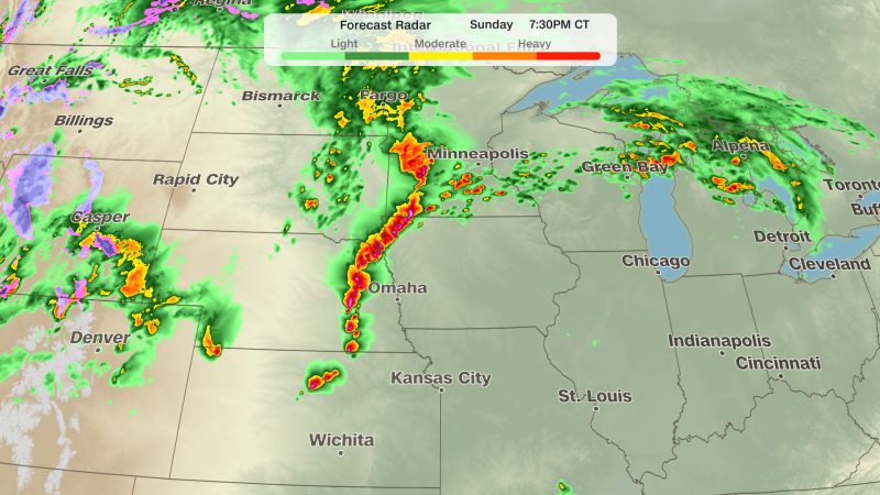
"A complex weather scenario will unfold today into tonight, with higher confidence in the threat for very large hail and tornadoes tonight across Kansas," the NWS Storm Prediction Center posted to X on Sunday. "A conditional severe threat will extend southward into Oklahoma."
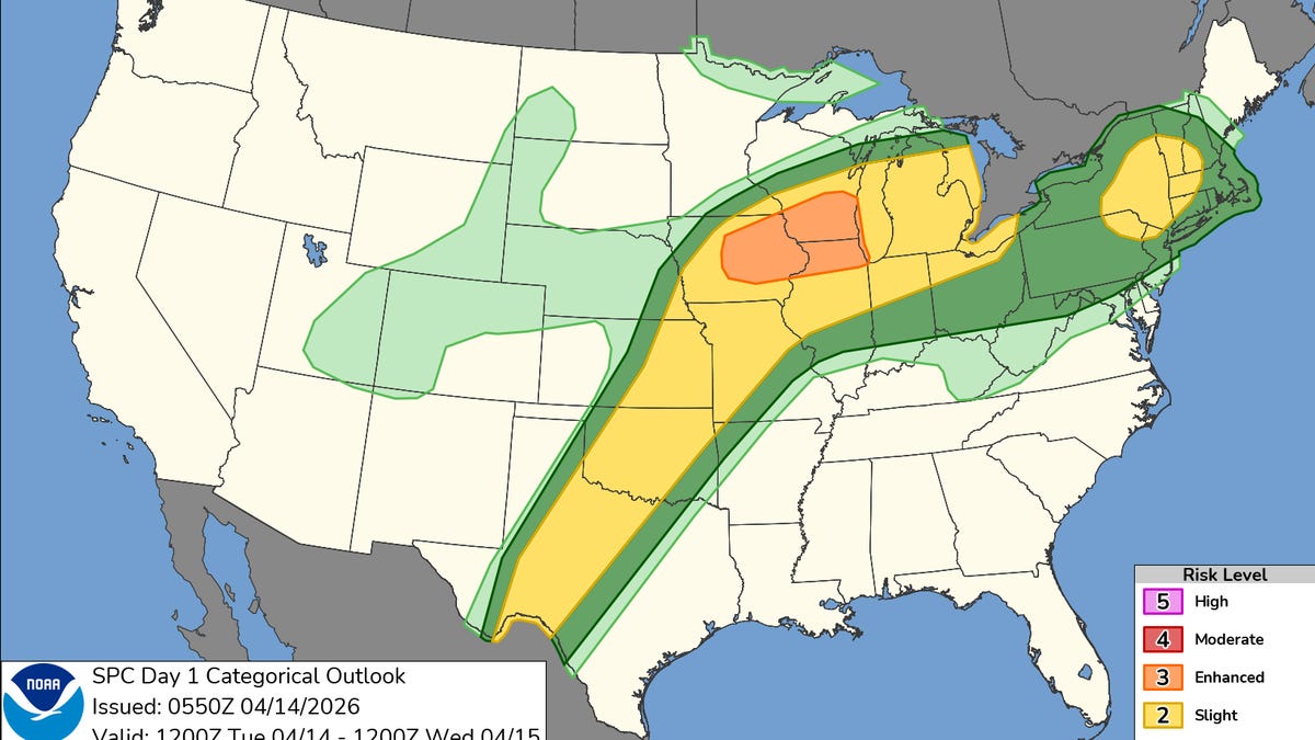
Excessive rainfall could also lead to flash floods. Sunday advisories are in effect for eastern Kansas, western Missouri, southern Iowa and Nebraska. Come Monday, April 27, eastern Iowa and northern Illinois – including urban areas around Chicago – face a "slight risk for excessive rainfall," the NWS reported.
AccuWeather Senior Meteorologist Dan Pydynowski said that Monday's risk zone will extend nearly 1,000 miles, from Mississippi to Wisconsin, with the "greatest threat for damaging storms" hovering above the St. Louis region.