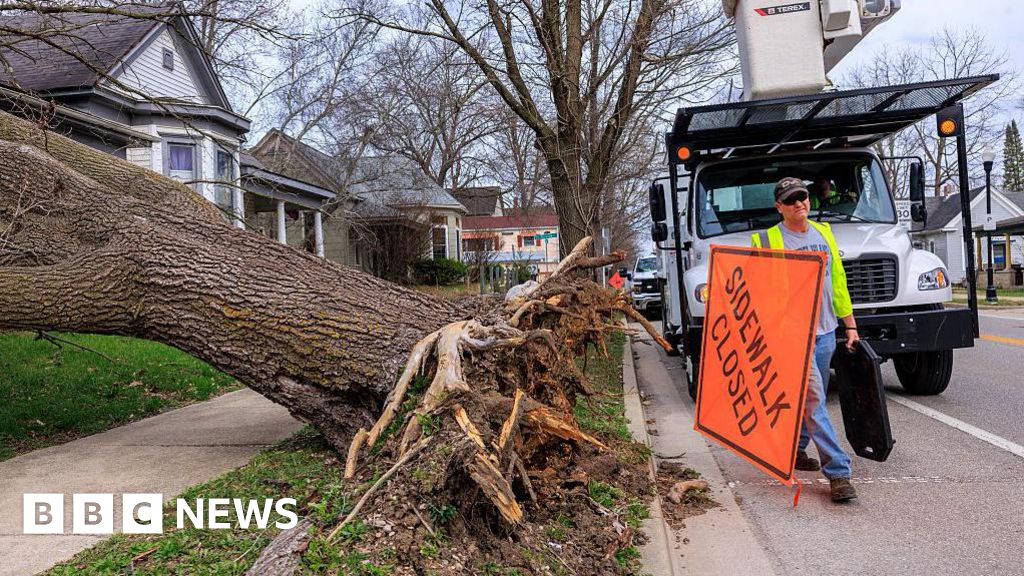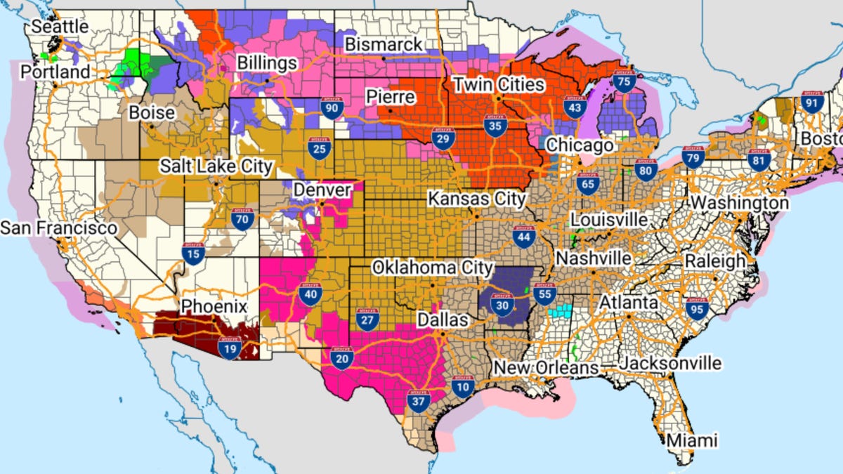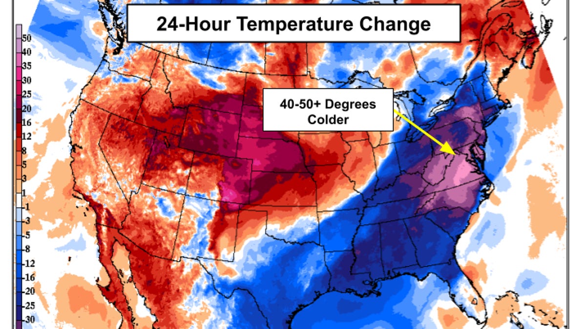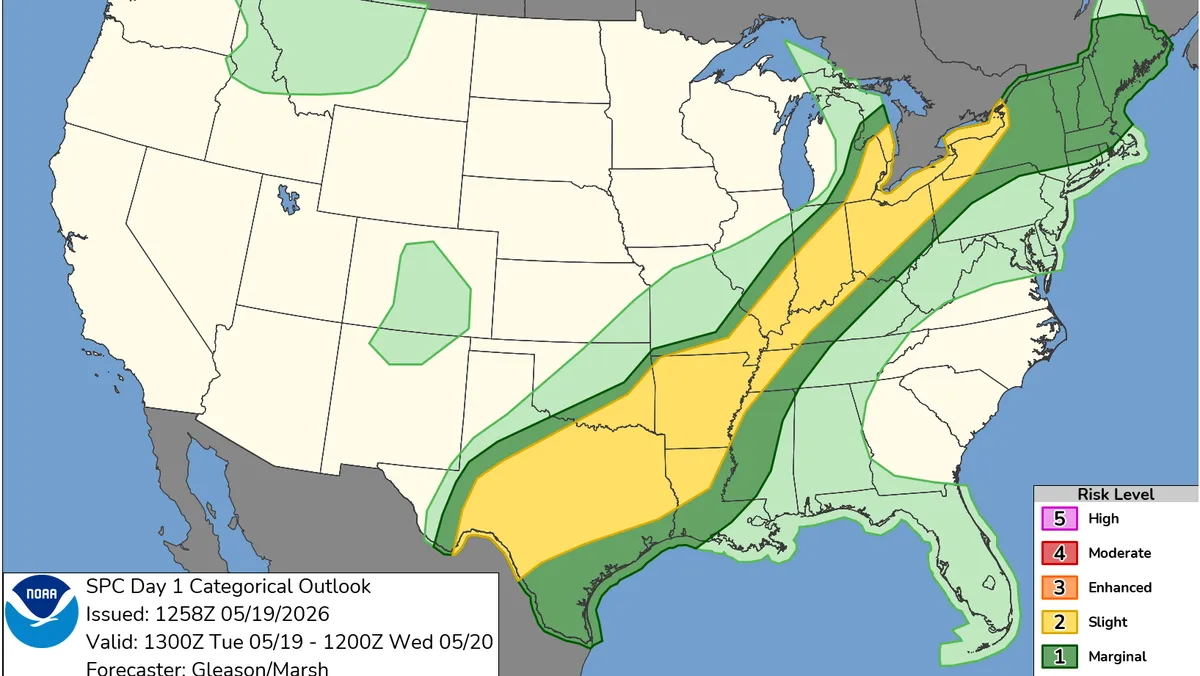
A broad and erratic patchwork of severe weather rumbled across much of the U.S. on Sunday, dumping heavy snow and making roads impassable in the Upper Midwest while damaging high winds swept across the Plains. Hawaii also continued to be affected by severe flooding.
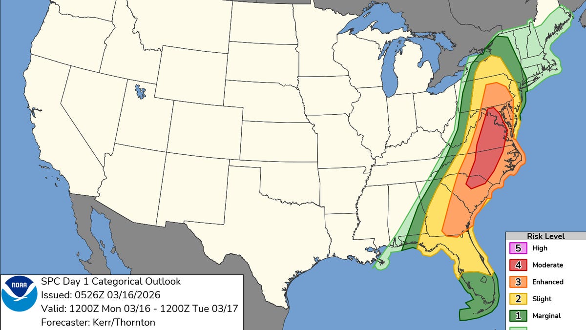
And portions of the mid-South readied for late-day thunderstorms. Forecasters said the storms will spread eastward and by Monday threaten a large swath of the Eastern U.S., with mid-Atlantic states and Washington, D.C., at greatest risk for high winds and tornadoes.
Successive punches of snow, wind and severe weather are “going to impact the eastern half of the United States,” said AccuWeather senior meteorologist Tyler Roys. Beyond the threat to lives and property, “whether it’s wind gusts from a squall line, blizzard or snow, or just wind because of the storm, you’re looking at several major airports being impacted.”
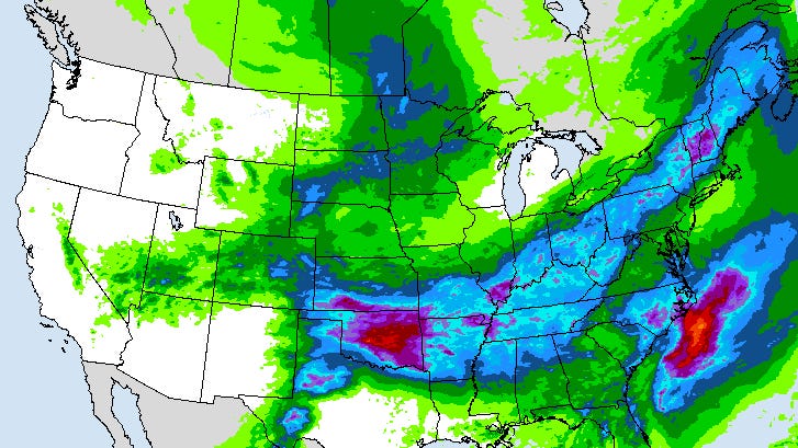
An area from central Wisconsin to Michigan’s Upper Peninsula was likely to see over 2 feet (60 centimeters) of snow, with higher isolated totals on the peninsula, Roys said. Lower snow accumulations in places like Chicago and Milwaukee will likely create trouble for commuters on Monday, he added.
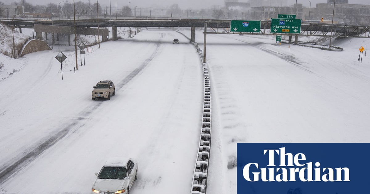
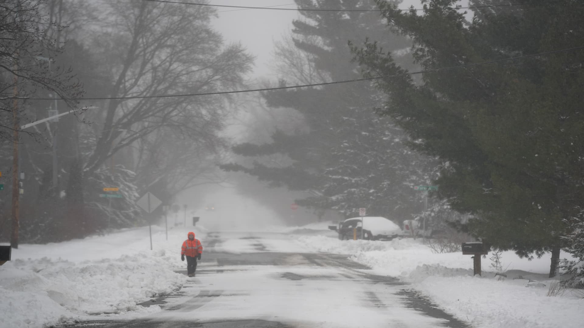
Over 20 inches (51 centimeters) of snow had fallen in some portions of southeastern Minnesota and western Wisconsin as of Sunday afternoon, according to National Weather Service reports. Transportation officials warned of worsening conditions with low visibility and snow-covered roadways.