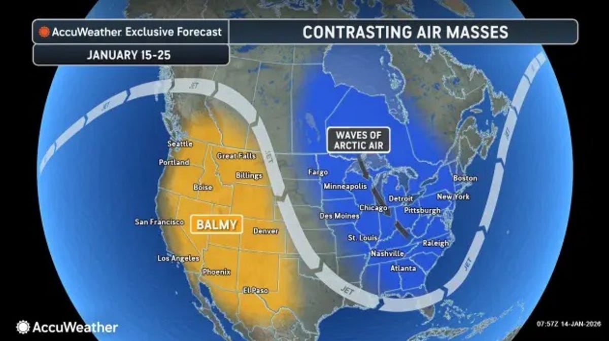
A strong cold front is pushing across the eastern half of the country this week, dropping temperatures well below average from the Midwest to the Northeast while a separate Pacific storm system moves into the West with heavy rain and mountain snow.
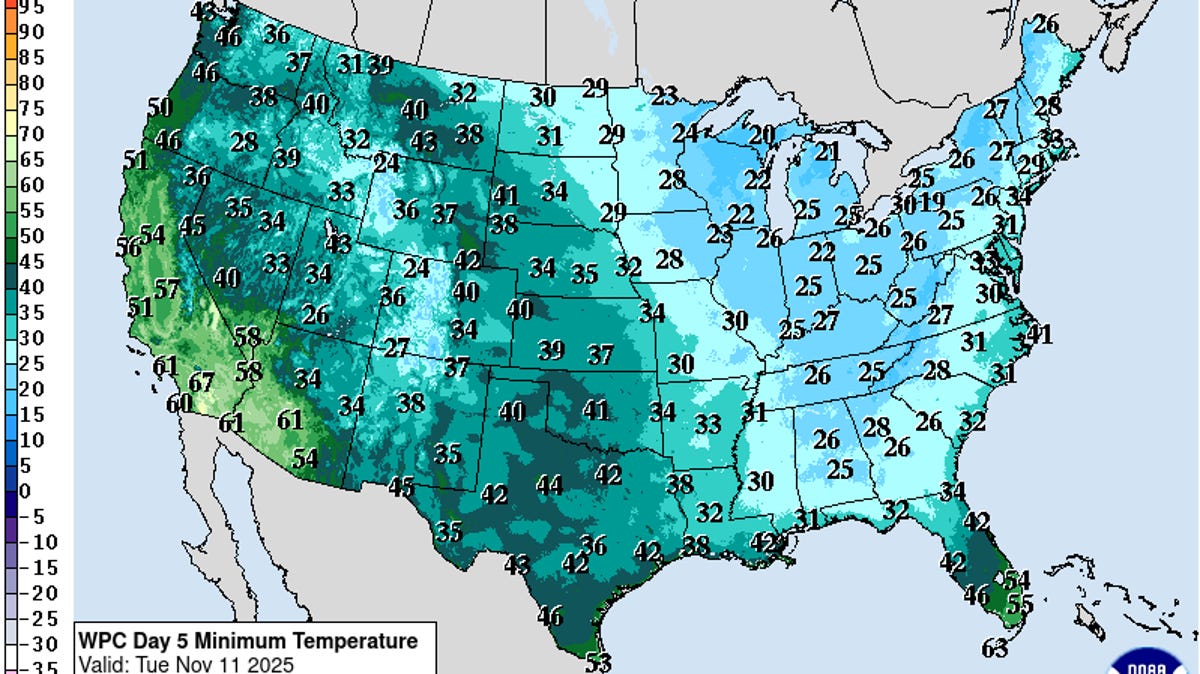
The National Weather Service weather prediction center said the eastern U.S. will see some of the coldest conditions behind the front, with daytime highs mainly in the 40s and 50s across the Midwest and Northeast. Overnight lows drop into the 20s and 30s in parts of the interior Northeast and Ohio Valley, prompting freeze warnings across portions of the Mid-Atlantic, including North Carolina which is set to see below-freezing temperatures well after the last average frost.
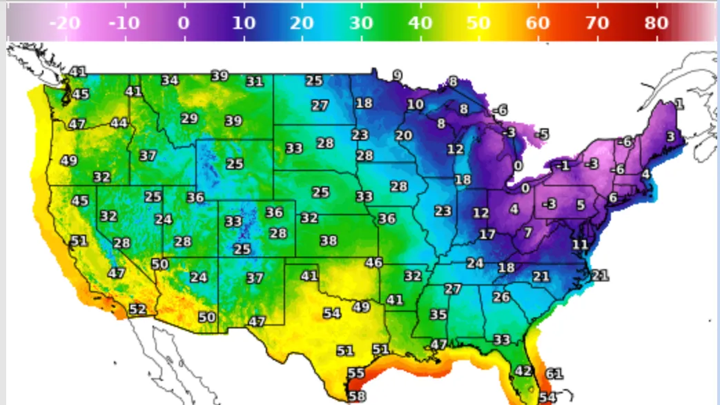
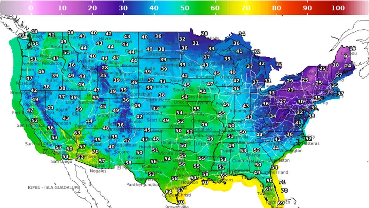
A temperature map from the National Digital Forecast Database shows widespread 20s and 30s across the Great Lakes and interior Northeast early Tuesday, with 40s stretching through the Midwest and lower 50s into the Mid-Atlantic. Warmer conditions remain in place across the Southeast, where lows stay in the 60s and 70s, including Florida.
"The dramatic temperature drop will lead to widespread frost and freeze conditions, especially away from the immediate lakeshores of the Great Lakes and across the interior Northeast. We are looking at two consecutive very cold mornings for many areas," Brett Anderson, AccuWeather senior meteorologist, said. "The biggest concern is Monday night into Tuesday morning, as high pressure builds overhead, creating ideal cooling conditions under clear skies and light winds. Expect widespread freezing conditions, with much of interior New England, upstate New York and parts of Pennsylvania and West Virginia dropping into the 20s with a hard freeze.”