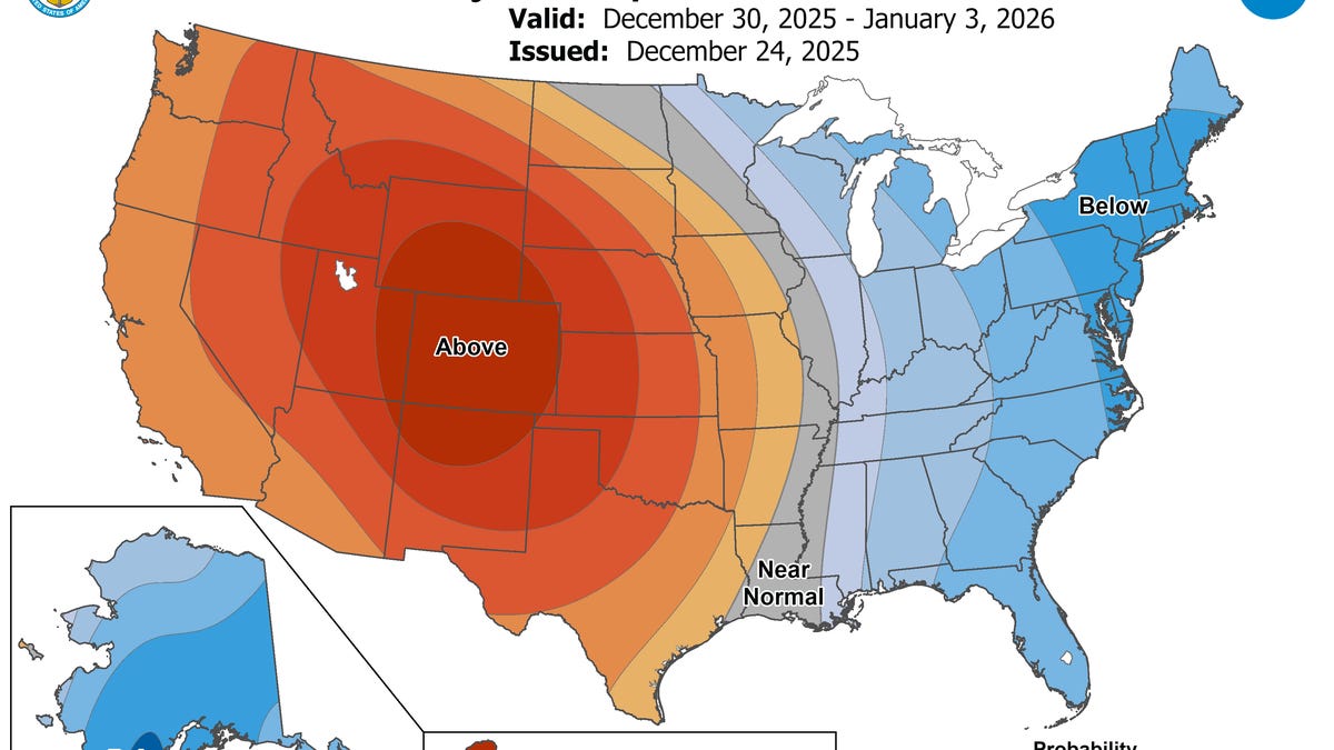
Farewell to the January thaw.
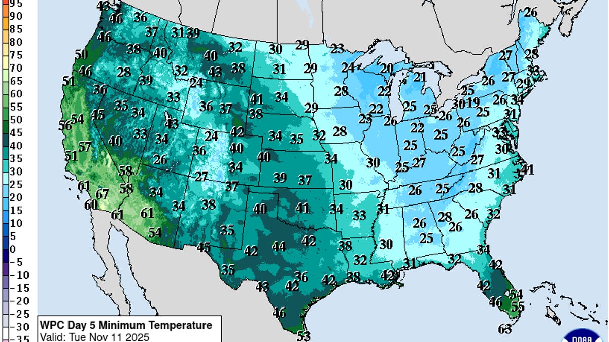
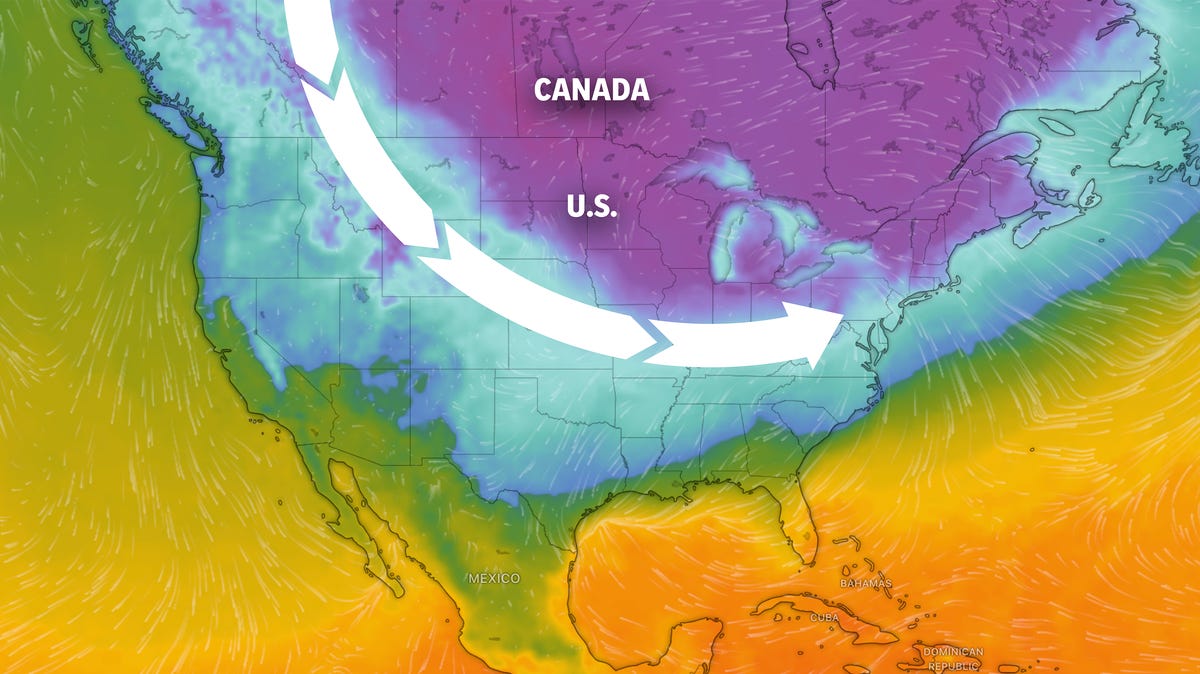
A fierce Arctic blast of bitterly cold air is poised to overtake much of the central, eastern and southern U.S. over the next few days, dropping temperatures well below average as far south as Florida.
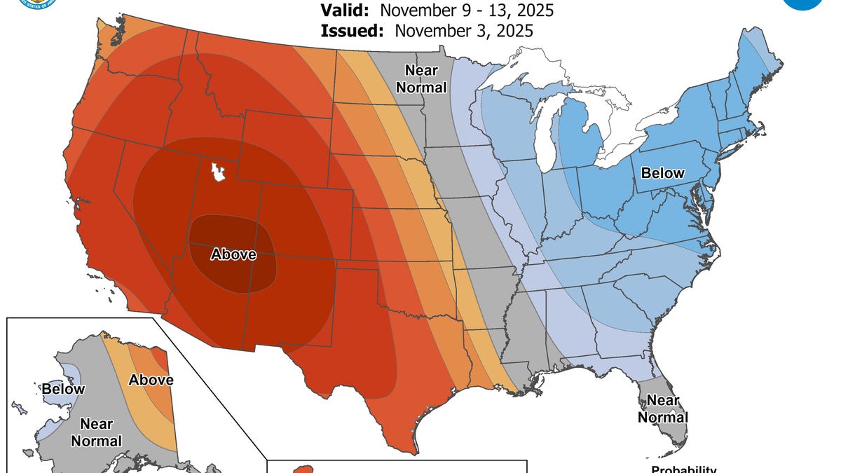
According to the National Weather Service, after an unseasonably warm and dry start to the work week, cold weather finally returns east of the Mississippi River Jan. 14 as a series of cold fronts merge over the Ohio Valley this afternoon (Jan. 14).
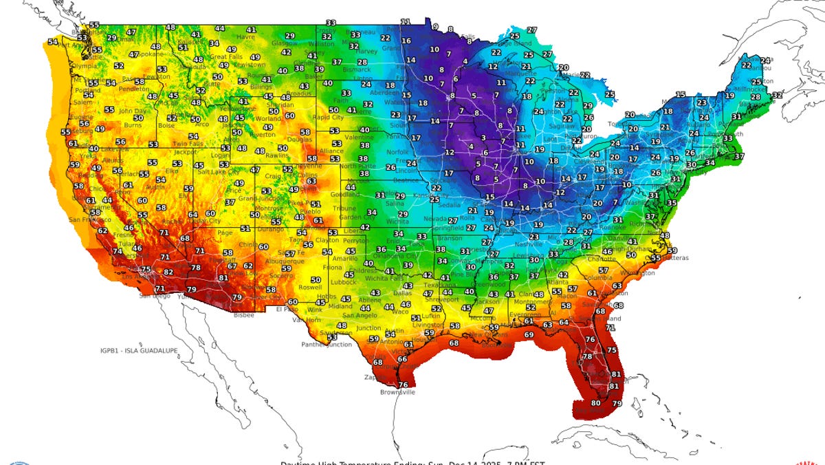
"While this cold front is not expected to set any records, tomorrow (Jan. 15) will feel much chillier across much of the Eastern U.S. as daytime high temperatures plummet 10-20 degrees across the board beneath Arctic high pressure," the weather service said in a Jan. 14 online forecast.
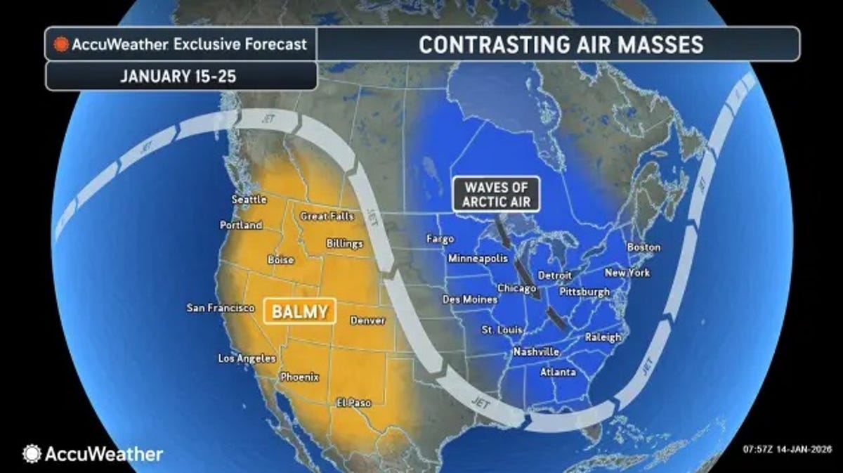
"A renewed surge of Arctic air is expected to dominate the central and eastern United States through late January, bringing significant temperature drops and rounds of snow," AccuWeather predicts. AccuWeather meteorologists say the active polar vortex could deliver the coldest conditions of the winter heading into early February.