Show Caption
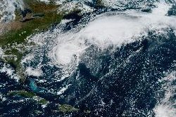
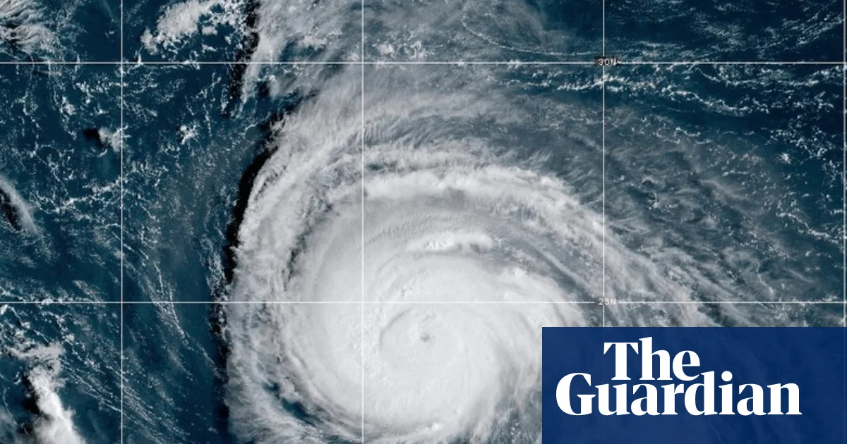
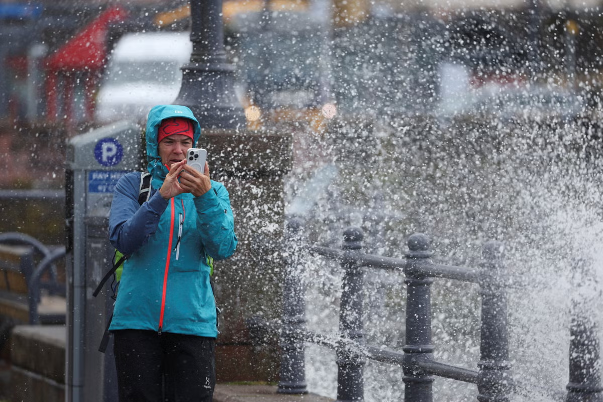
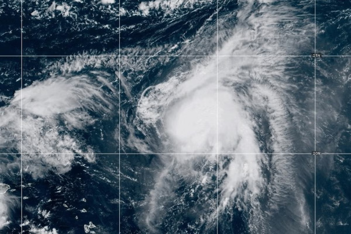
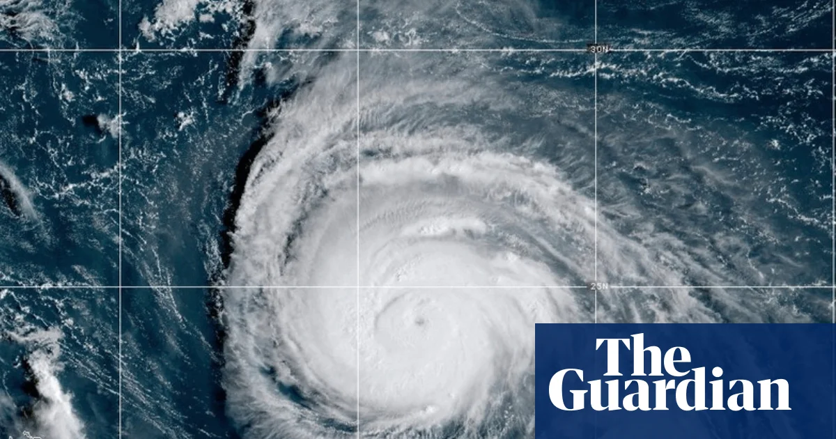
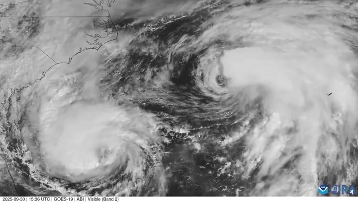
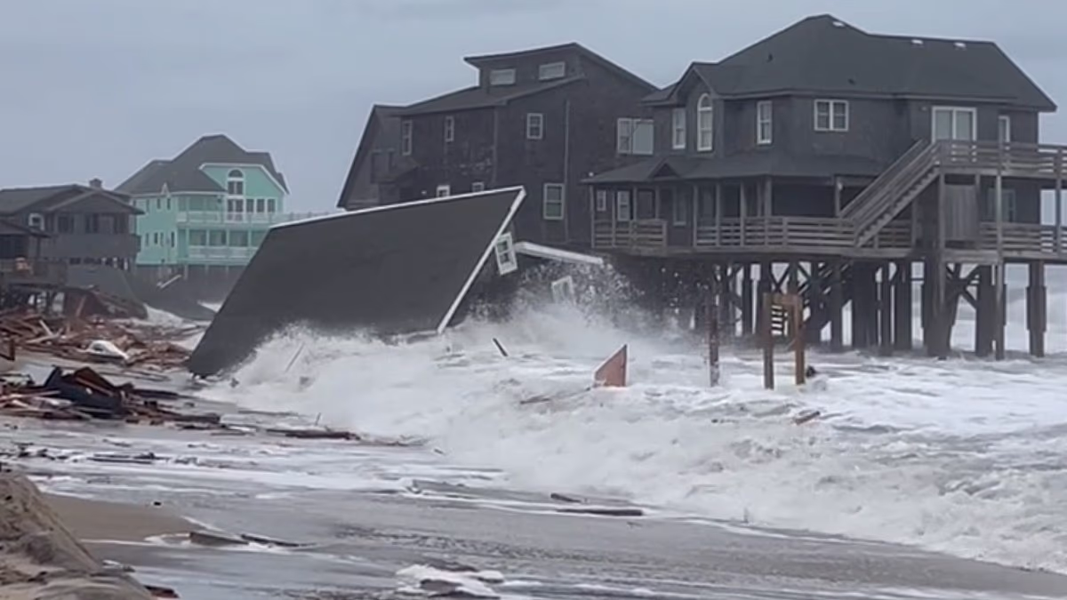
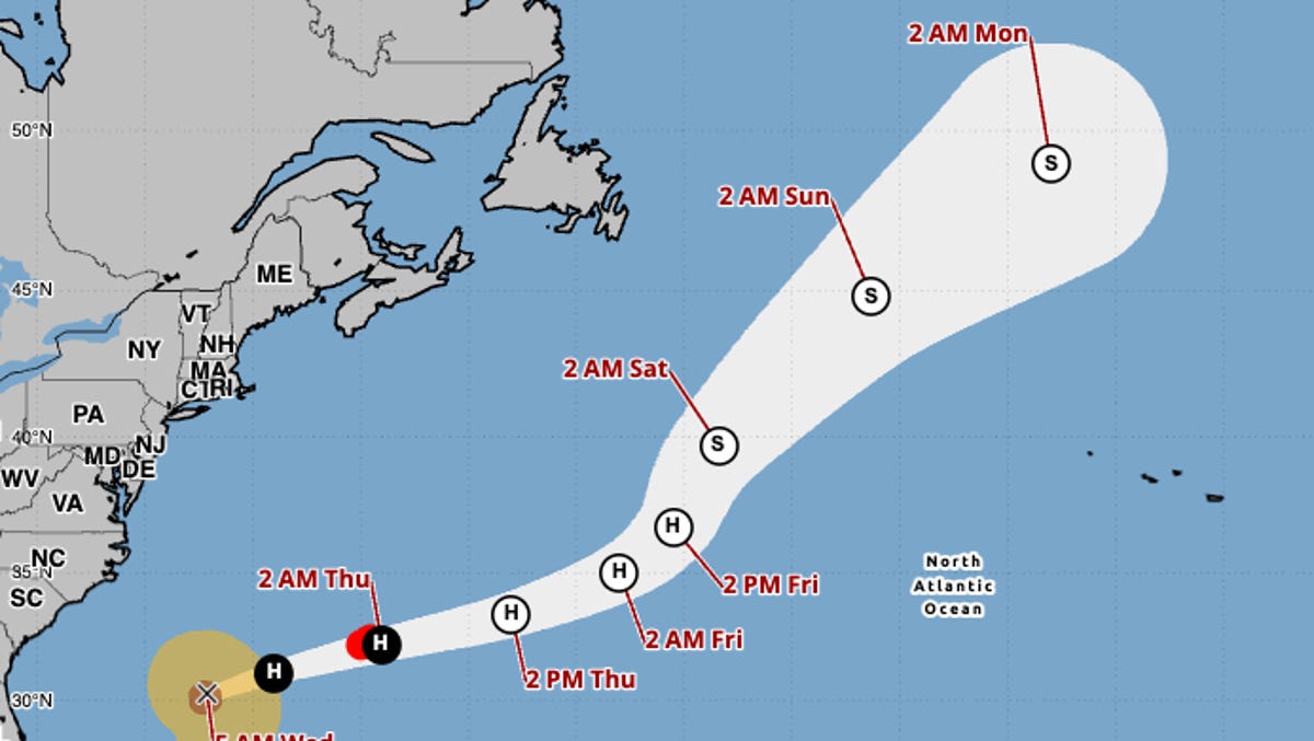
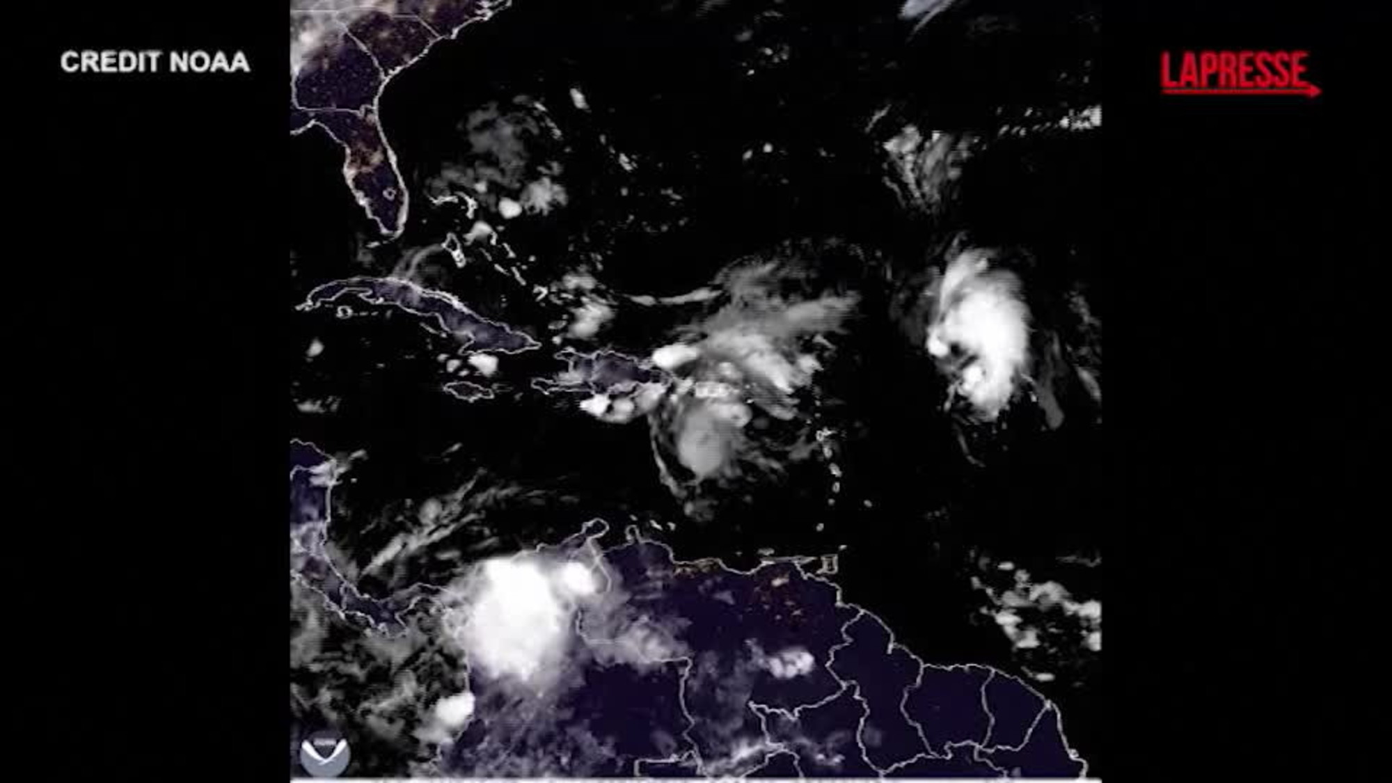
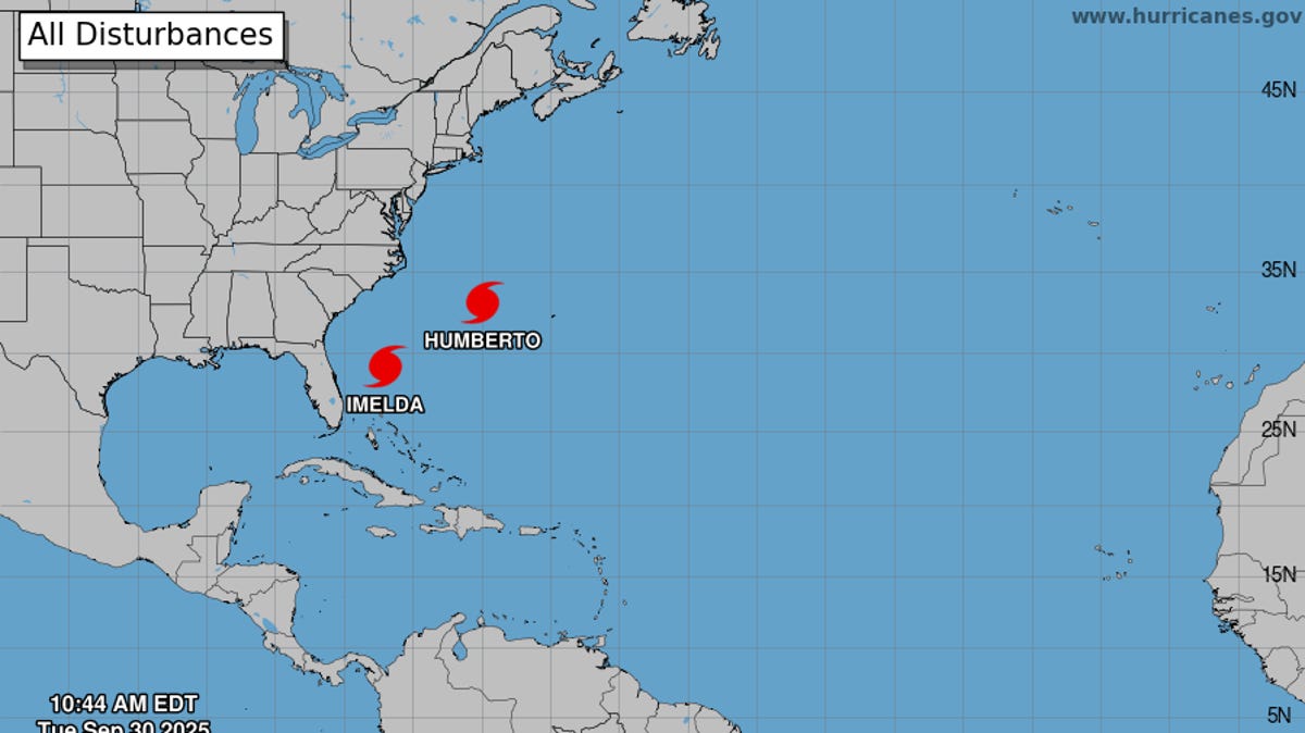
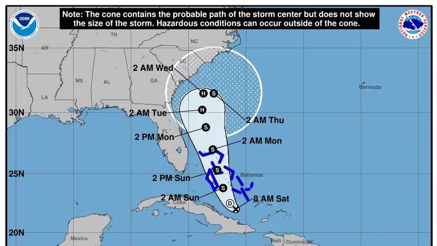
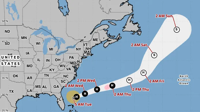
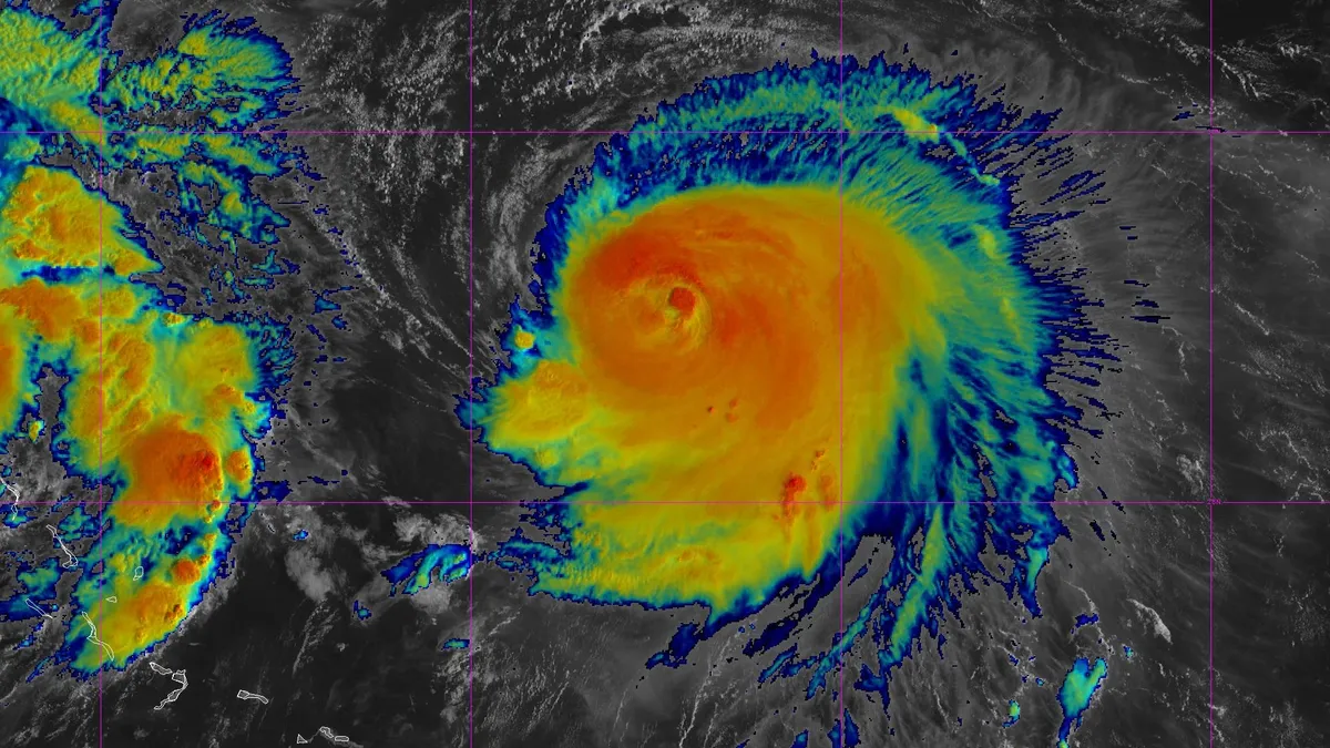
Hurricane Humberto, a Category 4 storm, is not expected to make landfall in the U.S., according to the National Hurricane Center's latest forecast on Sept. 29, but the East Coast could still see some impacts.The storm is spinning around 365 miles south-southwest of Bermuda, with maximum sustained winds of 145 mph, moving northwest at 14 mph, according to an NHC advisory published Monday morning, Sept. 29.The hurricane, along with Tropical Storm Imelda, is expected to create "dangerous marine conditions, including high surf and life-threatening rip currents," that will affect the northern Caribbean, Bahamas and Bermuda, according to the NHC. Much of the U.S. East Coast is expected to be affected starting Sept. 29.A tropical storm watch is in effect for Bermuda, meaning that "tropical storm conditions are possible within the watch area, generally within 48 hours," according to the NHC.Hurricane Humberto trackerThis forecast track shows the most likely path of the center of the storm. It does not illustrate the full width of the storm or its impacts, and the center of the storm is likely to travel outside the cone up to 33% of the time.Hurricane Humberto spaghetti modelsIllustrations include an array of forecast tools and models, and not all are created equal. The hurricane center uses only the top four or five highest-performing models to help make its forecasts.Where is Tropical Storm Imelda?The storm, located 265 miles east southeast of Cape Canaveral, Florida, is expected to turn away from Florida and the southeastern United States later in the week as it is pulled by Hurricane Humberto to its east and pushed by a system of high pressure building over the northeastern U.S., according to the Palm Beach Post, a part of the USA TODAY Network.The storm was moving north at nearly 9 mph with maximum sustained winds of 50 mph, according to the NHC.As of Monday morning, Sept. 29, the northwestern Bahamas, including Eleuthera, the Abacos, Grand Bahama Island and the surrounding keys, are under a tropical storm warning as Imelda spins near Bermuda.Tropical Storm Imelda trackerThis forecast track shows the most likely path of the center of the storm. It does not illustrate the full width of the storm or its impacts, and the center of the storm is likely to travel outside the cone up to 33% of the time.Tropical Storm Imelda to cause 'life-threatening rip currents' along East CoastAlthough no tropical storm or hurricane watches or warnings have been put in place for the U.S., there could be significant beach impacts in Florida starting today, including life-threatening rip currents, high surf and dune erosion, according to the National Weather Service office in Melbourne, Florida.Along the North Carolina coast, the NWS has issued a coastal flood warning for potential moderate oceanside flooding into Tuesday, Sept. 30. The warning includes Hatteras and Ocracoke islands and eastern Carteret County, located on the state's coast, about 118 miles northeast of Wilmington, North Carolina.How do hurricanes form?Hurricanes are born in the tropics, above warm water. Clusters of thunderstorms can develop over the ocean when water temperatures exceed 80 degrees. If conditions are right, the clusters swirl into a storm known as a tropical wave or tropical depression.A tropical depression becomes a named tropical storm once its sustained wind speeds reach 39 mph. When its winds reach 74 mph, the storm officially becomes a hurricane.Prepare now for hurricanesDelaying potentially lifesaving preparations could mean waiting until it’s too late. "Get your disaster supplies while the shelves are still stocked, and get that insurance checkup early, as flood insurance requires a 30-day waiting period," the National Oceanic and Atmospheric Administration recommends.Develop an evacuation plan. If you are at risk from hurricanes, you need an evacuation plan. Now is the time to begin planning where you would go and how you would get there.Assemble disaster supplies. Whether you’re evacuating or sheltering in place, you’re going to need supplies not just to get through the storm but for a possibly lengthy aftermath, NOAA said.Get an insurance checkup and document your possessions. Contact your insurance company or agent now and ask for an insurance checkup to make sure you have enough insurance to repair or even replace your home and belongings. Remember, home and renters insurance don’t cover flooding, so you’ll need a separate policy for those. Flood insurance is available through your company, agent or the National Flood Insurance Program.Create a family communication plan. NOAA says you should take the time now to write down a hurricane plan and share it with your family. Determine family meeting places and make sure to include an out-of-town location in case of evacuation.Strengthen your home. Now is the time to improve your home’s ability to withstand hurricanes. Trim trees and install storm shutters, accordion shutters, and impact glass, and seal outside wall openings.Julia is a Trending reporter for USA TODAY and covers all things Labubu and Pop Mart, scientific studies and trending news. Connect with her on LinkedIn, X, Instagram, and TikTok: @juliamariegz, or email her at jgomez@gannett.com