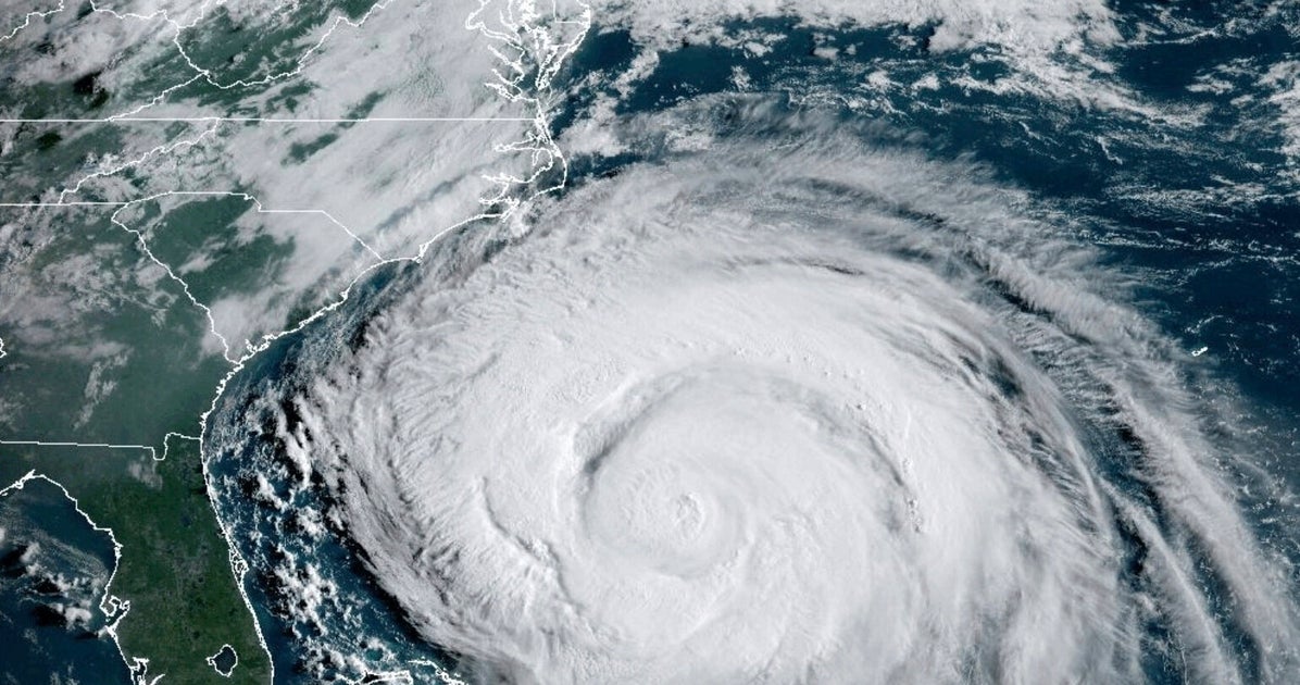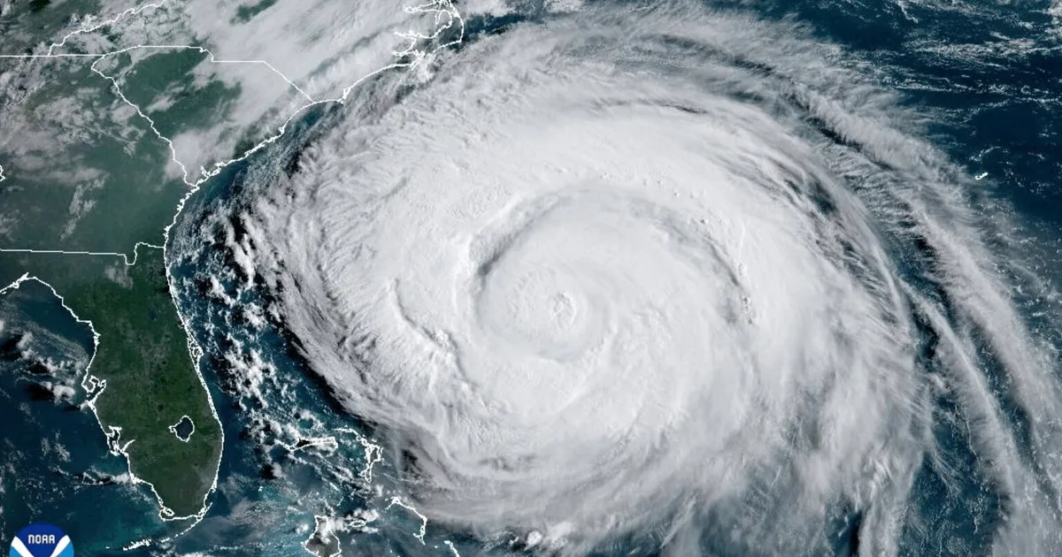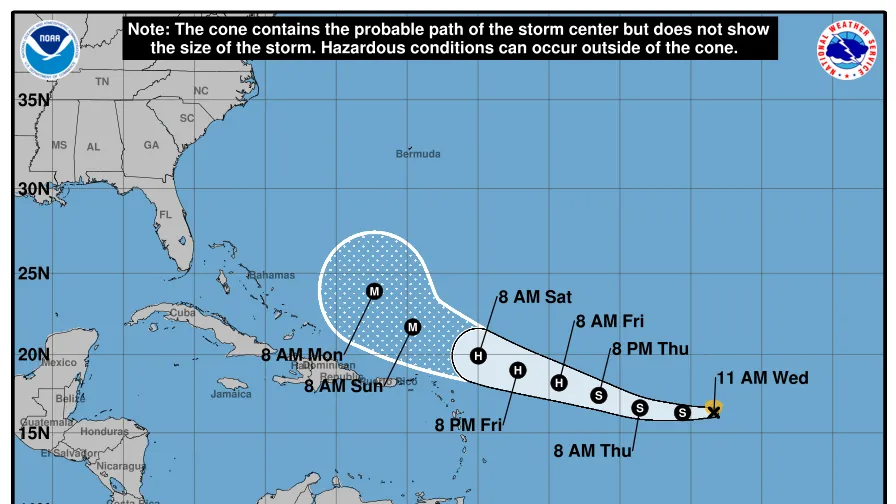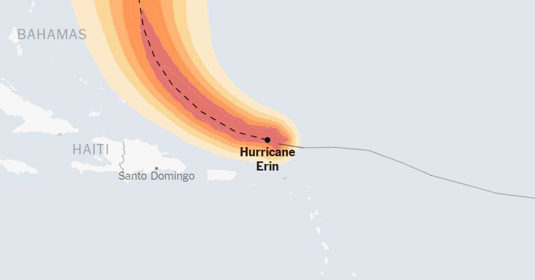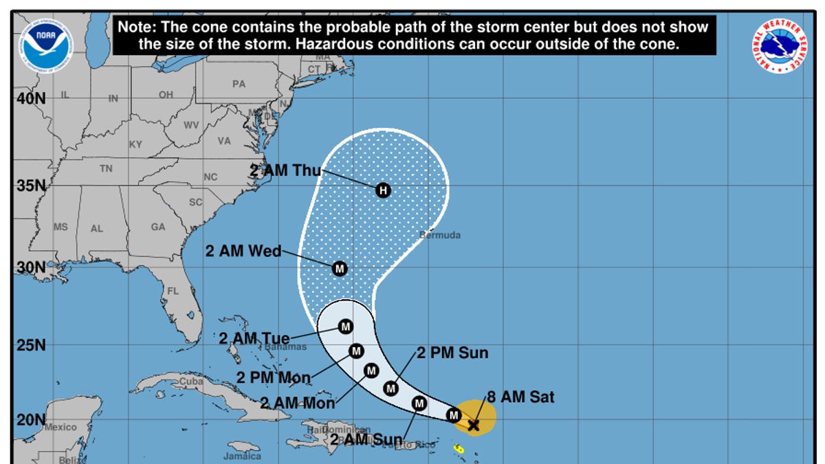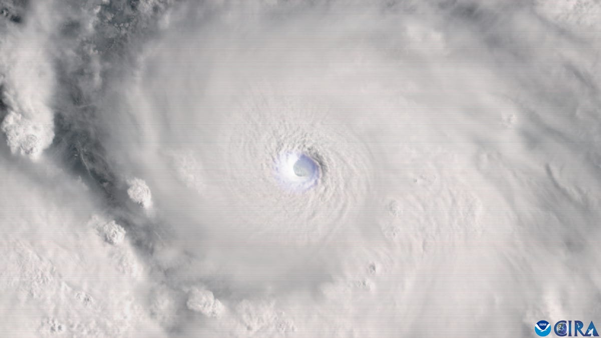
Hurricane Erin, with powerful winds of more than 160 mph on August 16, is expected to take a path familiar to many as the massive storm moves northward parallel to the United States coast.
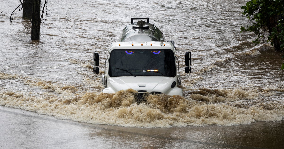
Dozens of hurricanes have made a similar trek in recent years, testing the nerves of millions who wait to see if the storms are destined to make any sharp left turns or wobbles toward the coast. Even when they don't brush the coast or make landfall, such storms can be deadly and cause millions of dollars of damage.
Erin is expected to remain hundreds of miles offshore, according to the National Hurricane Center, part of the National Weather Service. As of 5 p.m. Aug. 16, Erin is forecast to be centered roughly 600 miles east of Savannah on Aug. 20.
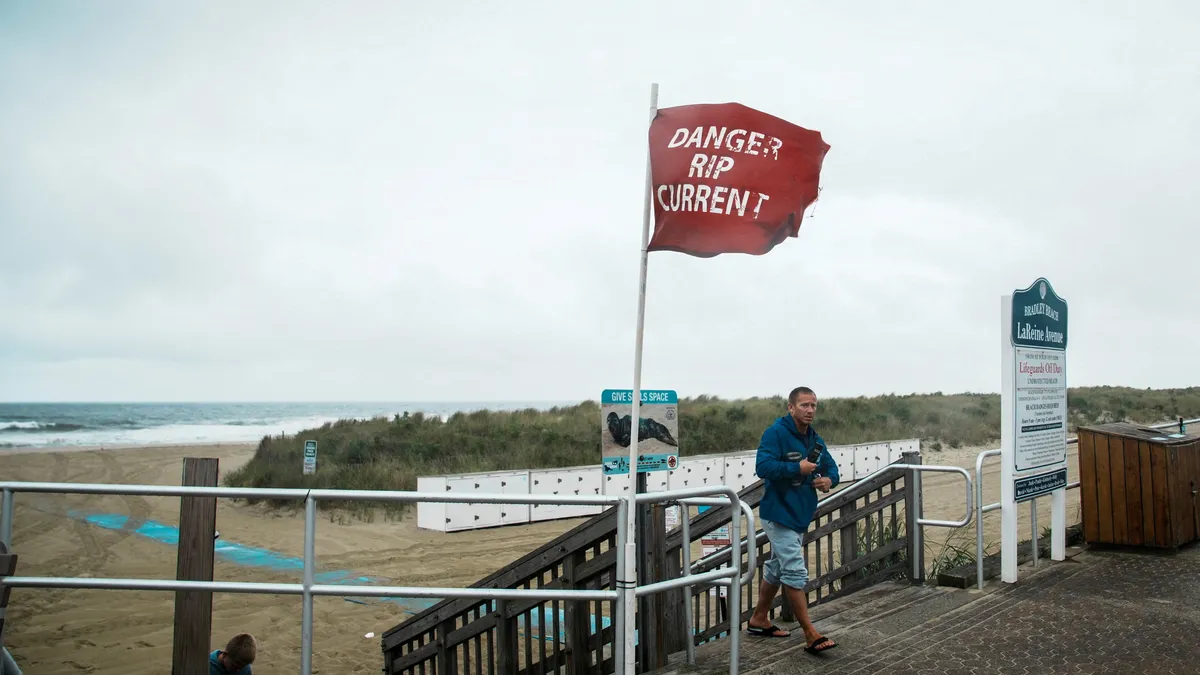
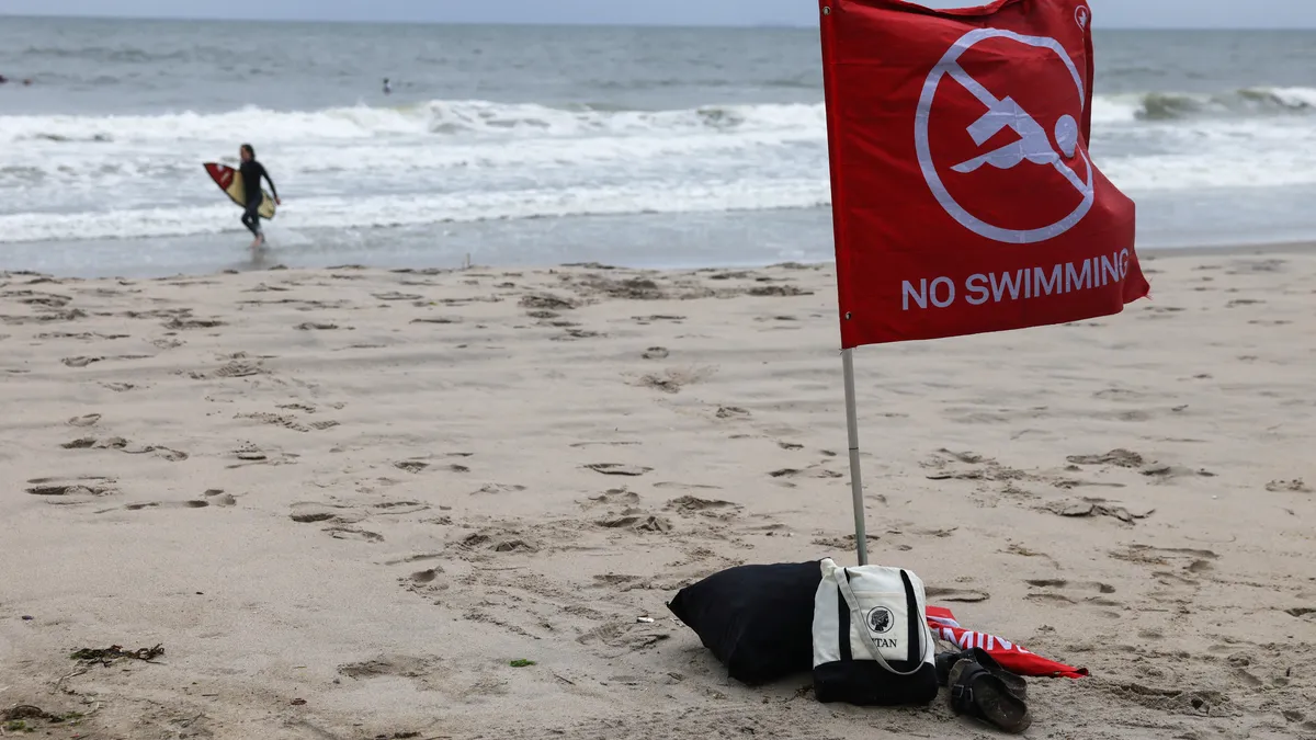
But because Erin is growing both in size and intensity, chances are increasing that it will still create rough conditions at sea and along beaches as it moves northward off the coast, the weather service says.
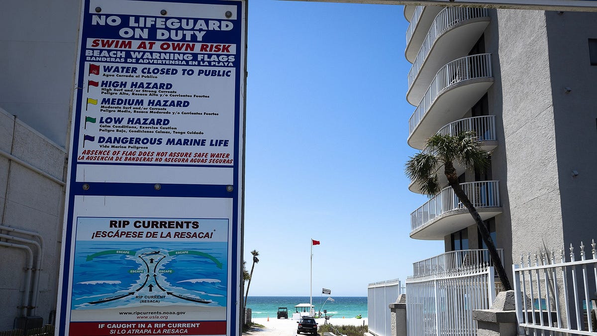
Many lives have been lost during hurricanes that remained well offshore but created rough surf or deceptive conditions that can disguise hazardous rip currents. Over a 10-year period, about 10 to 15% of all deaths in tropical storms and hurricanes were attributed to rip currents, according to the hurricane center. That's one reason behind a new public safety campaign NOAA launched earlier this year – "Blue IQ."