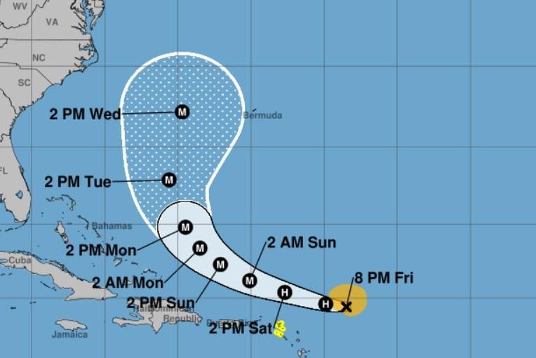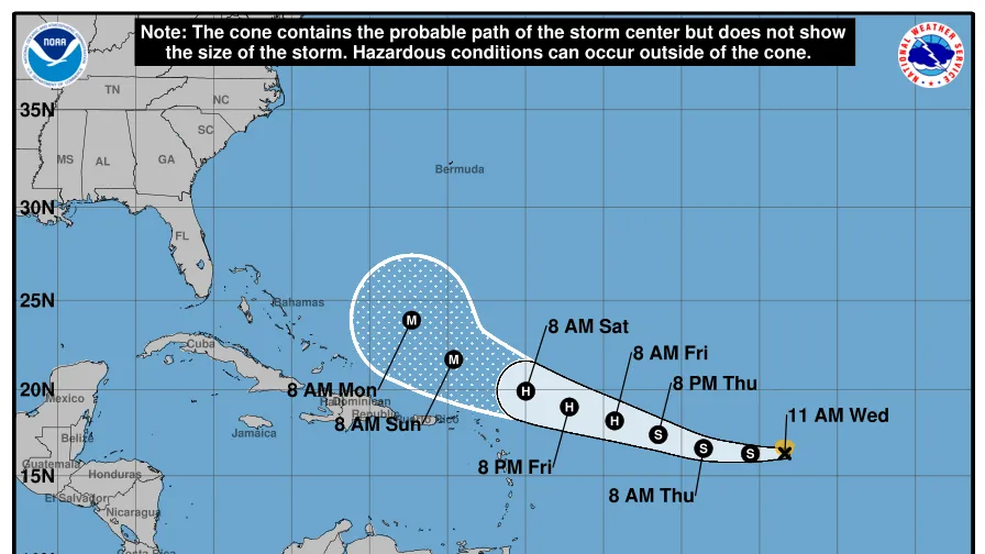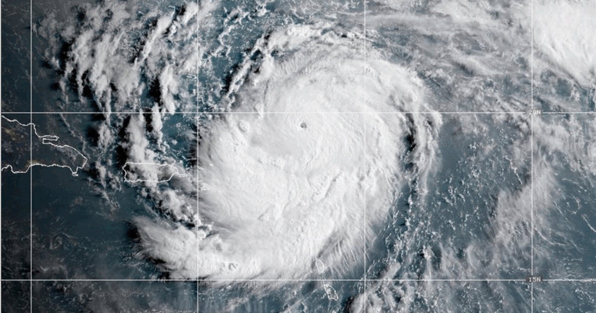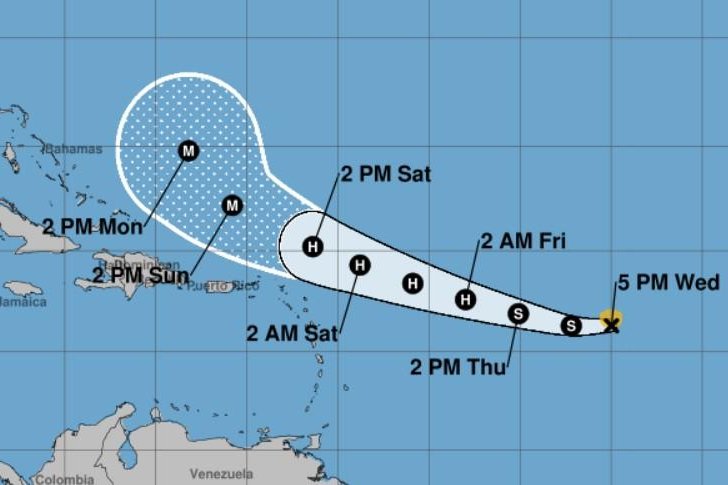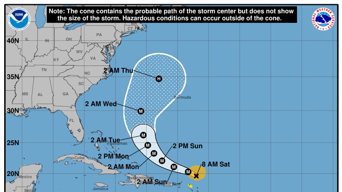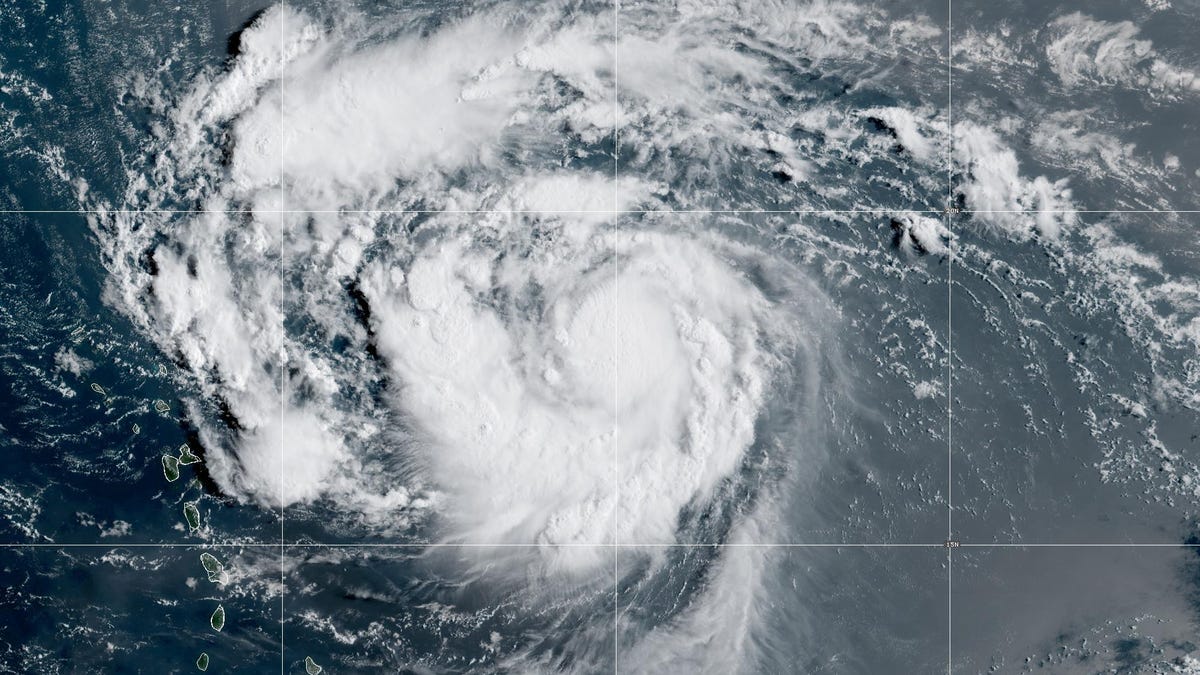
Hurricane Erin formed in the Atlantic on Aug. 15, becoming the first hurricane of the 2025 season and putting it on track to become a major hurricane over the weekend, forecasters said.
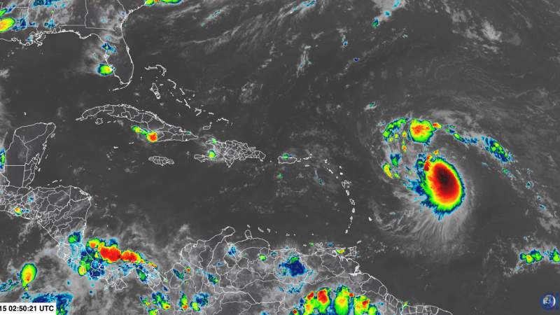
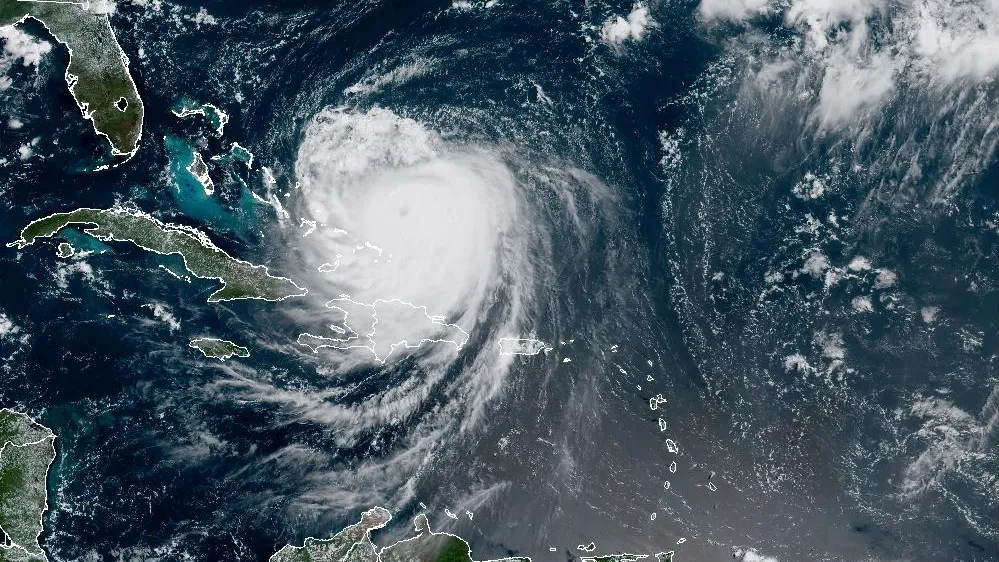
Erin became a hurricane shortly before 11 a.m. ET and was located about 460 miles east of the northern Leeward Islands, moving west-northwest at about 18 mph. Its winds were clocked at 75 mph with higher gusts, surpassing the 74 mph needed to be classified as a Category 1 hurricane.
"At this time we don’t expect a direct hit to the United States – we still need to watch it just in case," said AccuWeather Lead Hurricane Expert Alex DaSilva. "We expect the entirety of the East Coast to be impacted by big waves, rip currents next week."
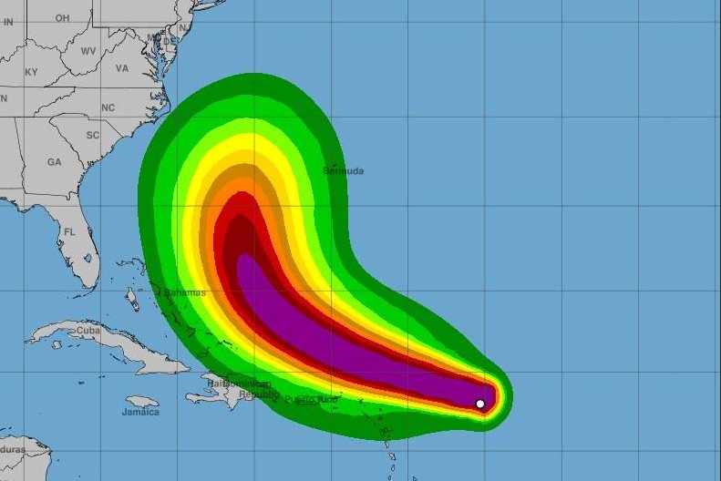
It was still too early to determine exactly what impact Erin might have on the East Coast of the United States, the Bahamas and Bermuda, forecasters said. Rough surf conditions and rip currents could be in store for the Atlantic basin, with potential for tropical storm conditions in Puerto Rico and the Leeward Islands. Experts urged preparing ahead of time for potential hurricane impacts.
Other impacts to land include the chance of 10- to 15-foot waves along the Outer Banks, barrier islands off North Carolina and southern Virginia, flash flooding and mudslides in Puerto Rico and wind gusts of 60 to 80 mph in Bermuda, AccuWeather said.