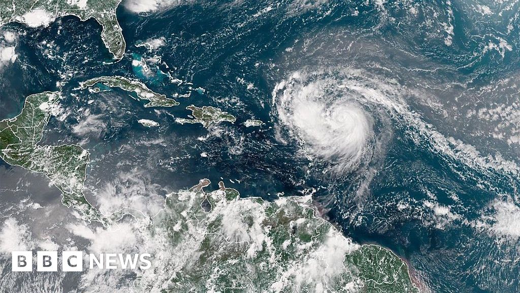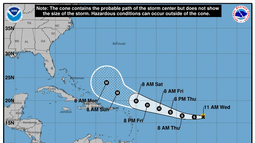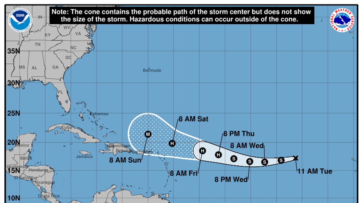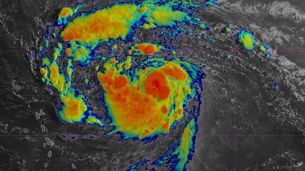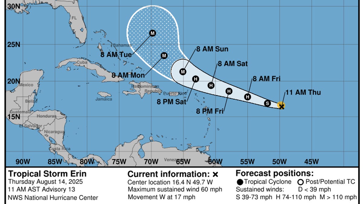
Tropical Storm Erin, now spinning far out in the central Atlantic Ocean, could undergo rapid intensification into a powerful 125-mph hurricane over the next few days, meteorologists said in an Aug. 14 advisory.
This phenomenon can cause a tropical storm to escalate into a hurricane or a hurricane to jump one or more categories on the Saffir-Simpson scale in less than a day.
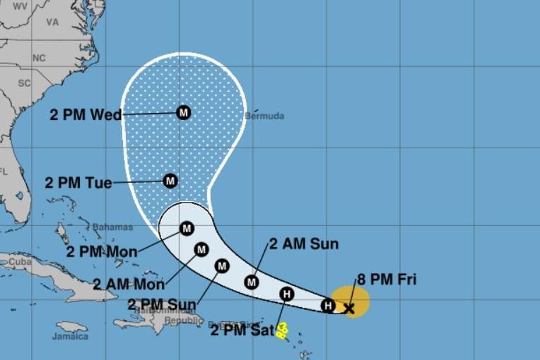
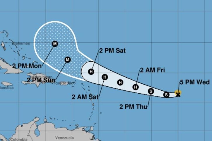
An early Aug. 14 forecast from the National Hurricane Center said that Erin was forecast to undergo rapid intensification, but based on new data, a later forecast called for "steady" intensification over the next few days.
"Erin is moving into an environment with very warm water temperatures, and it's not going to exit that environment for at least 5 or 6 days," said Houston-based meteorologist Matt Lanza in his Substack The Eyewall. "Erin should begin to tap into this environment over the next couple days, and it's possible that we see a burst of rapid intensification at some point."
Regardless, the environment ahead looks ripe for Erin to become a powerful major (Category 3 or stronger) hurricane this weekend, and the storm is forecast to be nearing Category 4 strength as it turns into the western Atlantic early next week, noted WPLG hurricane specialist Michael Lowry in an Aug. 14 Substack post.