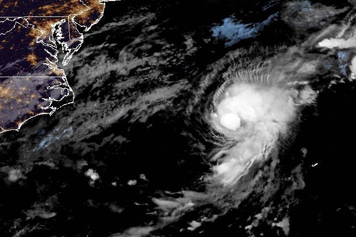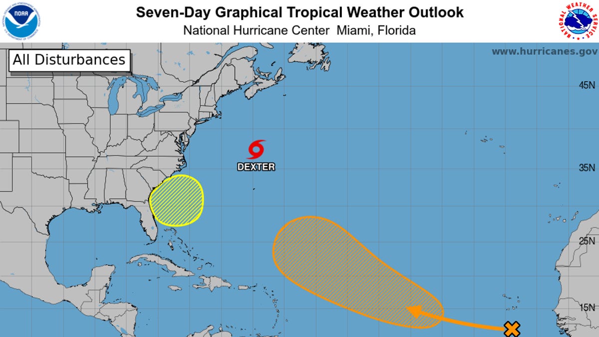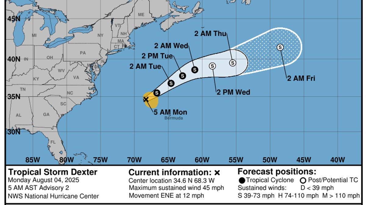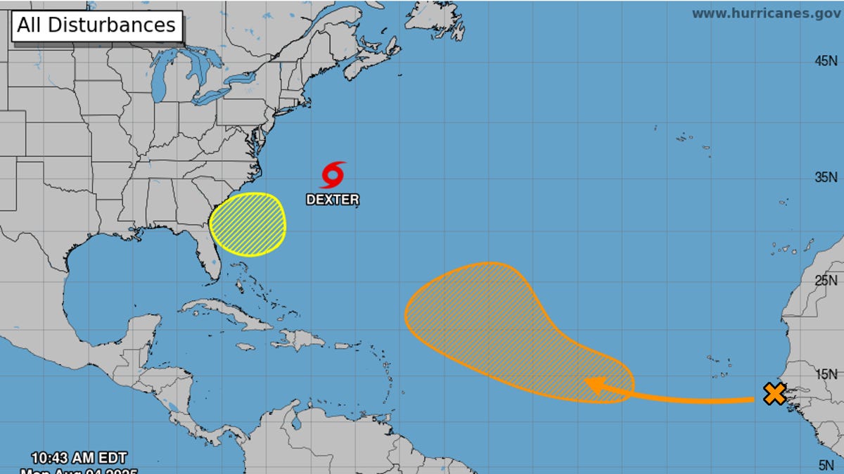
As Tropical Storm Dexter races out to sea away from the United States, hurricane forecasters Aug. 4 were watching two other areas of potential concern in the Atlantic, which if they form, could be named Erin and Fernand.
One, a tropical wave that's just recently moved off the coast of Africa, could develop into a named storm in the central Atlantic by later in the week, some forecast models show.
The second is a developing area of low pressure much closer to home, off the Southeast U.S. coast ‒ a system that promises a dreary week of weather for hordes of beachgoers.
"We are now moving into a more active period (of the) Atlantic hurricane season," said Weather Trader meteorologist Ryan Maue in an Aug. 4 email to USA TODAY.
"Dexter is already exiting stage right, moving east northeast around 10 to 15 mph," said Houston-based meteorologist Matt Lanza in an Aug. 4 newsletter post. "By the end of the week, Dexter should be post-tropical. Eventually, this will probably end up in the British Isles, either as part of another typical European storm or as a passing disturbance. Either way, it's mostly just a curiosity than anything else."