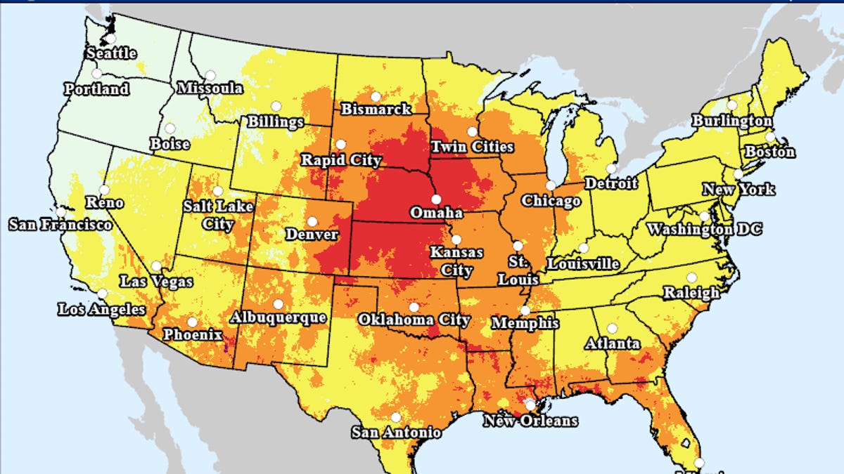
The clock is ticking on the extremely high temperatures from the Midwest to the Northeast, and as the heat dome weakens during the second half of this week, thunderstorms will erupt in areas where humidity levels remain high, AccuWeather meteorologists advise. In some cases in the Northeast, the cooldown can be dramatic.
Millions recently hoped for relief from the relentless downpours and abnormally cool conditions and they got their wish with a virtually cloudless sky and searing summer heat. Now, millions are seeking some relief from the sudden surge of extreme heat and blazing sunshine, or at least a break from the extreme temperatures.
Temperatures will throttle back as showers, thunderstorms return
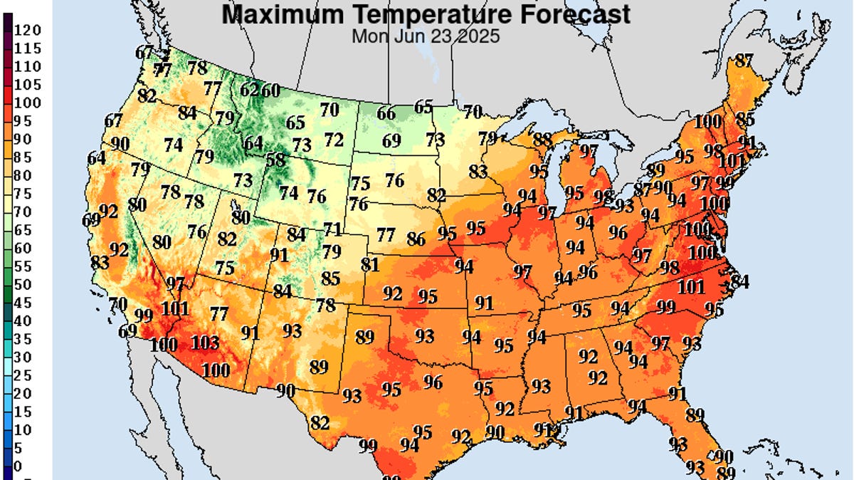
In many cases, where high temperatures were within a few degrees of 100 F into Tuesday, highs closer to 90 will be in store later in the week, with some spots experiencing highs in the 80s. Where highs were in the middle to upper 90s during the first few days of the week, highs in the 80s will be more common by week's end, with some places getting a day or two with highs in the 70s.
"There's even a rare backdoor cool front that will drop southward from New England to part of the mid-Atlantic region during the middle and latter part of this week," AccuWeather Senior Meteorologist Brett Anderson said. "This can dramatically drop temperatures by 20-40 degrees in some cases, which is about as big as it gets this time of the year."