HomeAI · summaries
Storia in 3 fonti
NASA's NISAR satellite Antarctica image captures a giant bird-like shape hidden in East Antarctica's ice; here's what the colourful radar view means
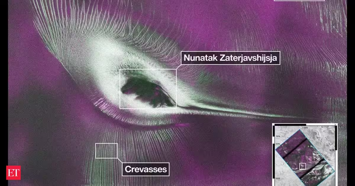
The joint India-US NISAR satellite has released radar data that captured a striking image of East Antarctica's frozen landscape. The satellite's L-band radar provided detailed insights into ice movement. According to NASA, the colours show differences in the way polarized microwave signals, which vibrate in different directions, interact with and reflect from the ice
Confronto fonti
3 prospettive sulla stessa storiaTimeline cronologica
- ·
nasa.gov

US-India Satellite Delivers Data, Reveals ‘Hummingbird’ in Antarctica - NASA
As of July 20, the public can access data from the two powerful radar instruments aboard the NISAR (NASA-ISRO Synthetic Aperture Radar) satellite. Teams in
- ·
science.nasa.gov

NISAR’s L-Band Radar Reveals ‘Hummingbird’ in Antarctica - NASA Science
Data from the Earth-orbiting U.S.-India NISAR (NASA-ISRO Synthetic Aperture Radar) satellite’s L-band radar was used to produce an image of Nunatak