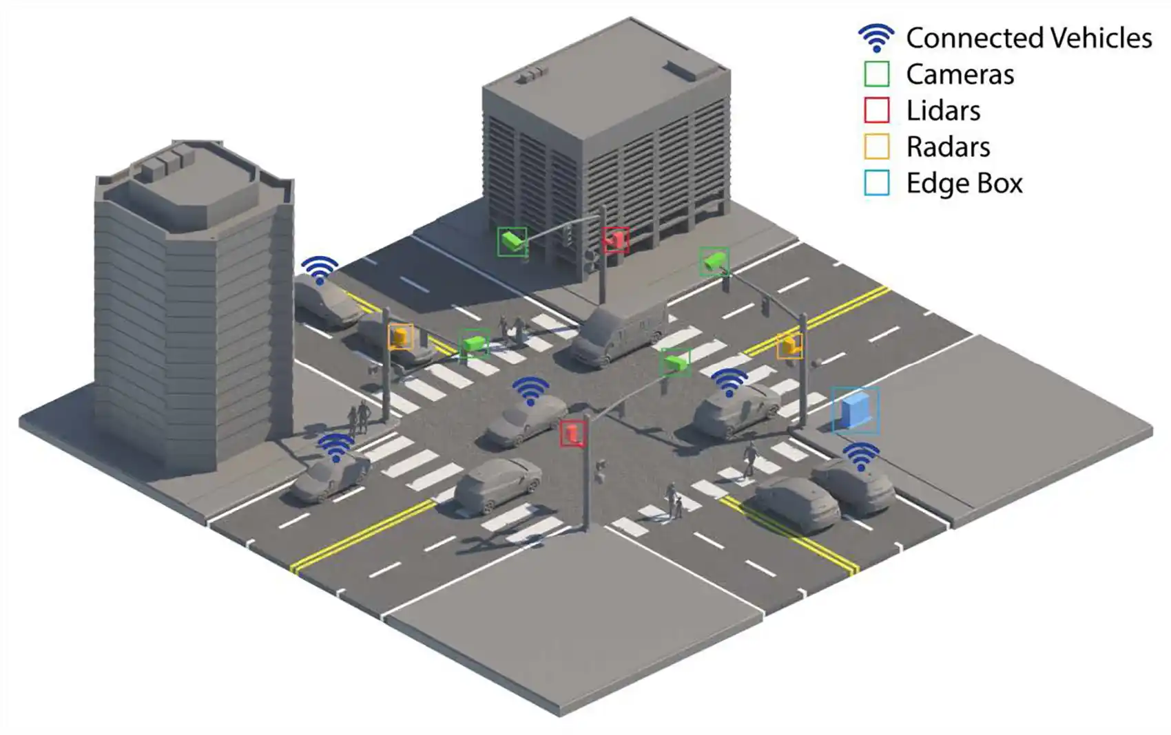
A new tool that integrates data from cameras, lidar, radar, and vehicle sensors could enable cities and departments of transportation to monitor and analyze intersection activity more effectively, helping reduce crashes and improve efficiency. Illustration by Besiki Kazaishvili, National Laboratory of the Rockies/
Support CleanTechnica's work through a Substack subscription, on Patreon, or on Stripe. Help us produce all of the high-quality, original content we publish week after week despite the challenges of content-scraping AI, antisocial media, inflation, and other hurdles.
Digital-Twin Framework Provides Real-Time Visibility Into Traffic Conditions
A new tool that integrates data from cameras, lidar, radar, and vehicle sensors could enable cities and departments of transportation to monitor and analyze intersection activity more effectively, helping reduce crashes and improve efficiency. Illustration by Besiki Kazaishvili, National Laboratory of the Rockies.
We have all been there: stopped at a red light at an empty intersection or narrowly avoiding a collision after a driver runs a red light.