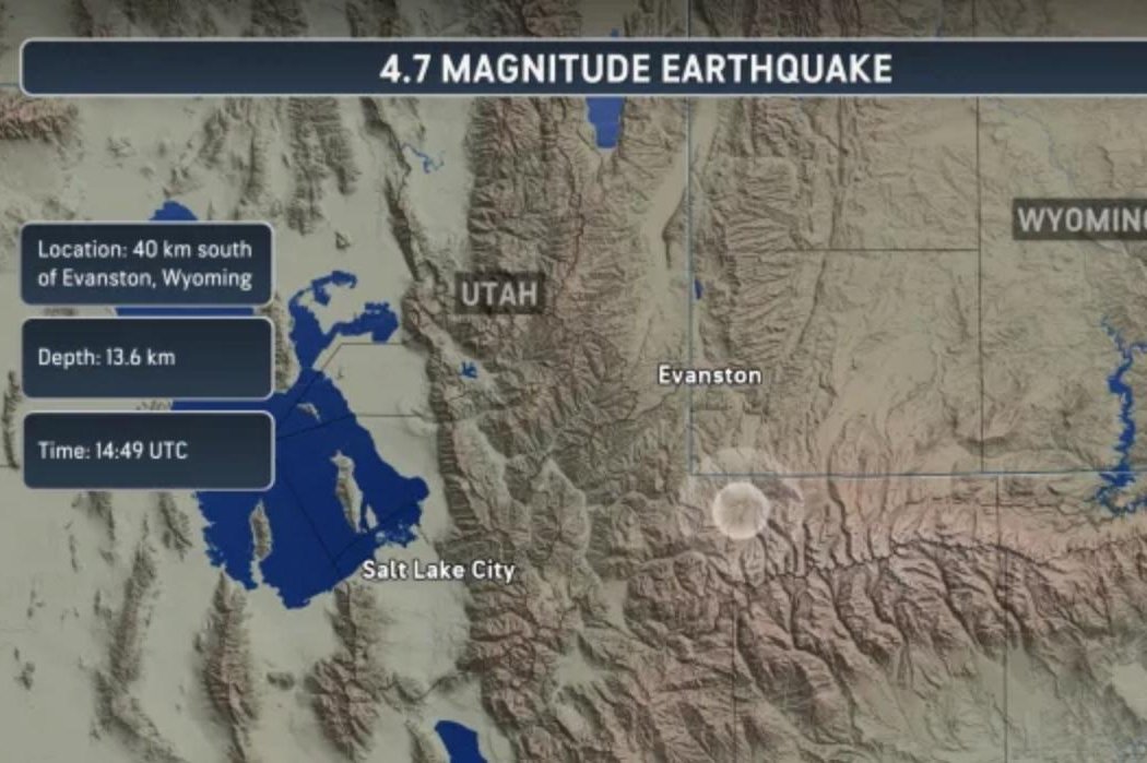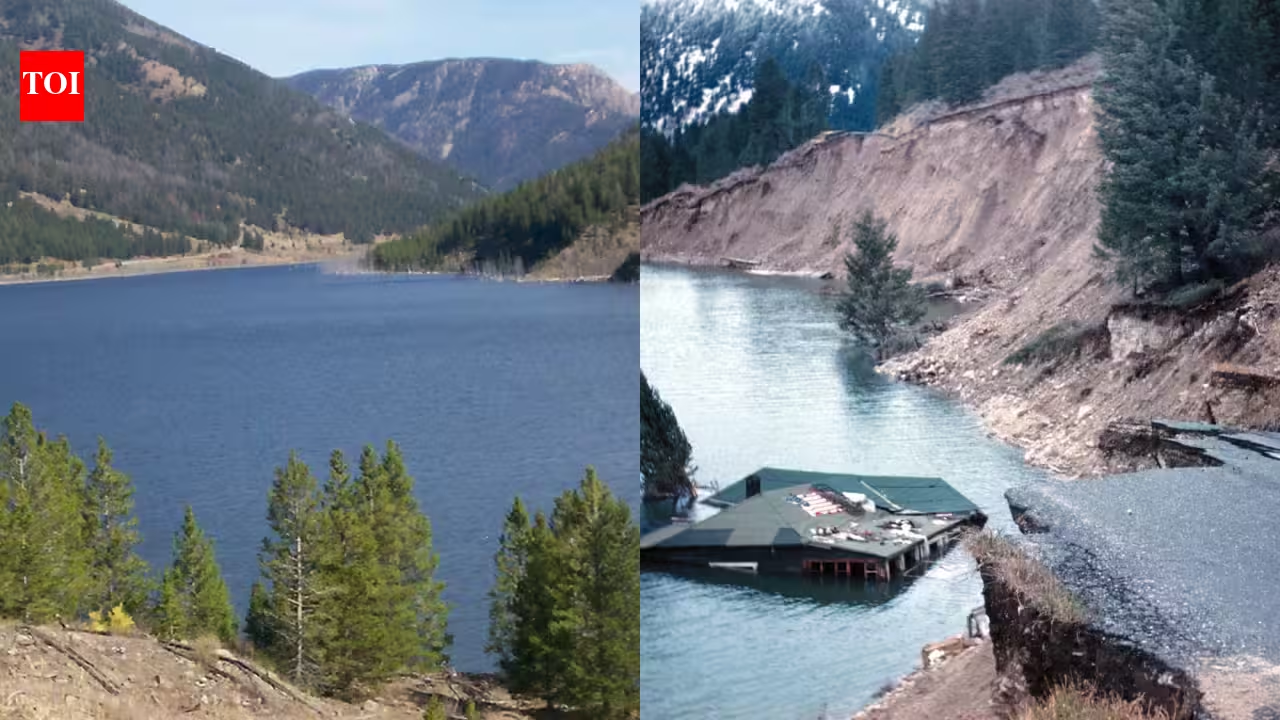
Quake Lake in Montana/Highway 287 slumped into Hebgen Lake | Wikimedia CommonsAn earthquake struck southwestern Montana late on August 17, 1959, with a force that would permanently alter part of the landscape west of Yellowstone National Park. The Hebgen Lake earthquake, now officially described by the U.S. Geological Survey as magnitude 7.3, occurred at 11:37 p.m. local time near the western boundary of Yellowstone. A huge section of the canyon's south wall broke loose and crashed into the valley below. The debris crossed the Madison River, surged partway up the opposite canyon wall and formed a natural dam, and water soon began collecting behind it. That newly blocked stretch of river became Earthquake Lake, which remains in the valley today. The USGS says the earthquake caused 28 deaths, most associated with the massive landslide in Madison Canyon.Quake Lake in Montana/Highway 287 slumped into Hebgen Lake | Wikimedia CommonsWhen the Madison Canyon wall came downThe USGS describes the Madison Slide as the largest seismically triggered landslide in North America in recorded history. The slide extended about a mile from its head scarp to its toe and was roughly three-quarters of a mile wide. A section of the south canyon wall about 1,300 feet high collapsed northward into the canyon. In places, the moving mass swept about 430 feet up the north canyon wall. Its debris formed a dam estimated at about 220 feet high across the Madison River.USGS estimates place the slide mass at roughly 37 million to 43 million cubic yards, although other USGS summaries use an approximate figure of 50 million cubic yards. The variation reflects different methods and summaries, so the narrower description is that tens of millions of cubic yards of rock, soil and debris fell into Madison Canyon. Twenty-six people died at the slide site, including 19 whose bodies were never recovered and are believed to remain buried within the debris. Two additional deaths brought the earthquake's overall death toll to 28. The slide also buried part of the Rock Creek campground. A muddy wave and a powerful air blast generated by the collapsing mass caused further destruction in the canyon.A river blocked overnight began filling the canyonThe water upstream had nowhere to go once the debris dammed the Madison River, and Earthquake Lake began forming almost immediately. By 6:30 the following morning, USGS records say water had covered the vehicles and trailers at the Rock Creek campground and was at least 20 feet deep there. About 250 survivors gathered at Refuge Point, which is the highest ground between the landslide and Hebgen Dam. Getting them out was another problem, since the earthquake had damaged the route upstream, and the canyon's geography limited access.Engineers and emergency crews had to deal with a growing lake behind a freshly formed and unstable natural dam. If water overtopped or rapidly cut through the debris, downstream communities and infrastructure could face another disaster. Work began within days, and on August 24, 1959, two bulldozers started building an access road to the top of the slide. By August 27, crews were working on a 250-foot-wide spillway intended to lower the eventual level of Earthquake Lake by about 14 feet. By September, the response involved 62 pieces of heavy equipment and 190 operators and mechanics working around the clock. Five lighting plants kept the site active at night while the lake continued to rise and inundate cabins along the former river corridor.Memorial for the victims from the 1959 earthquake at the Earthquake Lake Visitor Center | Wikimedia CommonsThe 1959 earthquake still matters to the Yellowstone regionUSGS's detailed geological investigation recorded major fault scarps around Hebgen Lake, changes in the lake basin and widespread ground deformation. The earthquake remains the largest recorded earthquake in the Yellowstone region in historical times, although its epicenter was outside Yellowstone National Park itself. It also provides scientists with a well-documented example of how a major earthquake can reshape a landscape in seconds through secondary effects such as landslides.The lake did not exist before August 1959, and it now occupies part of the Madison River valley because the earthquake-triggered slide blocked the river and engineers later modified the natural dam to control the lake's level. The water still covers land that had been part of the canyon floor and river corridor before the quake even after six decades. For visitors driving west of Yellowstone, the lake can appear to be another long-established Montana water body.
In 1959, a 7.3 quake hurled a landslide across Montana’s Madison River: 67 years later Earthquake Lake still floods the valley west of Yellowstone
An earthquake struck southwestern Montana late on August 17, 1959, with a force that would permanently alter part of the landscape west of Yellowstone National Park. The Hebgen Lake earthquake, now officially described by the U.S.
737 words~3 min read