5 min readImage of the Day for August 24, 2026The drying of the massive lake exposed playas that became the setting for feats of engineering and technological ingenuity, as well as epic tales of exploration and desperation.NASA Earth ObservatoryAug 24, 2026 Article
View more Images of the Day:
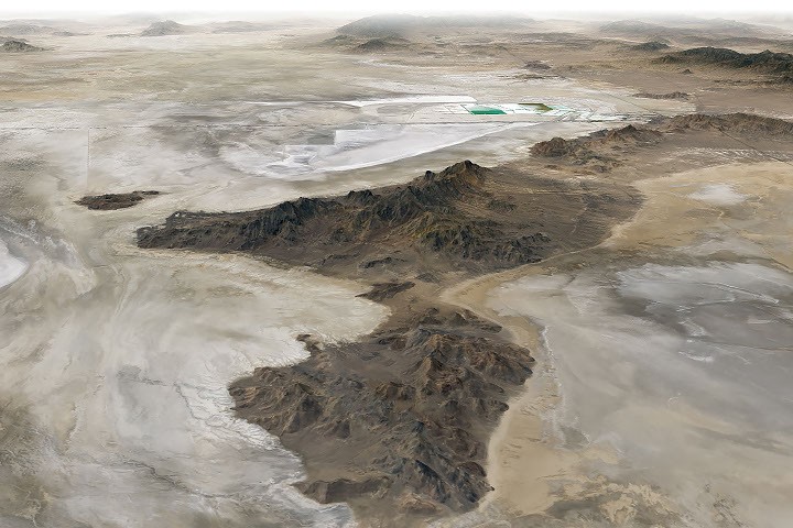
At its peak, ancient Lake Bonneville would have been a sight to behold. Nearly as large as Lake Michigan, the Ice Age lake spread across much of western Utah and parts of Nevada and Idaho. When it eventually receded, it left behind flat, bright playas and salt flats rich with minerals—a landscape that would later serve as the setting for feats of engineering and technological ingenuity, as well as epic tales of exploration and desperation.
Lake Bonneville began forming about 55,000 years ago during a cool, wet period, when volcanic eruptions in what's now southeastern Idaho diverted the Bear River, causing water to gather in Gem Valley and other basins to the south. For tens of thousands of years, a natural dam at Red Rock Pass helped confine the lake.
Then, about 18,000 years ago, water breached that dam, unleashing a torrent that entered the Columbia River system. Over a six-week period, amid one of North America's largest floods, lake levels plummeted by more than 350 feet (105 meters). As the climate warmed and dried in subsequent millennia, the lake shrank dramatically, leaving remnants that include today's Great Salt Lake, Utah Lake, and Sevier Lake.