An intense heat wave spread across parts of the western and central United States on Saturday, with triple-digit temperatures forecast from the Intermountain West into the Northern Plains and dangerous heat and humidity lingering in parts of the Southeast.
The National Weather Service's Weather Prediction Center said the heat would continue through much of the coming week as a strong upper-level ridge stretched from the western United States into the Midwest.
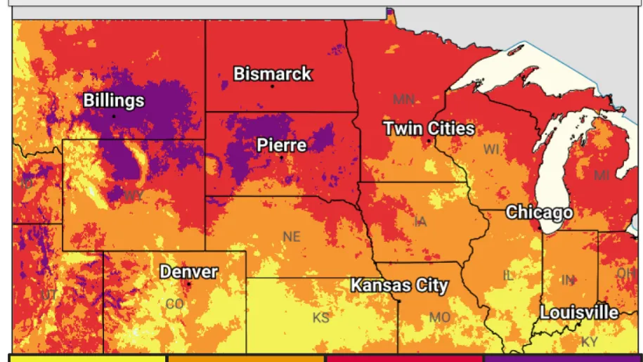
Several days of well-above-normal temperatures — including potentially record-breaking daytime highs and overnight lows — were expected to produce major to extreme heat risks in parts of the Intermountain West, Northern Plains, and Upper Midwest.
Sunday is expected to be hotter than Saturday across much of the north-central United States. Forecast highs in central and eastern Montana and North Dakota ranged from 100 to 110 degrees Fahrenheit (38 to 43 degrees Celsius), with higher local readings possible. Those temperatures would be about 8 to 14 C above normal for mid-July.
Forecasters said all-time temperature records could be challenged, including Salt Lake City's record of 41.6 C and Billings, Montana's record of 42.2 C. A cold front is expected to begin bringing cooler air into Montana late Sunday and Monday, but the heat is forecast to intensify farther east across the Northern Plains and Upper Midwest after Monday.