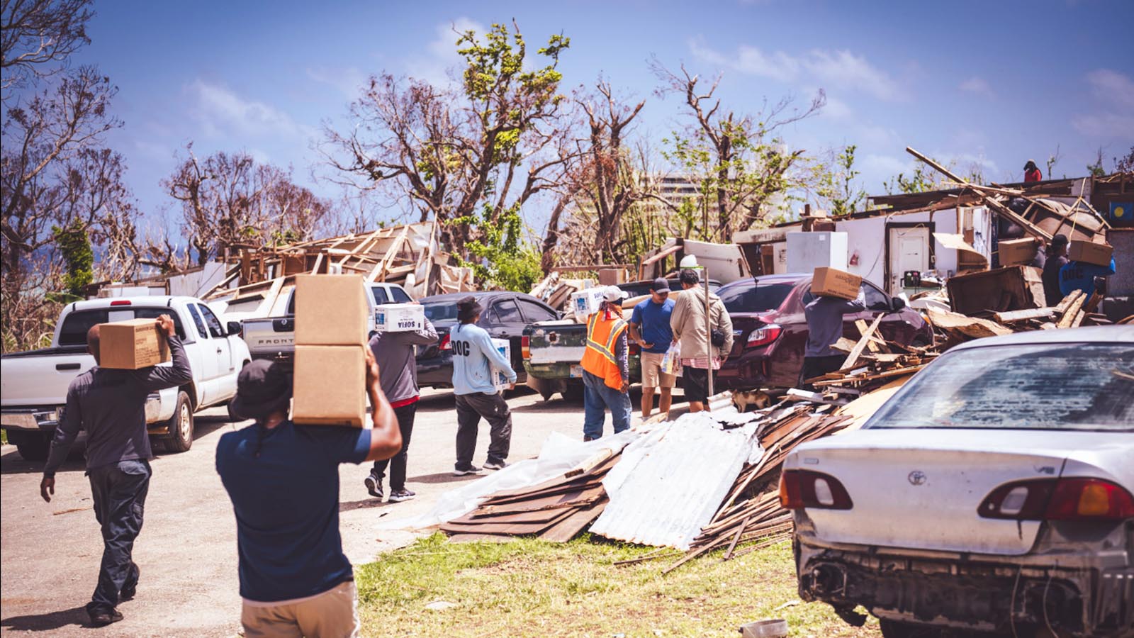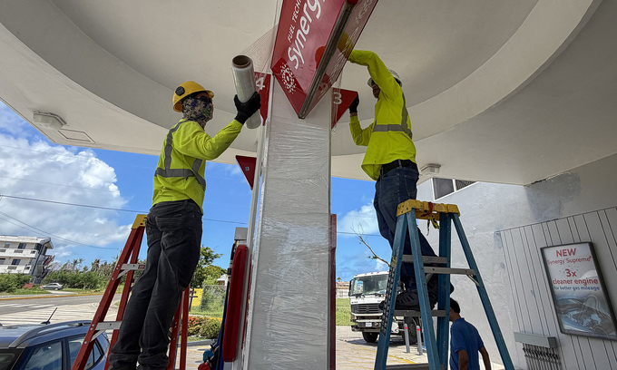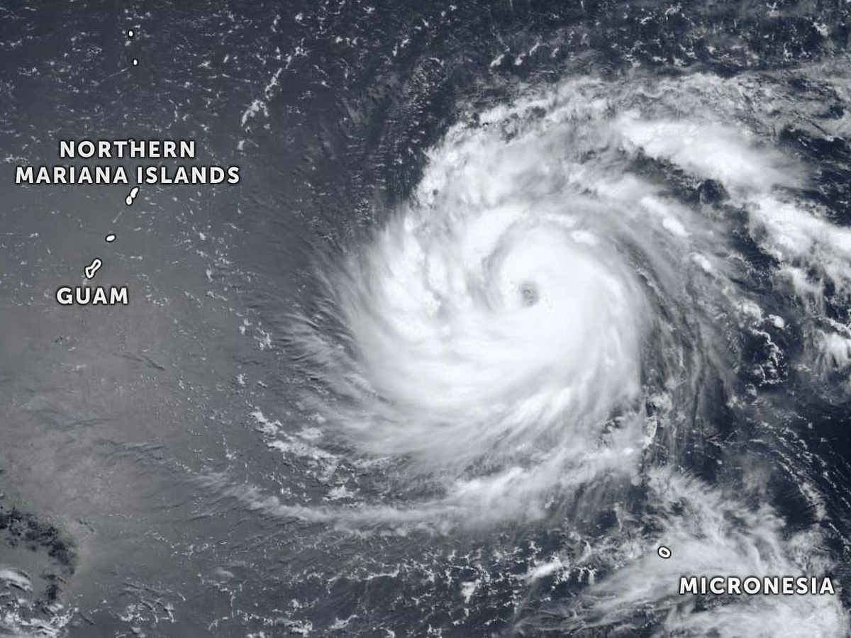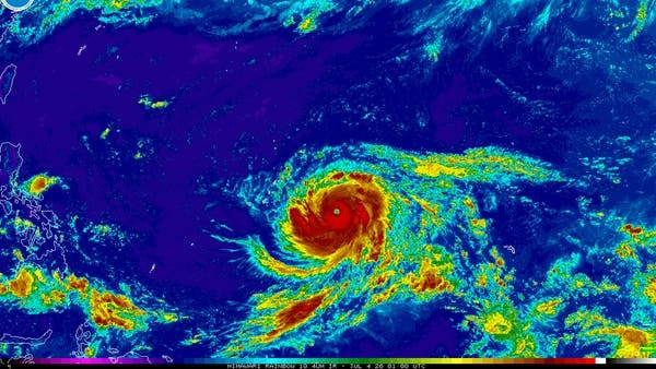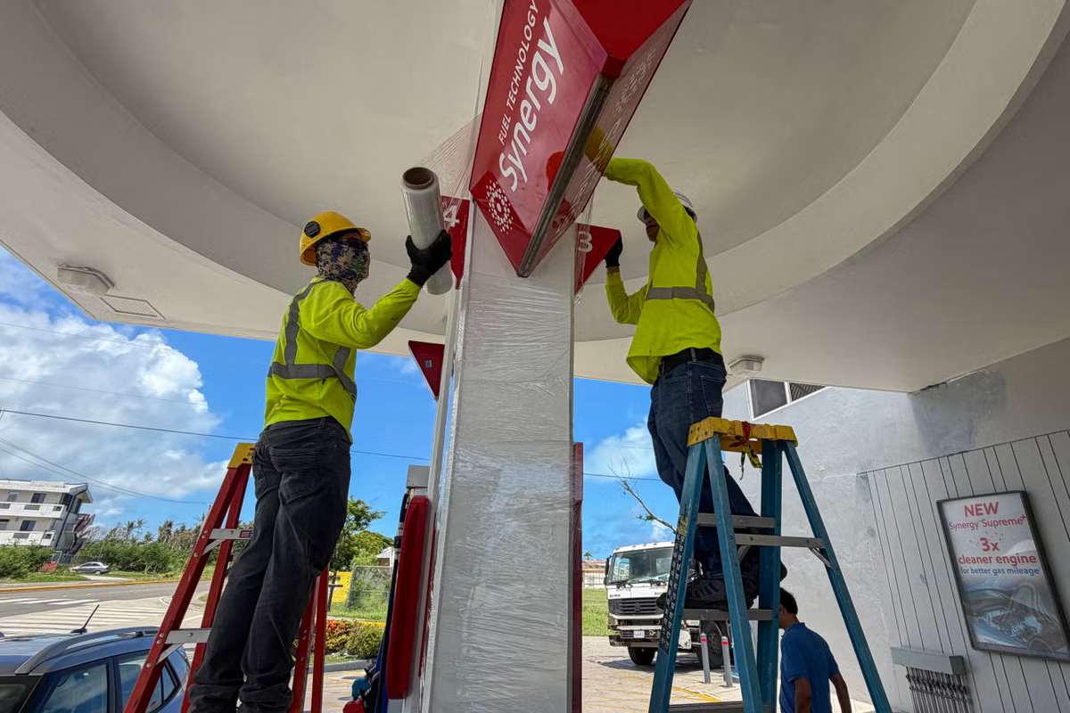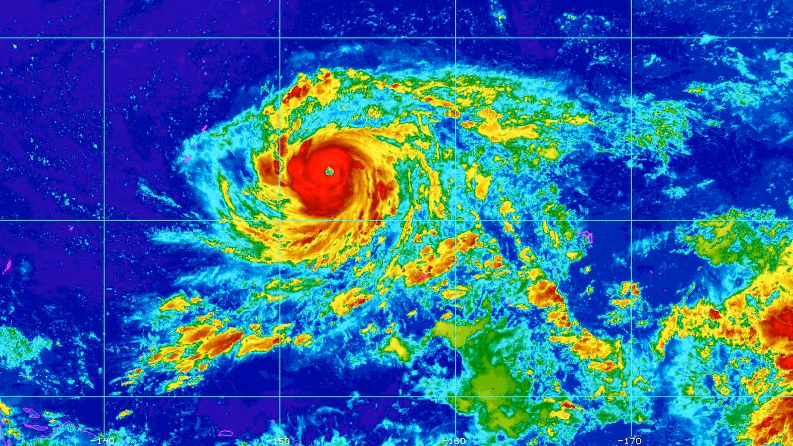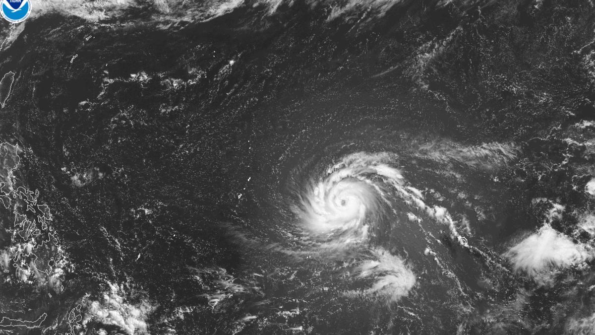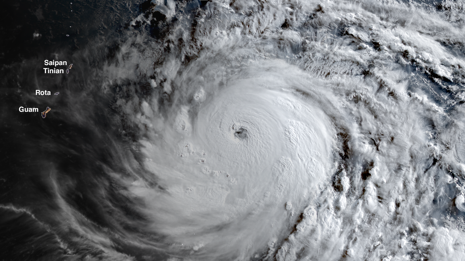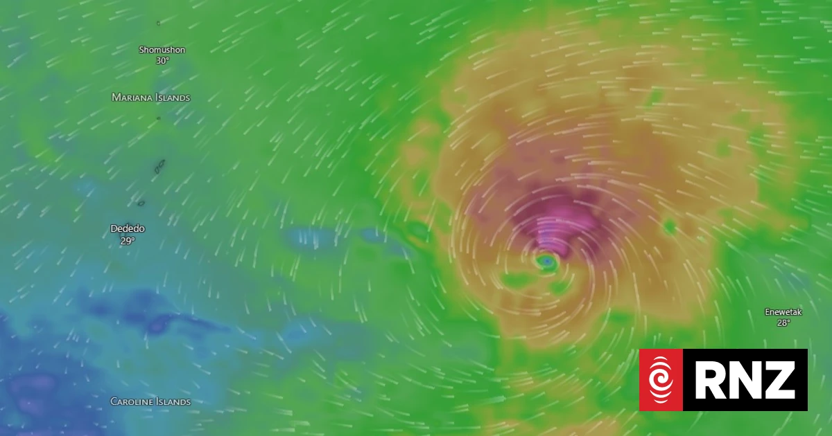
US National Weather Service is warning residents of the Northern Marianas to prepare for super typhoon Bavi, before storm force winds hit the area on Sunday night.The category five typhoon is expected to make landfall on Monday morning.However, seas were already hazardous, before tropical storm force winds expected to hit the islands on Sunday.National Weather Service meteorologist Josh Whisnant said the typhoon was expected to pass between the islands of Tinian and Rota - slightly closer to Rota - with peak wind speeds of 280km/h, Whisnant said.It was expected to weaken slightly before passage, but winds could still reach 257 km/h.He said preparation was the most important thing people could do, with anything not secured likely to be picked up by winds well before the arrival of the typhoon.The weather service said the winds would pose a deadly threat, and advised people to seek shelter in re-inforced concrete buildings and be ready to evacuate, if necessary.Flash flood warnings were in place for the entire area, with waves predicted to reach 8-11m near the centre of the storm, as it passes.Bavi is the second category five cyclone to hit the area in a space of months.Sinlaku battered the Marianas and Guam in April, causing widespread devastation to local infrastructure and the economy, killing at least six and wiping out up to 60 percent of the livestock on Saipan.
Northern Marianas warned to prepare for super typhoon Bavi
US National Weather Service is warning residents of the Northern Marianas to prepare for super typhoon Bavi, before storm force winds hit the area on Sunday night.
227 words~1 min read