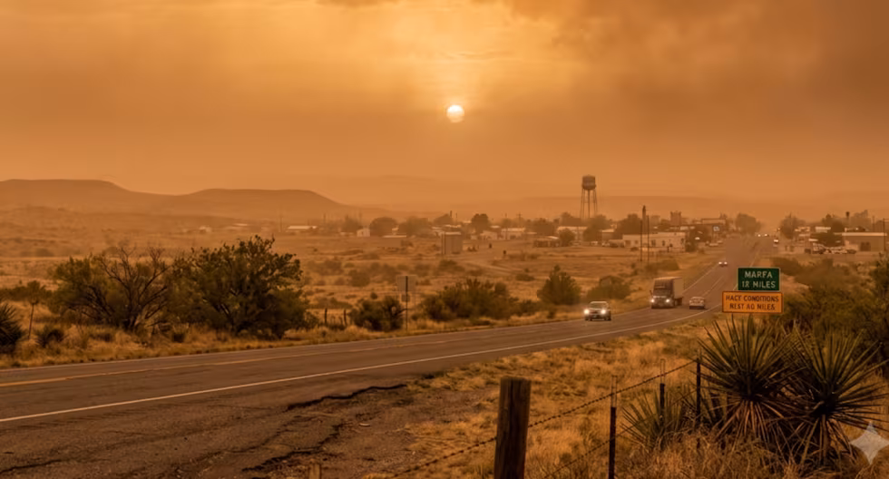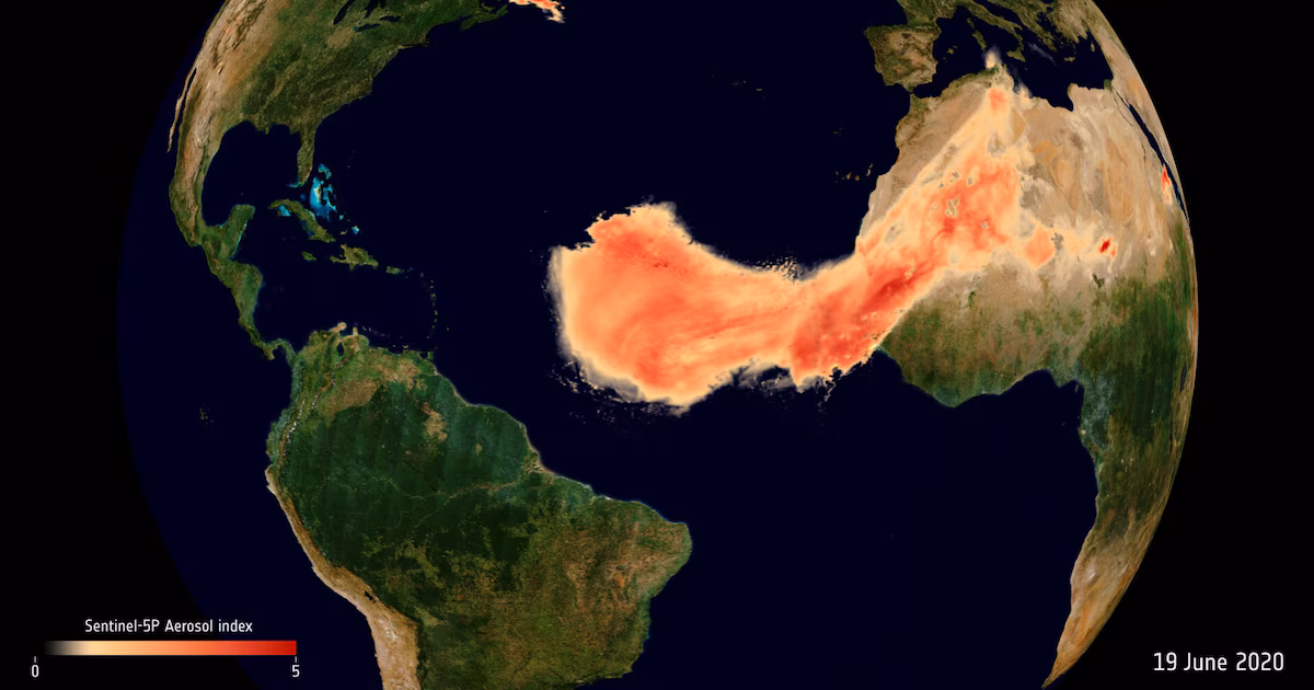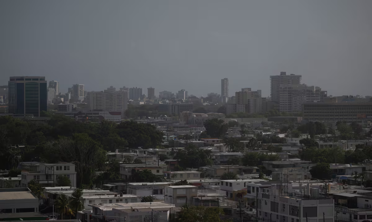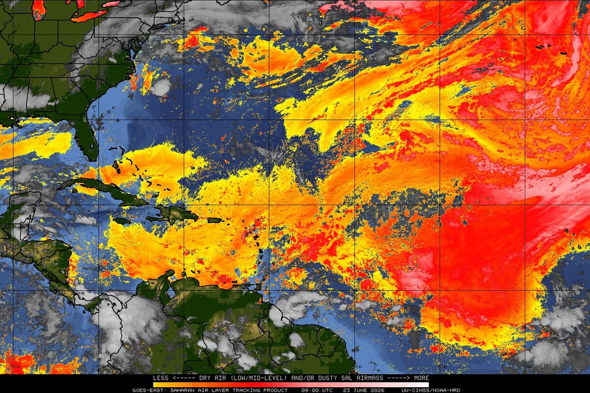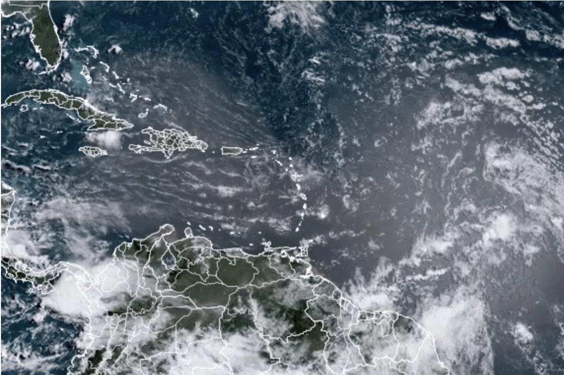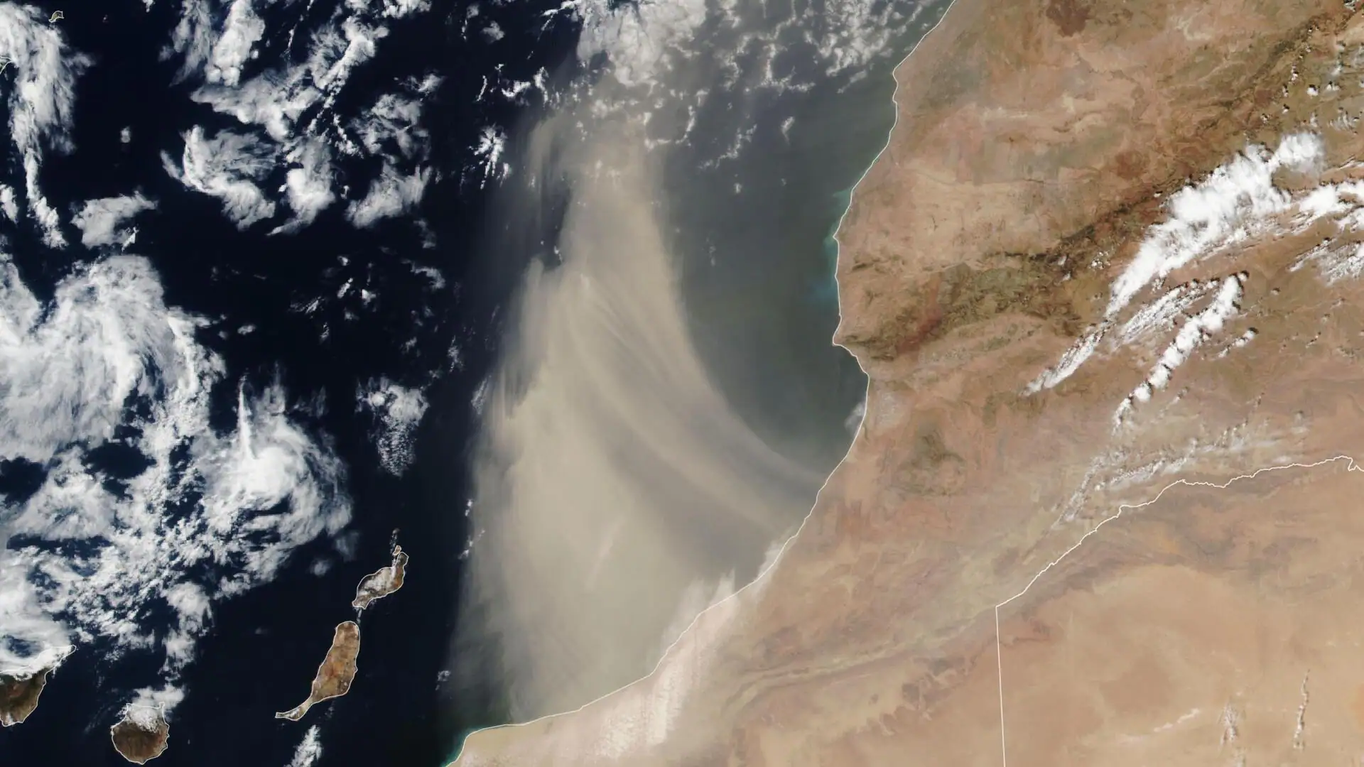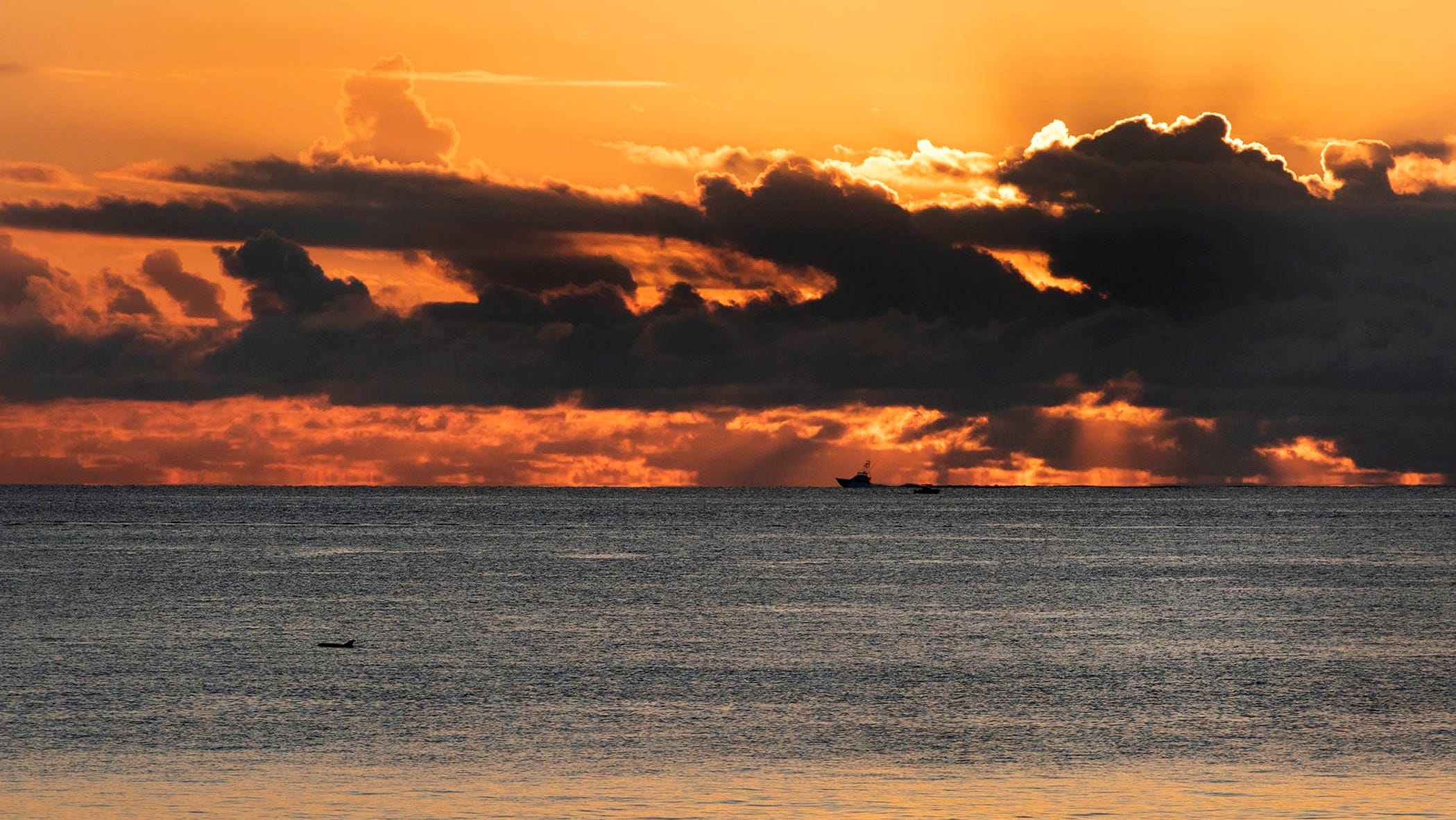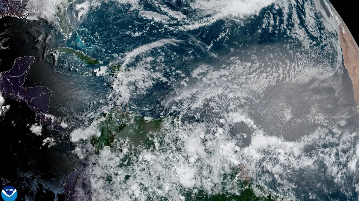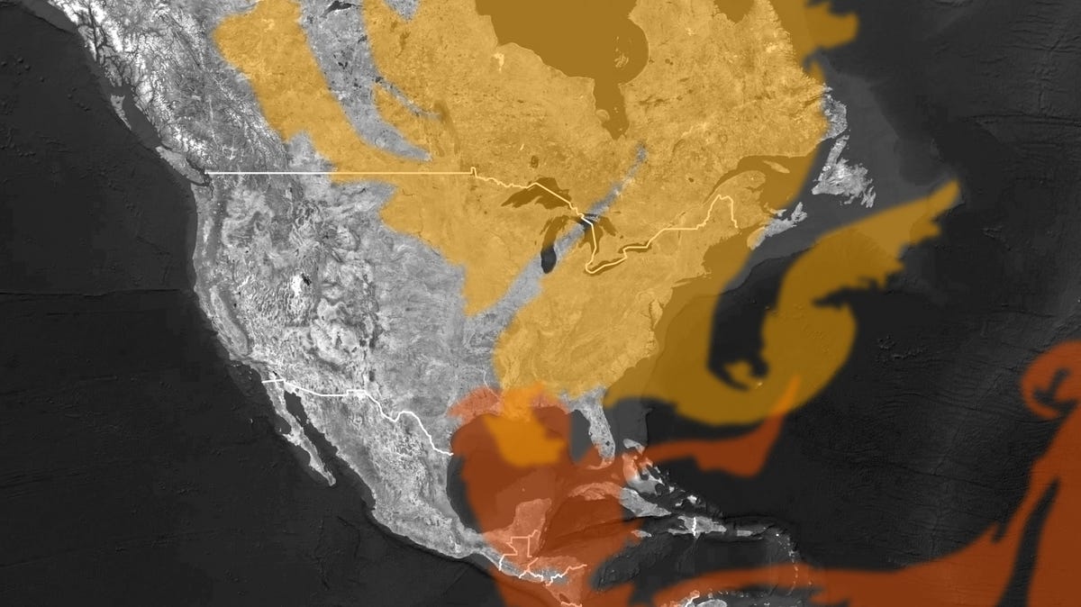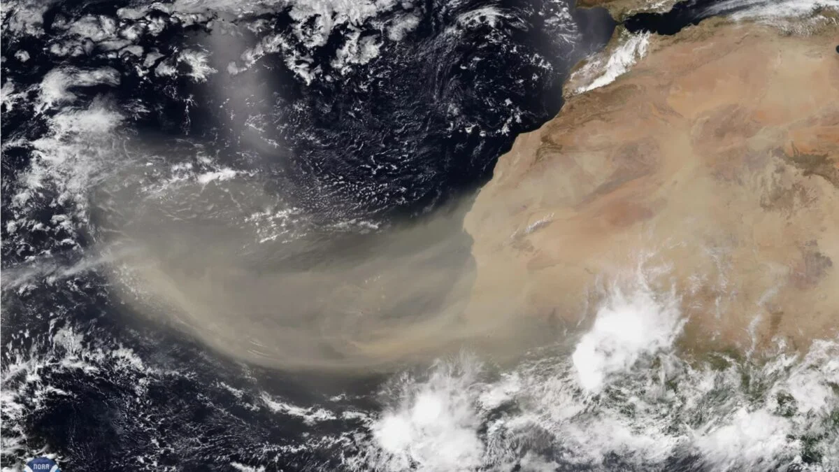
The Sahara Desert is once again sending enormous plumes of dust across the Atlantic, and parts of the U.S. are already feeling the effects. Dry, dusty Saharan air reached Florida on June 27 before continuing west, arriving in Texas on Monday. Now, it’s heading north into the Great Lakes Region. Another dust cloud is on track to reach Puerto Rico and the U.S. Virgin Islands today, so it’s possible that Florida could receive another blast of desert air over the July 4th weekend. Meteorologists say most of the dust will stay aloft high in the atmosphere rather than falling to the ground, so it’s unlikely to have a significant impact on air quality. With that said, affected areas should still see hazy conditions, vivid sunsets, increased temperatures, and suppressed storm activity through the holiday weekend. Saharan dust on the move These intruding air masses are part of the Saharan Air Layer, or SAL, which forms over northern Africa from late spring to early fall each year. It’s created by tropical waves (ripples in the lower-to-middle atmosphere) that track along the southern edge of the Sahara Desert and waft tons of dust up into the atmosphere, NOAA meteorologist Jason Dunion explained in a 2020 interview.
Saharan Dust Is Blowing Into the US. Here's What It Means for Holiday Weekend Weather
This annual phenomenon can influence weather in a variety of ways, from raising local temperatures to inhibiting storm formation.
483 words~2 min read