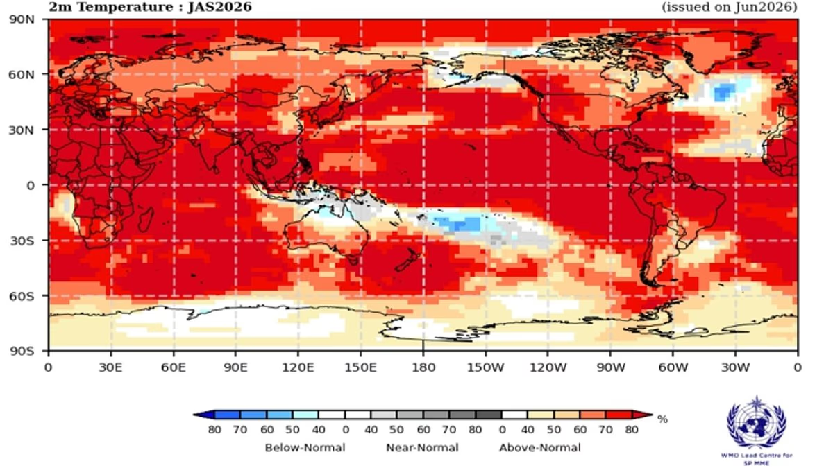
All global models are forecasting continued warming of the tropical Pacific and its related effects globally over the coming months
| Photo Credit:
A potential super El Nino is rapidly taking shape, with the tropical Pacific warming well beyond El Nino thresholds and atmospheric conditions reinforcing the event, says the Southern Hemisphere Monitoring Report of the Bureau of Meteorology Australia (BoM).Meteorologists say it may become one of the most powerful El Niño events since 1950, triggering fears of major worldwide weather and climate disruptions.El Nino is now present. SSTs in the central tropical Pacific are above El Nino thresholds, and atmospheric indicators are also indicative of an El Nino state. Ocean-atmosphere coupling (when the ocean and atmosphere work to reinforce the El Nino state) is likely to increase and keep El Nino going until at least the end of the year, says the report.0.3°C warming in the past fortnightThe latest relative Nino3.4 index value (for the week ending 28 June 2026) is +1.24°C, comfortably above the El Nino threshold (+0.80°C) and warming by about 0.3°C over the last two weeks. All global models are forecasting continued warming of the tropical Pacific over the coming months.Atmospheric indicators, such as trade winds, pressure and cloud patterns, are at levels consistent with El Nino. Trade winds are weaker than average or reversed over most of the tropical Pacific, cloudiness has increased near the date line, and the Southern Oscillation Index (SOI) is strongly negative. The latest 30-day SOI on June 27 was -25. 2.IOD OutlookThe Indian Ocean Dipole (IOD) is neutral. The index is −0.02°C on 27 June 2026. Models indicate that a positive IOD event is likely during the southern hemisphere winter-spring. But model forecasts indicate a wide range in onset and magnitude of this potential event.A positive IOD can bring more moisture to India, often helping monsoon rains even in an El Nino year. IOD is a climate phenomenon caused by variations in sea temperatures in the Indian Ocean. Its positive, negative and neutral phases can influence the Indian monsoon.Warming SeasSea surface temperatures around the globe have been very warm, with May 2026 global SSTs the warmest May on record (since 1900), says the BoM report.Meanwhile, the Copernicus Climate Change Service (C3S) and the Copernicus Marine Service (CMEMS) have both confirmed that the global sea surface temperatures (SST) have now exceeded the record levels for the time of year observed in 2023 and 2024. The C3S daily SST reached 20.86ºC on 21 June, slightly higher than 20.83ºC in 2023 and 2024. Copernicus Marine daily SST data also show record high temperatures on 21 June, reaching 21.0°C and exceeding the previous records from 2023 and 2024 by 0.1°C.Over the past three years the global ocean outside of the polar regions (between 60°N and 60°S latitude) has been 0.35ºC-0.73ºC warmer than the long-term average, and in June these anomalies have now reached record-high levels for the time of year.“Current conditions could indicate the beginning of a new phase, leading, once more, to uncharted territory. With ocean temperatures at these levels and El Nino on the horizon, we are likely to see more temperature records fall in the coming months. That Copernicus Marine data reaches the same conclusion through independent methods speaks to the strength of European science — and to why open, robust data matters now more than ever,” said Carlo Buontempo, Copernicus Climate Change Service Director at ECMWF.Broad impactsIt is not yet clear if this exceedance is transitory or reflective of the coming months. While record-setting temperatures for this time of year are noteworthy, they coincide with the beginning of El Nino, says the Copernicus report.Warming oceans have broad impacts. It will keep the atmosphere warmer for longer, give storms more energy and increase evaporation, all of which makes extreme rainfall and floods more likely. Ocean warming is also a contributor to sea level rise and ice melt and stresses marine ecosystems.Higher SSTs are also associated with more frequent and intense marine heatwaves — periods of abnormally high ocean temperatures that disrupt ecosystems and fisheries and impact coastal economies, which can also exacerbate heat extremes over adjacent land areas, the report adds.Published on July 1, 2026