Show Caption
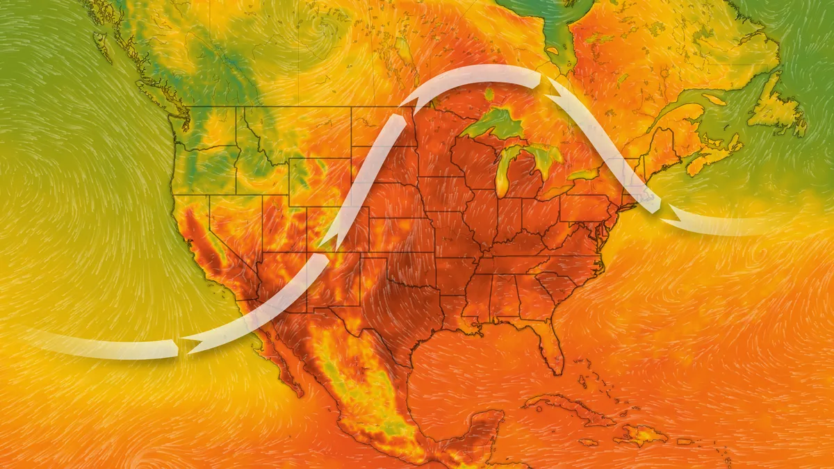
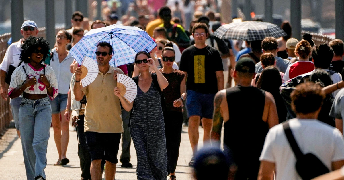
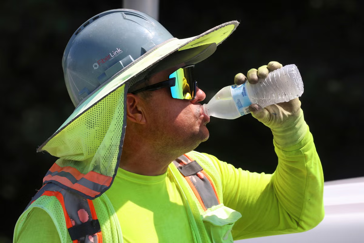
The heat is on.A prolonged, dangerous heat wave will continue to intensify across most of the central to eastern U.S. into the Fourth of July weekend, with both smothering humidity and searing highs that could approach all-time records in the mid-Atlantic.So far, the heat has forced the cancellation of outdoor activities such as summer camps and communities to open cooling centers. In Columbus, Ohio, for instance, cooling centers are open June 30, and the city has waived bus fares and public pool entry fees during the heat wave.Overall, about 230 million people, or roughly two‑thirds of the U.S. population, could be exposed to extreme heat this week, Weather.com warned."The extreme heat will peak Tuesday [June 30] through Thursday [July 2] in the Midwest and Mississippi Valley, shifting eastward into the Ohio Valley and East Coast Thursday [July 2] and into the weekend," the National Weather Service said in an online forecast.The heat wave will bring the hottest weather so far this year for many, and in some cases, the worst in years, according to AccuWeather meteorologist Alex Sosnowski.How hot will it get?In the Midwest, Weather.com forecast that highs in the 90s will stretch as far north as northern Michigan and northern Wisconsin, with heat indices reaching triple‑digit values in cities such as Milwaukee, Chicago, St. Louis and Minneapolis.The mid‑Atlantic is forecast to see dangerous heat indices of 100 degrees to 110 degrees in Washington, D.C., Philadelphia and Richmond, with possible triple‑digit temperatures lasting several days.Washington, D.C., New York City and Boston could each hit 100 degrees by Thursday [July 2], and overnight lows in parts of the Mid‑Atlantic may remain above 80 degrees, Weather.com said.Parts of the I-95 corridor from southern New England to Northern Virginia could reach triple-digit highs each afternoon from Thursday through Saturday, according to Weather.com.This could flirt with all-time records in a few places, including Philadelphia's all-time record high (106 degrees from Aug. 7, 1918)."The extreme heat and humidity are expected to bring near-record, or possibly record, energy usage to the mid-Atlantic power providers," AccuWeather senior meteorologist Alan Reppert said."This is especially critical on Thursday [July 2], as some companies could see possible power cuts to stabilize the grid," Reppert said.Elsewhere, the South will continue to experience 90‑plus highs, and some locations in the southern Plains and the Southeast could exceed 100 degrees, with humidity pushing heat indices over 100 degrees from Texas to the Carolinas.Dangerous conditions for folks out in the heatThe heat will bring significant dangers not only for young children, the elderly and those with fragile respiratory and cardiovascular conditions, AccuWeather's Sosnowski said, but also anyone who will be undertaking manual labor or rigorous physical activity.Experts urge people to take breaks from the heat, seek shade and remain hydrated, as the risk of heat exhaustion and heatstroke will be much higher during this prolonged and dangerous heat wave than on a typical summer day, AccuWeather said."Friends, family members and neighbors are encouraged to check in regularly on the elderly, who may attempt to isolate themselves from the heat by shutting their windows without air conditioning," Sosnowski said in an online forecast.Heat to help squelch tropical system off Southeast coastHurricane forecasters have been tracking a weak area of low pressure off the Southeast coast this week for possible tropical development.While the National Hurricane Center was still maintaining 10% odds of the system developing as of the morning of June 30, WPLG-TV hurricane specialist Michael Lowry said that most of the reliable forecast models have dropped the chances of development entirely.The low-pressure system will get trapped under the high-pressure heat dome centered over the Ohio Valley this week, which will nudge it slowly back toward the southeastern U.S. and in the direction of coastal Georgia and South Carolina from late Thursday, July 2, into Saturday, July 4, Lowry said."At that point, however, the combination of increasing wind shear and very dry continental air will wash out the system, and it won’t pose any significant issues for the July 4th holiday," Lowry said in an e-mail to USA TODAY.Elsewhere, the Atlantic should stay dormant for at least the first half of July, he said.Doyle Rice is a national correspondent for USA TODAY, with a focus on weather and climate.