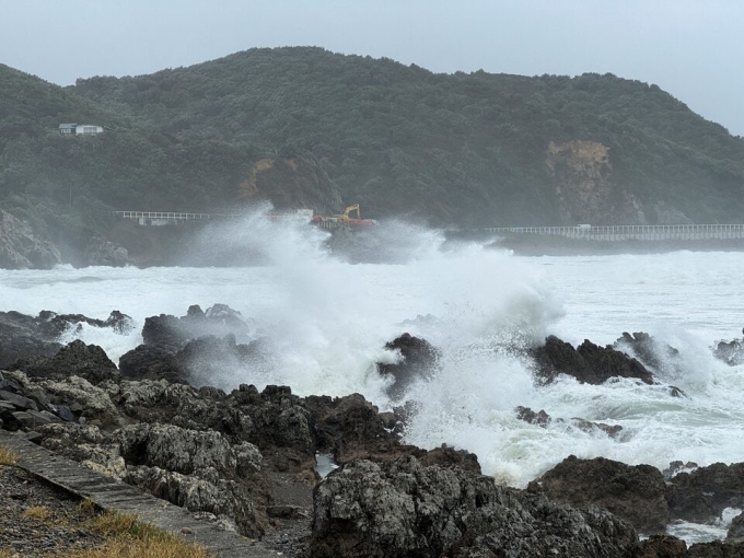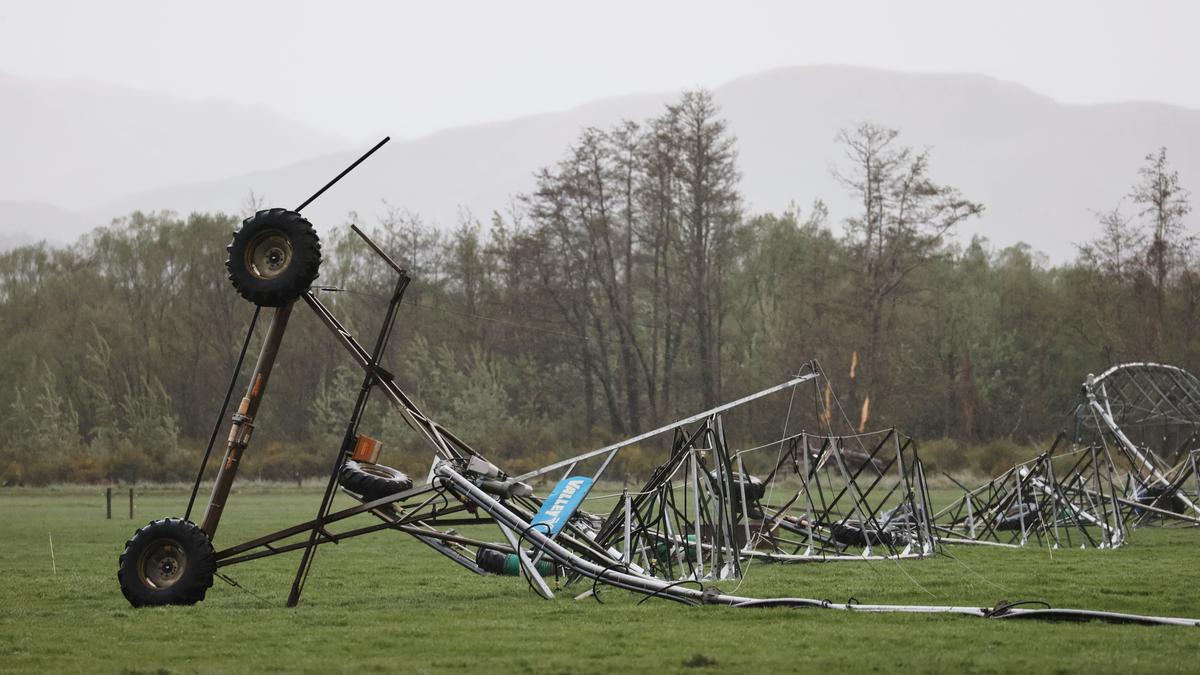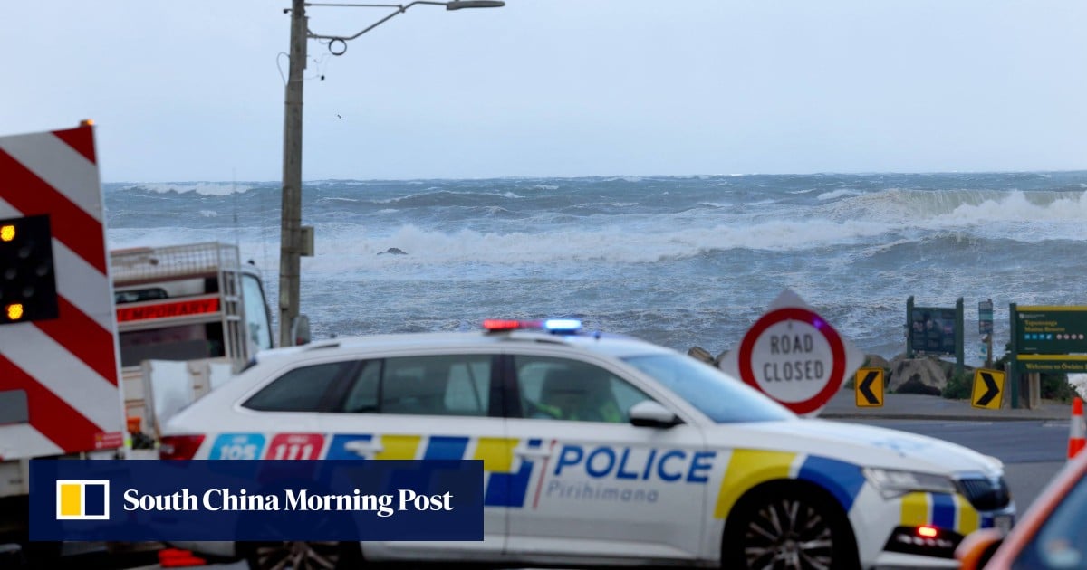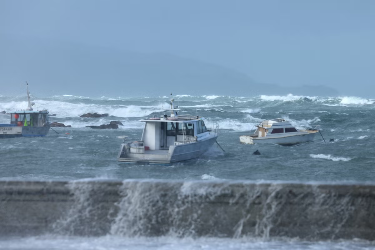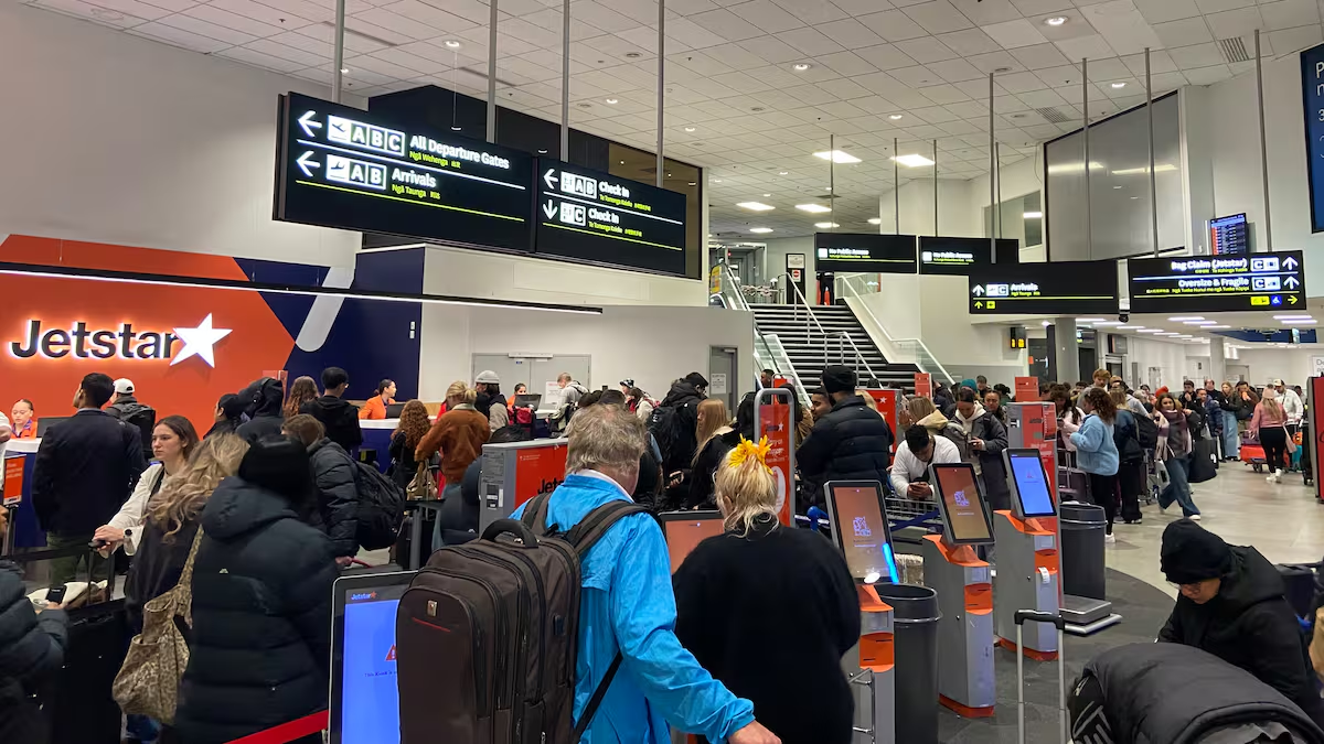
Gale-force winds have been hitting Taranaki and Wellington overnight, bringing down trees, lifting roofs and sending trampolines flying.Both regions are under orange strong wind warnings through to this evening, with severe gales and gusts of 130 km/h in exposed places.Several flights into Wellington and New Plymouth have been delayed or cancelled this morning, with 70kmh southerly gales measured at the capital’s airport and gusts up to 100kmh.Fire and Emergency central region shift manager Alison Munn said crews had been sent to 20 wind-related callouts - eight around Wellington and the rest in Taranaki, mostly in New Plymouth.“The majority have been loose roofing, trees down and trampolines that weren’t secured escaping and trying to bounce off down the road,” Munn said.No injuries had been reported, nor any major or structural damage to buildings.Wellington’s windiest spot was the highly-exposed peak of Mount Kaukau, where a 153km/hr gust had been measured as the wind continued to strengthen this morning, MetService meteorologist Matthew Ford said.The suburb of Kelburn was gusting 107 km/hr, while the airport was seeing 92km/hr gusts.Sustained winds at The Brothers - a pair of very exposed islands in the Cook Strait - have reached a “hurricane force” 129km/hr, with gusts up to 155km/hr, Ford said.“That’s very exposed and not necessarily representative, but that’s probably the windiest spot at the moment.”In New Plymouth, gusts had hit 114km/hr while Hawera was seeing 103km/hr gusts.Ford warned the severe weather would only ease “extremely slowly” today.Multiple severe weather warnings in placeWeather warnings are in place nationwide as rain and strong southerly winds accompany a deep low-pressure system crossing New Zealand.The wild weather could force major delays for Auckland commuters as strong winds threaten to shut down the harbour bridge during rush hour. Gusts up to 95km/h are forecast for this afternoon in the city, with all lanes of the bridge to be closed if winds reach more than 90km/h. Speed restrictions will likely also be enforced as the winds develop.MetService meteorologist Katie Lyons told the Herald last night the high-speed winds were set to start developing on Thursday evening and be felt by those in exposed places.“The southwesterlies that we’re expecting tomorrow [Friday], they pick up tonight and into tomorrow morning and we’re expecting 90km/h gusts with those,” Lyons said. “We say mostly in exposed places, but an exposed place could be somewhere like the harbour bridge and there are quite a few hills around Auckland, so that could still mean that your average person who doesn’t live in the Waitakeres could experience those.” Lyons said commuters living in different parts of the region might feel the wind less than others.The Auckland Harbour Bridge may have to close on Friday as high winds are expected to hit the city. Photo / Michael Craig
Flights cancelled and truck driver trapped by fallen tree as gales wreak havoc
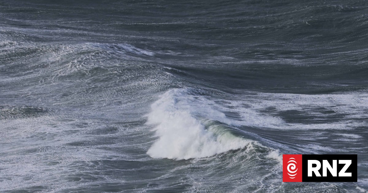
'Hurricane-force' winds have been measured on The Brothers islands in the Cook Strait.
862 words~4 min read