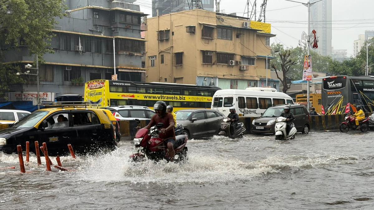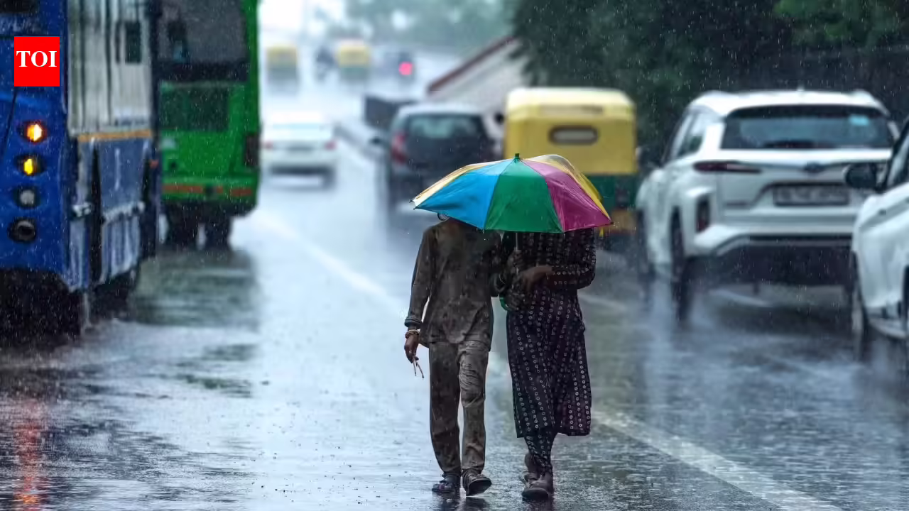
The India Meteorological Department (IMD) has reported further progress of the Southwest Monsoon across several parts of the country. As of 25 June 2026, the monsoon has advanced into more areas of Gujarat and Madhya Pradesh, covered the remaining parts of Maharashtra, and spread further into Chhattisgarh and Jharkhand.At the same time, the weather department has warned of heavy to very heavy rainfall in several states, while heatwave conditions are expected to continue in parts of Uttar Pradesh, Bihar and Madhya Pradesh.Southwest Monsoon Advances Further Across IndiaAccording to IMD, favourable conditions remain in place for the Southwest Monsoon to advance further over the next few days.The monsoon is expected to cover more parts of Gujarat, Madhya Pradesh, Chhattisgarh, Jharkhand and Bihar during the next two to three days. Thereafter, it is likely to move into additional parts of Uttar Pradesh and Uttarakhand.This marks another significant step in the monsoon's journey across the country as many regions await widespread rainfall.Heavy Rainfall Alert Along West Coast and Northeast IndiaIMD has forecast heavy to very heavy rainfall over several regions during the coming week.Areas likely to receive intense rainfall include:Konkan and GoaCoastal KarnatakaKerala and MaheSub-Himalayan West Bengal and SikkimAssam and MeghalayaArunachal PradeshNagaland, Manipur, Mizoram and TripuraExtremely heavy rainfall is expected over Sub-Himalayan West Bengal and Sikkim on 27 and 28 June. Residents in these regions have been advised to remain alert for possible waterlogging, flash floods and landslides.Heatwave Conditions to Continue in Uttar Pradesh and BiharWhile monsoon rains are advancing, parts of northern and eastern India continue to face extreme heat.IMD has predicted heatwave conditions in:East Uttar Pradesh until 28 JuneBihar on 25 JuneNortheast Madhya Pradesh on 25 JuneTemperatures in several areas have remained significantly above normal. Banda in Uttar Pradesh recorded the country's highest maximum temperature at 43.8°C.Thunderstorms and Strong Winds Likely in Several StatesThe weather department has also issued warnings for thunderstorms accompanied by lightning and gusty winds across many states.Wind speeds of 40-60 kmph are expected in parts of:Delhi-NCRHaryanaPunjabRajasthanUttar PradeshMadhya PradeshBiharJharkhandWest BengalSome areas may witness stronger thundersqualls with wind speeds reaching 70 kmph.Residents are advised to stay indoors during severe thunderstorms and avoid taking shelter under isolated trees.Delhi Weather: Light Rain and Thunderstorm Activity PossibleFor Delhi and adjoining regions, isolated rainfall and thunderstorms are likely on 25 and 26 June.The IMD has warned that gusty winds reaching up to 60 kmph may accompany thunderstorms. While widespread rainfall is not expected immediately, weather conditions could become more favourable for monsoon advancement towards the region in the coming days.Rainfall Forecast for Central IndiaCentral Indian states are expected to receive a mix of scattered and widespread rainfall.Madhya PradeshHeavy rainfall is likely in parts of East and West Madhya Pradesh. Thunderstorms and lightning activity are also expected through the week.ChhattisgarhHeavy rainfall is forecast between 26 and 29 June, with widespread rain expected by the end of the week.VidarbhaSeveral districts may experience heavy rainfall between 25 and 28 June along with thunderstorms and strong winds.East India Weather ForecastEastern states are likely to witness increased rainfall activity over the next few days.BiharRainfall activity is expected to increase from 28 June onwards. However, heatwave conditions may persist in some districts in the short term.JharkhandHeavy rainfall is likely between 25 and 30 June, with the possibility of thunderstorms and strong winds.OdishaSeveral districts may receive heavy rainfall between 25 and 29 June, accompanied by lightning activity.Northeast India to Continue Receiving Heavy RainThe Northeast is expected to remain one of the wettest regions in the country.Heavy rainfall is likely over:Arunachal PradeshAssamMeghalayaNagalandManipurMizoramTripuraAssam and Meghalaya could experience very heavy rainfall between 26 and 28 June.West Coast States Under Heavy Rain WatchThe west coast will continue to receive active monsoon rainfall.Konkan and GoaHeavy to very heavy rainfall is expected over the next few days, especially on 27 June.MaharashtraMadhya Maharashtra and Marathwada may witness heavy showers along with thunderstorms and strong winds.GujaratRainfall activity is likely to increase as the monsoon advances further into the state.Fishermen Advised Not to Venture Into the SeaIMD has advised fishermen to avoid venturing into several parts of the Arabian Sea and Bay of Bengal due to rough sea conditions and strong winds.Warnings remain in effect for coastal areas along Maharashtra, Goa, Karnataka, Kerala, Odisha and West Bengal, among others.Fishermen already at sea have been advised to return to the coast and avoid deep-sea operations until conditions improve.IMD's Key Weather Message for the WeekThe coming days will bring contrasting weather conditions across India. While heavy rainfall and thunderstorm activity are expected across western, central, eastern and northeastern regions, heatwave conditions will continue in pockets of Uttar Pradesh, Bihar and Madhya Pradesh.With the Southwest Monsoon steadily advancing, many regions are expected to see a gradual transition from intense summer heat to more widespread monsoon rainfall.
Weather updates today, June 25, 2026: IMD issues rain alert for UP, Gujarat, Maharashtra, MP & more; over 15 districts under heavy rain warning as southwest monsoon advances
The Southwest Monsoon is making significant progress across India, reaching more areas of Gujarat and Madhya Pradesh. While heavy to very heavy rainfall is forecast for the West Coast and Northeast, heatwave conditions persist in parts of Uttar Pradesh and Bihar. Thunderstorms and strong winds are also expected in several states, with fishermen advised to stay ashore.
784 words~4 min read