This is AI generated summarization, which may have errors. For context, always refer to the full article.
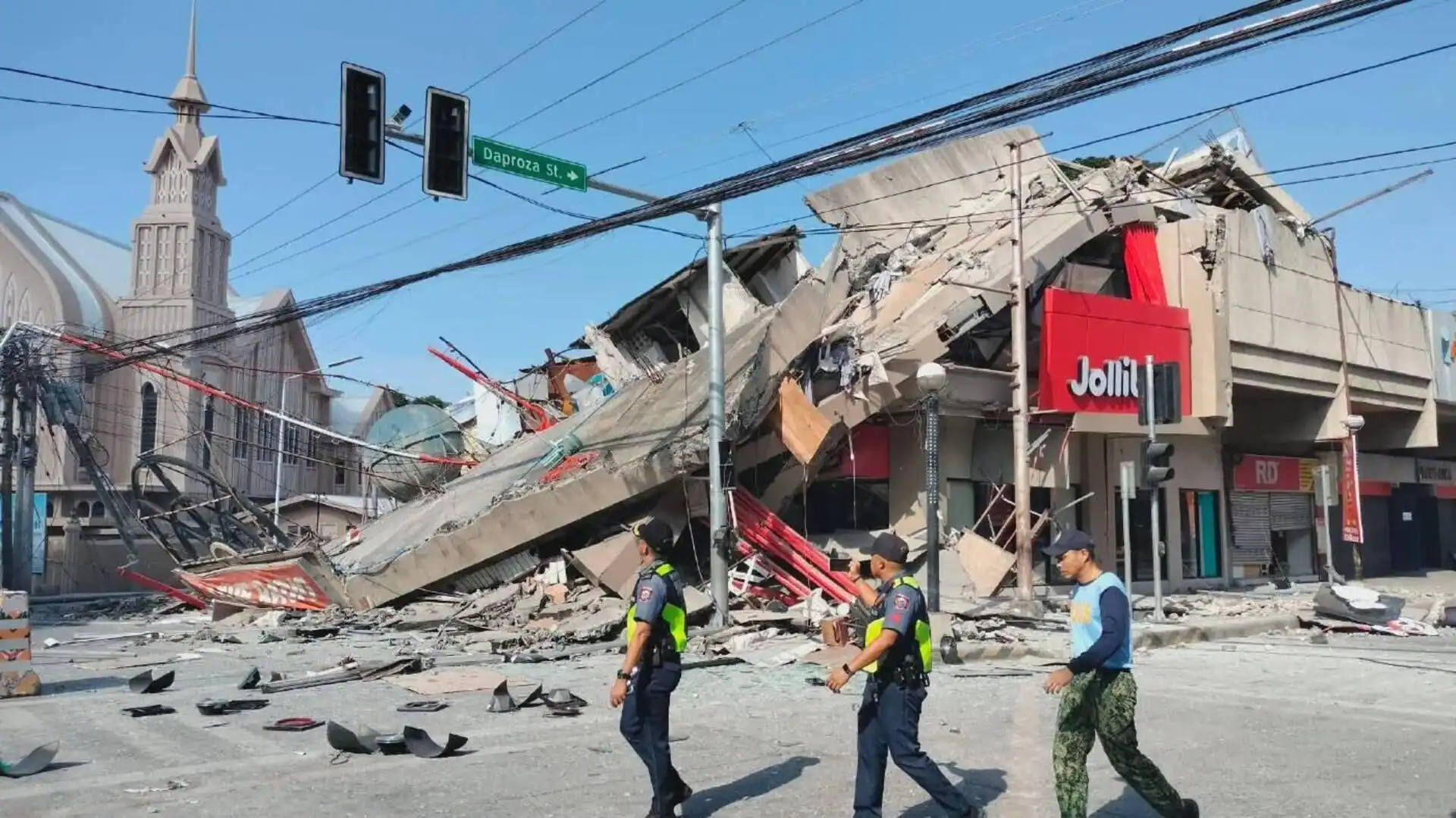
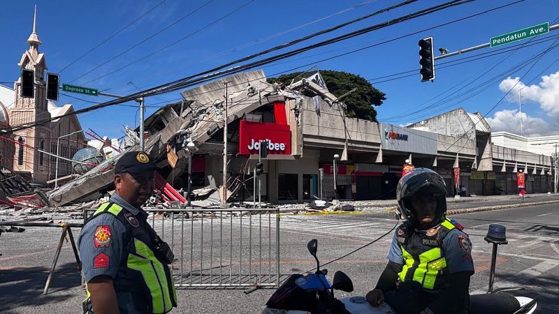
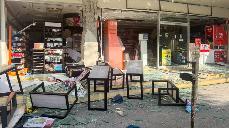
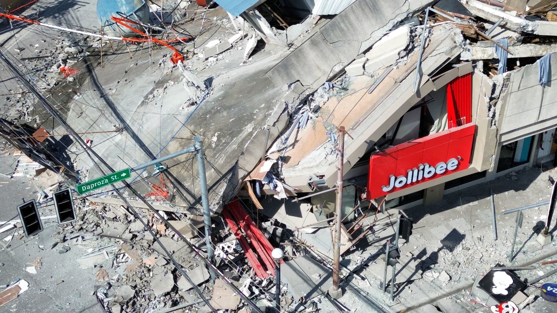
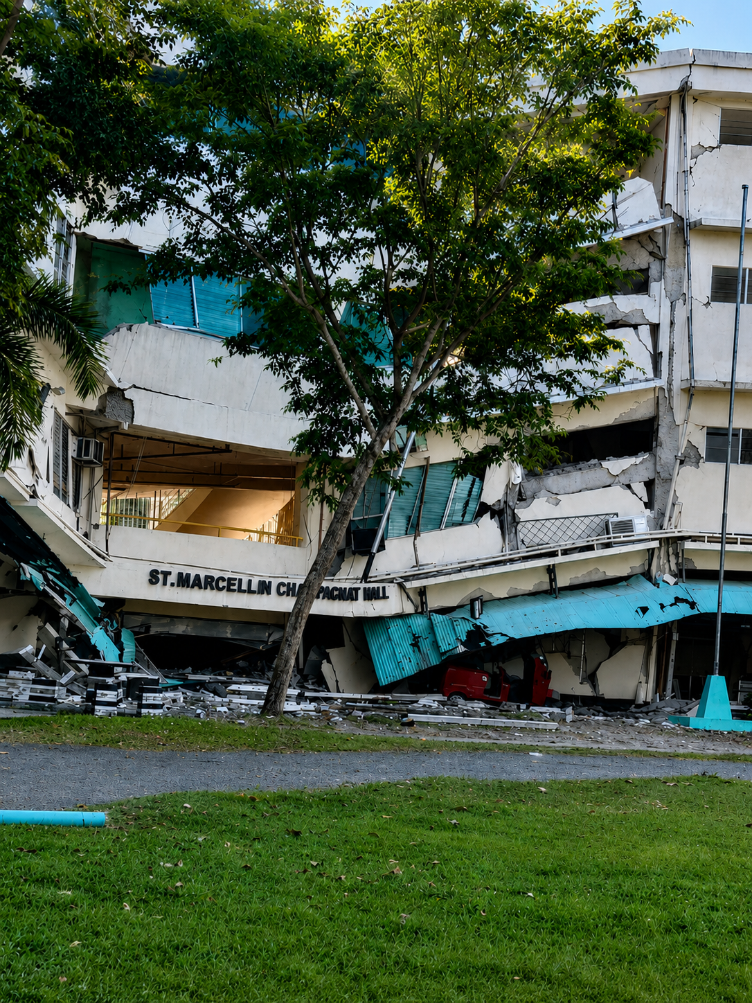
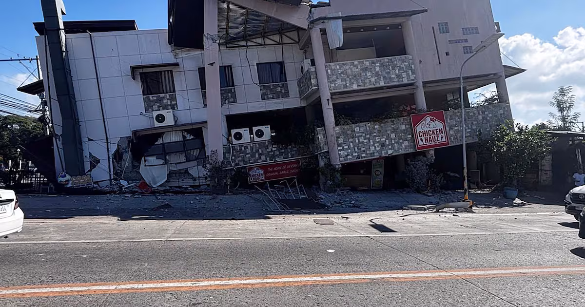
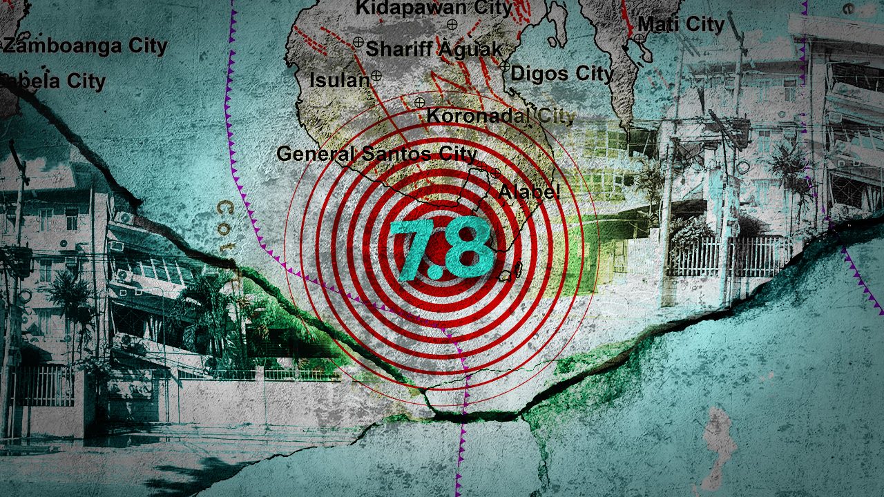
Just a few minutes after half past seven in the morning of Monday, June 8, on the first day of the new school calendar instituted by the Department of Education (DepEd) for school year 2026-2027, a powerful magnitude 7.8 earthquake struck offshore General Santos City in Mindanao. Early reports of massive damage to infrastructure in the city have started coming in.
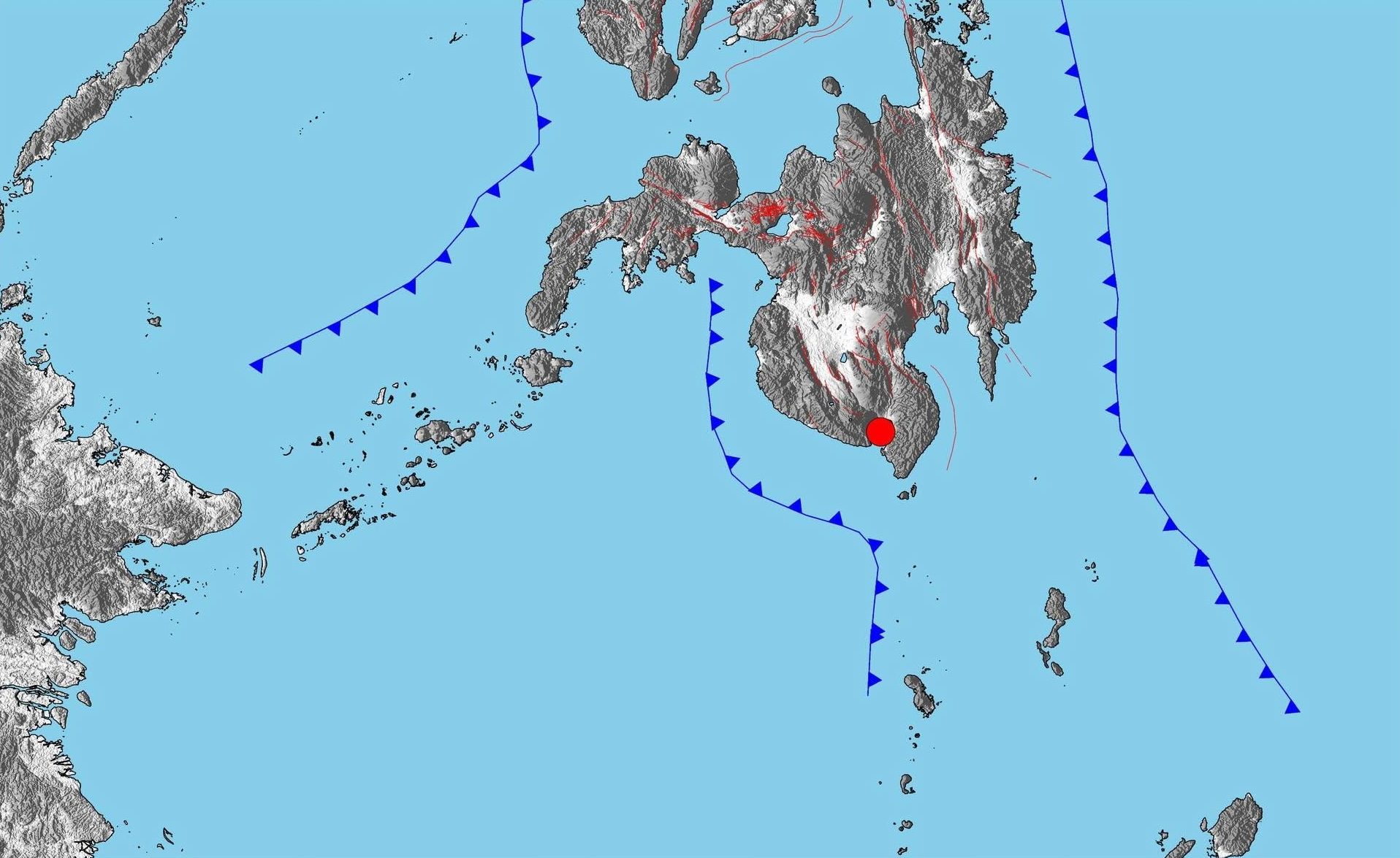
Mindanao Island is surrounded by three active subduction trenches. The Sulu Trench runs offshore on the west coast of the Zamboanga Peninsula, the Philippine Trench skirts the eastern coast of Mindanao from Siargao Island in the north to Mati in Davao Oriental in the south, and in the middle, the Cotabato Trench hugs the western coast of the main island.
The Cotabato Trench takes an arcuate geometry which is concave to the east trending generally northwesterly, following the curving coastline from Sindangan in the north to Sarangani in the south. Until there, the trench then extends southwards and notably bends more northerly towards the Indonesian islands of Sangihe, and adopts the name Sangihe Trench.
Based on preliminary reports from local and global seismological observatories, it is likely the northern section of the Sangihe Trench and/or the southern segment of the Cotabato Trench that ruptured and generated the earthquake.