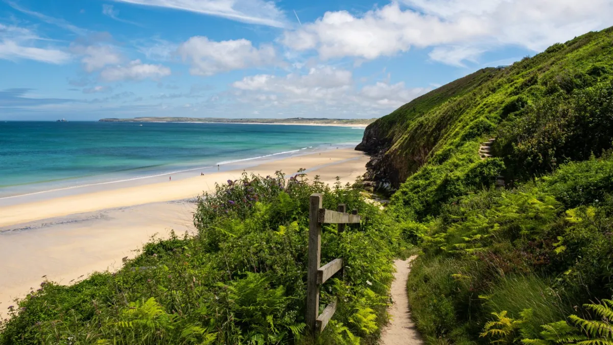
Minehead may be the birthplace of the science fiction writer Arthur C Clarke, but it’s a coastal, rather than cosmic, odyssey I’m beginning here, walking 11 miles east to St Audries Bay.Despite this being one of Somerset’s most well-trodden stretches of coast, few tackle it in one go; tides dictate when beach paths are passable, and return journeys rely on a public transport system that doesn’t yet stretch to moonbuses, so many visitors opt for circular hikes instead. Until now I’ve done the same, but the opening of the England coast path has inspired me to pull on my walking boots and lace together the sections I’ve skipped.It’s not a propitious start. Coastal erosion has forced a 1½-mile diversion leaving Minehead. Instead of clamouring gannets and the rush of waves, I’m trailed by the rumble of engines as the route follows the A39. It’s not far to Dunster, however, where the soundtrack switches to lawnmowers and willow warblers, and I’m soon at the beach.Clattering shingle underfoot, I’m buffeted along to the village of Blue Anchor, with its huddle of beach chalets. Along the promenade, I meet angler Steve, who’s hoping for dogfish or conger.“Will you eat them,” I ask?“I’m soft,” he smiles. “I throw them back. If I want fish, I go to the chippy.”From here on, the path gets steeper and prettier, detouring around the headland through woods trimmed with blossom and birdsong. Midweek, the trail is quiet, despite the herds of caravans corralled in adjacent fields.Approaching Watchet, the path spills on to the grassy earthworks of Daw’s Castle, a clifftop fortress founded by King Alfred to stave off Viking raiders. Fossil hunting is another long tradition along this coast, and when I stop at the town’s Market House Museum, I’m transfixed by a huge ammonite, found on a nearby beach a century and a half ago.It’s market day in Watchet, and the trail leads past a rainbow of striped awnings to East Quay, the town’s social enterprise arts hub. In its cafe I order a charred sweetcorn and courgette salad and a cheese scone almost as gargantuan as that ammonite.Rhiannon Batten on the path between Doniford and St Audries Bay. Photograph: Rhiannon BattenI’d like to visit East Quay’s art gallery and Watchet’s boat museum, but time and tide wait for no woman along this shoreline. Two hours before low tide, the route across neighbouring Helwell Bay is passable, but I’m cautious as I step over rocks and slippery kelp, mesmerised by the swirling mud and serrated shoreline below my boots as I play seaweedy hopscotch.Leaving the beach near Doniford Farm Park, the trail winds through a maze of caravans then out into fields before dropping into St Audries Bay. I feel the waterfall here before I see it, its icy spray a reminder not to linger.Retracing my steps to Doniford Halt, a request stop on the West Somerset Railway, I arrive just in time to flag down a steam train to take me back to Minehead. As we puff along, the landscape I have walked is rewound through the window. There are better coastlines in England for swimming than these estuarine bays, but as a tidal immersion on foot this walk has been stellar.Train from Doniford Halt to Minehead is £17.50 one-way (west-somerset-railway.co.uk). Doubles at the Foxes hotel in Minehead from £120 B&BRhiannon BattenChichester harbour, Hampshire and West SussexWest Wittering beach, West Sussex. Photograph: Stephen Tattersall/AlamyFrom Prinsted To West WitteringDistance 16½ milesWild, windswept wetlands stretch to the horizon. Human figures are outnumbered by birds. Church spires and thatched roofs signpost scattered settlements. Can this really be the crowded south coast of England?My boyfriend and I are walking part of a 35-mile stretch of the King Charles III England coast path, linking South Hayling in Hampshire to East Head in West Sussex, which opened in February. This section includes Chichester harbour, a protected estuary with open water and sheltered inlets, reedbeds, salt marshes, mudflats, shingle banks, sand dunes and a wooded shoreline.We join the path at pretty Prinsted, after coffee (and directions) from the Southbourne farm shop. We set off east around Chidham peninsula, trying to spot the birds pictured on the information boards. Tens of thousands of wading birds and waterfowl spend the winter here, and in summer it’s a breeding ground for threatened species of seabirds and waders. Early April may not be peak time for birdwatching, but we still see a plethora of gulls and ducks, plus oystercatchers, curlews and a kestrel.After rounding the peninsula and making our way up the other side, the day’s destination comes into sight across the water. Bosham, a cluster of buildings crowding up to the quayside, looks close enough to touch, but the winding coastal path is deceptive, and we still have a way to go (8½ miles in total).We are glad to reach the Millstream, a 31-room hotel made from converted cottages, set in a lovely garden. Our room is in a tiny thatched cottage, reached by a little bridge over the stream.Bosham (pronounced “Bozzum”) is ancient – believed to predate the Romans. Some think this is where King Canute tried to turn back the tide. King Harold II is depicted in the Bayeux tapestry praying at Bosham church, and the manor is recorded in the Domesday Book as one of the wealthiest in England. We visit the Saxon church and see the plaque to Canute’s eight-year-old daughter, who is said to have drowned and been buried here.Rachel Dixon on the trip from Ferry Hard to Itchenor jetty in Chichester Harbour. Photograph: Neil Clive FowlerMore cheerfully, we stop for a pint at the ivy-clad Berkeley Arms before dinner at the harbourside Anchor Bleu. The latter, family-run inn has been welcoming weary travellers since 1741 and has a daily changing, seafood-heavy chalkboard menu. The inspired kelp, samphire and seaweed “seacakes” mean that vegetarians don’t miss out, either.The next morning, we walk across the harbour (a walkway appears at low tide) and continue south for a couple of miles. The wind is howling and it’s hard going – thankfully the route is flat and the formerly muddy tracks are now smooth paths. Areas along the trail that previously flooded at high tide have boardwalks above the water level, made from recycled bottles, and the paths are designed to be easily “rolled back” in the event of coastal erosion.We battle the wind to the water’s edge and wave down the ferryman on the far shore. For hundreds of years, travellers have taken the Itchenor Ferry (AKA the Itchy Bosom) across the Chichester Channel to save them a 13-mile detour by foot. Today, the ferry also operates as a taxi service for people going to and from their boats, and on our crossing a bonus spin up the channel to pick up a couple of sailors is included in our £3.50 fare.We disembark at West Itchenor and stop for coffee and cake at the Quarterdeck Cafe in the bustling boatyard. From here, it’s a six-mile shoreline stroll to the dunes at East Head spit, and the adjacent sandy beach at West Wittering. We are no longer alone – the car park is packed – but the beach is so vast, we don’t mind sharing.Southbourne station is within walking distance of the start of the walk and Chichester station is a bus ride from the end. Accommodation was provided by the Millstream hotel (doubles from £200 B&B)Rachel DixonThe Fylde coast, LancashireHuge flocks of shimmering lapwings and other migratory birds have arrived to feed on the Ribble Marsh nature reserve. Photograph: Media World Images/AlamyFrom St Annes-on-the-Sea To FreckletonDistance 11½ miles
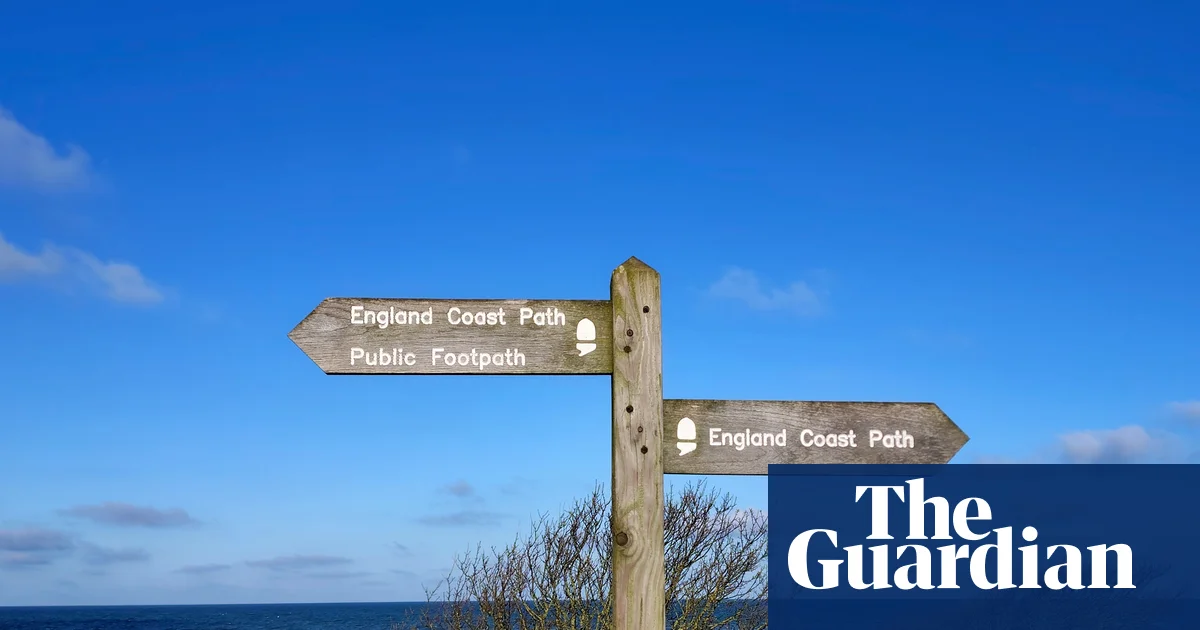
Five stunning walks on the new King Charles III England coast path
The 2,700-mile route covering the entire English coastline is almost complete. We walked less trodden sections big on scenery and history
1,818 words~8 min read