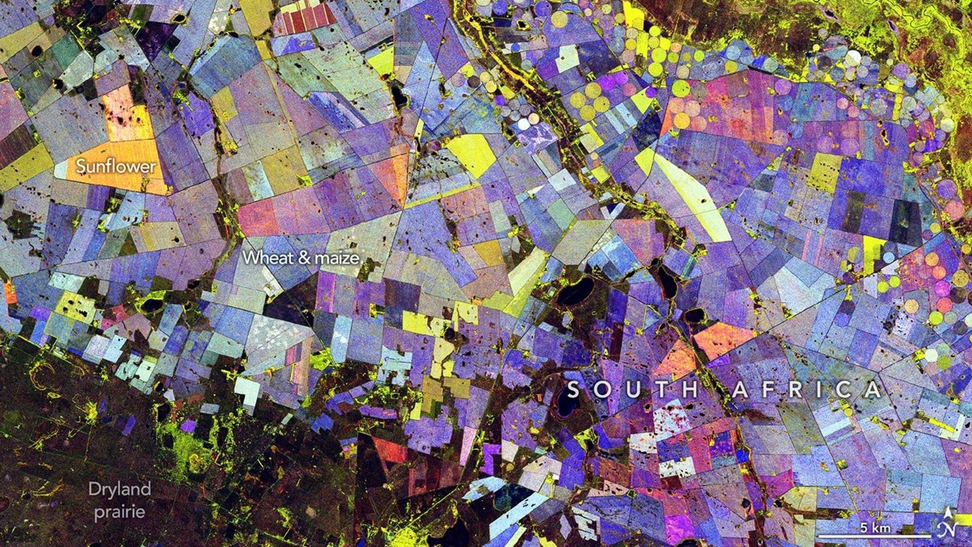
3 min readImage of the Day for May 29, 2026Radar data from an agricultural area in South Africa, shown in a vivid color palette, reveal crop types and how they changed during the Southern Hemisphere's growing season.NASA Earth ObservatoryMay 29, 2026 Article
View more Images of the Day:
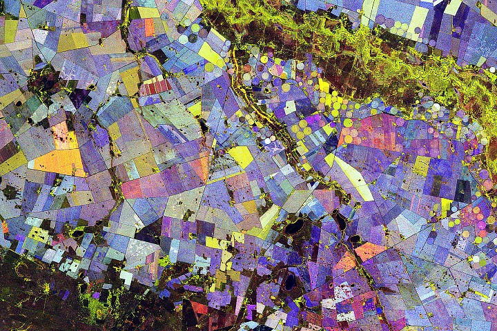
Along the Vetrivier (Vet River) in South Africa, a patchwork of circular and rectangular fields spreads across what is otherwise a semi-arid part of the Free State province. The water brings life to an array of crops, contributing to the agricultural productivity of the wider Maize Triangle.
The agricultural area shown in this image lies about 110 kilometers (70 miles) north of Bloemfontein. The scene is reminiscent of a modern abstract painting. Colorful circles mingle with straight-edged fields in combinations of red, green, and blue. But each color carries physical meaning, providing clues about crop types and revealing how they changed over the course of the Southern Hemisphere’s growing season.
Data for the visualization were acquired by the NISAR (NASA-ISRO Synthetic Aperture Radar) satellite during 10 passes over the area between November 2025 and March 2026. L-band radar observations, which can “see” vegetation’s structure instead of its color, were analyzed to produce per-pixel statistical measures across the scene. By combining radar scattering behaviors observed across multiple dates into a single composite, scientists built a compact summary of seasonal agricultural activity and change.