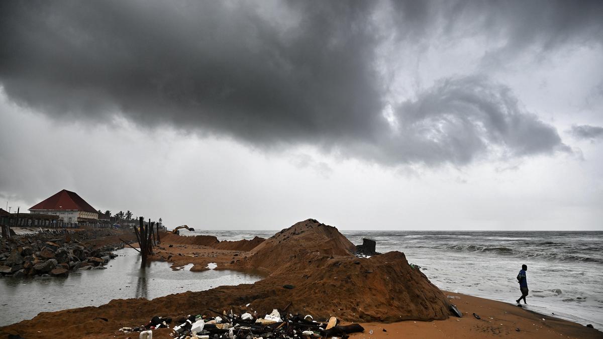
The southwest monsoon is forecast to arrive over Kerala on May 26, six days ahead of the normal June 1 date, the India Meteorological Department said on Friday — though an emerging El Niño could undercut the season well before it reaches peak intensity.Monsoon to hit Kerala on May 26, says IMD. (PTI File Photo)Conditions are favourable for the system to advance over parts of the south Bay of Bengal, the Andaman Sea, and the Andaman and Nicobar Islands within 24 hours, IMD said. Extensive rain is expected along the southern parts of the west coast through May 28.ALSO READ- Monsoon to arrive in Kerala on May 26: IMDIn 2025, the monsoon last arrived over Kerala on May 24. This year’s forecast carries a four-day error margin, the weather agency stated. The June 1 normal date itself carries a standard deviation of about 7 days, meaning early arrivals are not unusual — but early arrival has historically offered no protection against a weak season.What experts said“There is no correlation between the early onset of monsoon and overall quantum of monsoon rain. In fact, there have been years when monsoon has arrived early but rainfall has been weak. It depends on how many low pressure systems form or how the surge develops because monsoon moves in surges,” said Mahesh Palawat, vice president, climate and meteorology, Skymet Weather.But this year, atmospheric signals from the Pacific are on course to confirm the arrival of an El Nino. The US Climate Prediction Center said on Thursday that El Niño is “likely to emerge soon” and could reach “very strong” levels later in the year. Scientists at the National Oceanic and Atmospheric Administration put the probability of El Niño emerging between May and July at 82%, with the event likely to persist into next year. There is currently a greater than 50% chance of it becoming strong or very strong between September and November, NOAA’s charts show. Seasonal models have flagged the possibility of an unusually powerful event.ALSO READ - 'Super’ El Niño to hit Earth in coming months; world braces for intense weather conditionsIn India, El Nino is associated with harsher summers and a weaker monsoon. IMD’s first-stage long-range forecast already anticipates below-normal rainfall for the June–September season: 92% of the long-period average, with an error margin of plus or minus 5%.The LPA, calculated over the 1971–2020 period, is 87 cm. Below-normal rainfall is most likely across large parts of the country, with normal to above-normal rain expected only in parts of the northeast, northwest and south peninsular India. IMD is expected to release its second-stage forecast by the end of this month.How IMD found the Kerala onset dateIMD forecast the Kerala onset date using an indigenously developed statistical model issued operationally since 2005. Six predictors feed it: minimum temperatures over northwest India; pre-monsoon rainfall peak over the south Peninsula; outgoing longwave radiation, or OLR, over the south China Sea and the southwest Pacific region; and lower tropospheric zonal winds over the southeast and northeast Indian Ocean. OLR — the total radiation emitted to space by the atmosphere — is effectively a measure of cloudiness.On weather elsewhere that is affecting the country at present, the agency said a well-marked low-pressure area over the southwest and adjoining west-central Bay of Bengal is persisting, with an associated cyclonic circulation extending to the middle troposphere and tilting southwestwards with height.Heat wave to severe heat wave conditions are likely over northwest and central India on most days this week, even as heavy to very heavy rainfall is expected over northeast India and over Tamil Nadu, Puducherry and Karaikal, Kerala and Mahe, and south interior Karnataka over the next three to four days.
Monsoon set to hit Kerala early on May 26, says IMD amid El Nino warning
IMD forecast the Kerala onset date using an indigenously developed statistical model issued operationally since 2005. | India News
614 words~3 min read