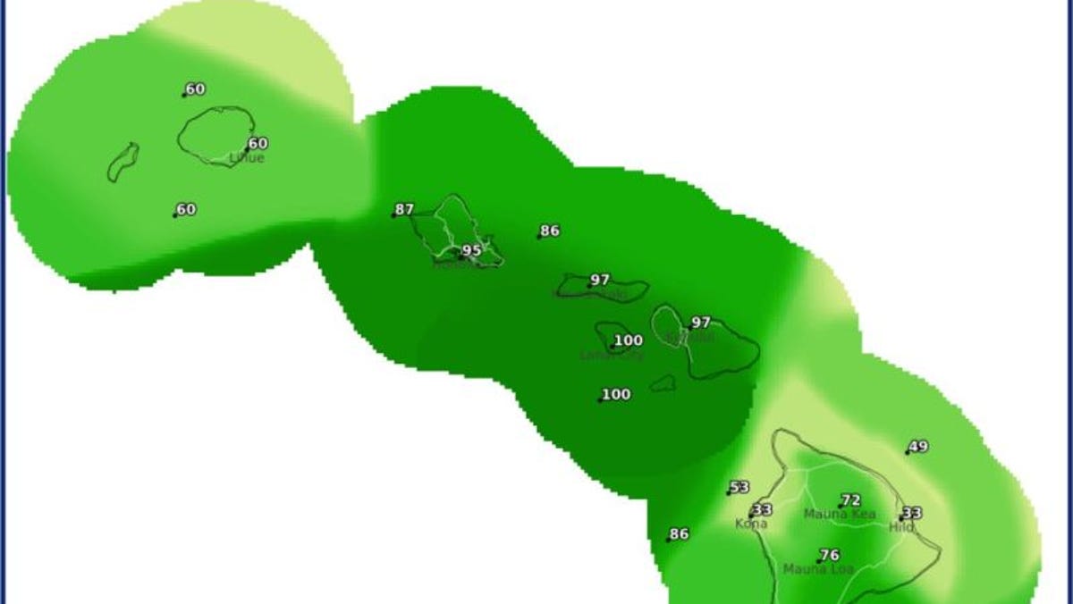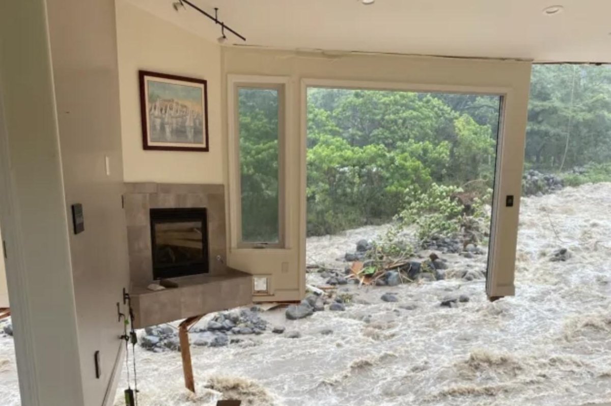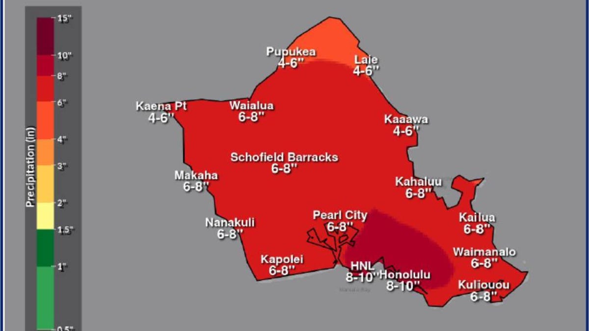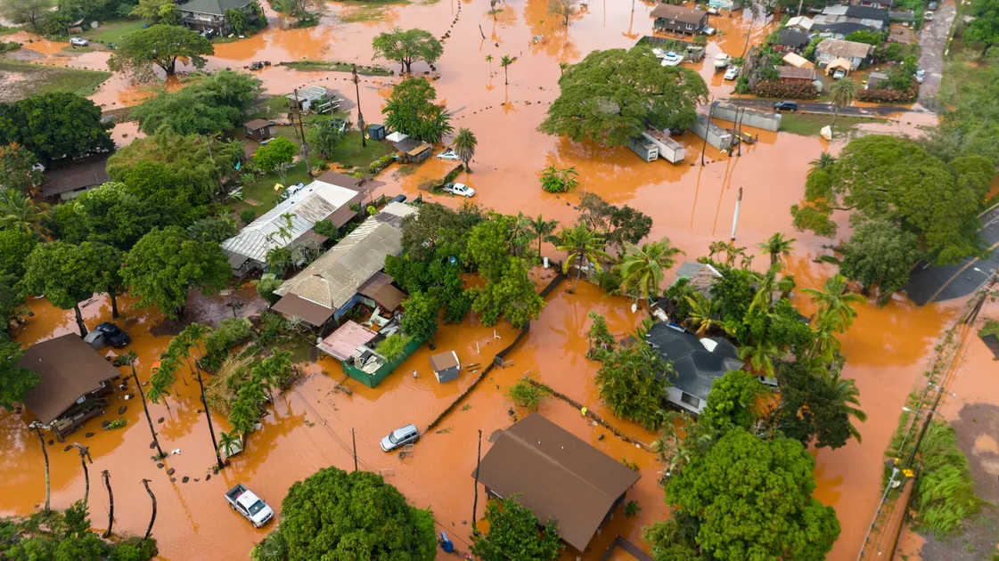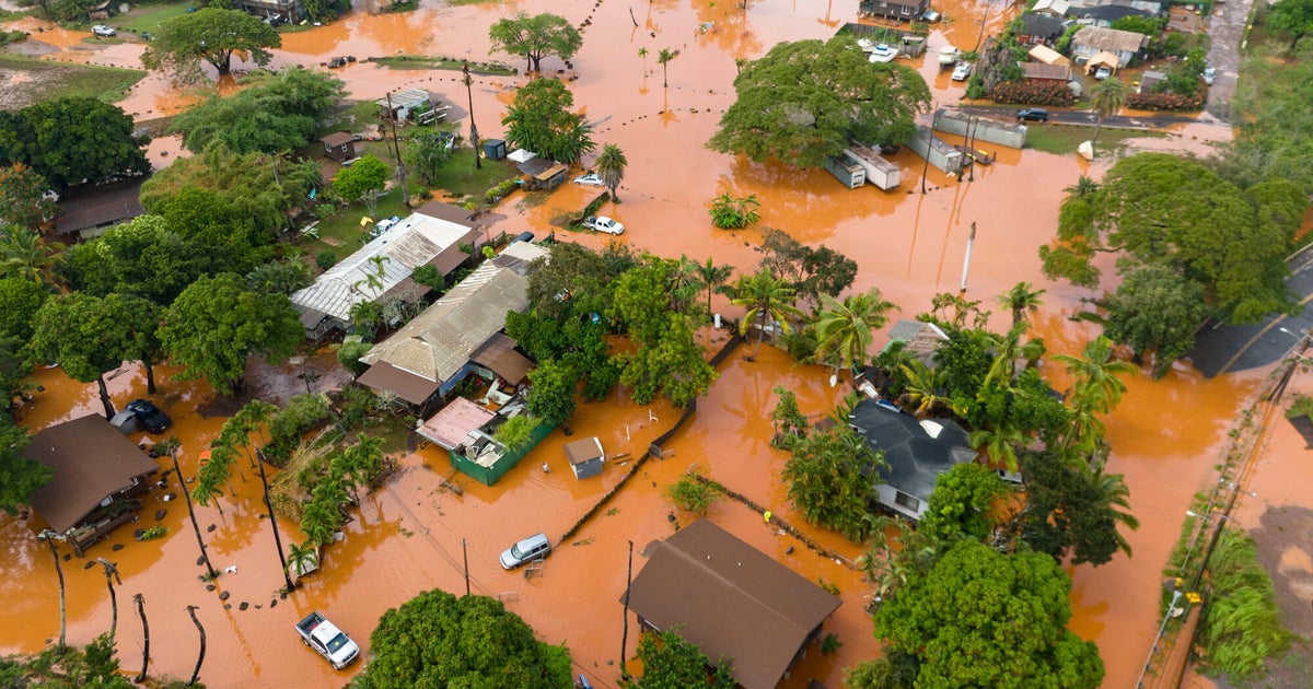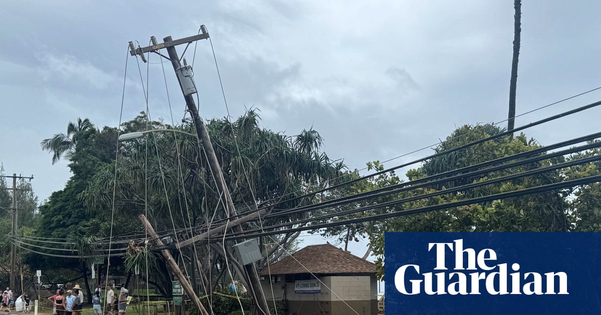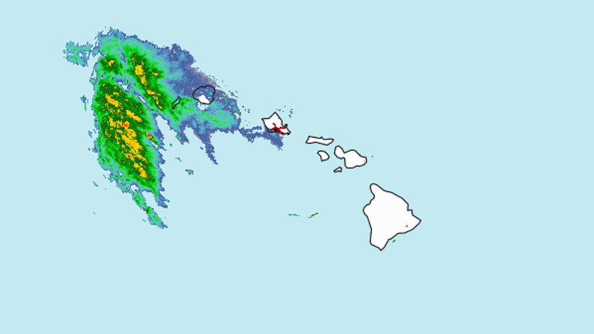
A powerful "kona storm" is threatening the Hawaiian Islands with heavy rainfall, flash flooding, damaging winds and thunderstorms through the end of the week, forecasters said.
The storm is expected to bring flash flooding risks beginning March 10 and spreading statewide through at least March 14, the National Weather Service in Honolulu said. Strong thunderstorms are expected to develop later in the week.
A kona storm, or a kona low, is a "major weather producer" in Hawaii, the weather service says. The word "kona" means leeward, or the side of the islands that is usually sheltered from trade winds and rainfall. But a kona storm, a type of seasonal subtropical cyclone, brings warmer, moisture-rich winds from the south to southwest, which can bring torrential rainfall, according to the weather service.
Gov. Josh Green issued an emergency proclamation on March 9 to allow agencies to coordinate emergency resources ahead of time.
"It's going to be kind of a rough-and-tumble week with the weather," Green said. "Be very safe. Be particularly safe on the roads."