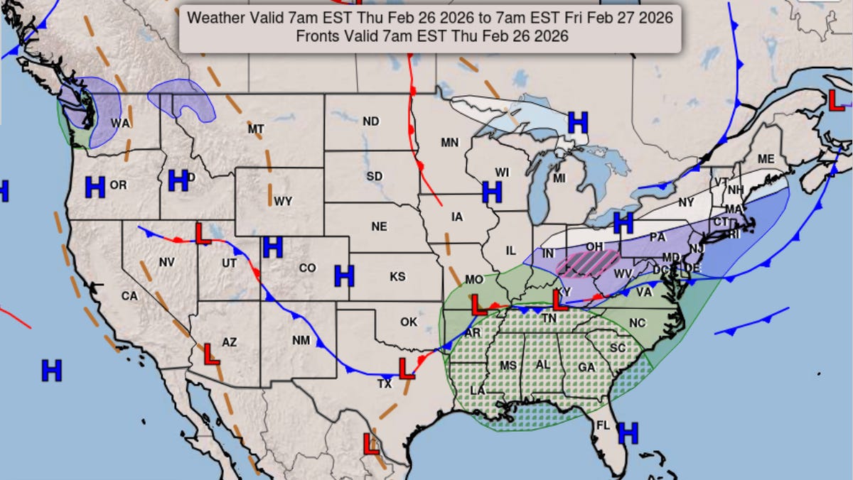
Snow from late January's catastrophic winter storm may finally be melting for many, but a brewing nor'easter is expected to dump inches of fresh snow on parts of the East Coast.
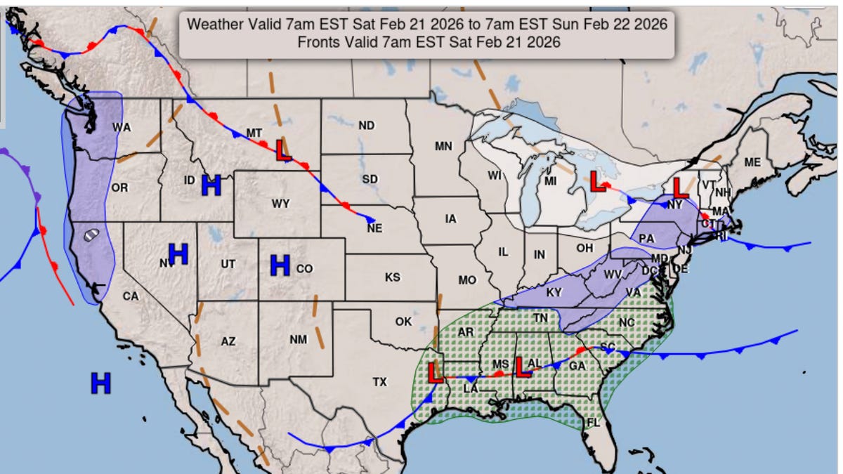
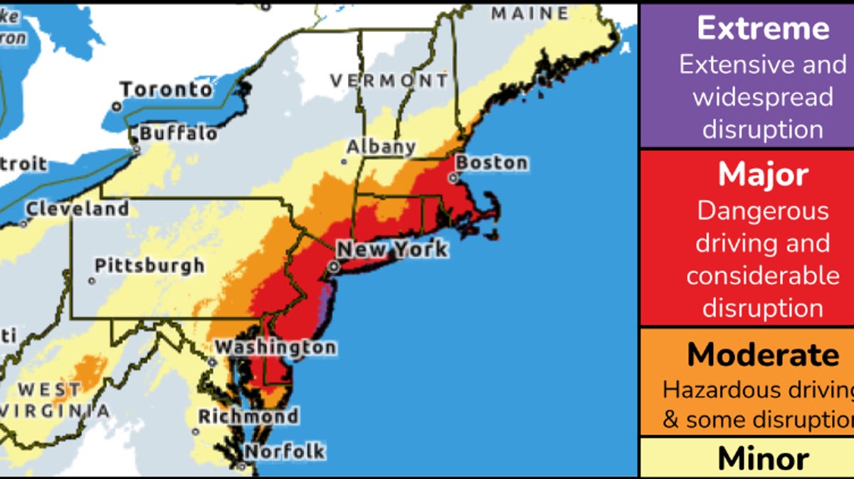
The storm's path and severity has been in flux as meteorologists monitored its approach closely, but the forecast was more clear on Feb. 21. The nor'easter is expected to bring heavy snow and high winds from the Mid-Atlantic to the Northeast on Feb. 22 and into Feb. 23, the National Weather Service said.
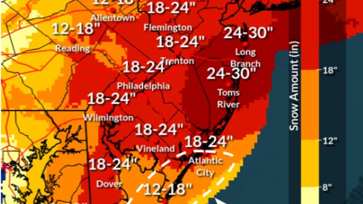
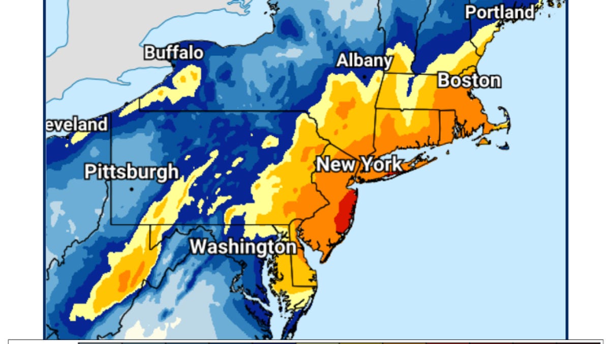
Some areas in the path of the storm are even under blizzard warnings, with conditions expected to make travel hazardous and cause some power outages, the weather service said. The heaviest snowfall and most severe storm impacts will be felt along the coast, where up to 20 inches could fall in some states, the weather service said. Wind gusts from 40 to 70 mph are expected from coastal New Jersey into southern New England.
"This will be a dangerous and incredibly disruptive winter storm," said AccuWeather Director of Forecasting Operations Carl Erickson.
Here's how much snow you could see in your state: