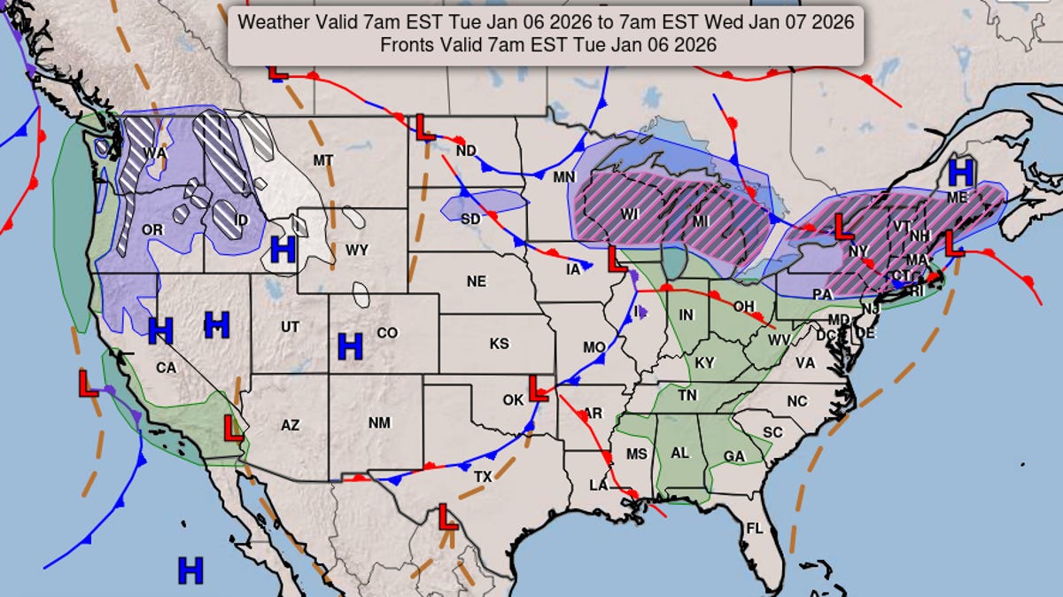
A band of snow and ice is forecast to create slippery travel on the northern edge of a fast-moving storm tracking over the eastern United States late this week.
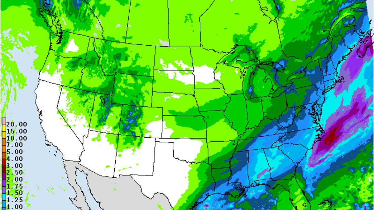
The storm, which AccuWeather meteorologists have monitored for over a week, will tap into enough cold air to produce ice and snow from portions of Oklahoma, Missouri and Arkansas during Thursday night to New Jersey, southeastern New York and southern New England by Friday evening.
"There will be plenty of cold air in place ahead of the storm, so much of the precipitation can fall as snow or ice along the northern edge," AccuWeather Senior Director of Forecast Operations Dan DePodwin said. "The significant question for now and as the storm gets underway is: How far north can the snow spread before running into overwhelmingly dry air?"
"We're most confident that snow will fall in the mountains of Kentucky, Tennessee, North Carolina and Virginia," DePodwin explained. "The snow can also spread north toward Washington, D.C., potentially causing slick roads on Friday.
Related