Home
Storia in 1 fonti
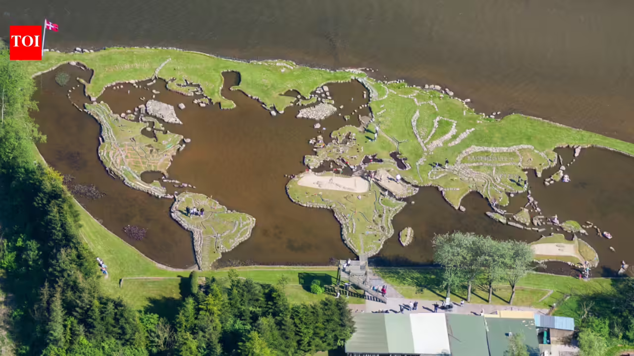
‘World inside water’: Danish farmer built an entire world map inside a lake
Long before satellite imagery and digital maps became common, a Danish farmer carved out one of the world’s most unusual geographical attractions entirely by hand inside a lake. Inspired by a stone near Klejtrup Lake that resembled Denmark’s Jutland Peninsula, farmer Soren Poulsen spent roughly 25 years transforming the waterbody into a giant miniature world map using rocks, soil, grass, and clay.
Raccontata da timesofindia.indiatimes.com