Story audio is generated using AI
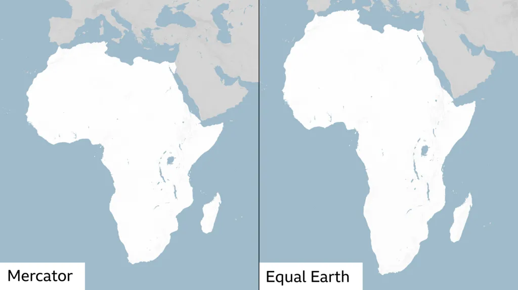
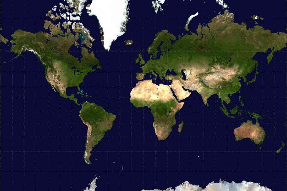
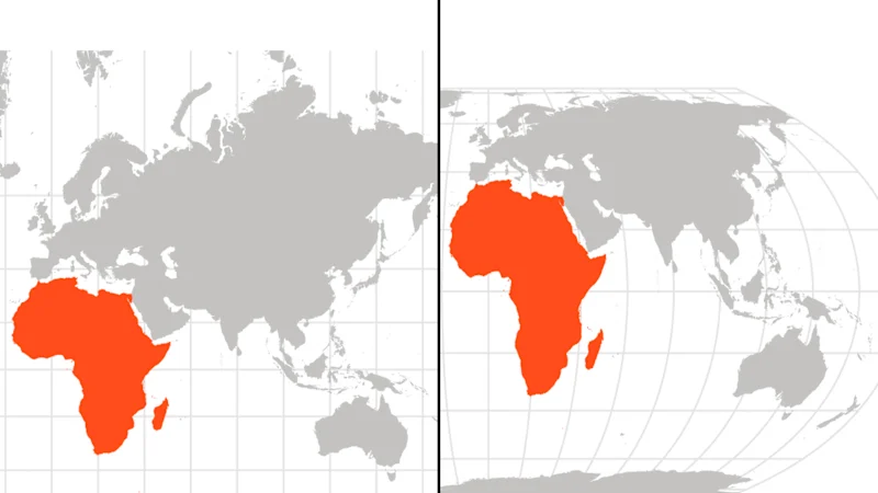
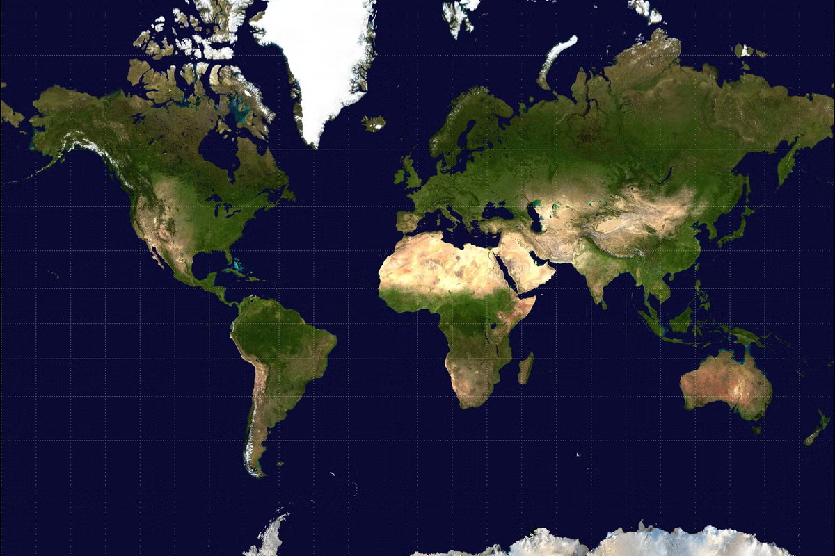
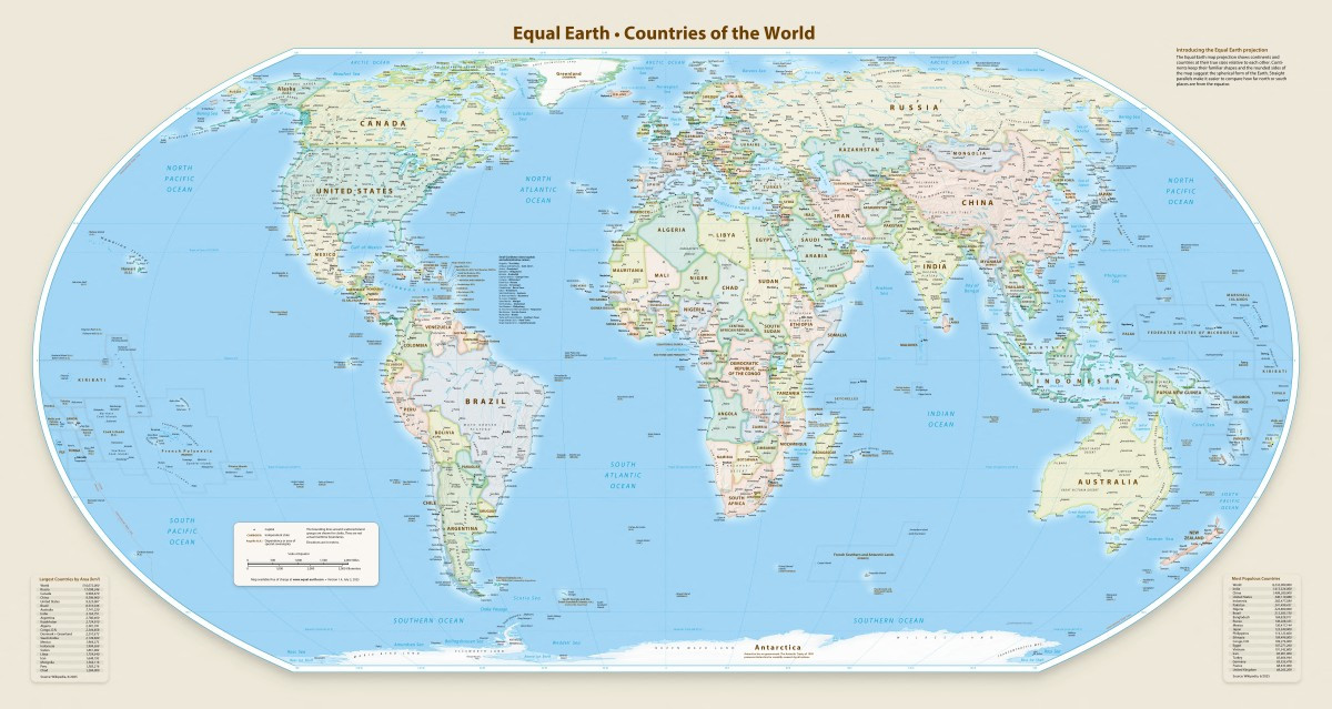
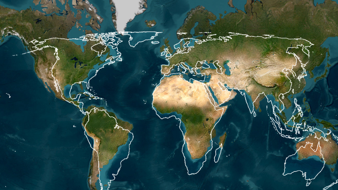
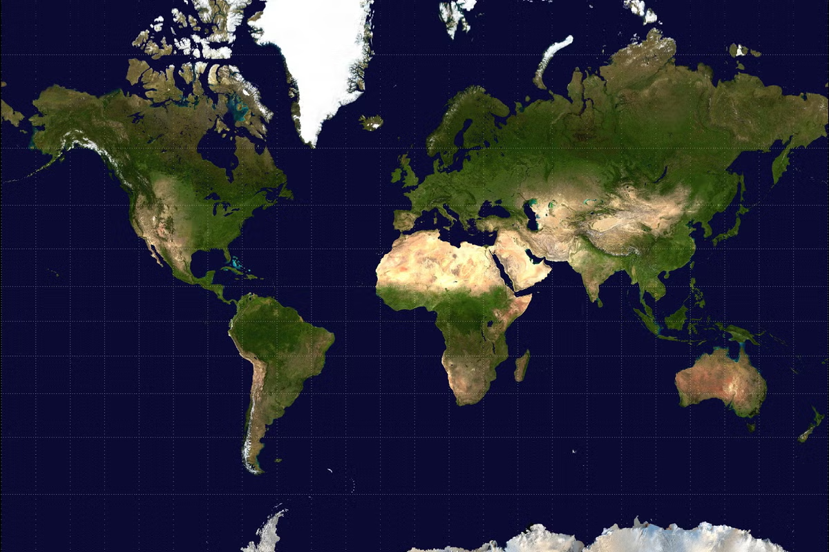
The way the world is drawn on maps could change after the UN General Assembly adopted a resolution encouraging countries to move away from the centuries-old Mercator projection towards the Equal Earth projection. The move has renewed debate about how maps shape people’s understanding of the world, particularly the size and position of Africa. The Mercator projection, developed by Flemish cartographer Gerardus Mercator in the 16th century, was created primarily for navigation. While it preserves the shape and direction of landmasses, it significantly distorts their size as they move further from the equator. Dr Christel Hansen, a senior lecturer in the department of geography, geoinformatics and meteorology at the University of Pretoria, said understanding the debate requires understanding how maps work. “The Earth is (mostly) round, and only on this round surface are country shapes and sizes correct,” Hansen said. “A map is projected from the 3D globe onto a 2D surface. Unfortunately, you simply cannot replicate the 3D globe on a 2D paper. You will always have to strike a compromise.” According to Hansen, different map projections are designed to preserve different characteristics, including area, shape or direction. The Mercator is a conformal projection, meaning it preserves shapes well. However, it does so at the expense of accurately representing the size of landmasses. “The further away you move from this standard parallel, the greater the distortion on your map,” Hansen said. “For the Mercator projection, this means countries appear larger than they actually are the further away you move from the equator.” The Equal Earth projection takes a different approach. It is an equal area projection, meaning the relative sizes of continents and countries are represented more accurately. This is particularly significant for Africa, which has often been visually diminished on conventional world maps. “Having countries drawn consistently larger than they are in reality would visually bias you if you do not know that the countries are inflated in size.” This could be particularly important in classrooms, where children rely heavily on maps when developing their understanding of geography and the world. Hansen said the discussion should not, however, result in the Mercator projection being removed from every application. “There is no one correct map. If you want things to be correct, get a globe and even that is not 100%. Maps are designed for a specific purpose and should only be used in that context,” she explained. She said an equal area projection would be appropriate when the purpose is to compare the relative sizes of countries and continents, while conformal projections remain useful when accurately depicting shapes is more important. This distinction also means GPS devices and digital navigation services would not necessarily have to change to Equal Earth. “They should use the projection suited to their application. Global navigation satellite systems (GPS) are used for navigation. That is the most important aspect. They should use projections that align with that purpose,” Hansen said. The UN resolution is therefore unlikely to result in an overnight overhaul of digital maps or navigation systems. In South Africa, Hansen said geospatial professionals are governed by legislation and professional standards, but there is no blanket requirement to use a particular projection for every application. The South African Geomatics Professions Act and the South African Geomatics Council regulate the professional field, while the office of the chief surveyor-general manages aspects relating to the country’s projections. “The equal area (equivalent) projection should be used for applications where relative size is important,” Hansen said. The change could, however, have implications for education. Schools and other institutions using traditional world maps could eventually need to redesign and reprint materials if they choose to adopt equal area projections. “There is certainly a cost implication. Previous maps must be redesigned using a more appropriate projection and reprinted,” Hansen said. She believes the bigger value of the UN resolution lies in encouraging people to think more critically about the maps they use. “You should never blindly accept or use any map. Instead, think about why you are using a particular map and whether it suits your purpose,” she said. Hansen believes the debate could encourage people to question other conventions in the way the world is represented. She said convention should not always be blindly followed. She said the most accurate representation of the world remains a globe, though even a globe has limitations. “I would love for every classroom to have a globe when they teach children about the world. To see how the countries look, to be able to feel their surface, and to see the extent of the oceans. That would be the ideal solution,” Hansen said. Sowetan