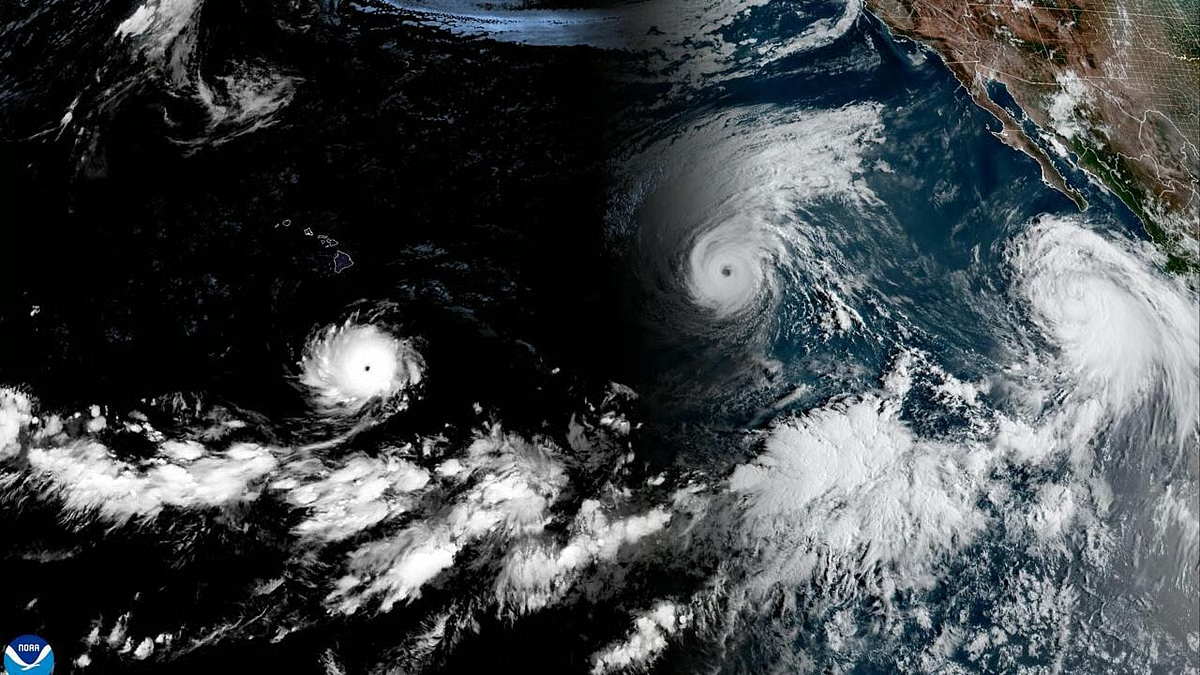
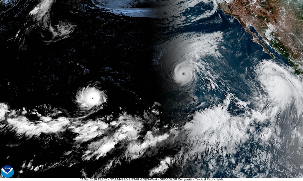
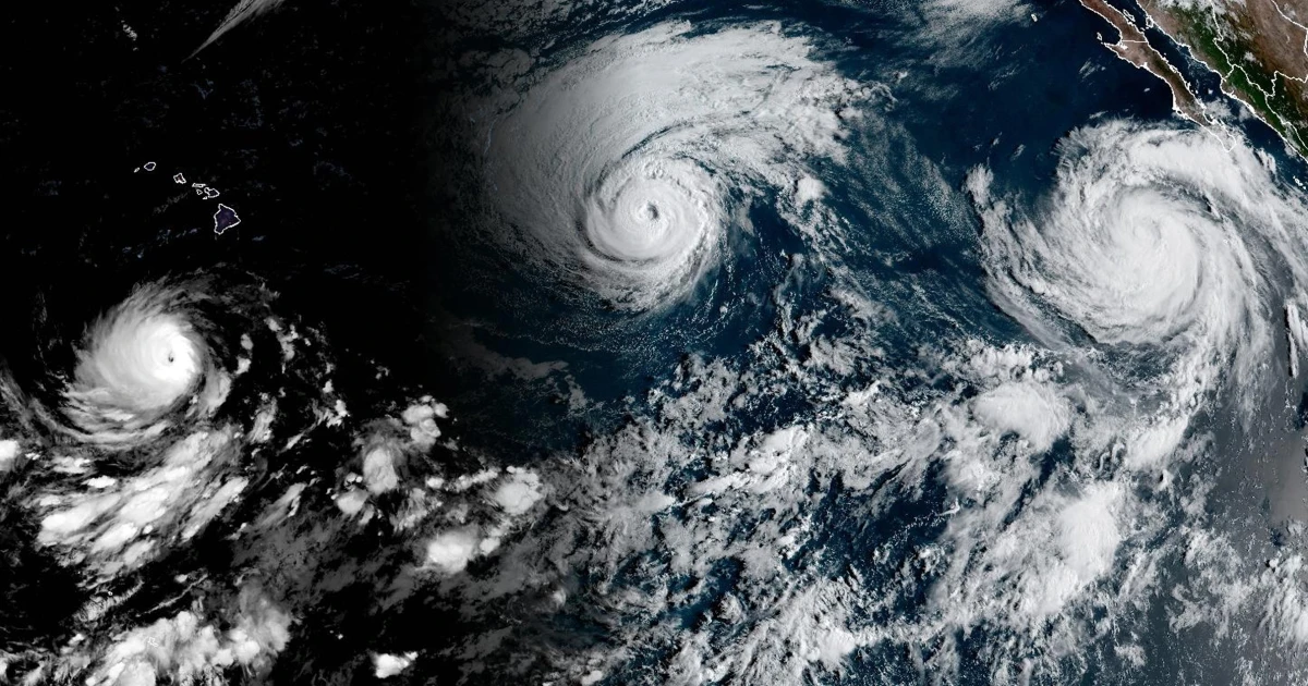
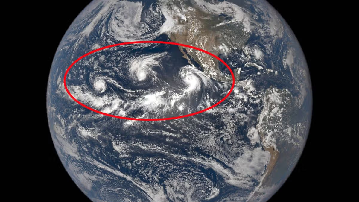
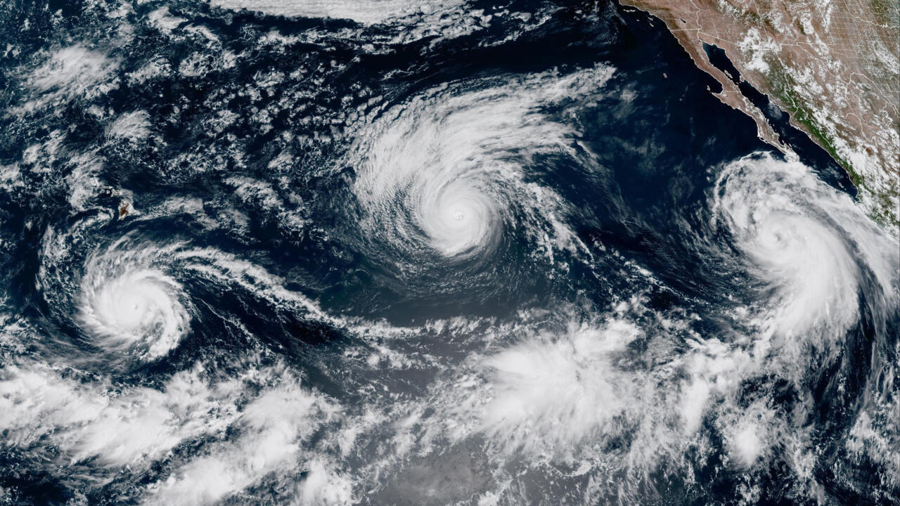
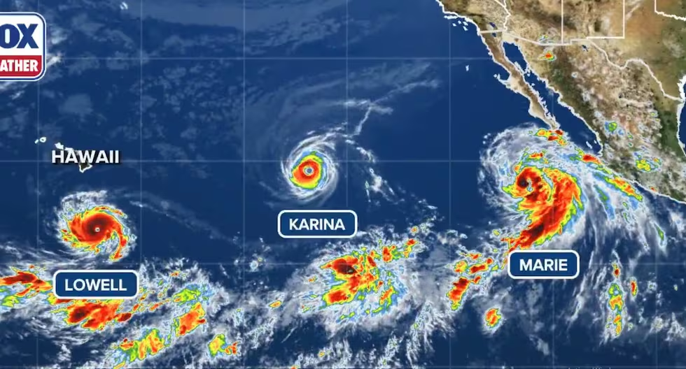
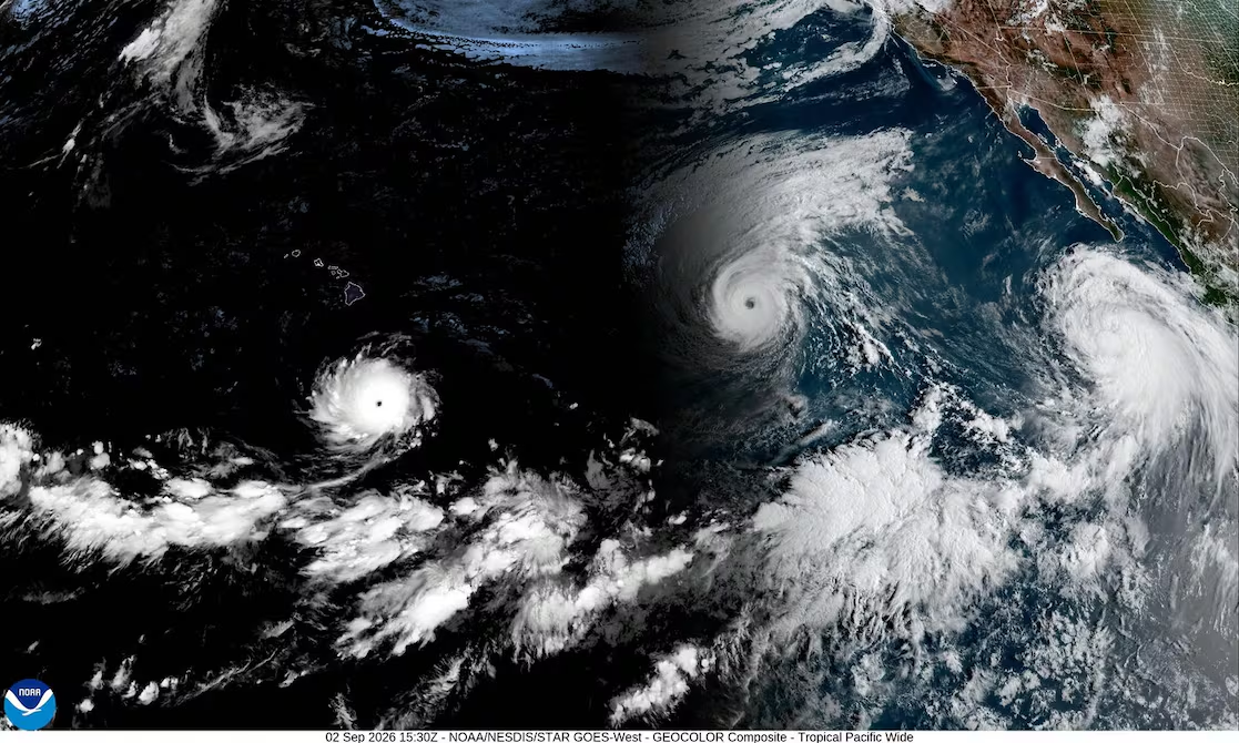
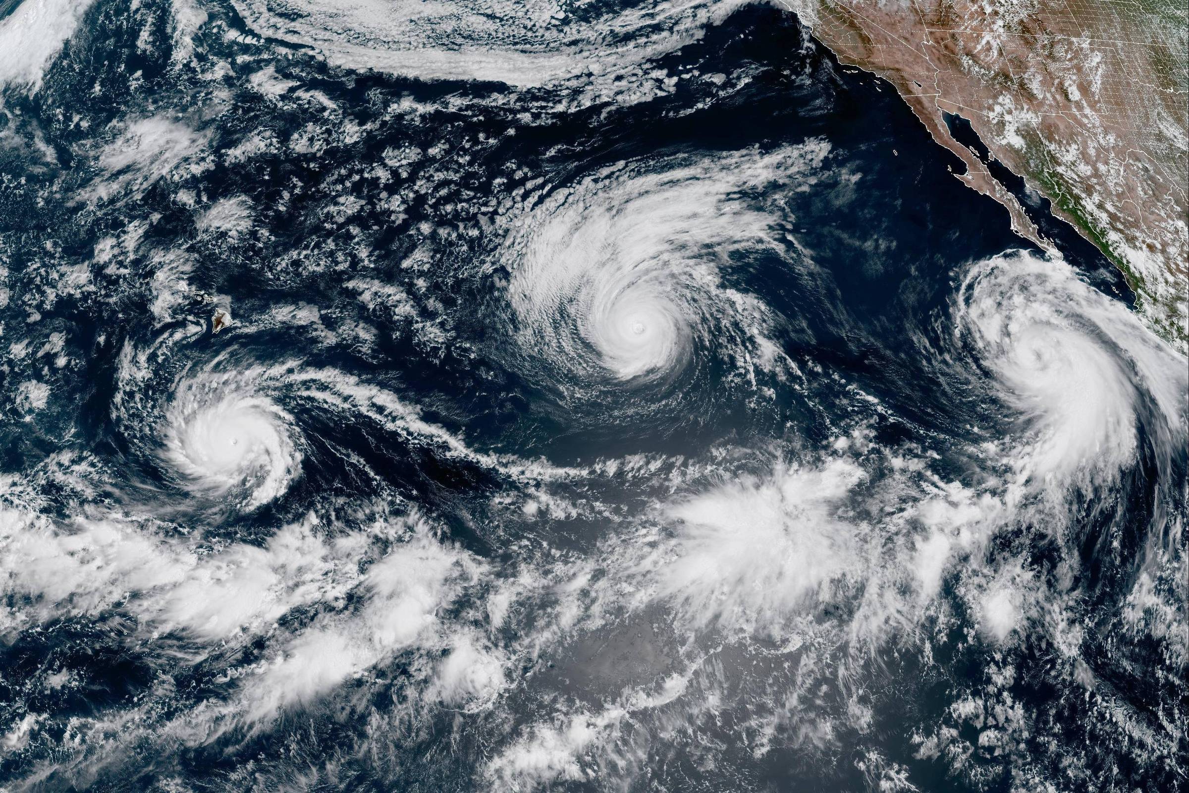
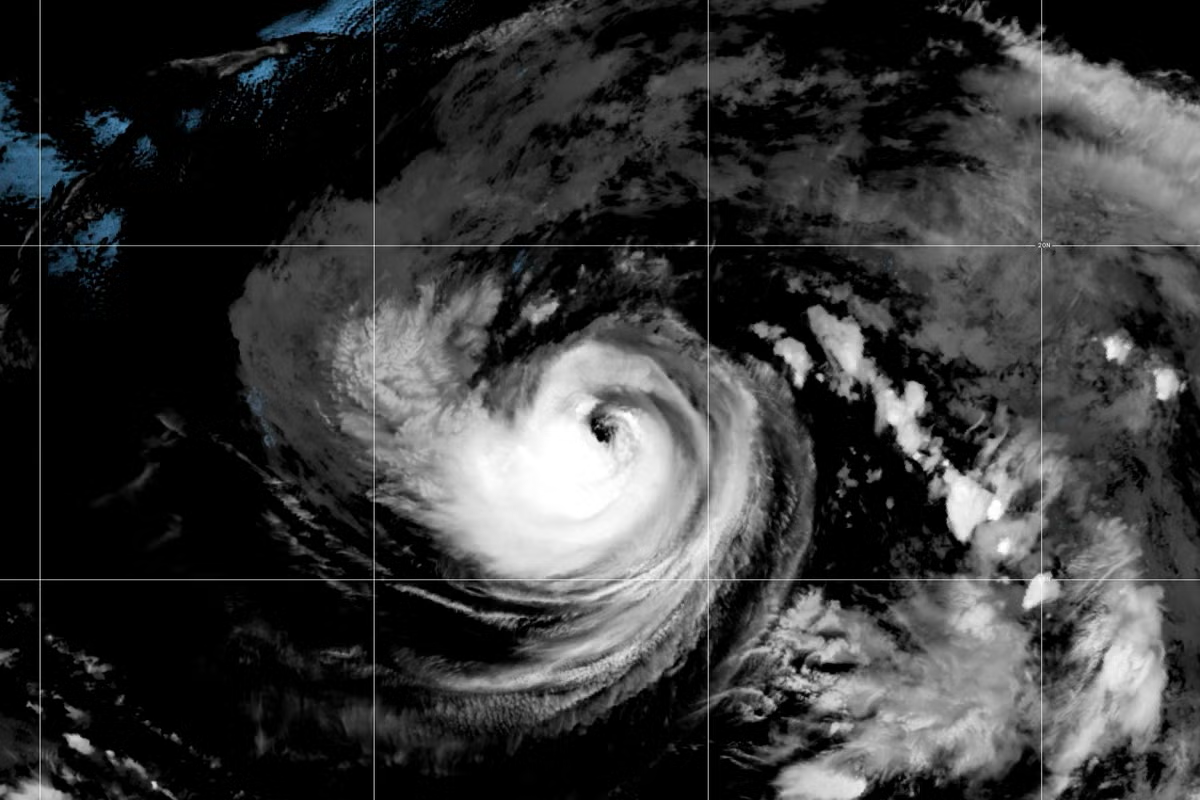
Two powerful hurricanes and a strengthening tropical storm on Wednesday were churning through the Pacific Ocean where waters were being warmed by a historically strong El Nino climate episode. Hurricane Lowell intensified to a Category 5 storm Wednesday, as it moves west, followed by Hurricane Karina, which is a Category 4 storm. Both storms are expected to pass well to the south and to the northeast of Hawaii, respectively, according to the National Hurricane Center (NHC). Read moreThis year's El Nino set to be strongest in more than a century, UK forecasters say "Swells generated by Lowell are spreading northward and will affect portions of the Hawaiian Islands during the next several days," and are "likely to cause life-threatening surf and rip current conditions", the NHC said. Hawaii is still recovering from the impacts of Hurricane Lala, which brushed past the southern part of the Big Island last month, bringing destructive winds and severe flash floods. Lowell and Karina are trailing to the east by Tropical Storm Marie, currently a few hundred miles south of Baja California and "expected to become a hurricane later today", the NHC said. "El Nino warming sets the stage for these storms, which are fuelled in large part by warm waters – when the tropical Pacific is warmer than normal we see an increase in strong storms," Julia Cole, a climate scientist at the University of Michigan, said. A train of three cyclones "is definitely rare to see", she added. A similar train of four cyclones happened in 2015, another intense El Nino year, when Typhoon Kilo, Hurricane Ignacio, Hurricane Jimena and Tropical Depression 14E crossed the Pacific at once. "The climate system has significantly warmed over the last 20 years or so," said Benjamin Kirtman, an atmospheric scientist at the University of Miami. Warm waters provide fuel for storms, and El Nino's effect on the atmosphere leaves little vertical wind shear over the Pacific, creating favourable conditions for hurricanes to intensify. "There's no other way to put it – it is juicy out there right now," he said. What's more, the sea surface temperature anomaly – how much warmer the ocean is compared to average – is already near record high, right in the middle of the Pacific hurricane season, Kirtman explained.
Rare train of cyclones fuelled by historic El Nino make their way across Pacific
Several storms, including Hurricane Lowell and Hurricane Karina, moved through the Pacific Ocean on Wednesday, fuelled by a historically strong El Nino that has already been linked to extreme weather…
685 words~3 min read