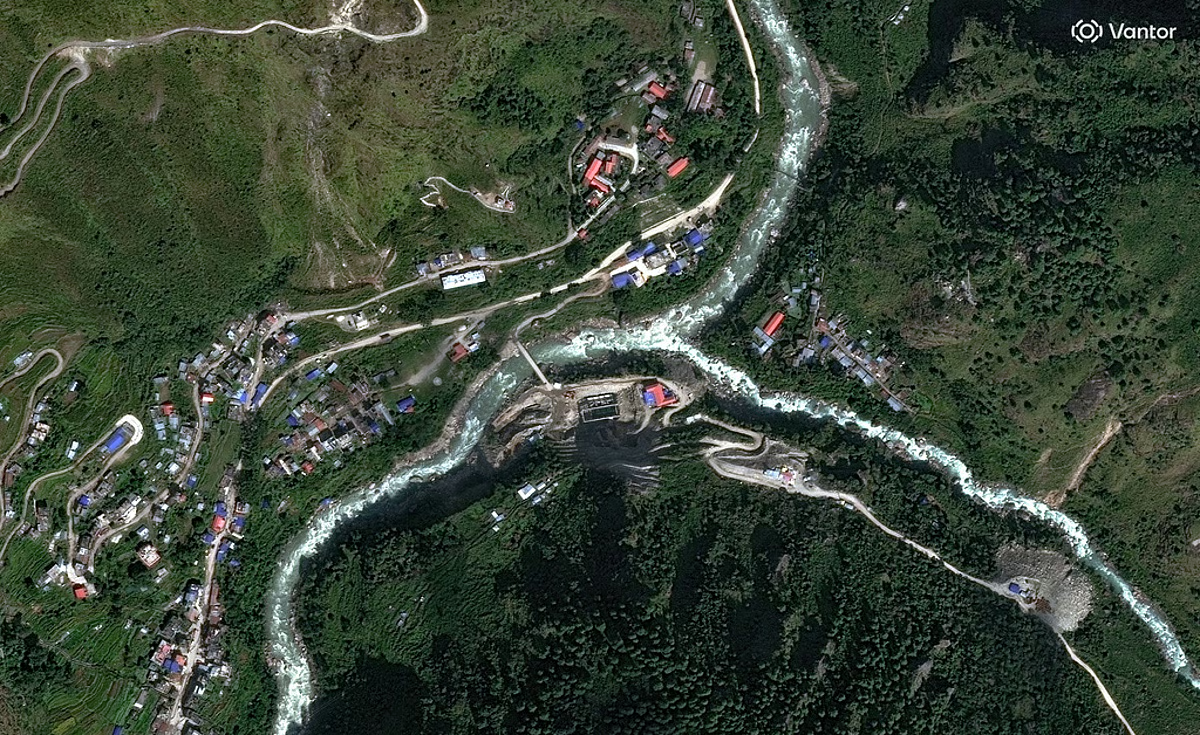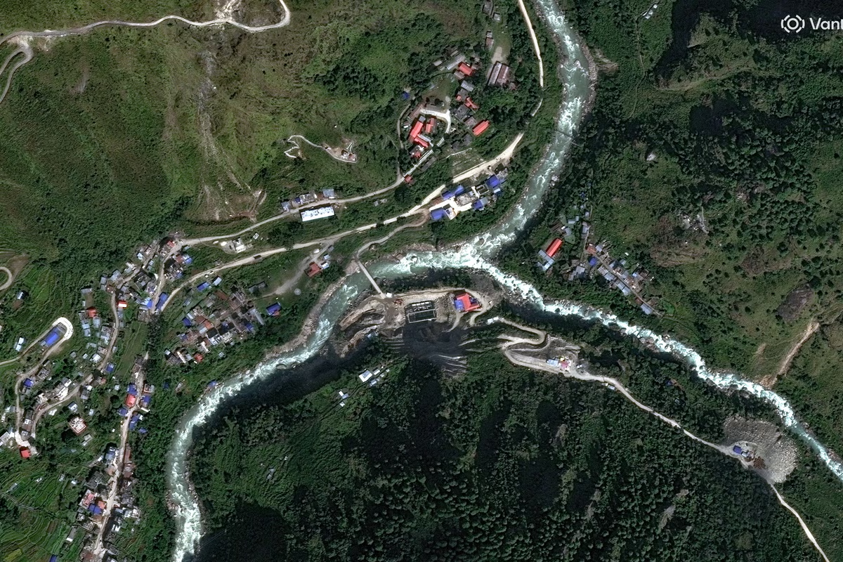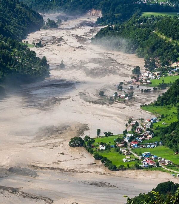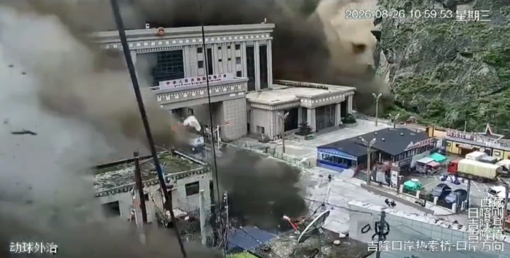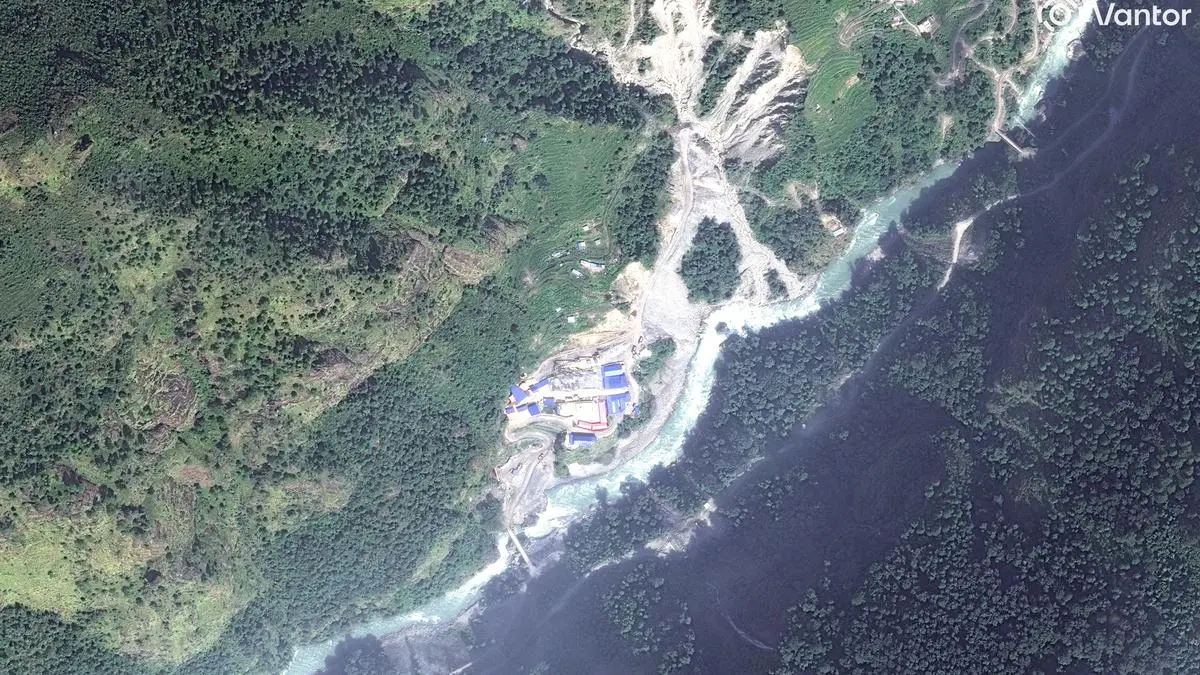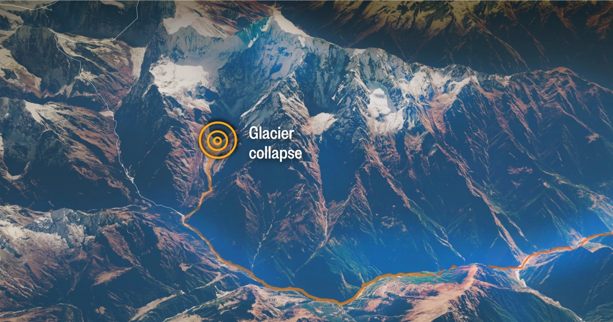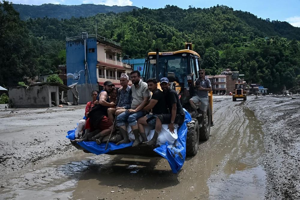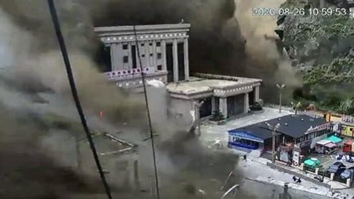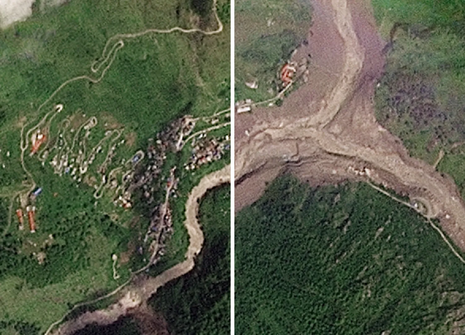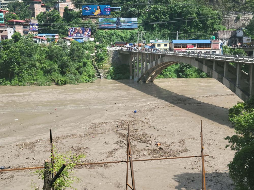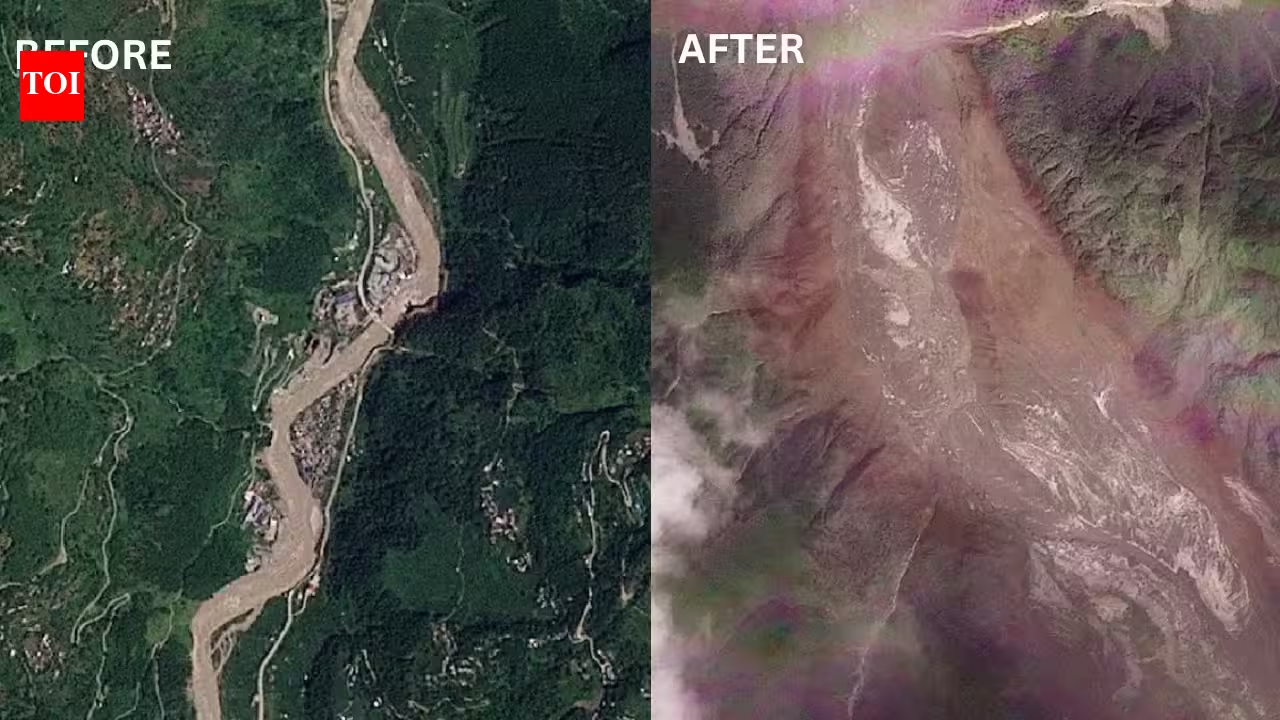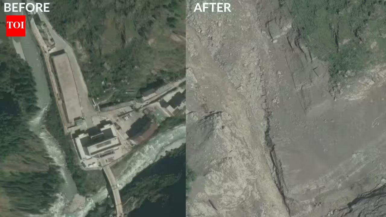
The China-Nepal Rasuwagadhi border crossing has been completely destroyed. (Photos: @Osinttechnical posting @vantortech)New satellite imagery has captured the scale of destruction caused by the Himalayan flash flood at the Nepal-China border, showing the Rasuwagadhi crossing virtually erased after a torrent of rock, ice, mud and water tore through the region on August 26.High-resolution before-and-after images released by commercial satellite company Vantor compare the area on April 19, 2024, with imagery captured on August 27, 2026, a day after the disaster. The earlier image shows a large multi-storey border facility, roads, paved areas and other infrastructure alongside the river. In the post-flood image, much of that infrastructure has disappeared beneath a wide expanse of rock, mud and debris.Other satellite images from the affected region show homes, bridges and sections of roads and infrastructure either swept away or buried. The principal multi-storey structure and surrounding facilities at Rasuwagadhi were no longer visible in the post-flood imagery, according to ABC News Verify.The disaster has killed at least 472 people, including 469 in Nepal and three in Tibet, while 1,535 remain missing. Of those, 977 are missing in Nepal and 558 in Tibet. At least 540 foreigners are among those still missing, including tourists and pilgrims travelling through the region.Glacier and bedrock collapse triggered massive debris flowScientists studying the disaster believe it began with a major collapse on Langtang Lirung in the Himalayas. The US Geological Survey has described the disaster as likely triggered by a glacial collapse on the north side of Langtang Lirung, while post-disaster satellite analysis indicates that bedrock beneath the glacier also failed. Geomorphologists examining the imagery have concluded that a section of the mountainside gave way beneath the ice, dragging part of a glacier into the valley.The collapse generated a massive rock-and-ice avalanche that transformed into a fast-moving debris flow after entering the river system. The torrent carried huge quantities of rock, ice, mud and water downstream, devastating communities along the river corridor.Initial reports suggested that an earthquake may have triggered the event. The US Geological Survey initially recorded a magnitude-4.4 seismic event, but later determined that no earthquake had occurred. Instead, it concluded that the rock-and-ice collapse generated a seismic signal equivalent to a magnitude 5.2 event.The force of the flood was reflected in downstream river levels. A monitoring station at Galchhi recorded the Trishuli River rising by roughly nine metres within half an hour, according to the International Centre for Integrated Mountain Development.Floodwaters and debris swept through communities, destroying or burying houses, bridges, roads, vehicles and hydropower infrastructure.Major China-Nepal trade route devastatedThe destruction at Rasuwagadhi has also hit a strategically important trade and travel corridor linking Nepal with China. The border crossing is connected to Gyirong in Tibet and serves as a major commercial and passenger gateway between the two countries.The Gyirong-Rasuwagadhi route accounted for nearly 30 per cent of bilateral trade volume between Nepal and China in 2024, according to the South China Morning Post.The latest disaster comes less than eight months after customs and passenger clearance resumed at the crossing on January 1, 2026, following an earlier flood that had shut the route for nearly six months after destroying the Friendship Bridge.The Vantor imagery shows a dramatic transformation of the landscape. A relatively narrow river corridor surrounded by buildings and roads has been replaced by a broad channel covered in sediment and debris. Vegetation has disappeared from parts of the valley, while large sections of the riverbed and surrounding terrain appear to have been scoured or buried.Satellite imagery farther downstream has also revealed extensive damage around Syapru Besi, a tourism hub in the Langtang region, as well as major changes along the Trishuli River.The destruction of roads and bridges has complicated rescue operations. More than 35 bridges and around 40 km of roads have been damaged or destroyed, according to authorities.Nepal has mobilised more than 30,000 security personnel for search and rescue operations, while more than 3,250 people have been airlifted to safer areas in Nepal as operations continue across the affected region.Fresh flood threat from two barrier lakesAuthorities in Nepal and China are monitoring two newly formed barrier lakes that pose a fresh flood threat after debris from the collapse blocked mountain rivers.Nepal's disaster management authority has warned that a lake formed by debris blocking the Bhotekoshi River is rising and could burst. On the other side of the border, Chinese engineers are monitoring another unstable barrier lake estimated to contain between 1.5 million and 2 million cubic metres of water.The Chinese-side lake is about 150 metres long and 40 to 50 metres deep. An eight-member engineering team is assessing whether a drainage channel can be excavated to reduce the risk of a sudden breach.China's Ministry of Water Resources estimates that around three million cubic metres of additional water could flow into the still-dammed lake over the next three days, with peak inflow expected around September 1. The rising volume has increased concerns about a possible breach and secondary flooding downstream.Nepal's disaster management authorities have urged residents and rescue workers to stay away from vulnerable riverbanks and other high-risk areas as water levels and the stability of debris dams remain under close observation.Scientists have not established that human-caused climate change directly triggered the collapse. However, researchers say warming is contributing to increasing instability in the high Himalayas, where retreating glaciers, thawing permafrost and weakening ice-bound rock faces can increase the risk of sudden slope failures.
Before and after: Satellite images reveal how Himalayan flood erased Nepal-China border crossing
New satellite imagery has captured the scale of destruction caused by the Himalayan flash flood at the Nepal-China border, showing the Rasuwagadhi crossing virtually erased after a torrent of rock, ice, mud and water tore through the region on August 26.
901 words~4 min read