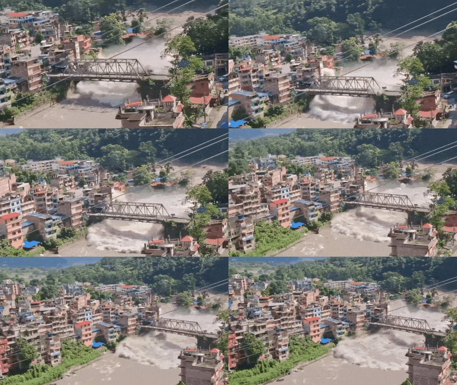
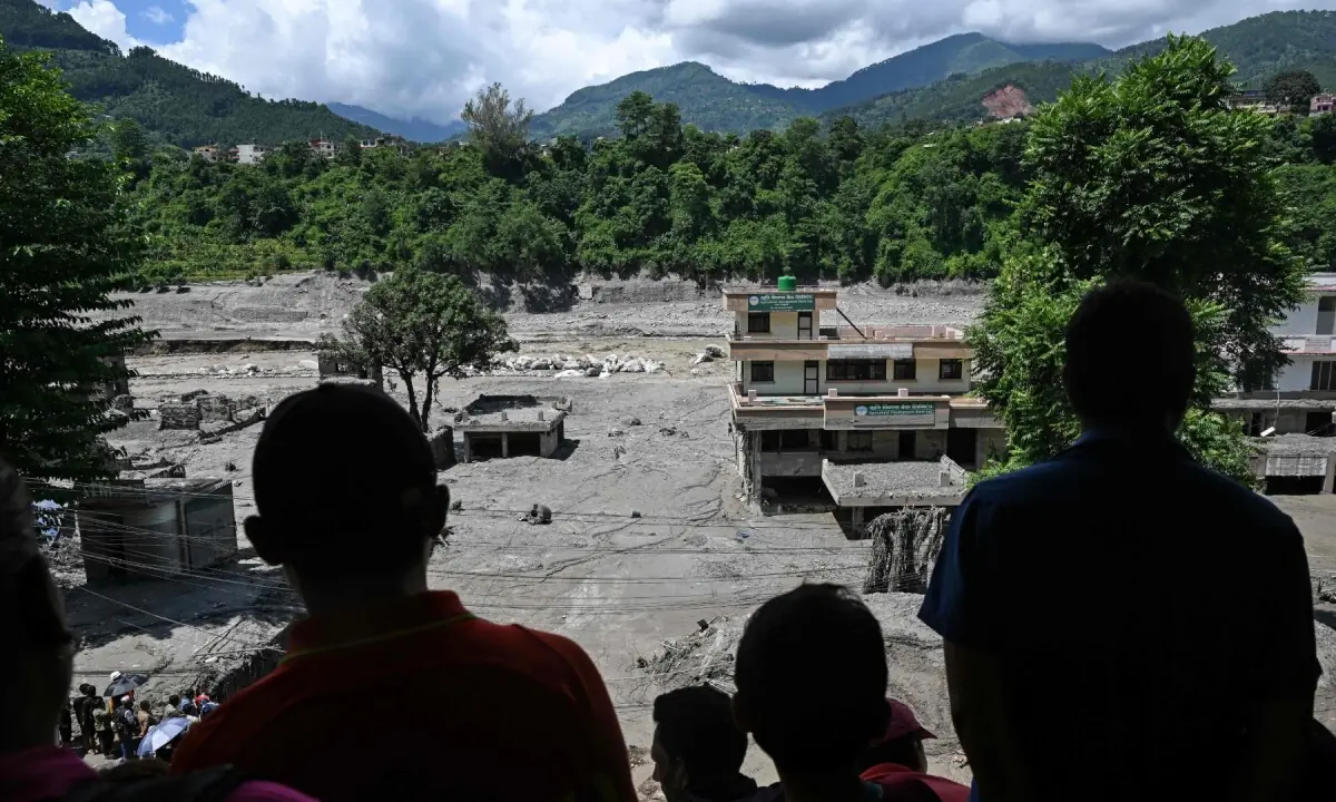
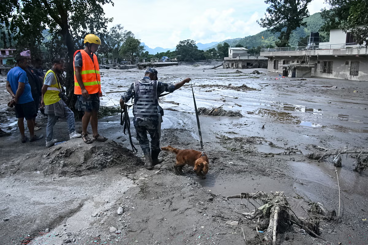
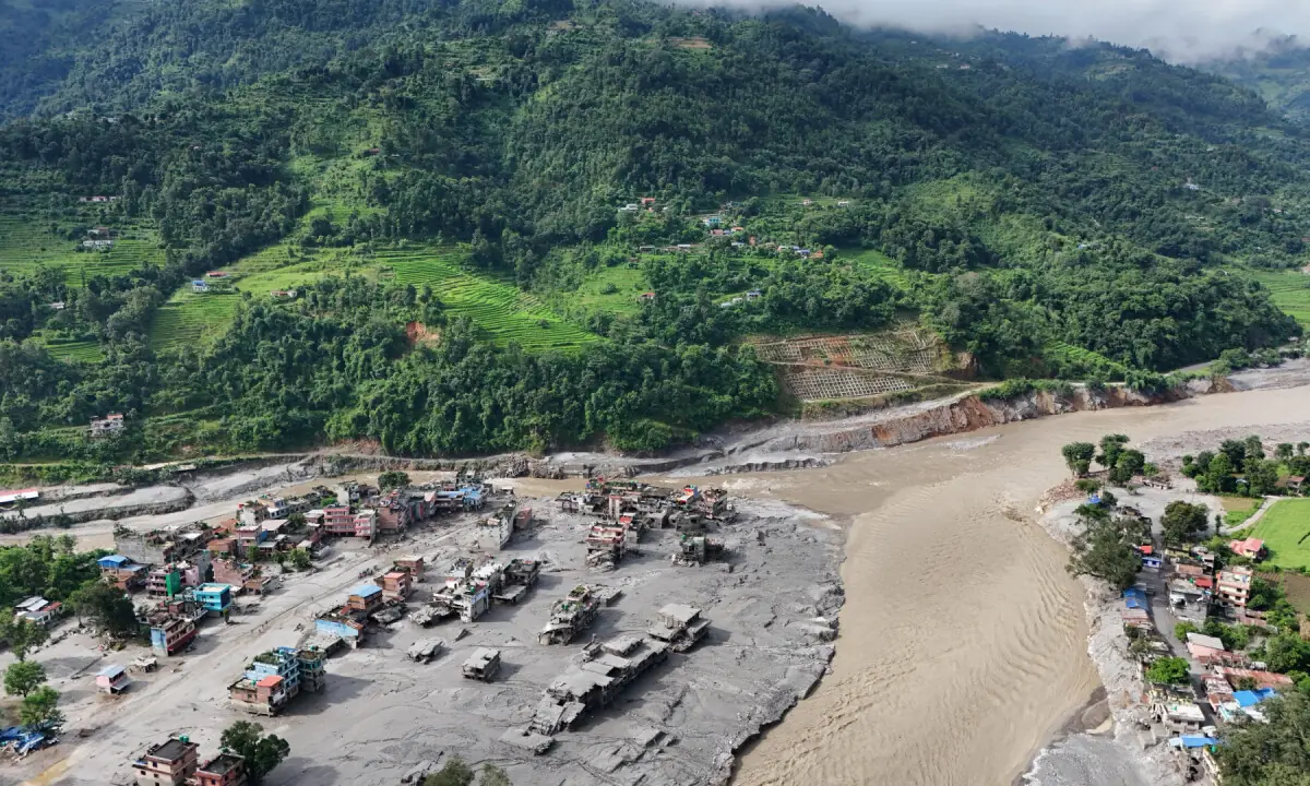
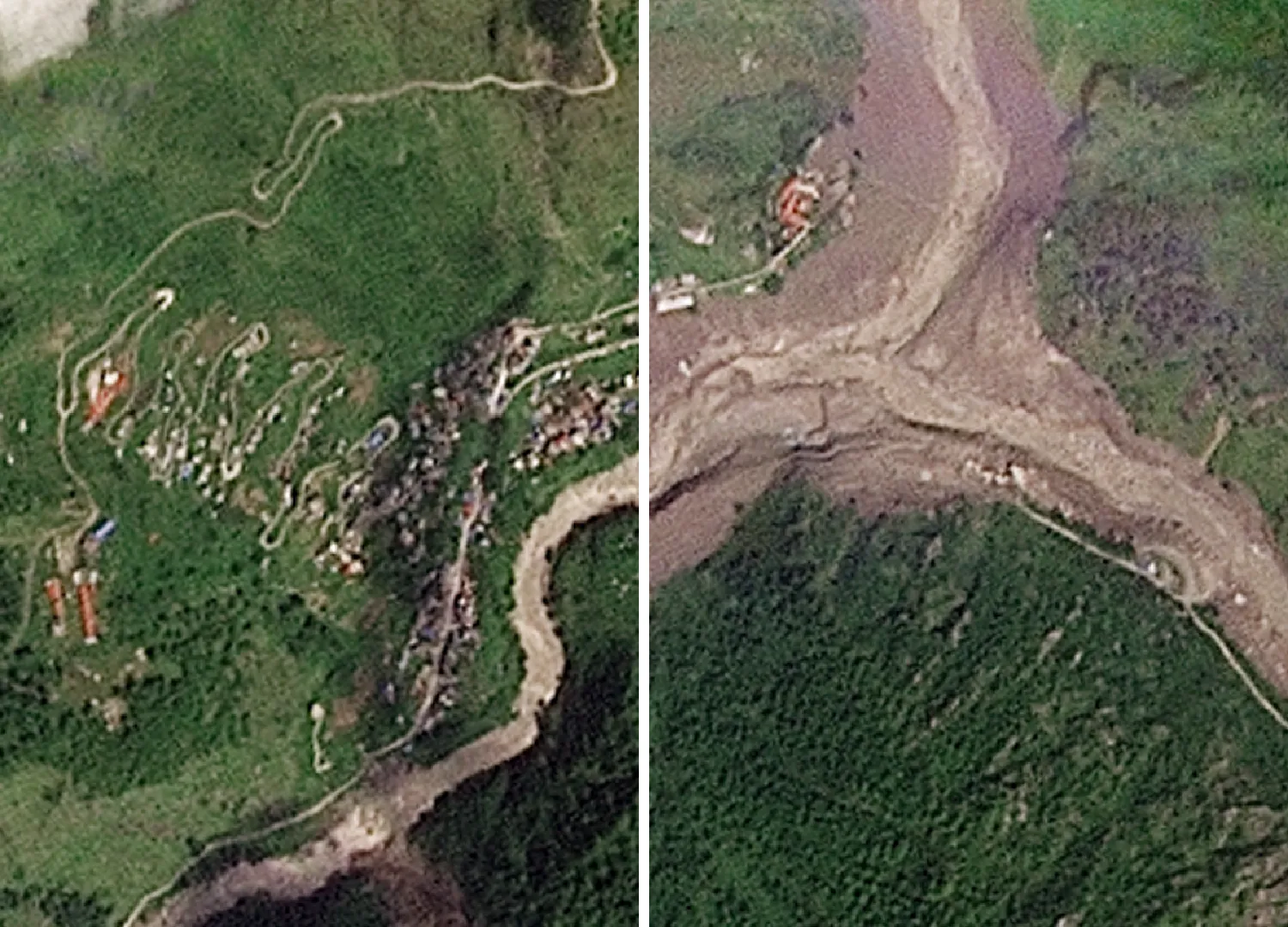
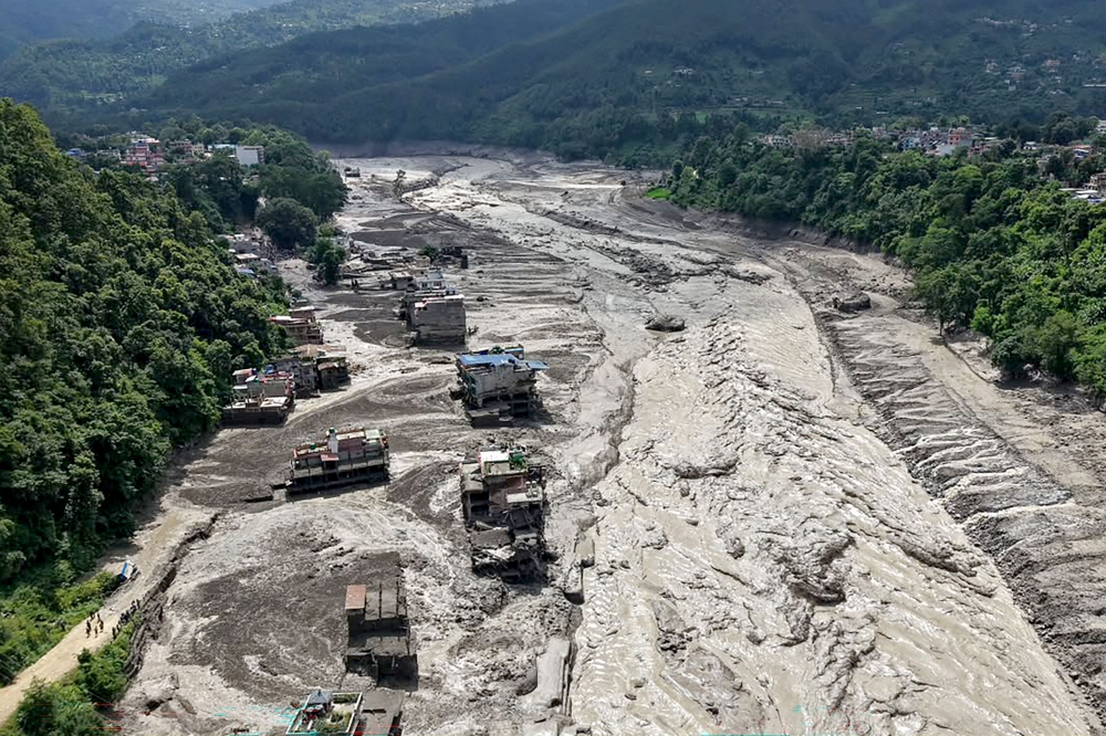
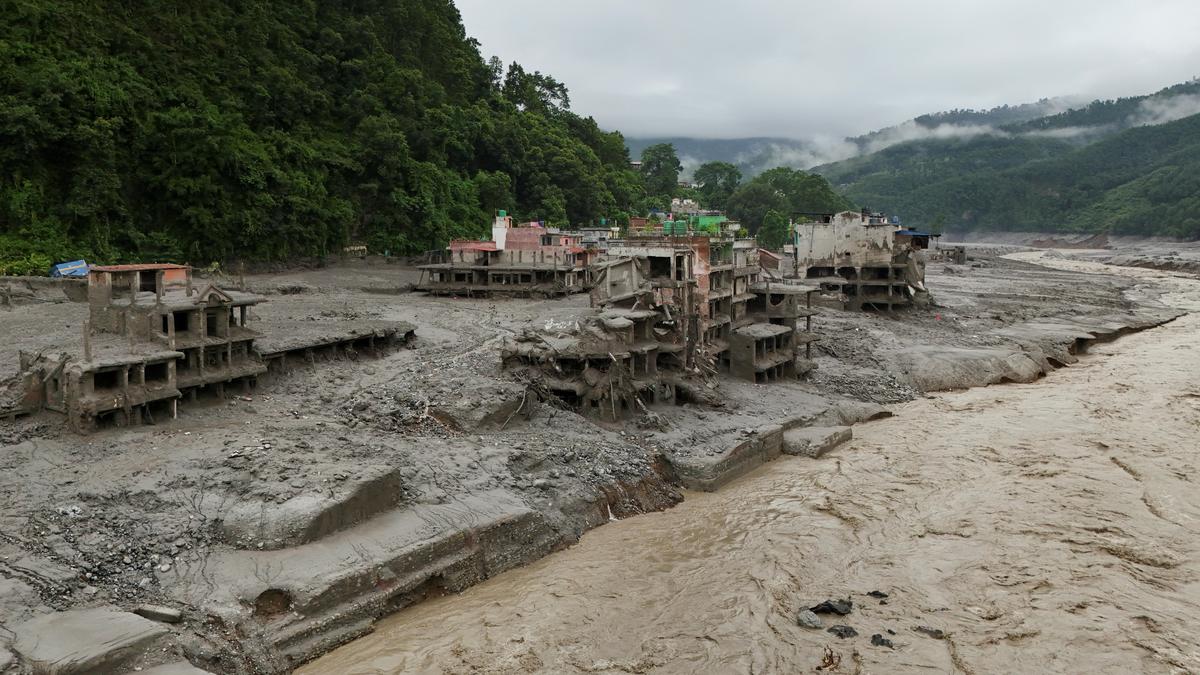
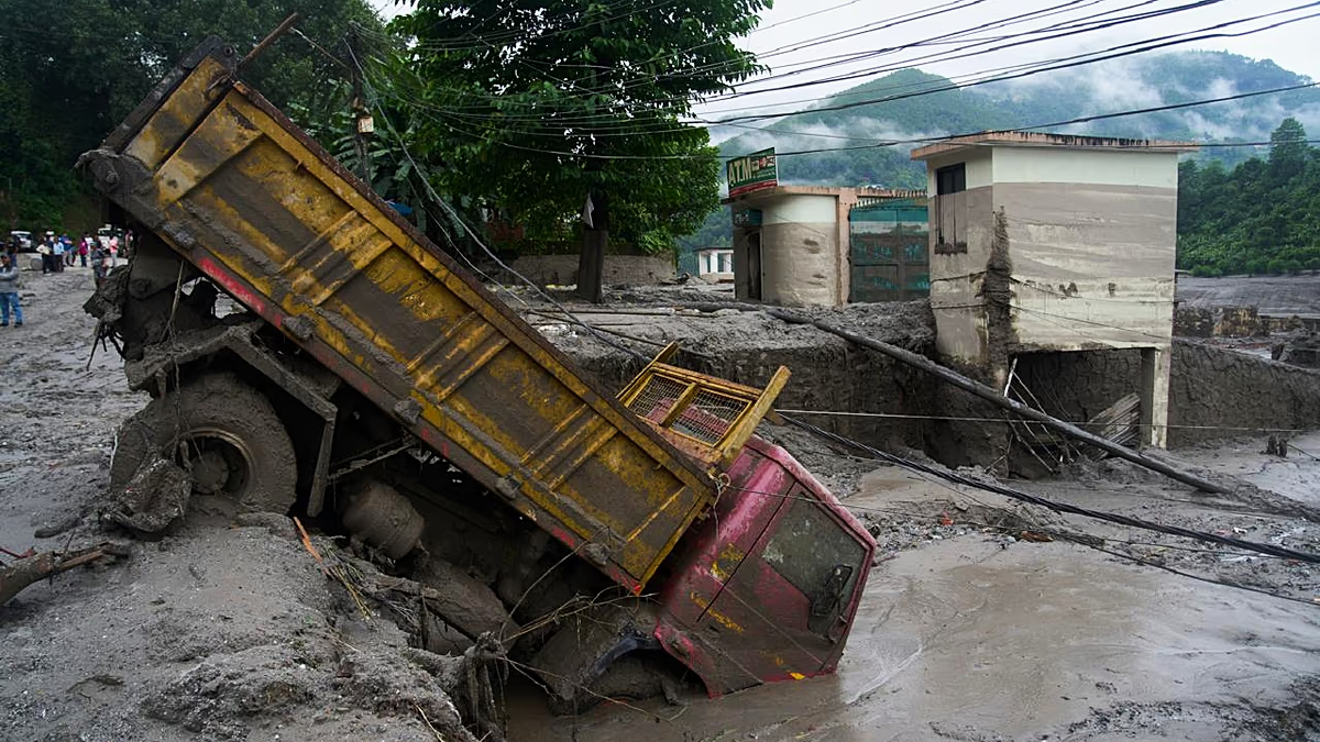
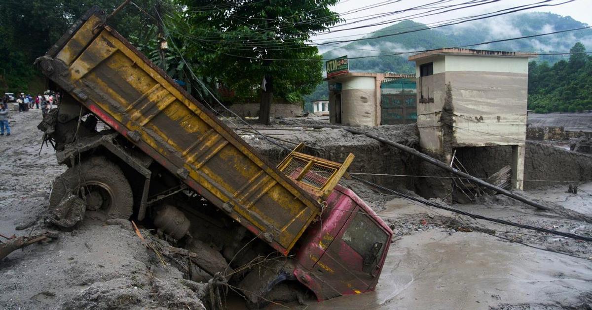
Seismic monitors first read the event as an earthquake. Satellite imagery, revised readings indicate a patch of a glacier in the Himalayas collapsed.Prefer HTon Google At water monitoring stations along Nepal's Trishuli river on Wednesday morning, levels rose by as much as nine metres in half-an-hour. It might have been a wall of mud, ice and rock that unraveled nearly 170km south through seven Nepali districts. On the Chinese side of the border, Gyirong in Tibet was struck by a linked mudslide, with state broadcaster CCTV reporting that some roads were buried under more than two metres of soil.A Google Earth screenshot shows the peaks and the spot where the glacial collapse is believed to have occurred. (Photo: HT/Google Earth screenshot)At least 180 people have been confirmed dead and close to 1,500 are missing in Nepal, with hundreds more unaccounted for in Tibet. Among those are foreigners and tourists from at least 29 countries, including India.What was initially believed to have been a glacial lake rupture triggered by an earthquake was by nightfall deemed a "glacier-inclusive flood", now confirmed by satellite imagery.A step-by-step look at what we know happened:The morning of the collapseSeismic stations picked up what was first read as a magnitude 4.4 earthquake about 66km north of Kathmandu at 8.37am local time on Wednesday. Within minutes, a surge tore down the Bhote Koshi river on the Tibetan side. On the Nepal side, the border settlements of Syabrubesi and Timure were hit shortly after 9am.Rasuwa district authorities issued warnings down the Trishuli river by 9.15am to five districts — Rasuwa, Nuwakot, Dhading, Gorkha and Chitwan — and later extended it to Narayani.As images of devastation emerged, Nepal's foreign minister Shishir Khanal told the country's parliament that an earthquake had likely triggered a landslide, which had then blocked a river and sent water gushing downstream.Satellite images of Shyaphrubesi village show Trishuli and Bhote Koshi rivers in Nepal's Rasuwa district before and after the flood ripped through the region. (Photo: Planet Labs via AFP)What satellite imagery showedThat sequence was revised hours later, when the US Geological Survey (USGS), whose monitors had picked up seismic activity, said its analysis showed that the 8.37am signal was "a glacial collapse and debris flow". In effect, this meant the collapse had shown up on its seismic stations, and that "no earthquake had occurred".Analysing satellite images released by Planet Labs, Dan Shugar, an associate professor at Canada's University of Calgary who studies geomorphology, said it appeared that the lower part of a glacier broke off at about 5,200 metres of elevation and crashed onto the valley floor roughly 1,200 metres below.The chunk of ice that broke off covered about 0.2 sqkm, according to Shugar's reading, before the mass snowballed downstream.Also read: ‘She’s gone’: Man recounts horror of watching wife get buried in Nepal flood mudA drone view of the devastation in Devighat area following a mud-laden flash flood caused by an outburst in the Bhotekoshi River, in Nuwakot on Thursday. (ANI Video Grab)The Kathmandu-based International Centre for Integrated Mountain Development (ICIMOD) had earlier issued a preliminary reading pointing to an ice-and-rock avalanche on the Nepali side that had blocked the Lhende Khola, a tributary of the Bhote Koshi, before the natural dam gave way.“It's confirmed that a substantial portion of that glacier snout collapsed to initiate the event — probably including or entraining a fair amount of rock and sediment,” Vikram Gupta, an engineering geology specialist at Sikkim University in India, told Reuters.Simon Allen, a research associate at the University of Zurich who studies glacial hazards in the Himalayas, told Bloomberg the sequence was "a large ice avalanche, probably a mixture of ice and rock, which detached, then became fluid and then transformed into this devastating flood".Ruth Gamble, director of La Trobe Asia in Australia, said the flood "operated like an inland tsunami, travelling nearly 170 kilometres" and hitting a highway used by tourists between Kathmandu and Lhasa.A combination of satellite images from August 24 (top) and August 26 (bottom) shows the glacier before and after it collapsed, which, according to experts, may have triggered flash floods and a mudslide, in Langtang, Nepal (Photo: Copernicus Sentinel-2 and Landsat 9/Handout via Reuters)Why glaciers breakGlaciers on steep mountain terrain are held in place by their own weight, the frozen ground beneath them, and the rock walls around them. Those bindings are sensitive to temperature, which is what makes climate crisis one of the usual suspects.A key link is permafrost, the frozen ground, which acts as an adhesive that binds soil, rock and adjacent glaciers together. When it thaws under rising air temperatures, that bond weakens. “We know that mountain permafrost is degrading under a warming climate," Andrew Mackintosh, a glaciologist at Australia's Monash University, told The Guardian.Glaciers also prop up the slopes they sit against, physically holding rock walls in place. When they retreat upstream — a documented consequence of a warming world — those supports are left unpropped. Repeated cycles of freezing and thawing then work on exposed rock, with water penetrating cracks and crystallising, wedging them apart over successive seasons.The final trigger can be a warm spell that thins snow cover and floods glacier surfaces with meltwater.Shugar, in his analysis, noted that some of the glaciers in the valley "were covered in snow" a day before the floods, but were "mostly bare ice" by Wednesday, suggesting that temperatures may have been unusually warm in the 24 hours preceding the collapse. Weather station data was yet to confirm the reading.Heavy rainfall wasn’t documented either, likely ruling out a downpour or a cloud burst as the trigger for the collapse.Scientists have cautioned against definitively linking Wednesday’s devastation to the global climate crisis this early. "There have been so few of these documented that we're not really able to make very clear statements about the specific relationship between glacier collapse and climate change yet," Mackintosh said. But, he added, there is still "very high confidence in the relationship between glacier retreat and climate change".Simon Cook, a glacier expert at Britain's University of Dundee, told the BBC: "When you look at the pattern of these events, you do think climate change could have an impact. The logic is that with a warming planet, you will see shrinking glaciers, lots of snow melt. The permafrost that is partially holding some mountainsides together is warming and thawing and degrading."Also read: Mumbai-based mountaineer goes missing in Nepal flash floodsA wall of mud and rock collapsed into a Himalayan river on Wednesday triggering floods. (Reuters)When has this happened beforeDocumented glacier collapses aren't common. This mechanism is also distinct from a glacial lake outburst flood, or GLOF, in which meltwater that has built up behind a natural dam bursts through.Researchers initially suspected a GLOF could have caused Wednesday's flooding. Both the 2013 Kedarnath disaster in Uttarakhand, which involved a glacial lake overflow among other triggers, and last year’s glacial burst in Tibet were flagged as reference points.The closest recent parallel to a glacier collapse in South Asia is the February 2021 Chamoli disaster in Uttarakhand, when a mass of the Himalayan glacier and adjoining rock detached and cascaded downstream, killing about 200 people at two hydropower construction sites. A subsequent peer-reviewed reconstruction published in the journal Science, whose authors included Shugar, estimated that the mass was made up of 27 million cubic metres of rock and glacier ice, which transformed into "an extraordinarily large and mobile debris flow".Beyond the Himalayas, a glacier collapse buried the Swiss village of Blatten in May 2025, when residents had been evacuated in advance. Cook told the BBC there were similar incidents in Italy in recent years.He said his team had detected that the lower part of a glacier near the Langtang Lirung peak, about 15km from the site of the floods, had collapsed. Satellite imagery appears to confirm this finding.People gather during a search and rescue operation in the aftermath of the devastating flash flood, at Trishuli Dam, in Nuwakot district, Nepal. (PTI)The wider pattern, ICIMOD researchers say, is one of "cryosphere hazards" — landslides, avalanches, GLOFs and glacier collapses — becoming more frequent across the region."The increasing frequency of cryosphere hazards is now visible more than ever. The pace is so fast that our ongoing efforts are not able to cope with this rapid change," Mohd Farooq Azam, a senior cryosphere specialist at ICIMOD, told Bloomberg.Also read: Nepal floods: Retired school teacher, ex-SAIL employee among those missing from WBHimalayas are particularly vulnerableThe Hindu Kush Himalaya, often called the world's Third Pole, is warming at nearly double the global average pace. The United Nations said in a 2023 assessment that Nepal's mountains had lost close to one-third of their ice in just over 30 years, and that the region's glaciers had disappeared 65% faster between 2011 and 2020 than in the previous decade.ICIMOD's assessment, released earlier this year, found that ice loss rates across the region have doubled since 2000.Warnings have been issued for decades. "The Himalayan Region has had a history of deadly flash floods. The event appears to have occurred without warning, catching those downstream unaware. Early warning saves lives, and there are efforts globally to improve early warning systems," said Andrew Gissing, chief executive of Natural Hazards Research Australia.Allen, the Zurich researcher, said such evacuations could have spared lives on Wednesday had the right equipment and communications been in place. "This is looking like it will be the biggest Himalayan disaster that we've seen. So I really hope this will be a turning point — that there will be more focus, more emphasis now on reducing the risks for these communities," he said.HT Explainers Desk delivers in-depth explainers and analysis on the stories shaping India and the world, from SimplyPut, Hindustan Times’ dedicated explainer section. The desk unpacks the science, policy, geopolitics and market forces behind major news events, breaking down complex developments into clear, accessible reporting for readers who want more than the headline.
Chunk of glacier fell 1.2km & sent a wall of mud, ice, water 170km downstream: What we know about Nepal-Tibet floods
Seismic monitors first read the event as an earthquake. Satellite imagery, revised readings indicate a patch of a glacier in the Himalayas collapsed.
1,766 words~8 min read