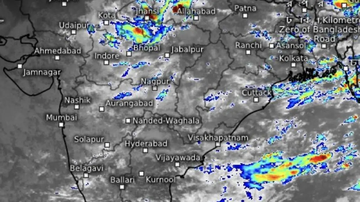
Tuesday morning satellite pictures show convective clouds/rain over parts of Kerala, Tamil Nadu, off Chennai coast, and parts of Madhya Pradesh and Uttar Pradesh.
| Photo Credit:
www.meteologix.com/in
Heavy to very heavy rain has been reported from isolated places over Assam and Meghalaya from Monday evening through Tuesday morning, as a prevailing low-pressure area remained anchored over West Bengal, Jharkhand and north Odisha. It may move north-west across Jharkhand and north Odisha until Wednesday.Heavy rain was also recorded at a few places over Jharkhand and East Uttar Pradesh and, rather against the grain, over Kerala and Mahe until Tuesday morning. A low-pressure area embedded over land in East and North-East India would not, by itself, normally be expected to deliver heavy rain over Kerala.More rain forecast Its influence can, however, be more indirect: the system can act as a remote switch, helping strengthen the south-westerly monsoon flow across the Arabian Sea and funnel moisture towards Kerala. The Western Ghats then do the rest, forcing the moisture-laden air upwards and squeezing out heavy rain.For Tuesday, the India Meteorological Department (IMD) has forecast heavy to very heavy rain over Chhattisgarh and Madhya Pradesh; heavy over Arunachal Pradesh and the North-Eastern States; hills of West Bengal and Sikkim; Assam and Meghalaya; Bihar; Jharkhand; East Rajasthan; Haryana, Chandigarh and Delhi; Uttar Pradesh; Madhya Maharashtra; Vidarbha; Coastal Karnataka; Kerala and Mahe; and Tamil Nadu, Puducherry and Karaikal.Late-season burst Thunderstorms accompanied by lightning and gusty winds are likely over the Andaman and Nicobar Islands, Andhra Pradesh, Karnataka, Kerala and Mahe, Lakshadweep, Odisha, and Tamil Nadu, Puducherry and Karaikal. But the more consequential question lies beyond the next 24 hours: can this late-season burst of rain over East and North-East India; the South Peninsula; and parts of North-West and Central India make a meaningful dent in the accumulated monsoon deficit (13 per cent as on Monday)?That is where September becomes the intriguing month during an El Niño year. In 1997, when India managed near-normal rainfall despite a strong El Niño. But the east Pacific warming phenomenon has generally acted as a negative background forcing on the monsoon, with its rainfall suppressing influence tending to become more pronounced in the latter half of the season.Contrasting El Niño yearsYet El Niño influence has repeatedly been modified, sometimes substantially, by competing forces: the Indian Ocean Dipole (IOD), the Madden-Julian Oscillation (MJO), the strength and configuration of the larger monsoon circulation, and, crucially, the timing and intensity of the El Niño itself.The contrasting outcomes below tell the story. El Niño years since 1997 produced rainfall departures ranging from +0.2 per cent in 1997 when a strong El Niño failed to derail the monsoon; to −20.9 per cent in 2002; −12.7 per cent in 2015; and −5.3 per cent in 2023. This year, El Niño became established in July, but the damage to rainfall balance had already begun in June.