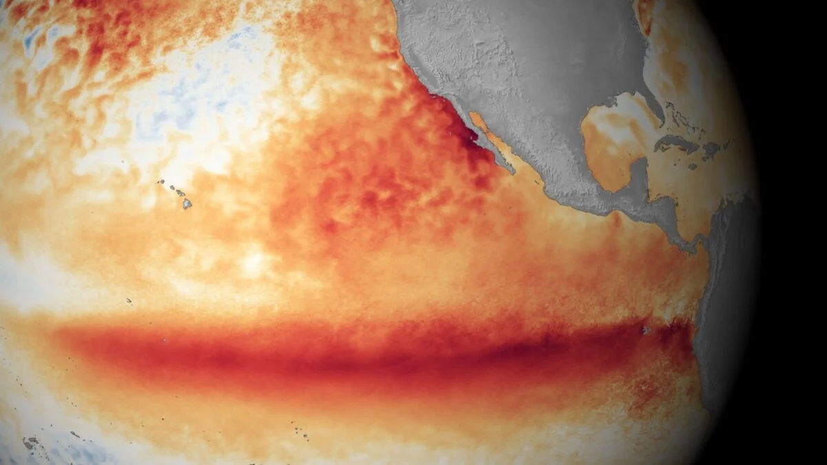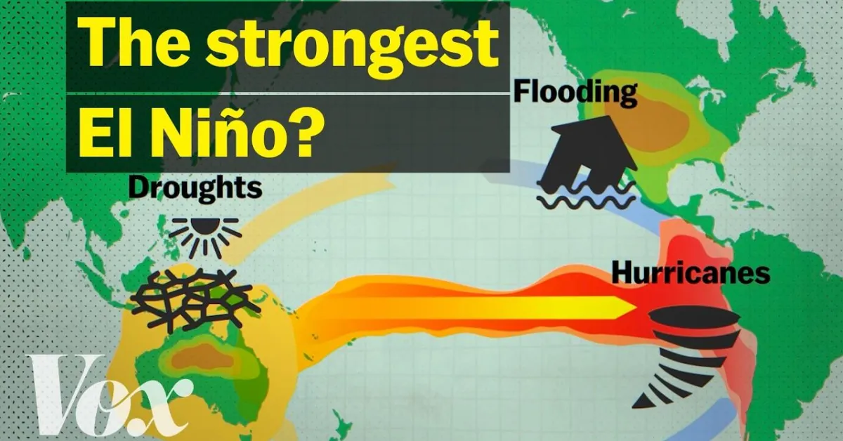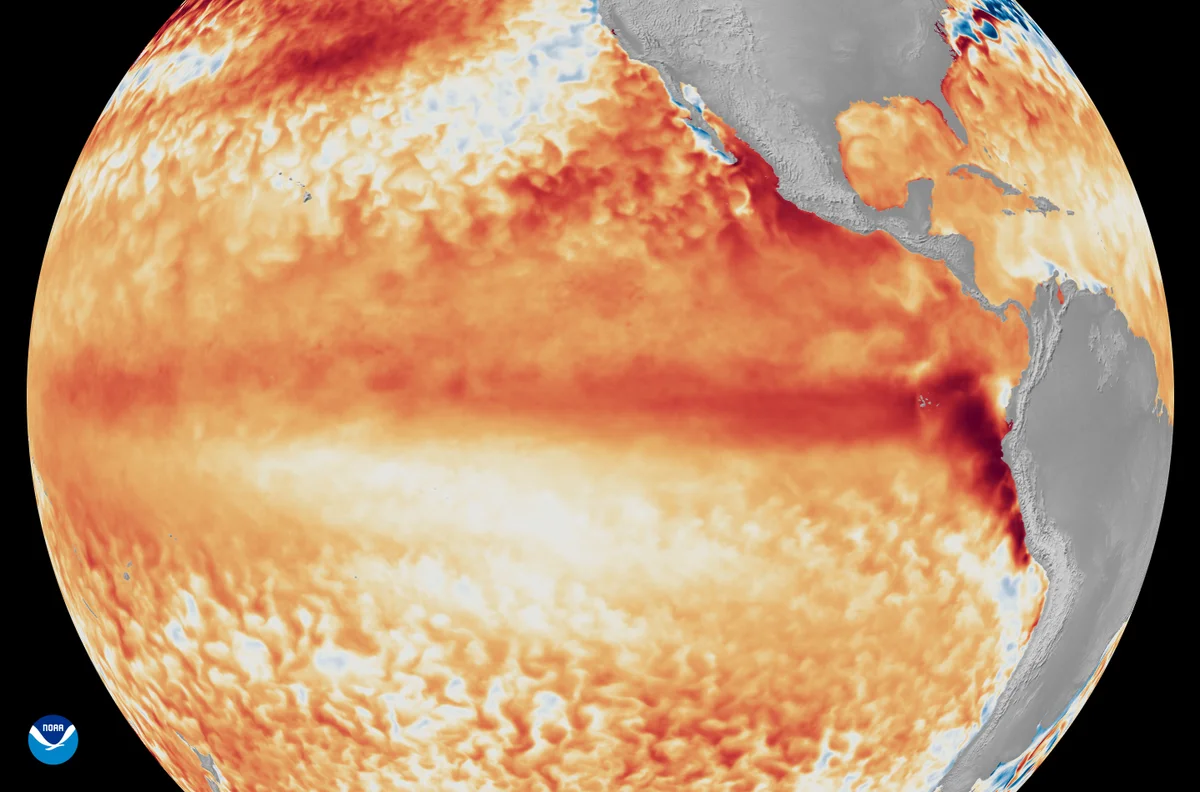
The odds of a Super El Niño just got higherThis climate system is tied to more powerful typhoons, as well as famine and wildfiresBy Adam Kovac edited by Andrea ThompsonSatellite imagery showing the difference from average sea surface temperatures at the equator in the tropical Pacific Ocean (depicted using various shades of red and orange for warmth) during the first week of June 2026, as compared with the baseline used by NOAA’s Coral Reef Watch. NOAA SatellitesJoin Our Community of Science Lovers!The ongoing El Niño has become more powerful over the past month and will likely continue to strengthen well into 2027, according to updated data from the National Weather Service (NWS). Such a "Super El Niño" could mean an increased risk of deadly and destructive extreme weather events in various places across the planet and would tip the odds of having record hot years globally.El Niño is a global climate pattern that originates in the Pacific Ocean. Waters in the eastern portion of the tropical Pacific near are normally colder than in the west, but during an Niño, that cooler water heats up. That, in turn, changes where heat is released into the atmosphere, changing major wind patterns. The downstream effects of that cascade can bring devastation to some places, such as raising the risks of famines, fires and floods in Southeast Asia, but benefits to others, such as a less active Atlantic hurricane season.The weather-related effects of a strong El Niño can be so devastating that some scientists have proposed geoengineering solutions to weaken the climate phenomenon, though such an action isn't currently technically feasible and raises thorny ethical questions.On supporting science journalismIf you're enjoying this article, consider supporting our award-winning journalism by subscribing. By purchasing a subscription you are helping to ensure the future of impactful stories about the discoveries and ideas shaping our world today.The famed climate pattern's emergence was confirmed by NOAA in June and the new data shows it’s only picked up steam since then. In an advisory issued on July 9, the NWS said sea surfaces in a large area of the eastern and central Pacific have been 1 degree Celsius or more higher than the norm, with some areas reaching almost 3 degrees warmer. If a Super El Niño materializes, it will be only the third since 1950. The NWS gave the system an 81 percent chance of reaching that status, alongside a 97 percent chance the El Niño will last through early spring 2027.The stronger the El Niño is, the better the odds it will cause 2026, 2027, or both to be the hottest year on record, as previous Super El Niños have done.It’s Time to Stand Up for ScienceIf you enjoyed this article, I’d like to ask for your support. Scientific American has served as an advocate for science and industry for 180 years, and right now may be the most critical moment in that two-century history.I’ve been a Scientific American subscriber since I was 12 years old, and it helped shape the way I look at the world. SciAm always educates and delights me, and inspires a sense of awe for our vast, beautiful universe. I hope it does that for you, too.If you subscribe to Scientific American, you help ensure that our coverage is centered on meaningful research and discovery; that we have the resources to report on the decisions that threaten labs across the U.S.; and that we support both budding and working scientists at a time when the value of science itself too often goes unrecognized.In return, you get essential news, captivating podcasts, brilliant infographics, can't-miss newsletters, must-watch videos, challenging games, and the science world's best writing and reporting. You can even gift someone a subscription.There has never been a more important time for us to stand up and show why science matters. I hope you’ll support us in that mission.
The odds of a Super El Niño just got higher
This climate system is tied to more powerful typhoons, as well as famine and wildfires
645 words~3 min read