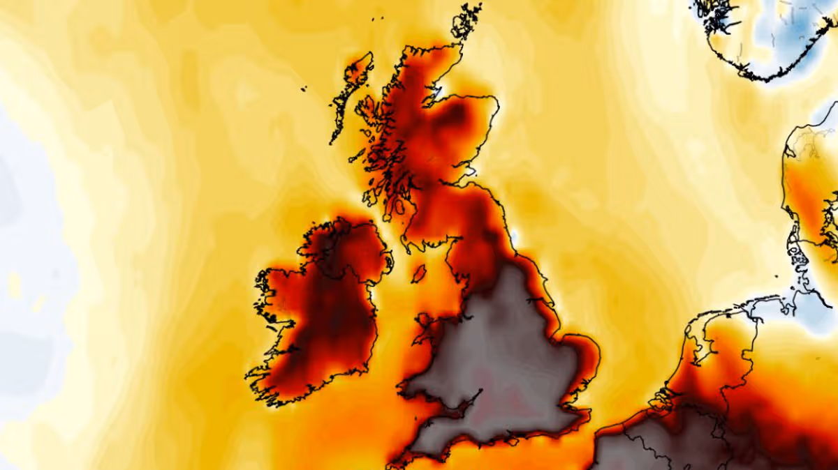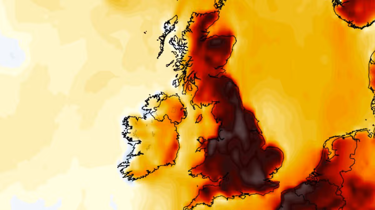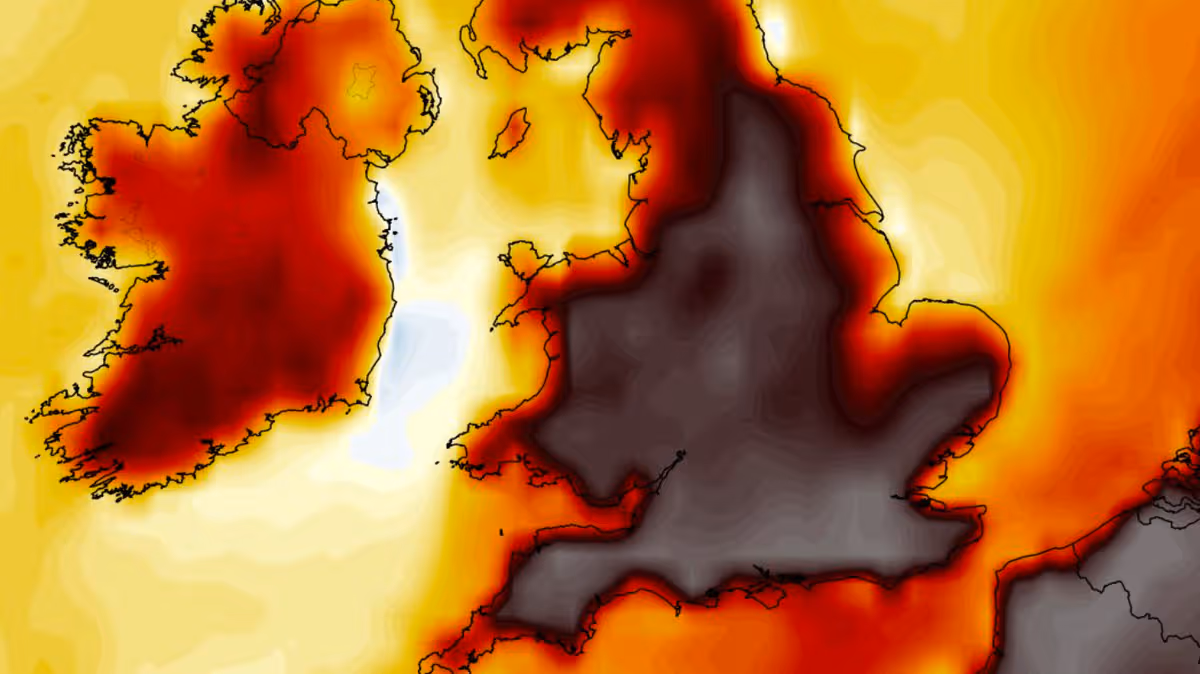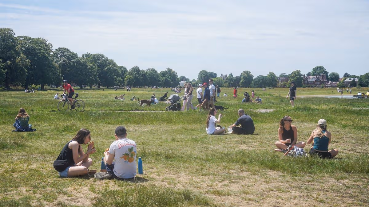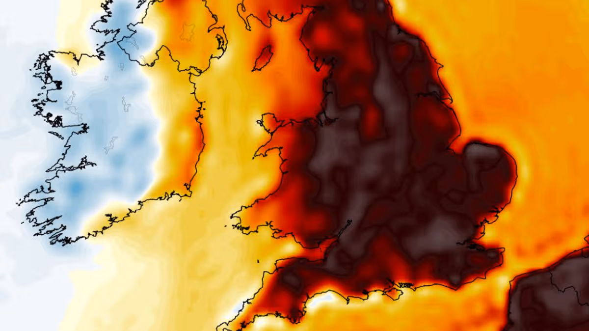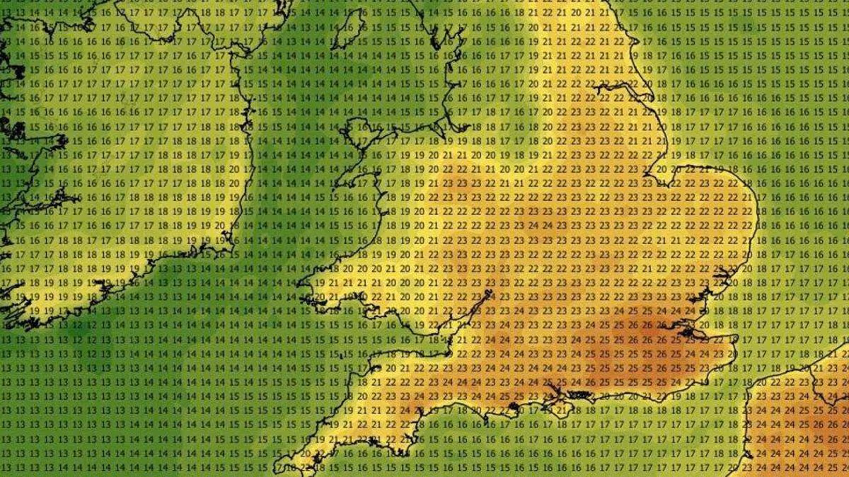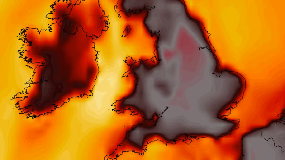
Another heatwave appears to be just days away as weather forecasting maps suggest we could soon see the hottest day in UK history with the mercury surging to 41C14:13, 28 Jun 2026Advanced weather modelling maps suggest the hottest day the UK has ever seen could be right around the corner as another heatwave looks set to take hold.Temperature records tumbled this week as the mercury surged past 37C. The country has seen the record for hottest June day ever broken on three consecutive days, culminating with 37.3C on Friday.However, the GFS weather model now suggests we might soon see the hottest day in British history. The current record stands at 40.3C, which was recorded during the scorching heatwave in July 2022.Another heatwave now looks set to roast the country within days, starting on July 8 when temperatures could rise as high as 35C in the south-east. Almost all of central and southern England may hit 30C or more, the data suggests, with highs of 33C coming as far north as Yorkshire.On July 9, the GFS model data shows 37C highs are possible in southern England. Temperatures could rise as high as 32C in parts of South Wales too, the data suggests.While on July 10 staggering highs of 40C could come in western and southern England. The data suggests the mercury could peak at 37C to 39C quite widely across central and southern England, on what could be the warmest day ever.Yet July 11 is projected to be even warmer still. The GFS model shows possible temperature maximums of 41C in western England, while swathes of the country from Yorkshire down to London could rise as high as 40C.Conditions are then expected to cool off ever so slightly, with maximum highs of 38C - primarily in the south-east - on the cards for July 12. The picture looks similar for July 13, when 37C could be the top temperature.These temperatures would almost certainly constitute an official heatwave, which is declared when an area records temperatures over the heatwave threshold for three consecutive days. The threshold varies from 25C to 28C in different counties - it sits at 28C in the south-east where temperatures tend to be warmer, and drops to 25C the further away from the south-east you go.Temperature anomaly maps for this period show the UK covered in areas of deep red and black. This shows where temperatures are expected to rise well above the seasonal average.In total, the GFS weather model maps show 18 counties could rise to 40C or more. They are all in England.UK counties facing 40C or more in new heatwaveYorkshireNottinghamshireLincolnshireLeicestershireDerbyshireNorthamptonshireLancashireCheshireShropshireBedfordshireHertfordshireHerefordshireWorcestershireWarwickshireOxfordshireBuckinghamshireBerkshireSurreyMet Office weather forecastThe Met Office says there is a "greater than normal chance" of more hot weather coming next month. "Thundery showers" are also on the cards, according to the national weather agency.The Met Office forecast for July 12 to 26 states: "High pressure is looking slightly more likely than low pressure during the early part of this period, meaning a greater chance of settled and drier than average conditions."Outbreaks of rain and stronger are possible at times, these more likely further north. As normal for the time of year, there is still a chance of some heavy and thundery showers which may interrupt any warm and settled weather.Article continues below"Towards the end of July there is no reliable signal for preferring any one weather pattern over another. However, temperatures are likely to be above normal on the whole, with a greater than normal chance of hot conditions developing at times."
UK weather maps show 41C heatwave is days away as 18 counties surge past 40C
Another heatwave appears to be just days away as weather forecasting maps suggest we could soon see the hottest day in UK history with the mercury surging to 41C
586 words~3 min read