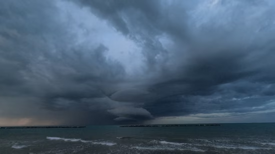
Show Caption
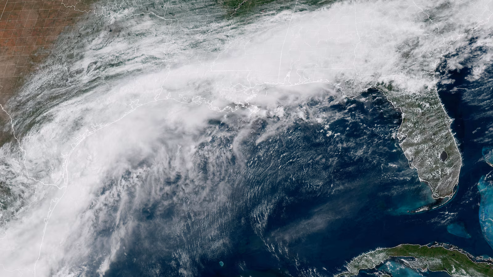
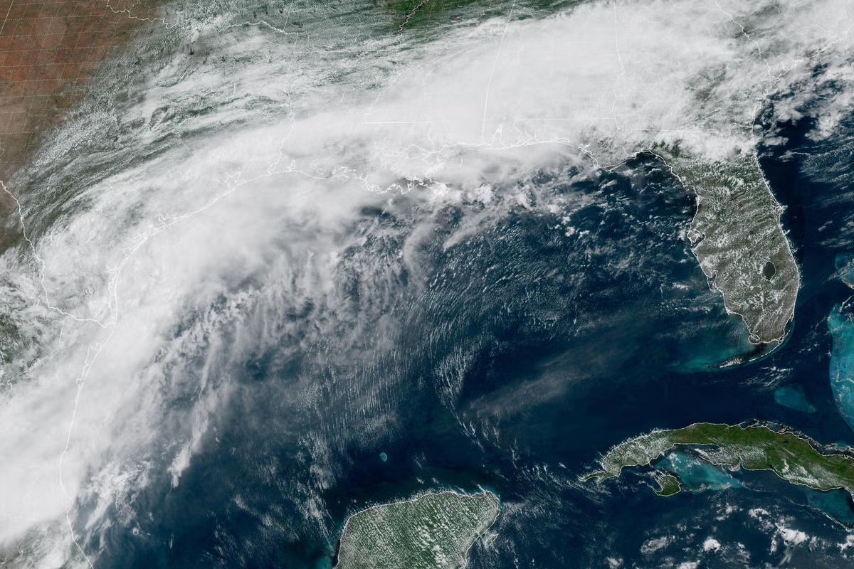
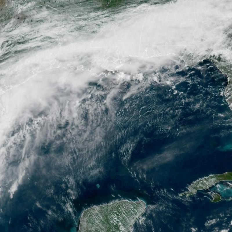
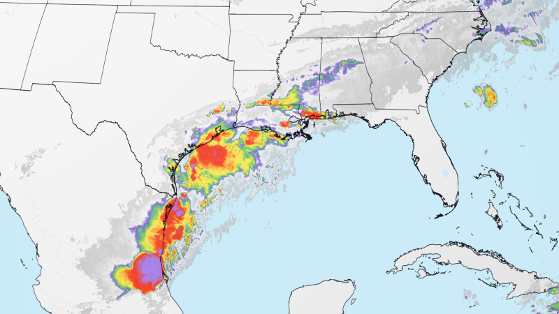
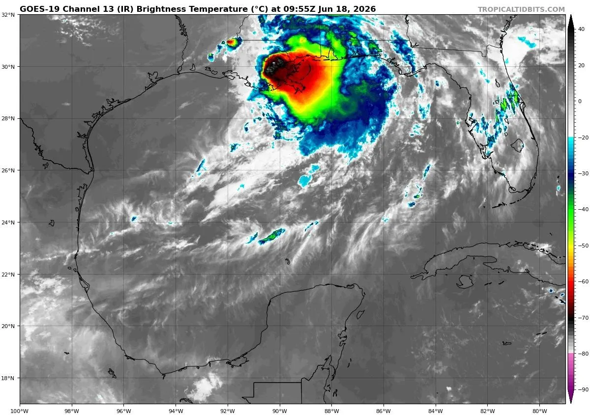
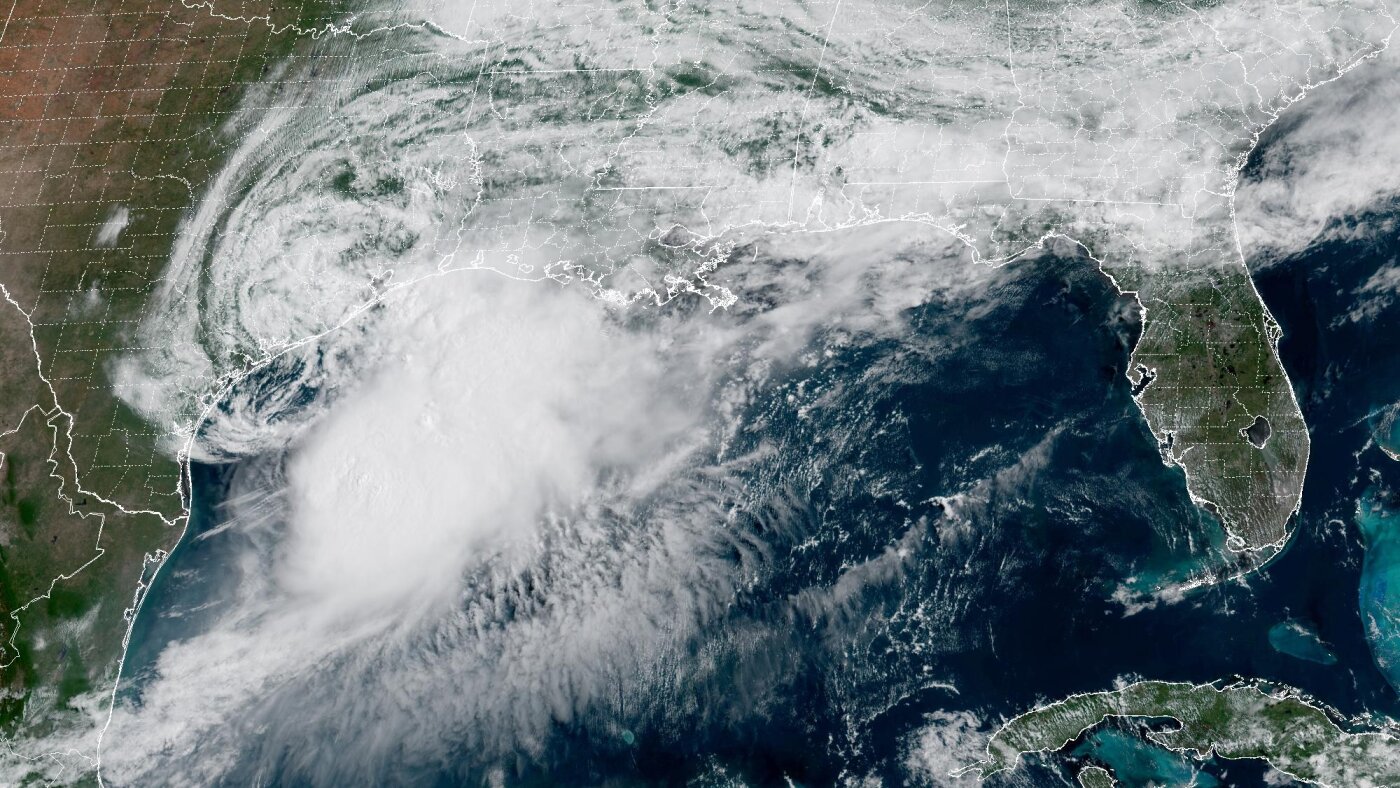
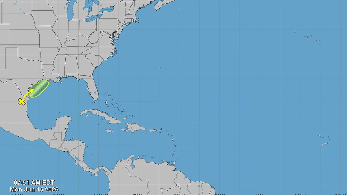
Could Tropical Storm Arthur be forming in the Gulf?A tropical disturbance in the western Gulf of Mexico (renamed the Gulf of America by the federal government) will contribute to the risk for heavy rain and numerous flash floods across the Gulf Coast and South this week, according to Michael Lowry, hurricane specialist with WPLG-TV in Miami.Due to the flood threat from the disturbance — coupled with other weather systems — a flood watch is in effect for over 20 million people in Texas and Louisiana, according to the National Weather Service. This includes the Houston, Austin and San Antonio metro areas.Areas between Corpus Christi, Texas, and Lake Charles, Louisiana, as well as in southwest Mississippi, are likely to see the heaviest rainfall, with maximum totals reaching or exceeding 15 inches in isolated spots, said Houston-based meteorologist Matt Lanza in his blog The Eyewall."This is the most significant rainfall setup in this area since 2024," Lanza said. As the Weather Prediction Center excessive rainfall discussion noted this morning, “any storms that develop in this environment (will have) an almost unnatural ability to produce heavy rain."Development will take a few daysThe developing tropical system is still over Mexico: The National Hurricane Center, in a forecast from Monday morning, said that a trough of low pressure located over northeastern Mexico continues to produce disorganized shower and thunderstorm activity."Development is not expected during the next day or so while the trough remains inland and drifts generally northward over northeastern Mexico and southern Texas," the hurricane center said."The system is then forecast to move northeastward and could re-emerge over the northwestern Gulf of America late Tuesday or Wednesday, where environmental conditions may support some development around midweek," the hurricane center said.Hello, Arthur?If it becomes a named system, it would get the name Tropical Storm Arthur.Regardless of tropical cyclone formation, heavy rainfall, flash flooding and gusty winds are possible across portions of eastern and southern Texas and Louisiana this week, the hurricane center said.With respect for tropical development, Lanza said, "it is not likely that any tropical development would extend beyond depression or low-end tropical storm status. You should be thinking of this as predominantly a heavy rainstorm and flash flooding event for the Gulf Coast."Disturbance came from Tropical Storm CristinaAccording to AccuWeather, the cluster of disturbed weather over Mexico can be traced in part to moisture associated with Cristina, which reached tropical storm strength in the eastern Pacific Ocean south of Central America.Cristina dumped rain across Central America late last week before dissipating.This system could drift back out over the Gulf just off the Texas coast, or a second one may try to form over the Gulf along a stalled front during the early part of the week, AccuWeather lead hurricane expert Alex DaSilva said in an online forecast.Any organized storm along or near the front could further enhance rainfall, though for most areas of the South, the wet forecast and flash flood concerns remain the same regardless of tropical development, DaSilva said.Doyle Rice is a national correspondent for USA TODAY, with a focus on weather and climate.