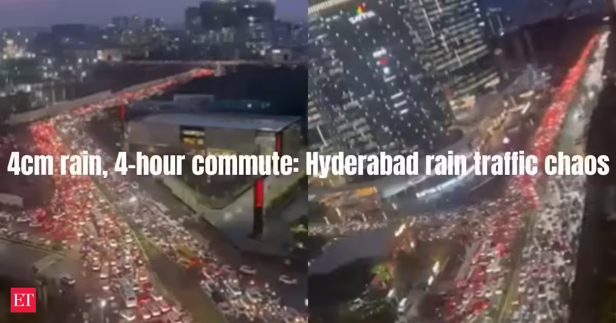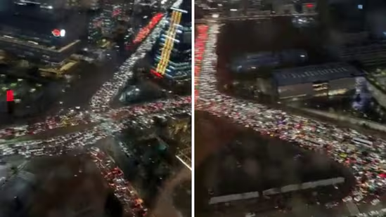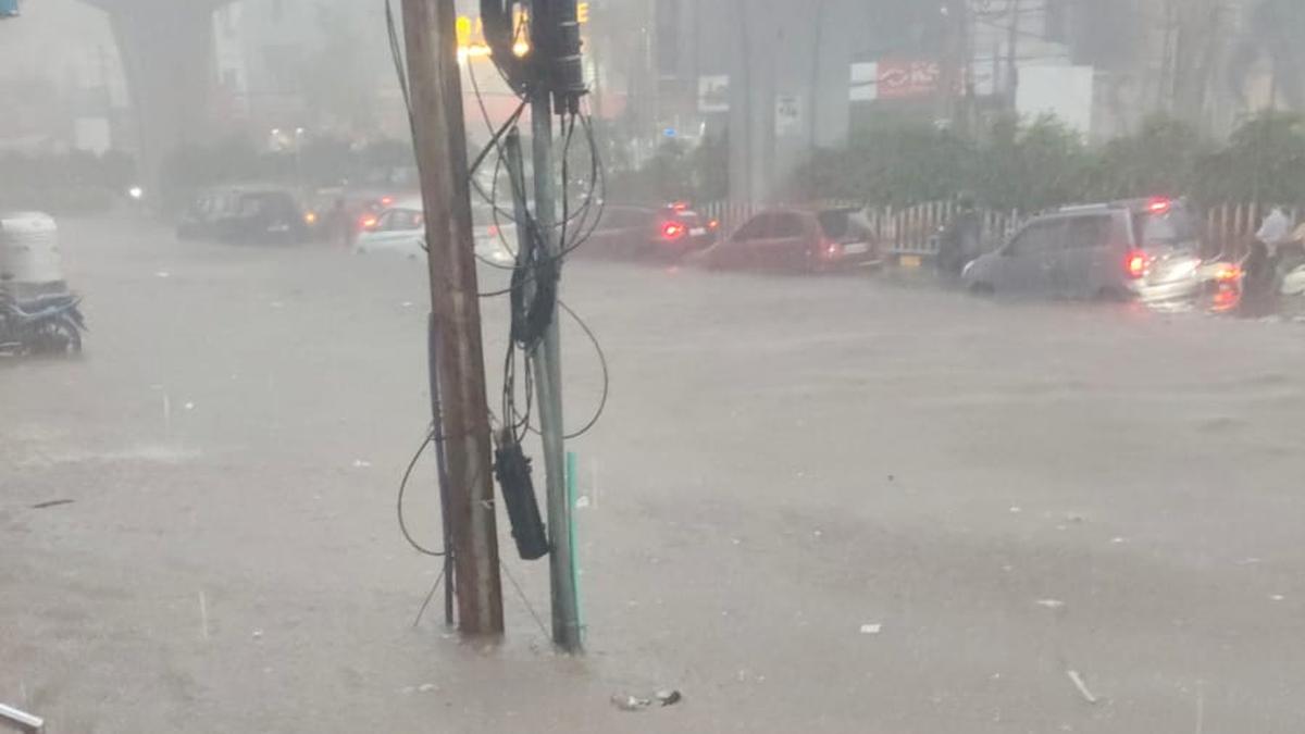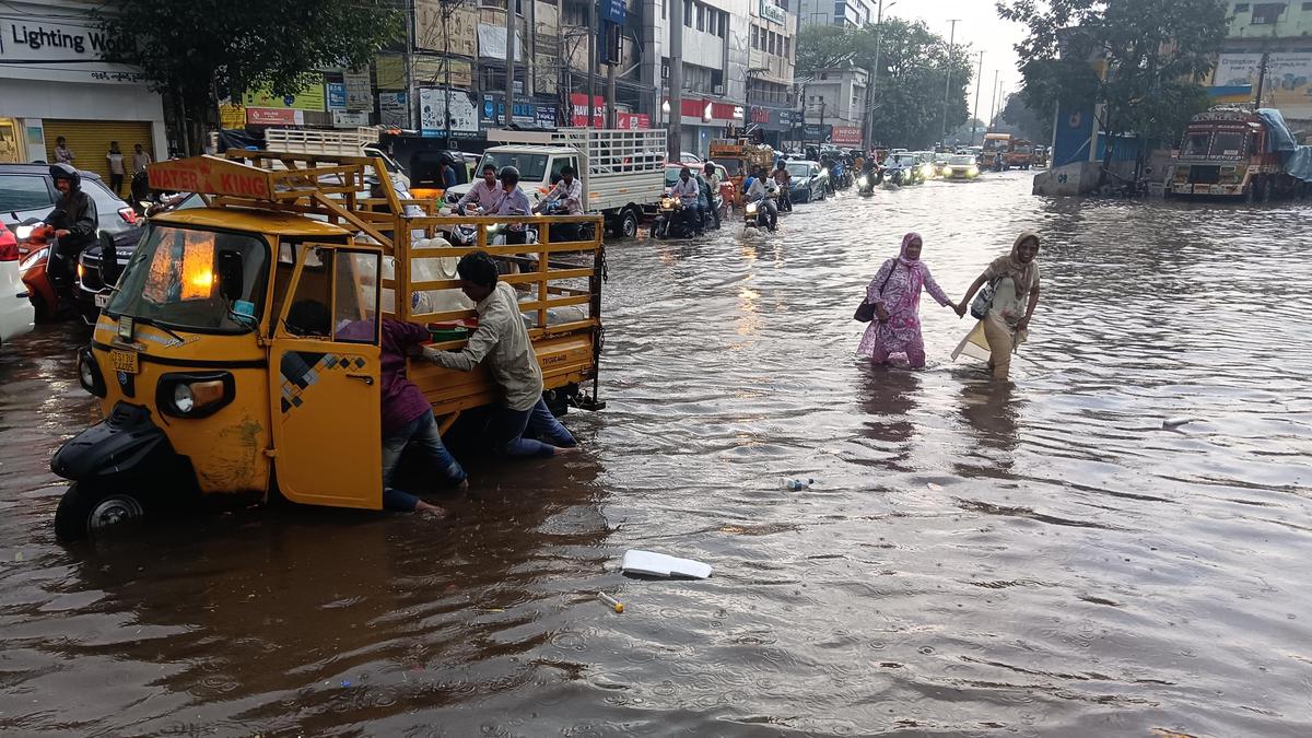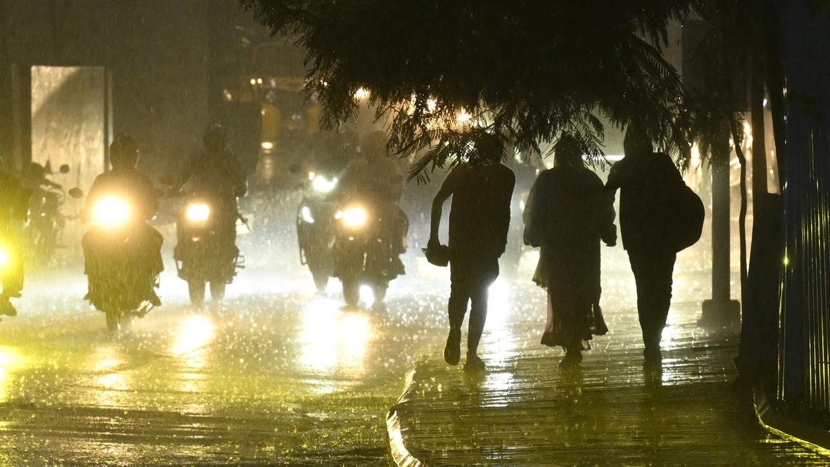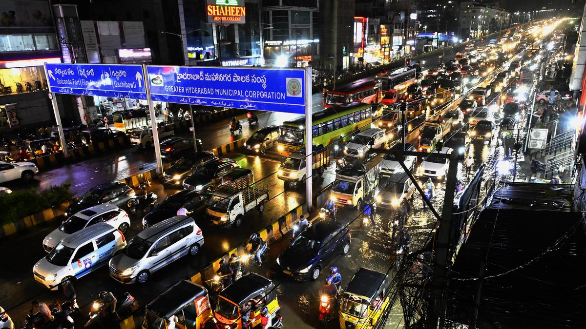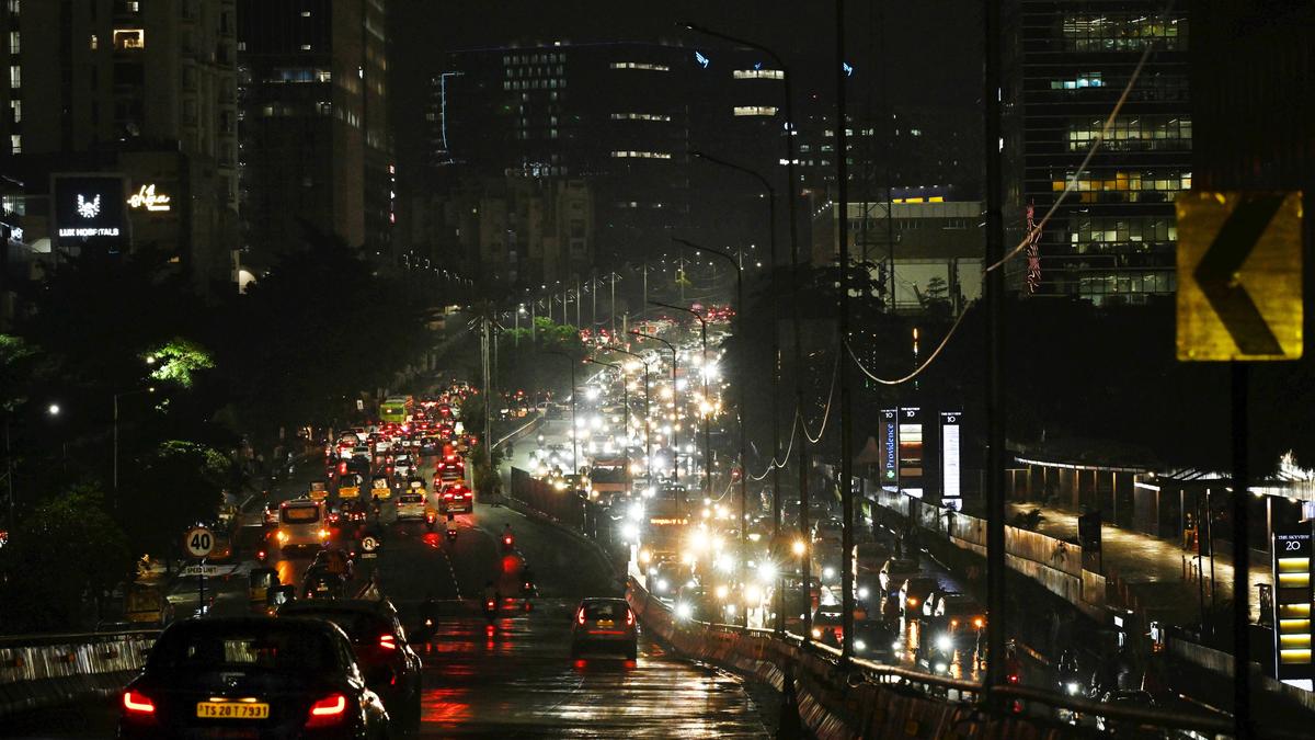
When M. Aditya stepped out of his office in Gachibowli, Hyderabad, around 8 p.m. on Tuesday (June 9, 2026), the rain had already stopped. But so had the city.Outside, the roads were slick with rainwater, traffic stood frozen, and a sea of red taillights stretched into the distance. His commute back home to ECIL, Nagaram, which ordinarily takes about 50minutes, turned into a three-and-a-half-hour ordeal of failed cab bookings, long walks to the nearest Metro station, packed trains and gridlocked roads. By the time he reached home, it was well past 11:30 p.m.“It was a nightmare. Just a few minutes of rain brought the entire traffic system to its knees,” he recalls.Aditya’s experience was not exceptional. Across Cyberabad, photos and videos captured a city at a standstill beneath the gleaming glass towers of multinational corporations and luxury residential complexes. According to police estimates, more than three lakh vehicles were caught in the traffic gridlock that paralysed large parts of Hyderabad’s western corridor. Stretched bumper to bumper, they would have covered roughly 824 acres, or 3.34 square km — an area equivalent to about 55 cricket grounds the size of Rajiv Gandhi International Cricket Stadium in Hyderabad.For many commuters, the scale of disruption seemed out of proportion to the rain spell that had triggered it.“Such thunderstorms are a common summer phenomenon following prolonged periods of intense heat,” explains G.N.R.S. Srinivas, senior meteorologist at the India Meteorological Department (IMD), Hyderabad centre. “Telangana had experienced temperatures between 41°C and 46°C over several days, causing severe heating of the land surface. The resulting temperature difference between the landmass and the surrounding seas drew in moisture-bearing winds from the Arabian Sea and Bay of Bengal, leading to the formation of cumulonimbus clouds and short-duration but intense rainfall events,” he adds.Unlike monsoon rains, which are widespread and persistent, the pre-monsoon showers are highly localised, he says. “The June 9 downpour was concentrated over pockets of the city while several localities received very little rain. Such events are typically driven by afternoon and evening heat build-up and last for brief durations.”But rainfall intensity alone does not explain the city’s flooding problem, Srinivas argues. Even rainfall totals of around 11 cm recorded in some pockets of Hyderabad on Tuesday (June 9, 2026) are not extraordinary from a meteorological perspective, he says.The flooding, in many ways, is a billion-year-old geological legacy with a 25-year-old urban twist. The rocks and hills that once defined the landscape may have given way to modern concrete towers, but the slopes and natural drainage patterns remain. Unlike the relatively flatter parts such as Charminar, Secunderabad, Nampally, Balanagar, Khairatabad, Musheerabad and Marredpally, western Hyderabad is shaped by a dense network of hills, valleys and natural channels. On Tuesday evening,(June 9, 2026) rainwater raced through these gradients and pooled under flyovers, along roads and around commercial hubs.“The flooding is due to the difference between high-elevation and low-lying areas. Water naturally flows from higher ground to the plains. Earlier, much of this water drained into Durgam Cheruvu,” says Hari Sarvothaman, guest faculty at the Centre for Earth, Ocean and Atmospheric Sciences, University of Hyderabad.“But now office and residential buildings have come up along the natural pathways, blocking water flow and causing flooding in low-lying areas. Gentle slopes and plains have been built over, and urban planning authorities have granted permissions (for construction) without respecting geological contours,” adds Mr. Sarvothaman, who has studied floods in Hyderabad, including the deluge of August 2000.The root of the problem, he says, goes back to the birth of Cyberabad itself.As Hyderabad hopped onto the IT bandwagon in the late 1990s, Cyberabad emerged as the city’s flagship technology hub. The Cyberabad Development Authority, created on January 20, 2001, was tasked with developing a “model enclave commensurate with the concentration of such institutions”.Cost of building against contoursRenowned architectural consultancy Vastu Silpi Consultants, helmed by B.V. Doshi, prepared the master plan, zoning framework and building regulations. Conceived around the area’s natural topography, the plan included two high-density corridors with a matching grid. Cyber Towers had already been built in 1998, while the master plan came into effect on October 29, 2001.Nearly 25 years later, the city is paying the price for design flaws, omissions and hubris, say critics. While a master plan existed, geologists were not part of the planning process. And then there were modifications in the plan itself. A 2013 government order, for instance, redesignated a proposed 24-metre CDA Master Plan road passing through parts of Gopanpally and Manikonda as a residential-use zone. This change occurred near the areas that experienced flooding on Tuesday evening (June 9, 2026).The consequences become evident during intense rainfall events. A community note prepared by IMD’s Srinivas states, “A 5-cm rainfall event over one square km generates around 50,000 cubic metres of water, or nearly 50 million litres, equivalent to approximately 10,000 water tankers being emptied simultaneously onto the urban terrain.”
When monsoon clogs Hyderabad’s tech heart
Hyderabad's monsoon chaos exposes infrastructure flaws in Cyberabad, raising urgent questions about urban planning and drainage systems.
TL;DRAI
June 9 downpour paralyzed Cyberabad tech hub for 3.5+ hours (300,000 vehicles); cause: 25 years of development that blocked natural drainage patterns. For IT leaders: rapid growth without geological expertise in master planning creates infrastructure gaps threatening operational continuity and competitive talent positioning.
1,450 words~7 min read