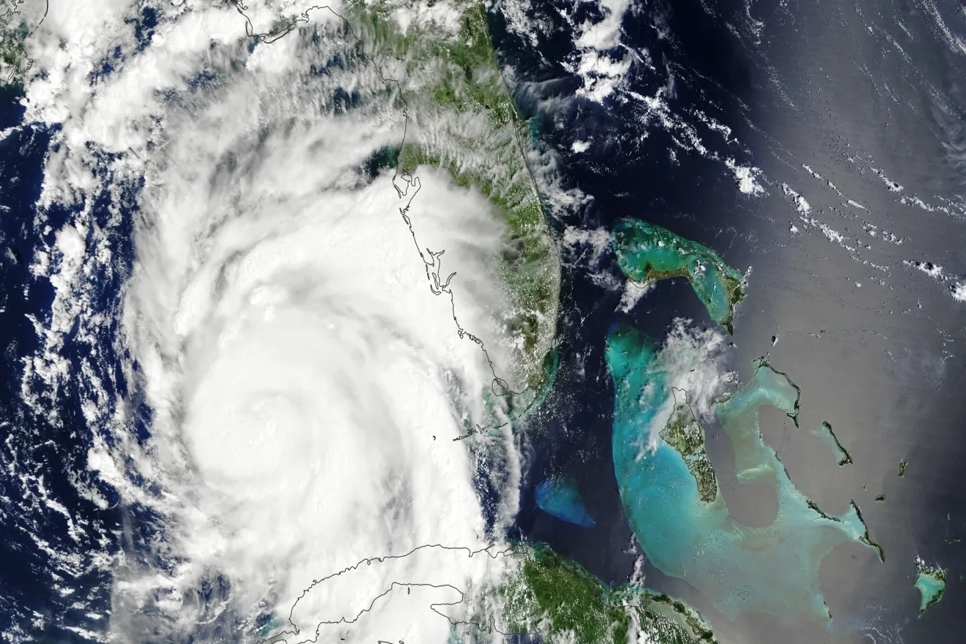
The Moderate Resolution Imaging Spectroradiometer (MODIS) on NASA’s Terra satellite acquired this image of Idalia around 11:35 a.m. Eastern Time on Aug. 29. At this time, Idalia was moving north, and the National Hurricane Center reported wind speeds of about 85 miles (135 kilometers) per hour. Credits: NASA Earth Observatory
June 1st marks the official start to the Atlantic hurricane season, and it’s likely to be a below-normal season, according to the National Oceanic and Atmospheric Administration. With a strong El Niño likely in the works, the forecast calls for a 55% chance of a below-normal season, a 35% chance of a near-normal season, and a 10% chance of an above-average season.
On May 21, NOAA is forecasting between eight and 14 named storms (winds of 39 mph or higher), of which three to six could become hurricanes (winds of 74 mph or higher), and of those hurricanes, one to three could be major hurricanes (Category 3, 4, or 5 with winds of 111 mph or higher).
Figure 1. A summary infographic showing hurricane season probability and numbers of named storms predicted from NOAA’s 2026 Atlantic Hurricane Season Outlook. (Image credit: NOAA)
When a positive phase of the El Niño–Southern Oscillation, meaning El Niño, occurs, the tropical Pacific has warmer-than-average temperatures. Although the oceanic warming is centered in the eastern tropical Pacific, El Niño has impacts worldwide. The phenomenon can occur at any time of the year, but when it is present in the summer, it directly affects the number of tropical systems likely to develop in the Atlantic.