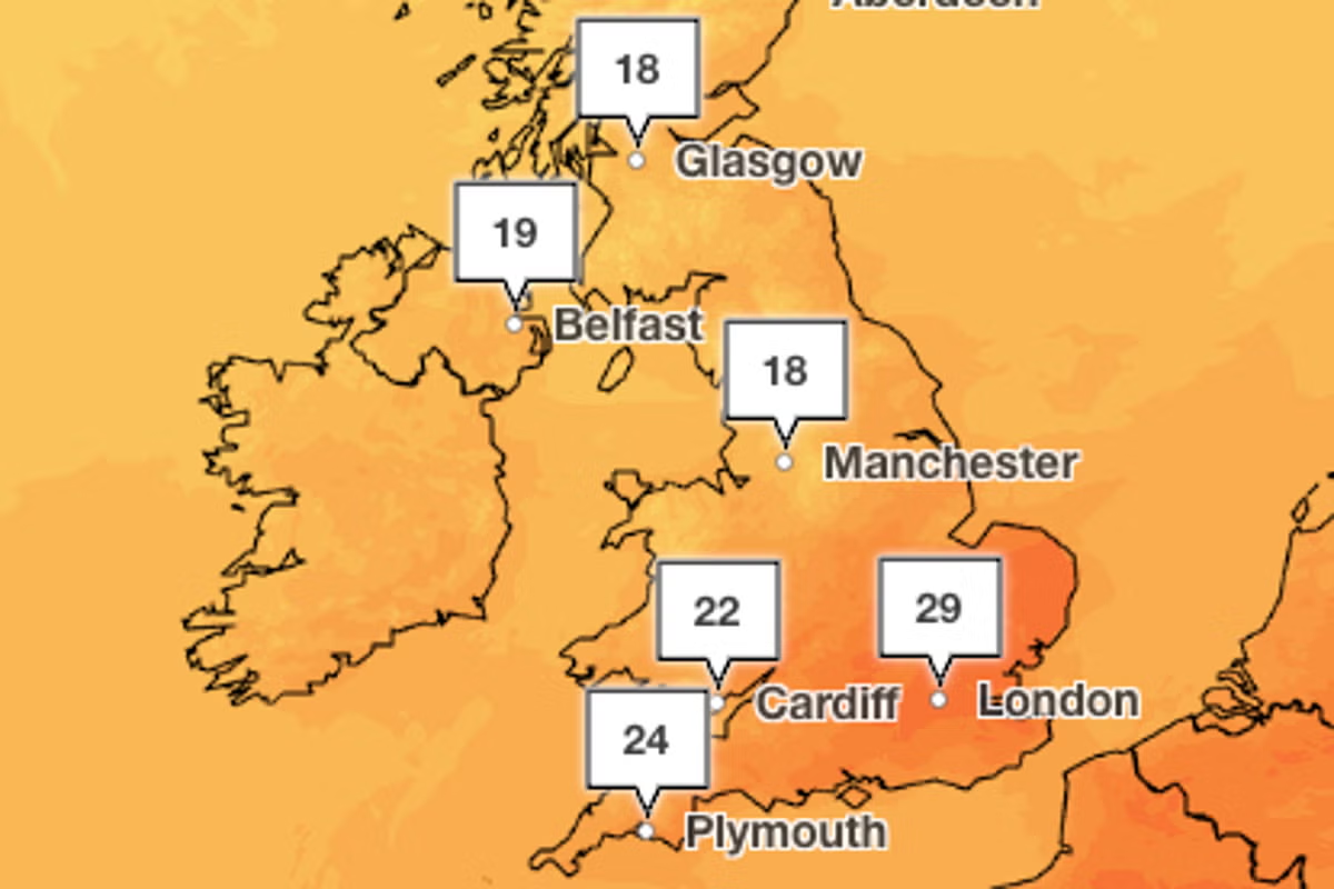
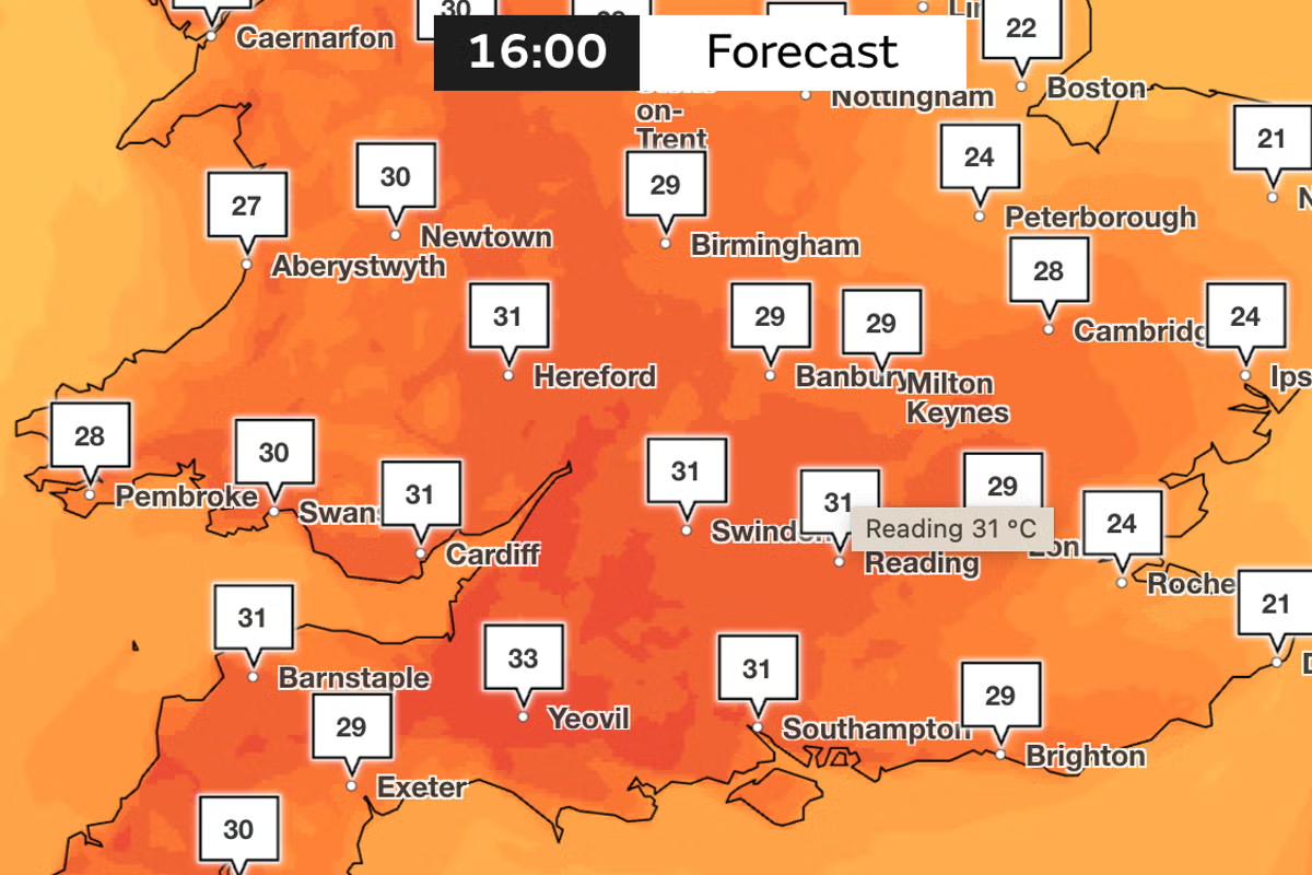
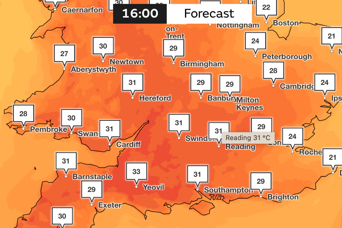
While the official heatwave may be coming to an end, Britons can still expect a warm weekend of sunshine with temperatures set to reach 28C in some areas. Londoners and the south-east of England are set for another hot Saturday, while Scotland and north England will enjoy temperatures between 15C to 23C. It follows a record-breaking heatwave, which saw temperatures climb to 35.1C in Kew Gardens, west London, on Tuesday.NHS England said there were 20,092 visits to its heatstroke advice page on bank holiday Monday, compared with 488 the previous Monday. Over the whole weekend, there were 36,724 visits.London can expect highs of 28C on Saturday (Met Office)On Thursday evening, thousands of people in Whitstable were left without water supply during the hot spell of weather as storage reservoirs for the area “reached a critical level”, South East Water said.Pictures show traffic and queues of people lined up at a bottled water collection point at a Sainsbury’s near the Kent town, as the water company said 8,000 customers were without supply.It comes as the firm urged customers to use water for essential purposes only – for drinking, washing and cooking, as supply issues continued from over the hot bank holiday weekend.On Wednesday, a teenage boy became the 11th person to die in a water-related incident over the course of the recent heatwave.The hot weather has attracted many to open water swimming, resulting in a number of deaths in South Yorkshire, West Yorkshire, Cornwall, Hampshire, Warwickshire, Cheshire, Pembrokeshire, Lincolnshire and Lancashire.Temperatures are set to be cooler on Sunday (Met Office)While temperatures remain above average for many, they will continue to ease as the weather turns cooler and more unsettled over the weekend.Outbreaks of rain are expected to spread from the west before moving gradually eastwards on Saturday, according to the Met Office.Temperatures should be near-average by Sunday, with clouds and rains set to affect the northern and western areas in particular, while brighter spells are expected in the east and southeast.Met Office chief forecaster Chris Bulmer said: “We’re now starting to see this spell of very hot weather break down.”He added: “As the heat starts to ease, the weather will also turn more changeable, with some showers and thunderstorms possible.“By the weekend, temperatures should be much closer to average for the time of year with accompanying rainfall for many through the weekend and into the start of next week.”Five-day weather forecast:Tonight:Rain clearing to leave a dry evening and night, with clear spells. Some fog developing during the early hours in the southwest. Rain arriving into the far northwest towards dawn.Saturday: Rain, heavy at times, will move eastwards across Scotland and Northern Ireland, moving across England and Wales during the evening and overnight. Ahead of this, plenty of warm sunny spells.Outlook for Sunday to Tuesday:Fresher for all on Sunday with a mixture of sunny spells and showers. Unsettled on Monday and Tuesday with heavy showers, longer spells of rain and possible brisk winds too.
Weather map: Where temperatures could hit 28C this weekend in the UK
Temperatures are set to become cooler from Sunday onwards
492 words~2 min read